Interactive map
Wisconsin Map
Every county, city and town in Wisconsin on one zoomable map, with interstates, US highways, rivers and lakes. Switch on towns and counties above the map and zoom in for every name; tap a county to see its seat, population and largest towns.
Loading the map…
Printable maps of Wisconsin
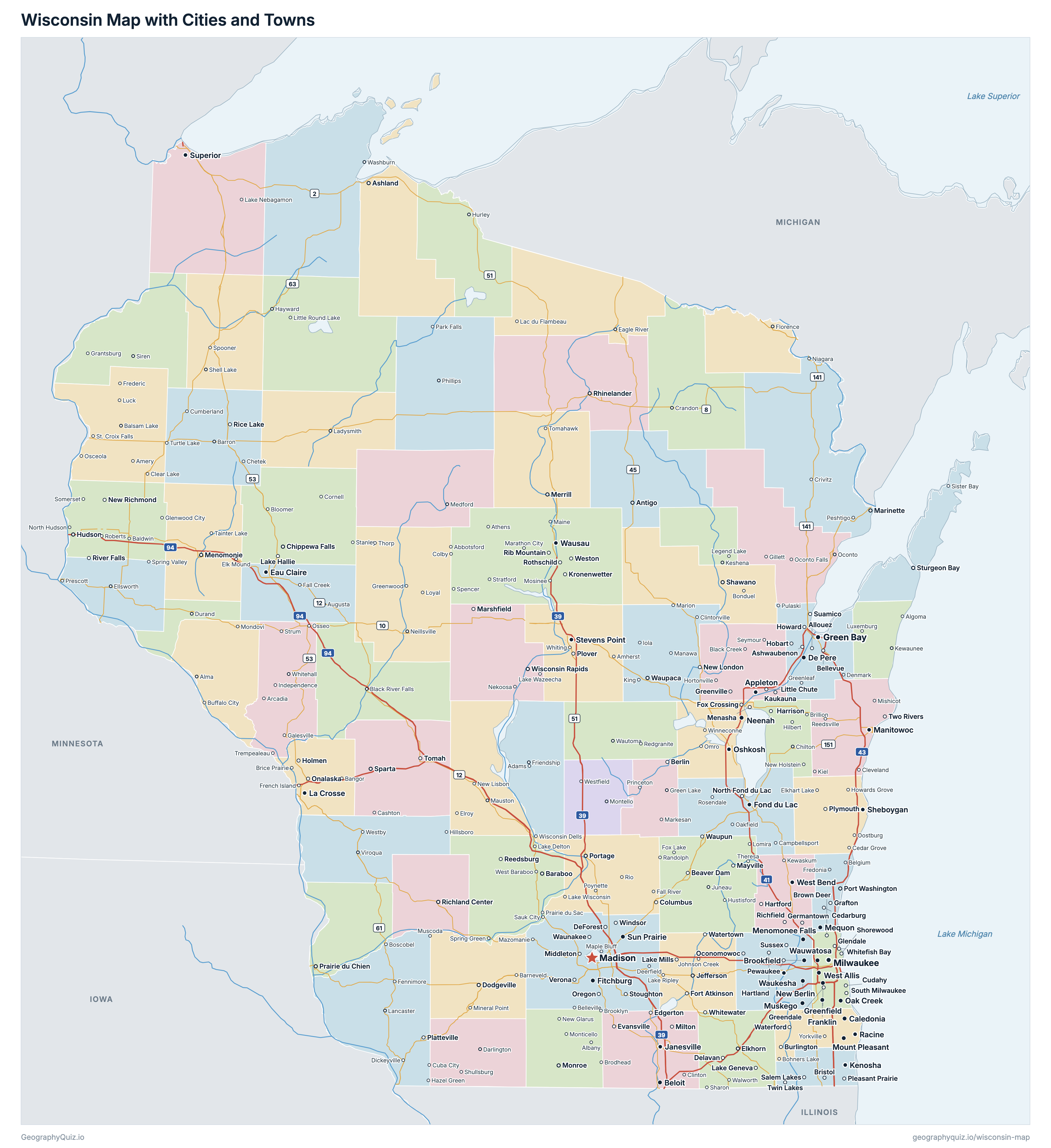
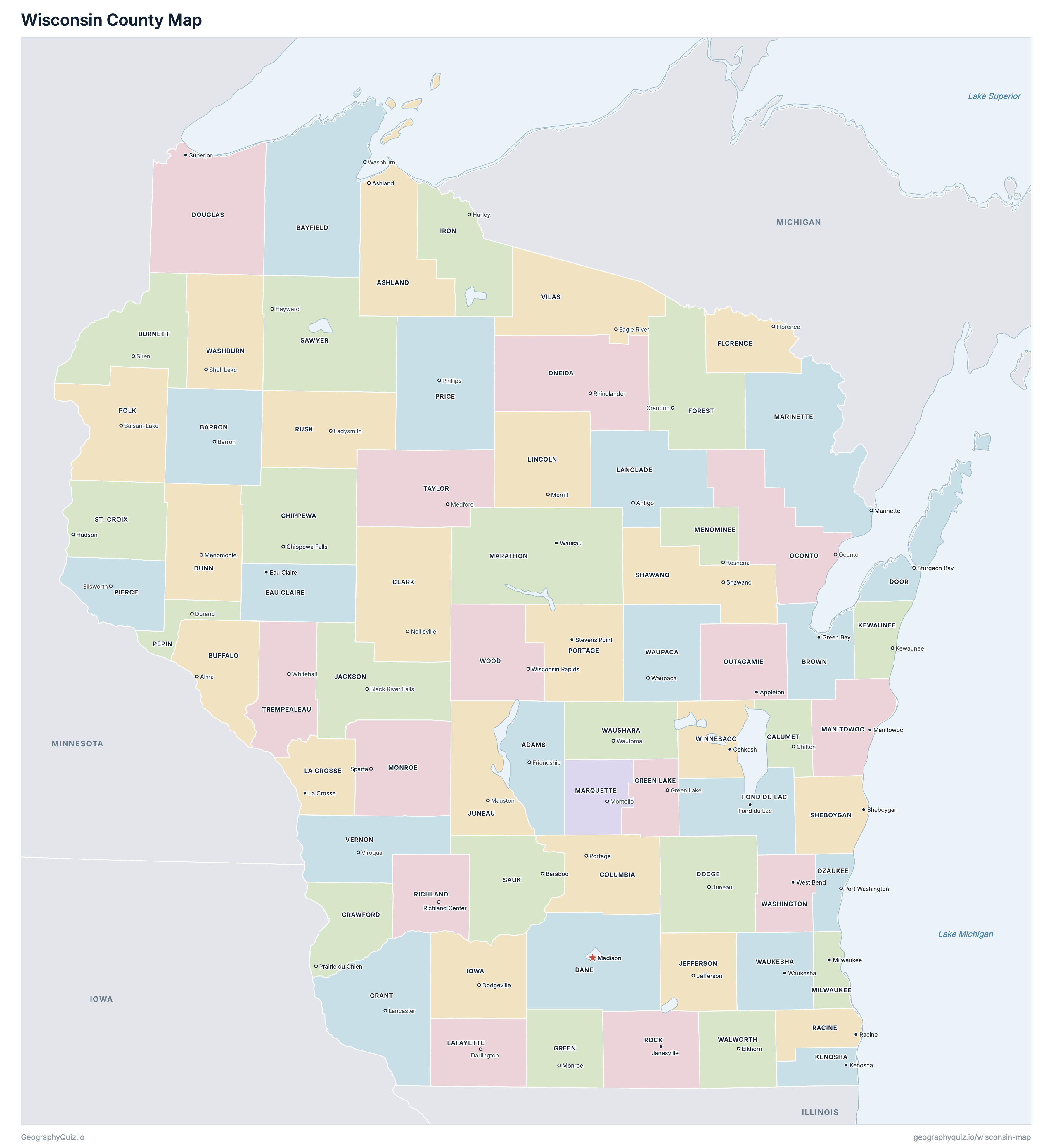
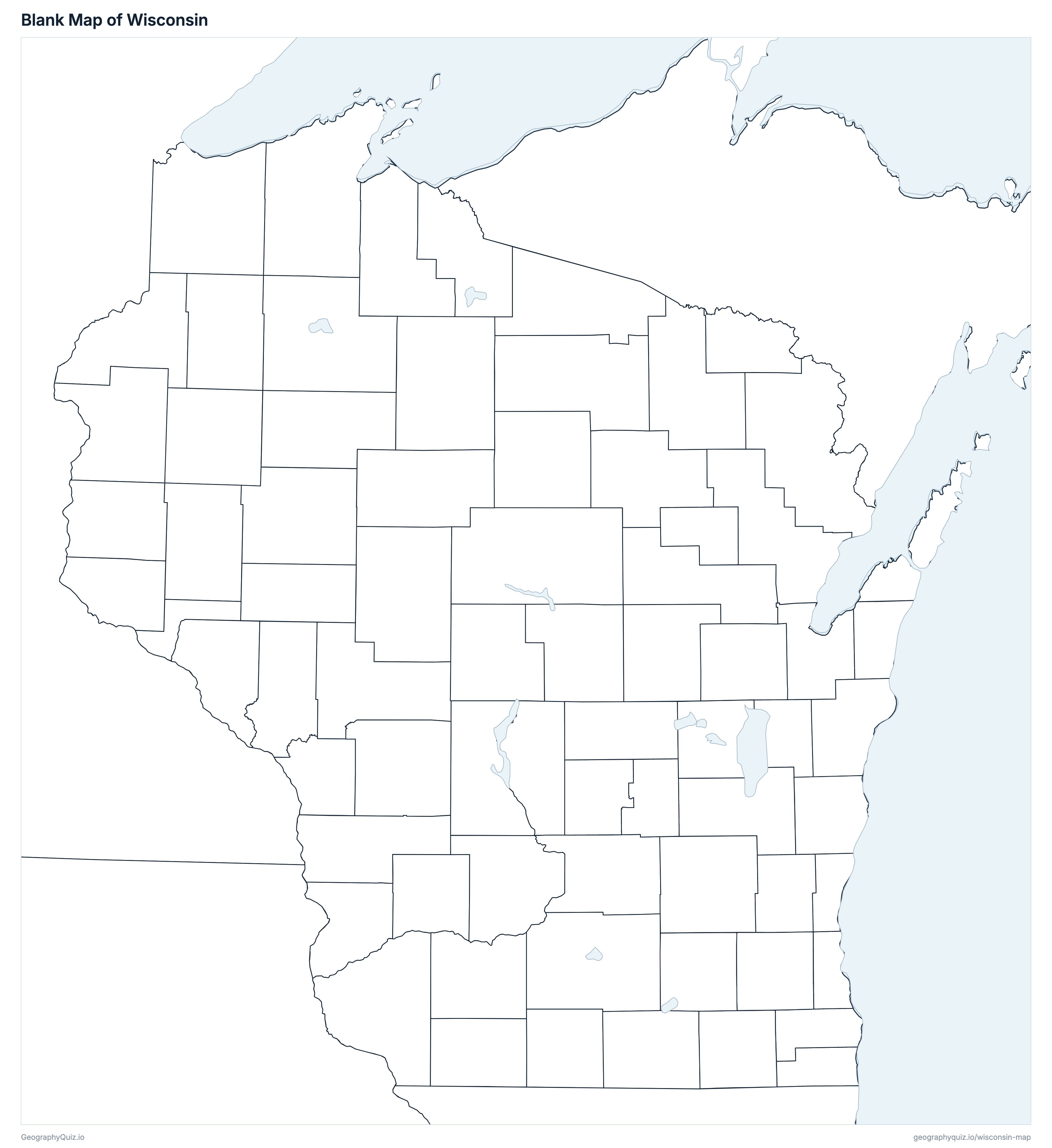
Free to print for class and home: Wisconsin with its cities and towns, a county map with every county and county seat, and a blank outline map. PDFs fit one A4 or US Letter page.
Wisconsin map with cities
Wisconsin county map
About Wisconsin
Wisconsin has 72 counties, 190 cities, 417 villages and 200 Census-designated communities, and about 5,972,787 people (2025 estimate) on 140,293 km² (54,167 sq mi) of land. The capital is Madison; the largest city is Milwaukee, with 562,407 people. It borders Illinois, Iowa, Michigan and Minnesota.
Wisconsin lies in the Upper Midwest between two Great Lakes: Lake Superior to the north and Lake Michigan to the east. Minnesota and Iowa are across the Mississippi and St. Croix rivers to the west, Illinois is to the south, and Michigan's Upper Peninsula borders it to the northeast.
Most Wisconsinites live in the southeast, in the corridor from Milwaukee and Kenosha up Lake Michigan to Green Bay, and around Madison, the capital, which sits on an isthmus between Lake Mendota and Lake Monona. The north is forest and lakes, the Driftless Area of the southwest was never covered by glaciers, and the Door Peninsula separates Green Bay from Lake Michigan.
Milwaukee County is the most populous county (924,216 people) and Menominee County the least (4,199); Marathon County is the largest by land area (4,002 km²) and Pepin County the smallest (601 km²).
Largest cities in Wisconsin
The 25 most populous cities and towns. All 807 are on the map above: switch on Towns and zoom in to see them.
| # | City | County | Population |
|---|---|---|---|
| 1 | Milwaukee | Milwaukee County | 562,407 |
| 2 | Madison | Dane County | 286,233 |
| 3 | Green Bay | Brown County | 106,675 |
| 4 | Kenosha | Kenosha County | 99,239 |
| 5 | Racine | Racine County | 77,908 |
| 6 | Appleton | Outagamie County | 75,452 |
| 7 | Eau Claire | Eau Claire County | 72,465 |
| 8 | Waukesha | Waukesha County | 70,872 |
| 9 | Oshkosh | Winnebago County | 67,460 |
| 10 | Janesville | Rock County | 66,929 |
| 11 | West Allis | Milwaukee County | 60,119 |
| 12 | La Crosse | La Crosse County | 50,784 |
| 13 | Sheboygan | Sheboygan County | 49,376 |
| 14 | Wauwatosa | Milwaukee County | 48,649 |
| 15 | Fond du Lac | Fond du Lac County | 44,541 |
| 16 | Brookfield | Waukesha County | 41,448 |
| 17 | Menomonee Falls | Waukesha County | 41,291 |
| 18 | Wausau | Marathon County | 40,188 |
| 19 | New Berlin | Waukesha County | 39,953 |
| 20 | Sun Prairie | Dane County | 39,227 |
| 21 | Oak Creek | Milwaukee County | 38,296 |
| 22 | Greenfield | Milwaukee County | 37,159 |
| 23 | Franklin | Milwaukee County | 36,687 |
| 24 | Beloit | Rock County | 36,649 |
| 25 | Manitowoc | Manitowoc County | 34,671 |
Populations are US Census Bureau estimates for July 2025, within city or town limits.
Counties of Wisconsin
All 72 counties with their county seats. Select one to show it on the map.
| Friendship | 21,752 | 1,672 | |
| Ashland | 16,203 | 2,706 | |
| Barron | 46,484 | 2,235 | |
| Washburn | 16,787 | 3,828 | |
| Green Bay | 275,803 | 1,373 | |
| Alma | 13,318 | 1,750 | |
| Siren | 17,223 | 2,128 | |
| Chilton | 53,982 | 824 | |
| Chippewa Falls | 67,614 | 2,612 | |
| Neillsville | 35,052 | 3,133 | |
| Portage | 58,132 | 1,983 | |
| Prairie Du Chien | 15,910 | 1,478 | |
| Madison | 590,375 | 3,099 | |
| Juneau | 89,097 | 2,268 | |
| Sturgeon Bay | 30,616 | 1,248 | |
| Superior | 43,990 | 3,378 | |
| Menomonie | 46,223 | 2,202 | |
| Eau Claire | 109,033 | 1,652 | |
| Florence | 4,748 | 1,264 | |
| Fond Du Lac | 104,669 | 1,864 | |
| Crandon | 9,574 | 2,627 | |
| Lancaster | 52,446 | 2,970 | |
| Monroe | 37,227 | 1,513 | |
| Green Lake | 19,305 | 905 | |
| Dodgeville | 23,951 | 1,975 | |
| Hurley | 6,127 | 1,964 | |
| Black River Falls | 20,999 | 2,559 | |
| Jefferson | 86,505 | 1,441 | |
| Mauston | 26,649 | 1,987 | |
| Kenosha | 168,448 | 704 | |
| Kewaunee | 20,758 | 887 | |
| La Crosse | 121,339 | 1,170 | |
| Darlington | 17,478 | 1,641 | |
| Antigo | 19,534 | 2,255 | |
| Merrill | 28,403 | 2,276 | |
| Manitowoc | 81,710 | 1,526 | |
| Wausau | 139,432 | 4,002 | |
| Marinette | 42,574 | 3,625 | |
| Montello | 15,927 | 1,180 | |
| Keshena | 4,199 | 926 | |
| Milwaukee | 924,216 | 625 | |
| Sparta | 46,572 | 2,333 | |
| Oconto | 40,195 | 2,583 | |
| Rhinelander | 38,131 | 2,885 | |
| Appleton | 195,894 | 1,651 | |
| Port Washington | 94,346 | 603 | |
| Durand | 7,513 | 601 | |
| Ellsworth | 43,519 | 1,487 | |
| Balsam Lake | 45,803 | 2,368 | |
| Stevens Point | 71,943 | 2,074 | |
| Phillips | 13,988 | 3,248 | |
| Racine | 198,919 | 861 | |
| Richland Center | 17,036 | 1,518 | |
| Janesville | 166,472 | 1,860 | |
| Ladysmith | 14,146 | 2,366 | |
| Baraboo | 66,652 | 2,154 | |
| Hayward | 18,846 | 3,257 | |
| Shawano | 41,560 | 2,313 | |
| Sheboygan | 118,047 | 1,325 | |
| Hudson | 98,276 | 1,870 | |
| Medford | 20,118 | 2,525 | |
| Whitehall | 31,171 | 1,898 | |
| Viroqua | 31,443 | 2,050 | |
| Eagle River | 23,761 | 2,221 | |
| Elkhorn | 106,127 | 1,439 | |
| Shell Lake | 17,087 | 2,065 | |
| West Bend | 139,238 | 1,115 | |
| Waukesha | 417,210 | 1,424 | |
| Waupaca | 51,461 | 1,937 | |
| Wautoma | 25,223 | 1,622 | |
| Oshkosh | 174,218 | 1,126 | |
| Wisconsin Rapids | 74,060 | 2,054 |
Practise US geography
Sources
- Counties, state borders, city and town locations and highways: US Census Bureau cartographic boundary files, Gazetteer files and TIGER/Line roads (2023).
- Populations: US Census Bureau Population Estimates, Vintage 2025; Census-designated communities: 2020 Census.
- County seats and founding years: National Association of Counties (NACo) County Explorer.