Interactive map
Vermont Map
Every county, city and town in Vermont on one zoomable map, with interstates, US highways, rivers and lakes. Switch on towns and counties above the map and zoom in for every name; tap a county to see its seat, population and largest towns.
Loading the map…
Printable maps of Vermont
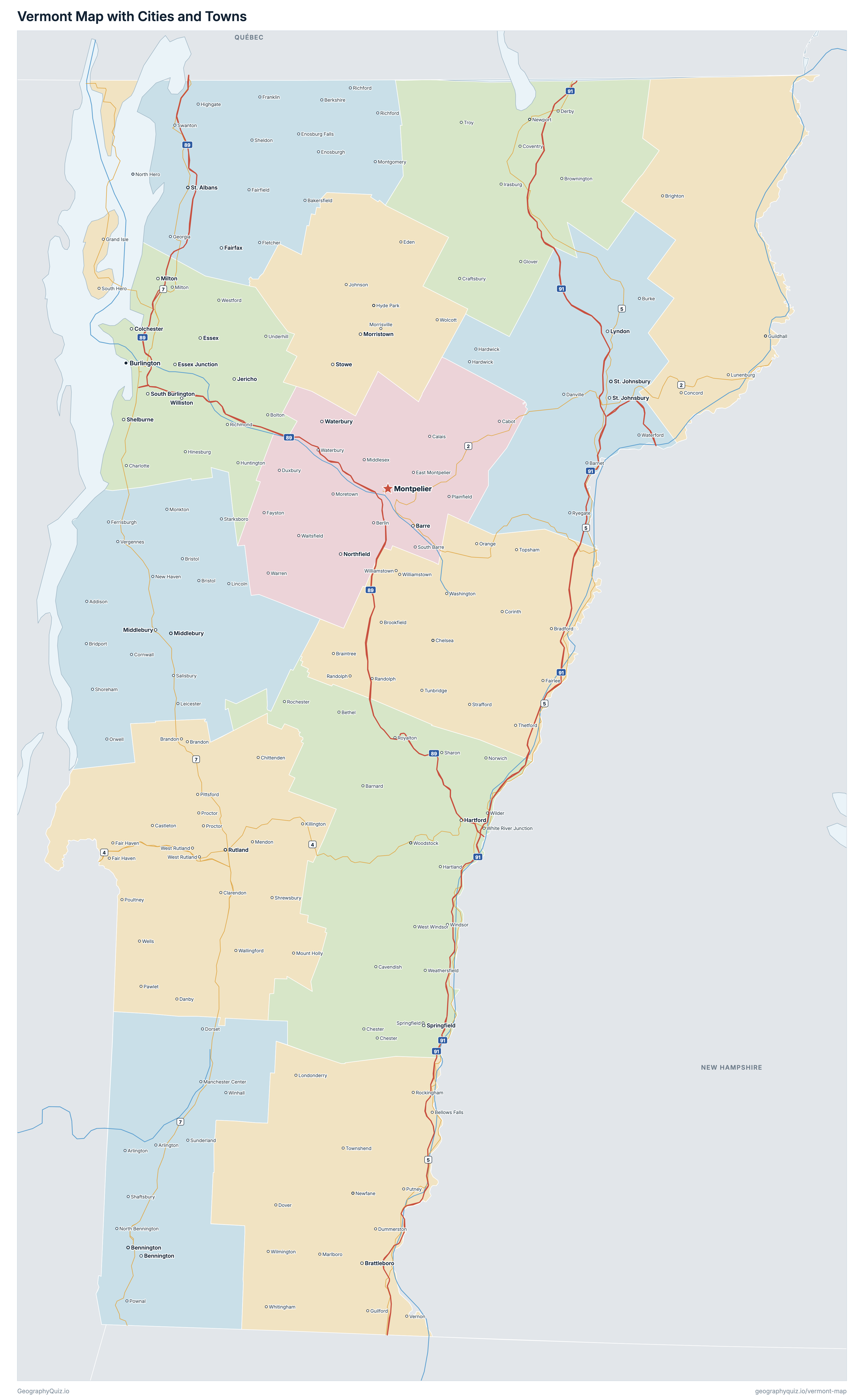
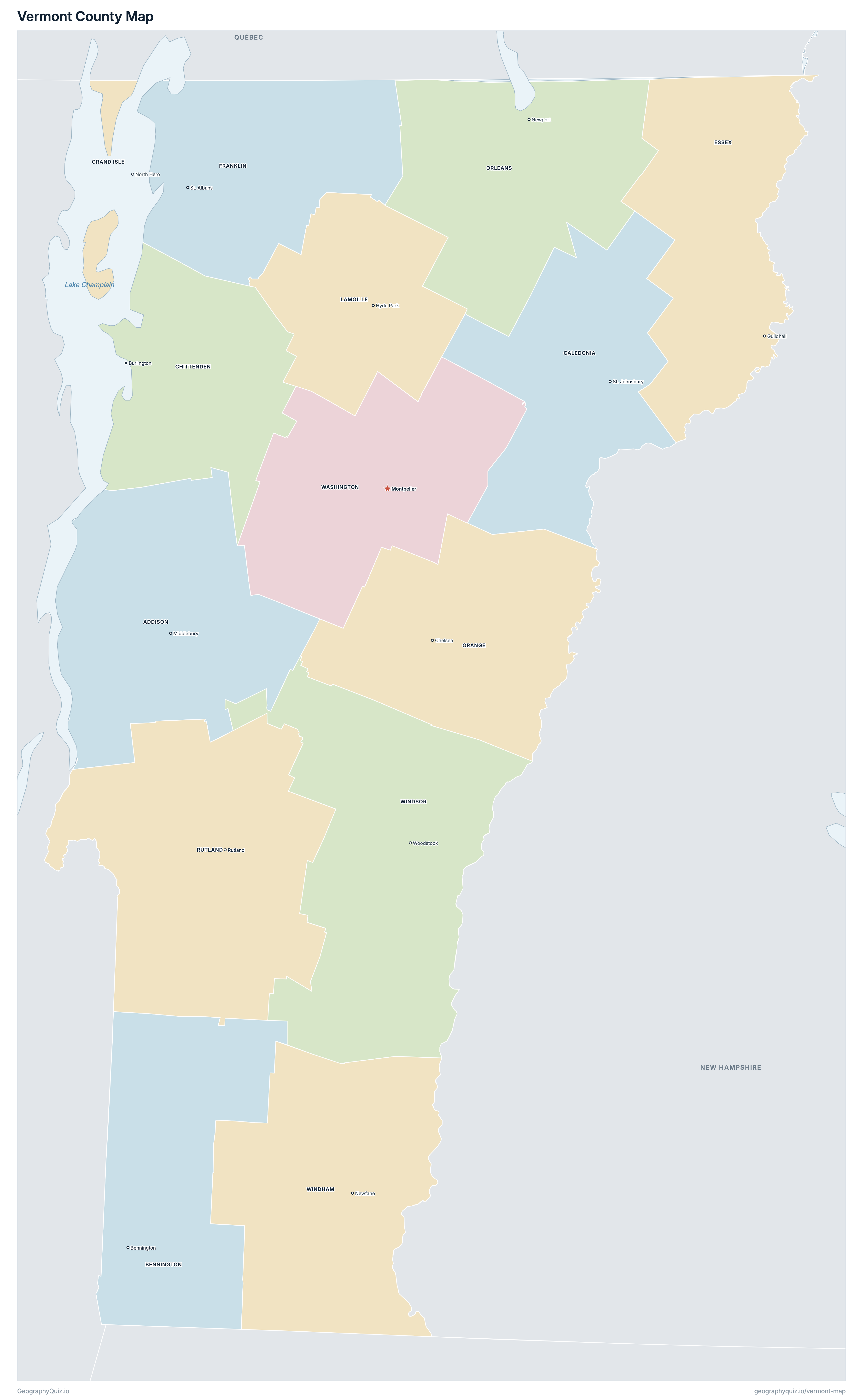
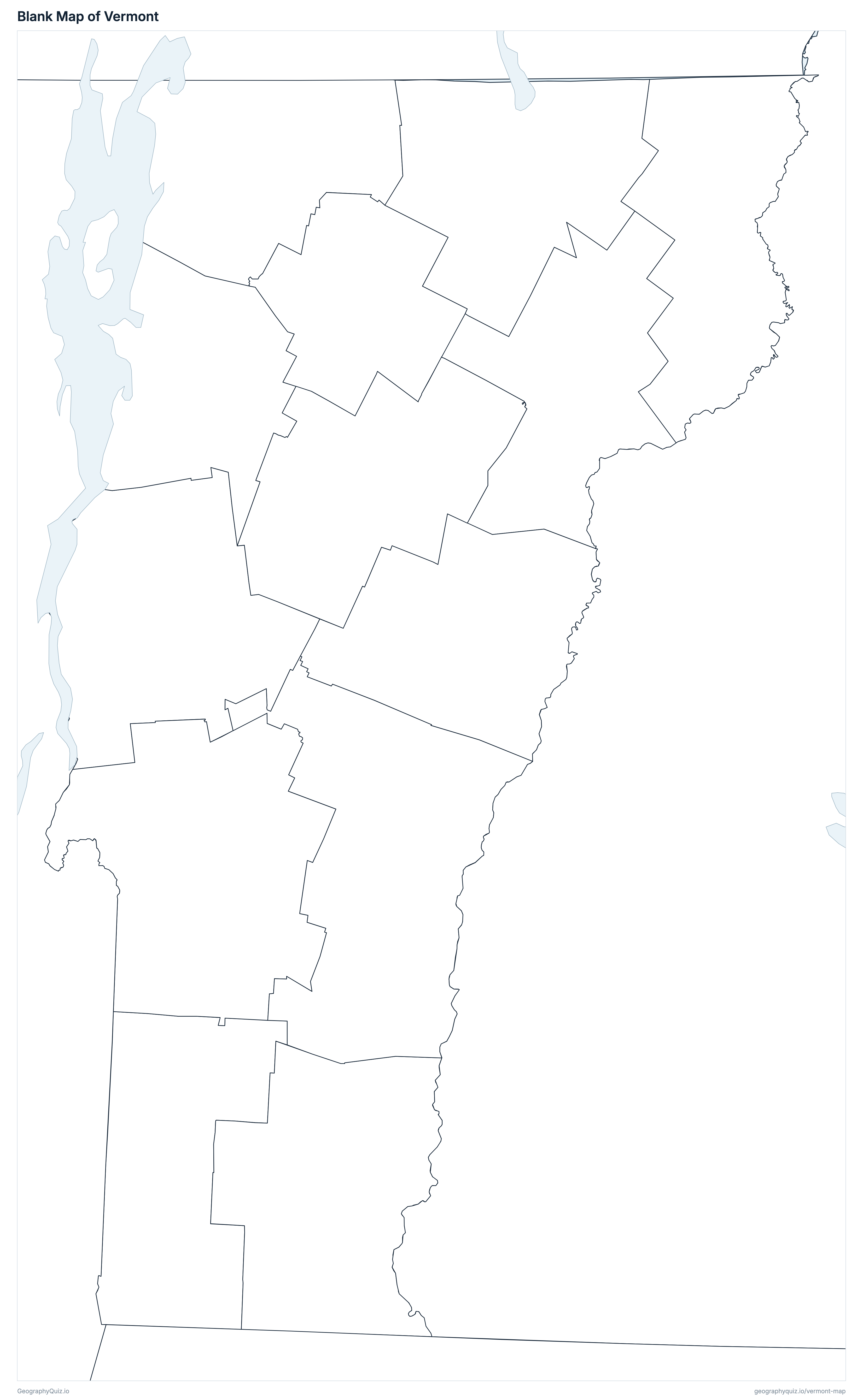
Free to print for class and home: Vermont with its cities and towns, a county map with every county and county seat, and a blank outline map. PDFs fit one A4 or US Letter page.
Vermont map with cities
Vermont county map
About Vermont
Vermont has 14 counties, 10 cities, 218 towns, 29 villages and 138 Census-designated communities, and about 644,663 people (2025 estimate) on 23,873 km² (9,217 sq mi) of land. The capital is Montpelier; the largest city is Burlington, with 44,019 people. It borders Massachusetts, New Hampshire and New York, and the Canadian province of Québec.
Chittenden County is the most populous county (169,115 people) and Essex County the least (6,051); Windsor County is the largest by land area (2,510 km²) and Grand Isle County the smallest (212 km²).
Largest cities in Vermont
The 25 most populous cities and towns. All 395 are on the map above: switch on Towns and zoom in to see them.
| # | City | County | Population |
|---|---|---|---|
| 1 | Burlington | Chittenden County | 44,019 |
| 2 | South Burlington | Chittenden County | 21,394 |
| 3 | Colchester | Chittenden County | 17,565 |
| 4 | Rutland | Rutland County | 15,363 |
| 5 | Bennington | Bennington County | 14,953 |
| 6 | Brattleboro | Windham County | 11,872 |
| 7 | Essex | Chittenden County | 11,346 |
| 8 | Essex Junction | Chittenden County | 10,921 |
| 9 | Hartford | Windsor County | 10,911 |
| 10 | Milton | Chittenden County | 10,646 |
| 11 | Williston | Chittenden County | 9,975 |
| 12 | Middlebury | Addison County | 9,208 |
| 13 | Springfield | Windsor County | 8,881 |
| 14 | Bennington | Bennington County | 8,795* |
| 15 | Winooski | Chittenden County | 8,239 |
| 16 | Barre | Washington County | 8,214 |
| 17 | Shelburne | Chittenden County | 8,133 |
| 18 | Montpelier | Washington County | 7,823 |
| 19 | St. Johnsbury | Caledonia County | 7,354 |
| 20 | Brattleboro | Windham County | 7,352* |
| 21 | Middlebury | Addison County | 7,304* |
| 22 | St. Albans | Franklin County | 6,939 |
| 23 | Shelburne | Chittenden County | 6,178* |
| 24 | Morristown | Lamoille County | 6,129 |
| 25 | St. Johnsbury | Caledonia County | 5,994* |
Populations are US Census Bureau estimates for July 2025, within city or town limits; * Census-designated communities, which have no local government or estimate, show their 2020 Census count.
Counties of Vermont
All 14 counties with their county seats. Select one to show it on the map.
| Middlebury | 38,048 | 1,985 | |
| Bennington and Manchester | 36,630 | 1,746 | |
| Saint Johnsbury | 30,414 | 1,681 | |
| Burlington | 169,115 | 1,390 | |
| Guildhall | 6,051 | 1,716 | |
| Saint Albans | 51,177 | 1,634 | |
| North Hero | 7,511 | 212 | |
| Hyde Park | 26,294 | 1,195 | |
| Chelsea | 30,002 | 1,779 | |
| Newport | 27,600 | 1,799 | |
| Rutland | 59,653 | 2,410 | |
| Montpelier | 59,652 | 1,779 | |
| Newfane | 45,204 | 2,036 | |
| Woodstock | 57,312 | 2,510 |
Practise US geography
Sources
- Counties, state borders, city and town locations and highways: US Census Bureau cartographic boundary files, Gazetteer files and TIGER/Line roads (2023).
- Populations: US Census Bureau Population Estimates, Vintage 2025; Census-designated communities: 2020 Census.
- County seats and founding years: National Association of Counties (NACo) County Explorer.