US geography · shaded relief
US Mountain Ranges Map
The mountain ranges of the United States on shaded relief, from the Appalachians in the East to the Rockies, the Sierra Nevada and the Cascades in the West and the Alaska Range with Denali. The triangles are the highest peaks; hover over or tap one for its height.
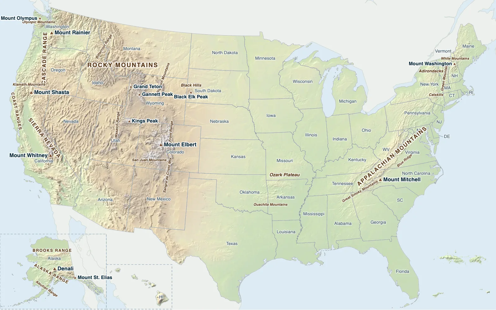
Hover over or tap a state, line or place for details.
Test yourself on this map
Mountain Ranges of the World · Includes the Rockies, Appalachians, Sierra Nevada, Cascades and Alaska's ranges
Printable US Mountain Ranges Map
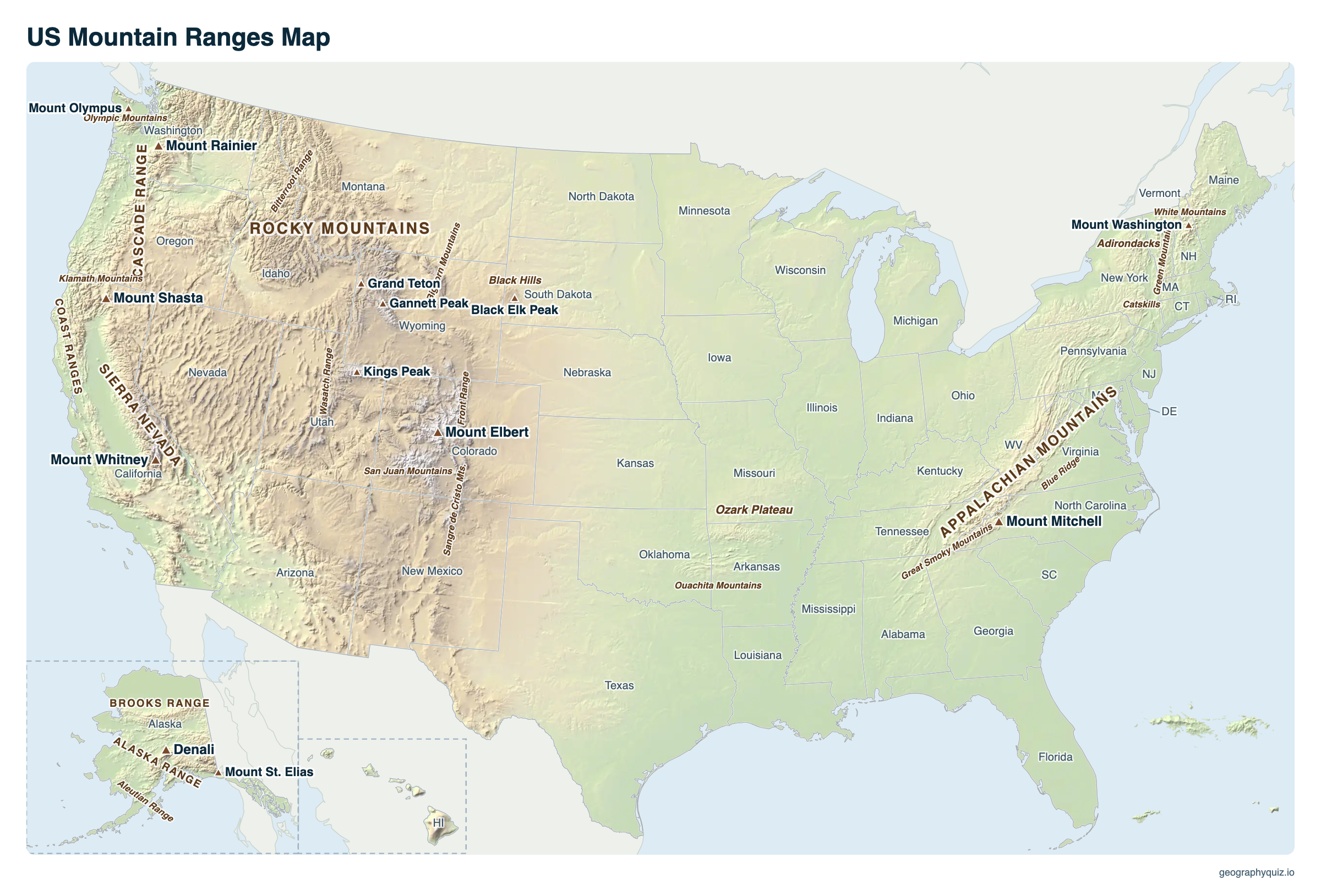
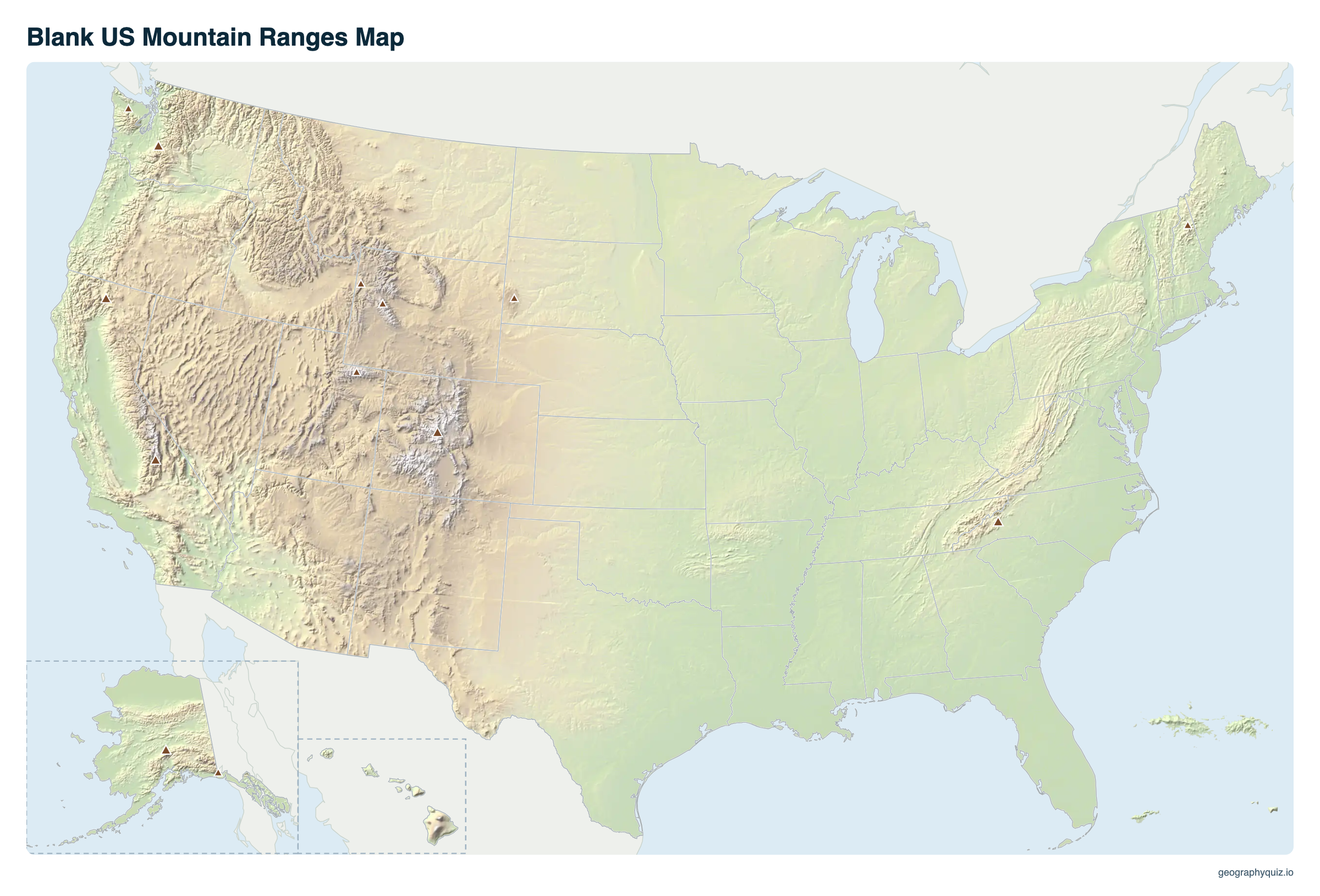
Free to print for class and home: the US mountain ranges on shaded relief with the highest peaks and the states, on one landscape page, labeled or blank. The blank version has the same map with no names on it, for labeling in class.
Key facts
- Highest peak
- Denali, Alaska Range, 20,310 ft (6,190 m)
- Highest in the lower 48
- Mount Whitney, Sierra Nevada, 14,505 ft
- Longest range
- Rocky Mountains, about 3,000 mi
- Highest in the East
- Mount Mitchell, North Carolina, 6,684 ft
- Fourteeners
- Colorado has at least 53 peaks over 14,000 ft, more than any other state
- Oldest major range
- Appalachian Mountains (about 480 million years)
Major mountain ranges of the United States
| Range | States | Highest peak | Elevation |
|---|---|---|---|
| Alaska Range | Alaska | Denali | 20,310 ft |
| Saint Elias Mountains | Alaska (and Canada) | Mount St. Elias | 18,008 ft |
| Wrangell Mountains | Alaska | Mount Blackburn | 16,390 ft |
| Sierra Nevada | California, Nevada | Mount Whitney | 14,505 ft |
| Rocky Mountains | New Mexico, Colorado, Utah, Wyoming, Idaho, Montana (and Canada) | Mount Elbert | 14,440 ft |
| Cascade Range | Washington, Oregon, California (and Canada) | Mount Rainier | 14,411 ft |
| Wind River Range (Rockies) | Wyoming | Gannett Peak | 13,804 ft |
| Teton Range (Rockies) | Wyoming | Grand Teton | 13,775 ft |
| Uinta Mountains (Rockies) | Utah | Kings Peak | 13,528 ft |
| Olympic Mountains | Washington | Mount Olympus | 7,980 ft |
| Black Hills | South Dakota, Wyoming | Black Elk Peak | 7,244 ft |
| Appalachian Mountains | Alabama to Maine (and Canada) | Mount Mitchell | 6,684 ft |
| Great Smoky Mountains (Appalachians) | North Carolina, Tennessee | Clingmans Dome | 6,643 ft |
| White Mountains (Appalachians) | New Hampshire, Maine | Mount Washington | 6,288 ft |
| Adirondack Mountains | New York | Mount Marcy | 5,344 ft |
| Green Mountains (Appalachians) | Vermont | Mount Mansfield | 4,393 ft |
| Catskill Mountains (Appalachians) | New York | Slide Mountain | 4,180 ft |
Mountains of the West and the East
Almost all the high mountains are in the West. The Rocky Mountains, the backbone of the continent, run about 3,000 miles from northern New Mexico through Colorado, Wyoming, Idaho and Montana into Canada, and carry the Continental Divide. Colorado alone has at least 53 peaks over 14,000 feet, the famous fourteeners. Farther west, the Sierra Nevada forms a 400-mile wall along eastern California, and the Cascade Range, a chain of volcanoes including Mount Rainier, Mount St. Helens and Mount Hood, runs from northern California into Canada.
The Appalachian Mountains stretch about 1,500 miles from Alabama to Maine. They formed about 480 to 300 million years ago and were once much higher; erosion has worn them into long, forested ridges, none higher than Mount Mitchell's 6,684 feet. Alaska's ranges are the highest of all: Denali, at 20,310 feet, is the highest peak in North America, and Alaska has 17 of the 20 highest peaks in the country.
How the ranges formed
- Folded and worn down: the Appalachians, pushed up when ancient continents collided to form the supercontinent Pangaea, then eroded for hundreds of millions of years.
- Uplifted blocks of the crust: the Rocky Mountains, raised far inland between about 80 and 55 million years ago, and ranges such as the Tetons and the Sierra Nevada, tilted up along great faults.
- Volcanoes: the Cascade Range, built over the sinking edge of an ocean plate off the Pacific Northwest, and the Aleutian Range in Alaska.
- Domes: the Black Hills and the Adirondacks, where old rock bulged up from below and erosion stripped off the layers above.
Frequently asked questions
What are the major mountain ranges in the United States?
The Rocky Mountains, the Appalachian Mountains, the Sierra Nevada, the Cascade Range, the Coast Ranges, and in Alaska the Alaska Range and the Brooks Range. Smaller ranges include the Olympic Mountains, the Adirondacks, the Ozarks, the Black Hills and the many ranges of the Great Basin.
What are the 3 major mountain ranges in the US?
Schoolbooks usually name three: the Rocky Mountains in the West, the Appalachian Mountains in the East and the Sierra Nevada in California. The Cascade Range and the ranges of Alaska are just as big, and Alaska's are the highest.
What is the longest mountain range in the US?
The Rocky Mountains, about 3,000 miles from New Mexico through the western states into Canada. The Appalachians, about 1,500 miles long, are the longest in the East.
What is the highest mountain in the United States?
Denali in the Alaska Range, 20,310 feet (6,190 m). The highest in the lower 48 states is Mount Whitney in the Sierra Nevada, 14,505 feet.
What are the 5 tallest mountains in the lower 48 states?
Mount Whitney, California (14,505 ft); Mount Elbert, Colorado (14,440 ft); Mount Massive, Colorado (14,428 ft); Mount Harvard, Colorado (14,421 ft); and Mount Rainier, Washington (14,411 ft). Older maps give each a few feet less, from an earlier survey datum, but the order is the same.
What is the highest mountain in the Rocky Mountains?
Mount Elbert in Colorado's Sawatch Range, 14,440 feet (4,401 m).
Were the Appalachians once taller?
Yes, much taller. When they formed, the Appalachians were probably more like today's Rocky Mountains, the US Geological Survey says; erosion over the last few hundred million years has worn them down to rounded ridges below 7,000 feet.
What mountains are in the eastern United States?
The Appalachian Mountains and their ranges, such as the Blue Ridge, the Great Smoky Mountains, the Alleghenies, the Catskills, the Green Mountains and the White Mountains, plus the separate Adirondack Mountains in New York.
Which mountain ranges are volcanic?
The Cascade Range, with active volcanoes such as Mount St. Helens, Mount Rainier and Mount Hood, the Aleutian Range in Alaska and the volcanoes of Hawaii.
Sources
- Shaded relief: US Geological Survey, 3D Elevation Program (3DEP) elevation data, in the projection of our US map.
- Elevations: US Geological Survey and National Geodetic Survey (Denali: 2015 survey); Mount Olympus: National Park Service.
- Formation of the ranges: US Geological Survey and National Park Service geology pages.
- State boundaries: US Census Bureau, cartographic boundary files (2024).