US history · interactive map
Mason–Dixon Line Map
The Mason–Dixon line is the border between Pennsylvania and Maryland, surveyed by Charles Mason and Jeremiah Dixon from 1763 to 1767, with Maryland's border with Delaware. It became the symbolic line between the free North and the slave South; west of Pennsylvania the Ohio River carried that divide on.
- Free states in 1860
- Slave states and D.C. in 1860
States are drawn with their modern borders; West Virginia was part of the slave state of Virginia until 1863.
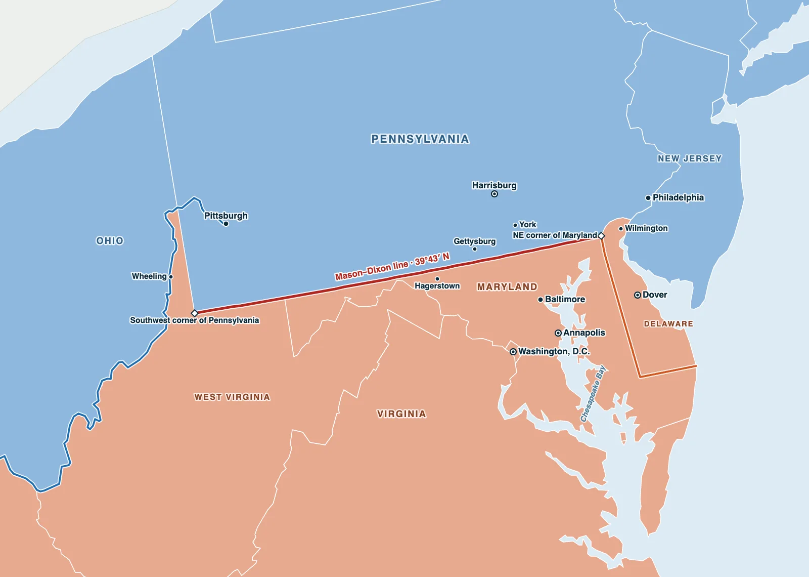
Hover over or tap a state, line or place for details. Use the key to show or hide lines.
Test yourself on this map
Find US States on the Map · Click each state we name
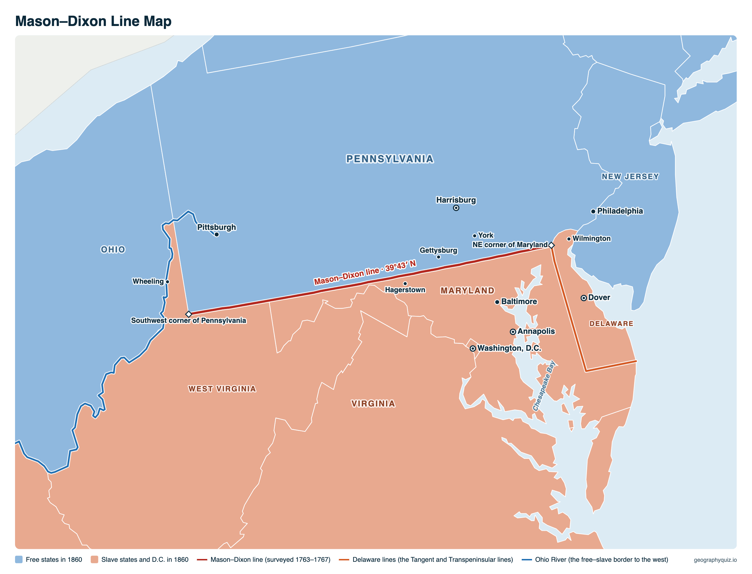
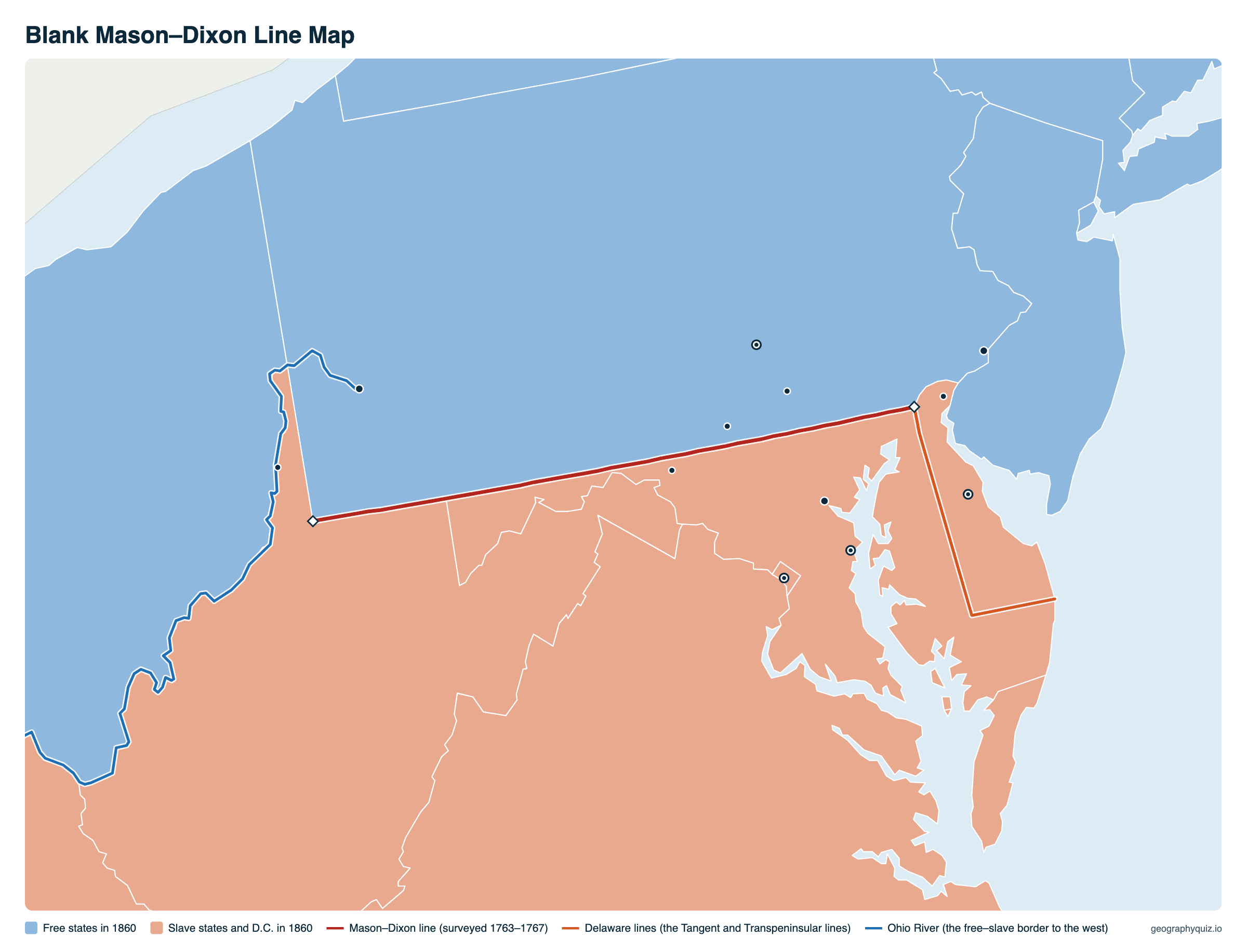
Printable Mason–Dixon Line Map
Free to print for class and home: the Mason–Dixon line and the Delaware lines, the free and slave states of 1860 and the Ohio River, on one landscape A4 or US Letter page. On the blank map, students can name the states and cities and trace the line. The blank version has the same map with no names on it, for labeling in class.
Key facts
- Surveyed
- 1763–1767, by Charles Mason and Jeremiah Dixon
- Separates
- Pennsylvania from Maryland (and West Virginia); Maryland from Delaware
- Latitude
- 39°43′20″ N
- Length surveyed
- 233 miles west, plus the Delaware lines
- Markers
- A stone every mile, with a crownstone carved with the Penn and Calvert arms every 5 miles
- Why
- To end a boundary dispute between the Penn family (Pennsylvania) and the Calverts (Maryland)
Where is the Mason–Dixon line?
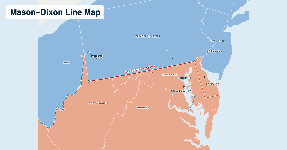
The line runs east–west along 39°43′20″ N, about 15 miles south of Philadelphia's latitude, from the point where Maryland, Delaware and Pennsylvania meet west to Pennsylvania's southwest corner, where it meets West Virginia. It forms the whole southern border of Pennsylvania with Maryland and part of its border with West Virginia. Mason and Dixon also surveyed Maryland's north–south border with Delaware (the North Line and the Tangent Line), which is usually counted as part of it.
Towns along it include Emmitsburg and Westminster, Maryland, just south of the line, and Gettysburg, York and Waynesboro just north. Interstates 83, 81 and 70 cross it.
Why was it surveyed?
King Charles I's charter for Maryland (1632) and King Charles II's charter for Pennsylvania (1681) overlapped, and the Calvert and Penn families argued over the border for 80 years; Philadelphia itself lay in land Maryland claimed. In 1760 they agreed on a compromise line 15 miles south of Philadelphia, and hired two English scientists to survey it: Charles Mason, an astronomer, and Jeremiah Dixon, a surveyor.
Working from 1763 to 1767 they fixed their position by the stars, cut a clearing through the forest and set limestone markers shipped from England every mile. In 1767 their Iroquois guides would go no farther west than a Native American war path near Dunkard Creek, after 233 miles; the line was completed to Pennsylvania's southwest corner in 1784.
How the line came to divide North and South
Pennsylvania passed the first law to gradually abolish slavery in 1780, and by the early 1800s every state north of the line had done the same, while Maryland, Delaware and the states south of them kept slavery. The Mason–Dixon line, carried west by the Ohio River and later by the Missouri Compromise line of 36°30′ N (1820), became the shorthand for the border between the free North and the slave South. For people escaping slavery on the Underground Railroad, crossing it into Pennsylvania was a first step to freedom.
Maryland and Delaware were slave states that stayed in the Union in the Civil War. Today the phrase is still used loosely for the cultural border between the North and the South, which is why Southerners are sometimes said to live "below the Mason–Dixon line".
Frequently asked questions
What states does the Mason–Dixon line separate?
Pennsylvania from Maryland, and at its western end Pennsylvania from West Virginia. The north–south lines Mason and Dixon surveyed separate Maryland from Delaware.
Is the Mason–Dixon line the border between the North and the South?
Symbolically. It was surveyed as a property line between two colonies, but after Pennsylvania began abolishing slavery in 1780 it came to mark the border between free states to the north and slave states to the south, carried west by the Ohio River.
Where does the Mason–Dixon line start and end?
The east–west line starts at the northeast corner of Maryland, where Maryland, Delaware and Pennsylvania meet, and runs west along 39°43′ N to the southwest corner of Pennsylvania, where it meets West Virginia. Mason and Dixon's north–south lines run from that corner south along the Maryland–Delaware border.
Does the Mason–Dixon line still exist?
Yes. It is still the legal border between Pennsylvania and Maryland and between Pennsylvania and West Virginia, and many of the original stone markers are still in place.
Which states are below the Mason–Dixon line?
Maryland and West Virginia lie directly south of it, and Delaware, east of the Maryland lines Mason and Dixon surveyed, is traditionally counted with them. Virginia, North Carolina and the states farther south are all below it. The line never reached New Jersey: southern New Jersey lies south of 39°43′ N, but New Jersey was a free state and is counted as part of the North.
What does it mean to cross the Mason–Dixon line?
To go from the North to the South, or back. Before the Civil War, for people escaping slavery, crossing it into Pennsylvania meant reaching a free state, though under the Fugitive Slave Acts they could still be captured there.
Who were Mason and Dixon?
Charles Mason (1728–1786), an English astronomer who had worked at the Royal Observatory in Greenwich, and Jeremiah Dixon (1733–1779), an English surveyor. They surveyed the line from 1763 to 1767.
How long is the Mason–Dixon line?
Mason and Dixon ran the east–west line for 233 miles before they had to stop in 1767; it was finished to Pennsylvania's southwest corner in 1784. They also surveyed the north–south lines along Maryland's border with Delaware.
Is Maryland north or south of the Mason–Dixon line?
South: the line is Maryland's northern border, so Maryland is traditionally counted as a Southern state, although it stayed in the Union in the Civil War.
Can you still see the Mason–Dixon line?
Yes. Many of the original stones, including crownstones with the Penn arms on the north face and the Calvert arms on the south, still stand along the border, and the line is marked where roads cross it.
Sources
- State boundaries and the Ohio River: US Census Bureau, cartographic boundary files (2024), and the rivers of our US map.
- The survey: Maryland Geological Survey and Pennsylvania Historical and Museum Commission (Mason–Dixon line markers); National Park Service (Underground Railroad).
- Abolition dates: Pennsylvania's Act for the Gradual Abolition of Slavery (1780), Maryland Constitution of 1864, 13th Amendment (1865).