US history · interactive map
Lewis and Clark Map
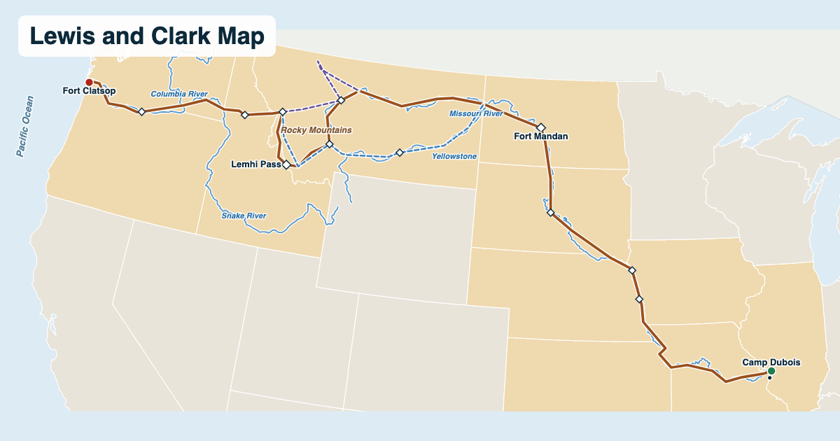
The Lewis and Clark expedition route, 1804–1806. In May 1804 Meriwether Lewis and William Clark led the Corps of Discovery up the Missouri River to explore the Louisiana Purchase and find a route to the Pacific. They reached the ocean in November 1805 and were back in St. Louis in September 1806, after about 8,000 miles. Hover over or tap a camp for what happened there.
- States on the Lewis and Clark Trail
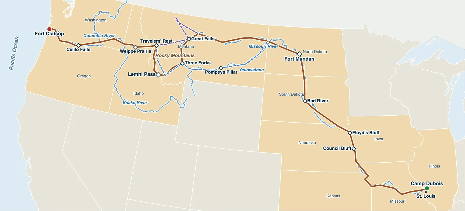
Hover over or tap a state, line or place for details. Use the key to show or hide lines.
Test yourself on this map
Find US States on the Map · Click each state we name
Printable Lewis and Clark Map
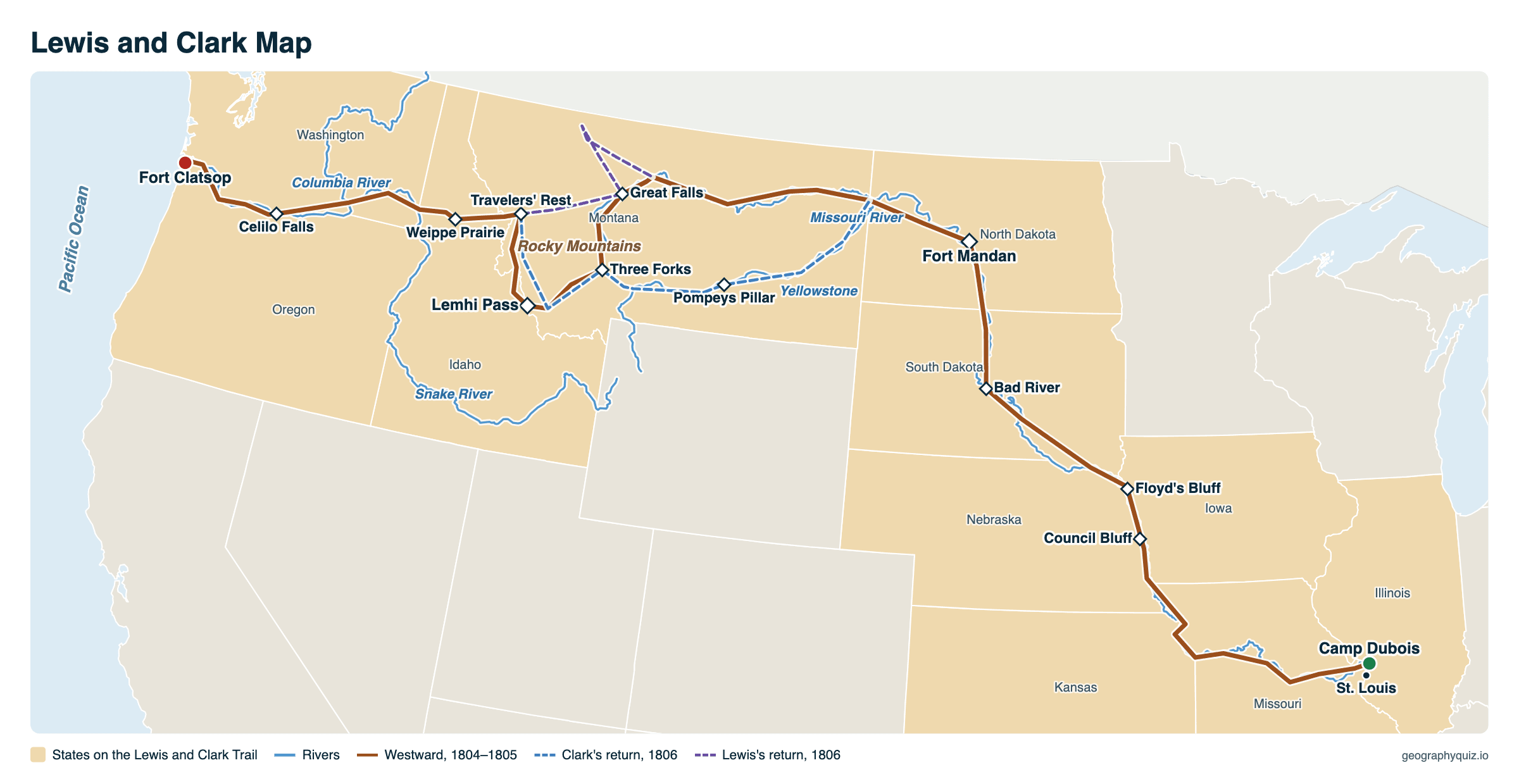
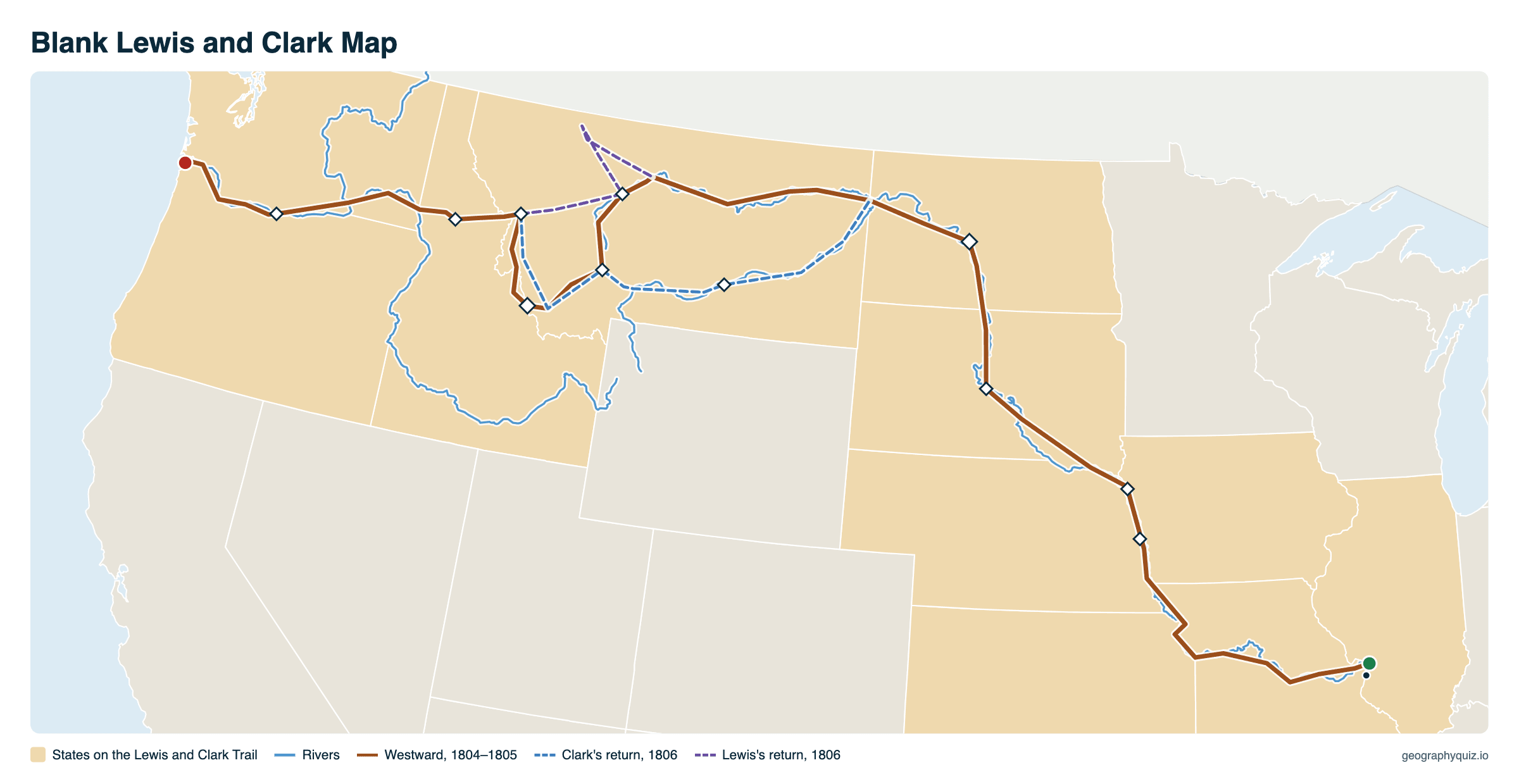
Free to print for class and home: the Lewis and Clark route with its camps, rivers and states and the two return routes of 1806, on one landscape A4 or US Letter page. The blank version has the same map with no names on it, for labeling in class.
Key facts
- Dates
- May 14, 1804 – September 23, 1806
- Leaders
- Captain Meriwether Lewis and William Clark
- Sent by
- President Thomas Jefferson
- Distance
- About 8,000 miles there and back
- Members
- About 33 in the permanent party, with Sacagawea, her baby Jean Baptiste and York, Clark's enslaved servant
- Reached the Pacific
- November 1805, at the mouth of the Columbia River
- Deaths
- One: Sergeant Charles Floyd, probably of appendicitis
Lewis and Clark timeline
| Date | Event |
|---|---|
| May 14, 1804 | The Corps of Discovery leaves Camp Dubois, Illinois, and heads up the Missouri River. |
| August 20, 1804 | Sergeant Charles Floyd dies near today's Sioux City, Iowa: the only death of the expedition. |
| September 25, 1804 | A tense standoff with the Lakota (Teton Sioux) at the mouth of the Bad River, South Dakota. |
| November 1804 – April 1805 | Winter at Fort Mandan, North Dakota; Sacagawea and Charbonneau are hired as interpreters. |
| June–July 1805 | The 18-mile portage around the Great Falls of the Missouri, Montana. |
| August 12, 1805 | Lewis crosses the Continental Divide at Lemhi Pass; the Shoshone trade horses. |
| September 1805 | The hungry crossing of the Bitterroot Mountains on the Lolo Trail; the Nez Perce help them build canoes. |
| November 7, 1805 | "Ocean in view! O! the joy": Clark sees the Columbia estuary. |
| December 1805 – March 1806 | Winter at Fort Clatsop, Oregon. |
| July 1806 | The captains split: Lewis explores the Marias River, Clark the Yellowstone. |
| September 23, 1806 | The expedition arrives back in St. Louis. |
The Lewis and Clark route, state by state
The expedition passed through 11 of today's states, from east to west on the way out.
| State | What happened there |
|---|---|
| Illinois | Camp Dubois, across the Mississippi from the mouth of the Missouri: the winter camp of 1803–1804 and the starting point, May 14, 1804. |
| Missouri | Up the Missouri past St. Charles, where Lewis joined the boats, in May and June 1804; the expedition ended at St. Louis on September 23, 1806. |
| Kansas | Camps along the Missouri on the Kansas side in June and July 1804, including at the mouth of the Kansas River (today's Kansas City) and on July 4, 1804. |
| Nebraska | The first council with Native leaders, the Oto and Missouria, at Council Bluff on August 3, 1804, on the Nebraska side of the Missouri. |
| Iowa | Sergeant Charles Floyd died here on August 20, 1804, the only death of the expedition; Floyd's Bluff is in Sioux City. |
| South Dakota | A tense standoff with the Lakota (Teton Sioux) near the mouth of the Bad River, by today's Pierre, on September 25, 1804; then visits to the Arikara villages. |
| North Dakota | Winter of 1804–1805 at Fort Mandan, among the Mandan and Hidatsa villages; Sacagawea and Toussaint Charbonneau joined here. |
| Montana | More of the journey than any other state: the Great Falls portage, Three Forks, the Missouri's headwaters, and in 1806 Lewis on the Marias and Clark on the Yellowstone. |
| Idaho | Over Lemhi Pass in August 1805 to the Shoshone, then across the Bitterroots on the Lolo Trail to the Nez Perce, who helped them build canoes on the Clearwater. |
| Washington | Down the Snake and Columbia rivers in October and November 1805, past Celilo Falls; Clark first saw the Columbia estuary on November 7. |
| Oregon | Winter of 1805–1806 at Fort Clatsop, near the Pacific at the mouth of the Columbia. |
Why Jefferson sent Lewis and Clark
Thomas Jefferson asked Congress for money for an expedition in January 1803, before the Louisiana Purchase was agreed. He wanted to find a water route to the Pacific for trade (a Northwest Passage), to map the new land, to study its plants, animals and geography, and to tell the Native nations along the way that the United States now claimed the land.
There was no all-water route: the Rocky Mountains were far higher and wider than anyone expected. But the expedition mapped thousands of miles, described about 178 plants and 122 animals new to science, and met nearly 50 Native American nations, whose help, from the Mandan and Hidatsa to the Shoshone, Nez Perce and Clatsop, was essential to its survival.
Frequently asked questions
What was the route of Lewis and Clark?
Up the Missouri River from Camp Dubois near St. Louis to its headwaters in Montana, over the Continental Divide at Lemhi Pass and the Bitterroot Mountains on the Lolo Trail, then down the Clearwater, Snake and Columbia rivers to the Pacific near Astoria, Oregon.
How long did it take Lewis and Clark to reach the Pacific Ocean?
About 18 months. They left Camp Dubois on May 14, 1804, and Clark first saw the Columbia estuary on November 7, 1805; they reached the ocean shore later that month.
Did Lewis and Clark make a map?
Yes. William Clark drew maps of the route all the way, using his own compass readings and what Native people told him about the land ahead. In 1814 his master map was published as A Map of Lewis and Clark's Track, Across the Western Portion of North America, the first map to show how wide the Rocky Mountains really are and that no easy water route crossed them.
How long did the Lewis and Clark expedition take?
About two years and four months, from May 14, 1804, to September 23, 1806.
What states did Lewis and Clark go through?
Eleven of today's states: Illinois, Missouri, Kansas, Nebraska, Iowa, South Dakota, North Dakota, Montana, Idaho, Washington and Oregon.
Who was Sacagawea?
A Lemhi Shoshone woman who joined the expedition at Fort Mandan with her husband, Toussaint Charbonneau, and their newborn son. She interpreted with the Shoshone, recognized landmarks in her homeland and helped show the expedition's peaceful intent.
Where did Lewis and Clark spend the winters?
1803–1804 at Camp Dubois, Illinois; 1804–1805 at Fort Mandan, North Dakota; and 1805–1806 at Fort Clatsop, near the mouth of the Columbia River in Oregon.
How many people died on the Lewis and Clark expedition?
Only one: Sergeant Charles Floyd, who died on August 20, 1804, probably of a burst appendix. He is buried at Floyd's Bluff in Sioux City, Iowa.
Sources
- Route: drawn after the National Park Service's Lewis and Clark National Historic Trail maps through the camps listed; the return routes of 1806 are drawn approximately.
- Town locations: US Census Bureau Gazetteer; state boundaries: US Census Bureau, cartographic boundary files (2024).
- Dates and events: the journals of the Lewis and Clark expedition and the National Park Service, Lewis and Clark National Historic Trail.