US Letter portrait · 1 page · Map activity
Lines on a Globe
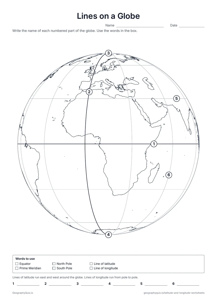
A globe with lines every 30°. Students name six numbered parts: the Equator, the Prime Meridian, both poles, a line of latitude and a line of longitude.
Free teacher resource
Eleven latitude and longitude worksheets that build step by step: name the lines on a globe, practice reading lines of latitude and then lines of longitude, write the coordinates of points on a world grid and plot your own, find the continent, ocean, country or US state at a set of coordinates, sort points into hemispheres, and estimate the coordinates of US and world cities.
Every sheet comes as an A4 and a US Letter PDF.Print it, then play it
US Letter portrait · 1 page · Map activity
A globe with lines every 30°. Students name six numbered parts: the Equator, the Prime Meridian, both poles, a line of latitude and a line of longitude.
US Letter landscape · 1 page · Map activity
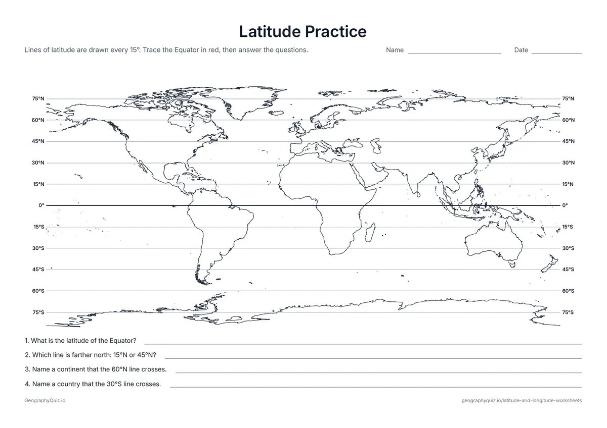
A world map with lines of latitude every 15°, labeled at both ends, and four questions about reading them.
US Letter landscape · 1 page · Map activity
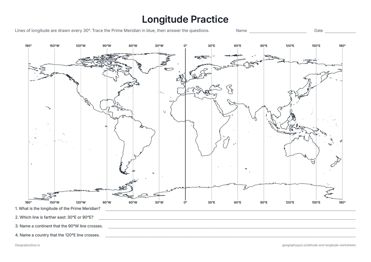
A world map with lines of longitude every 30°, labeled at the top and bottom, and four questions about reading them.
US Letter landscape · 1 page · Map activity
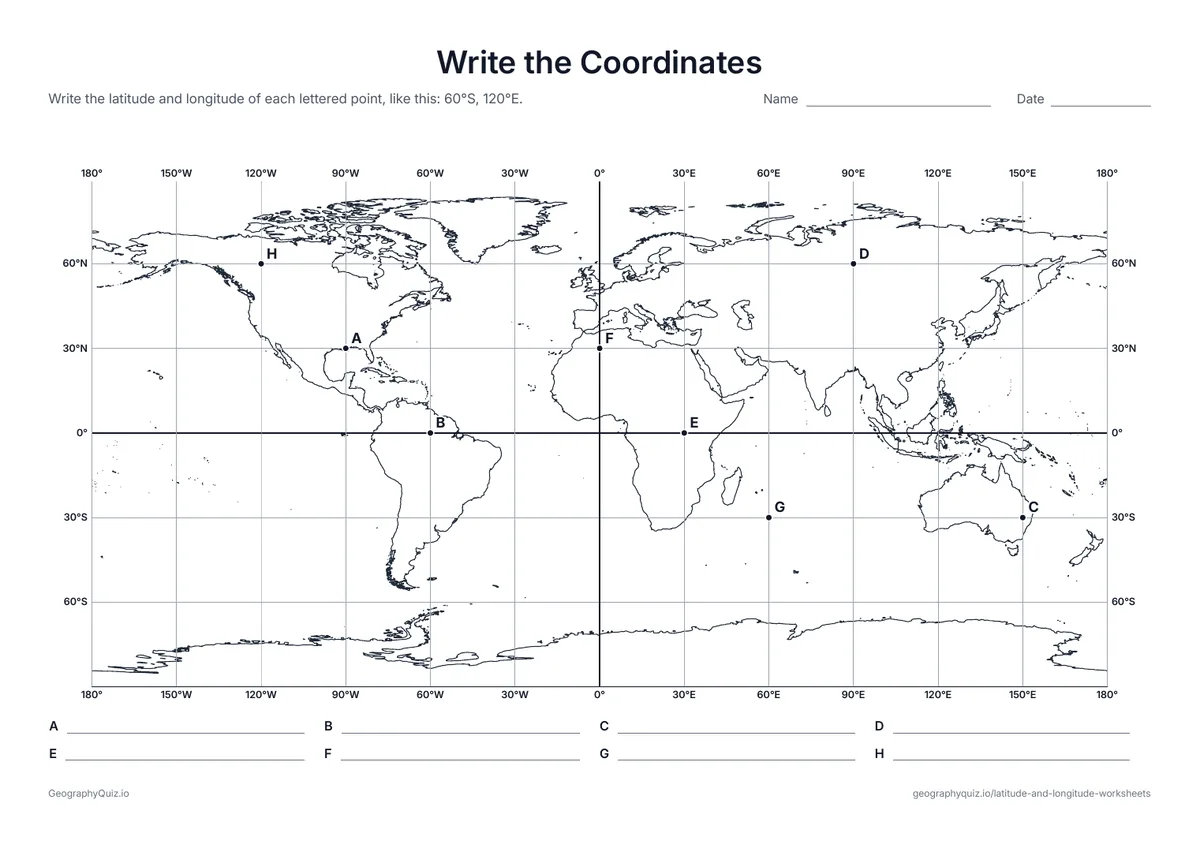
Eight lettered points sit where grid lines cross. Students write the latitude and longitude of each one.
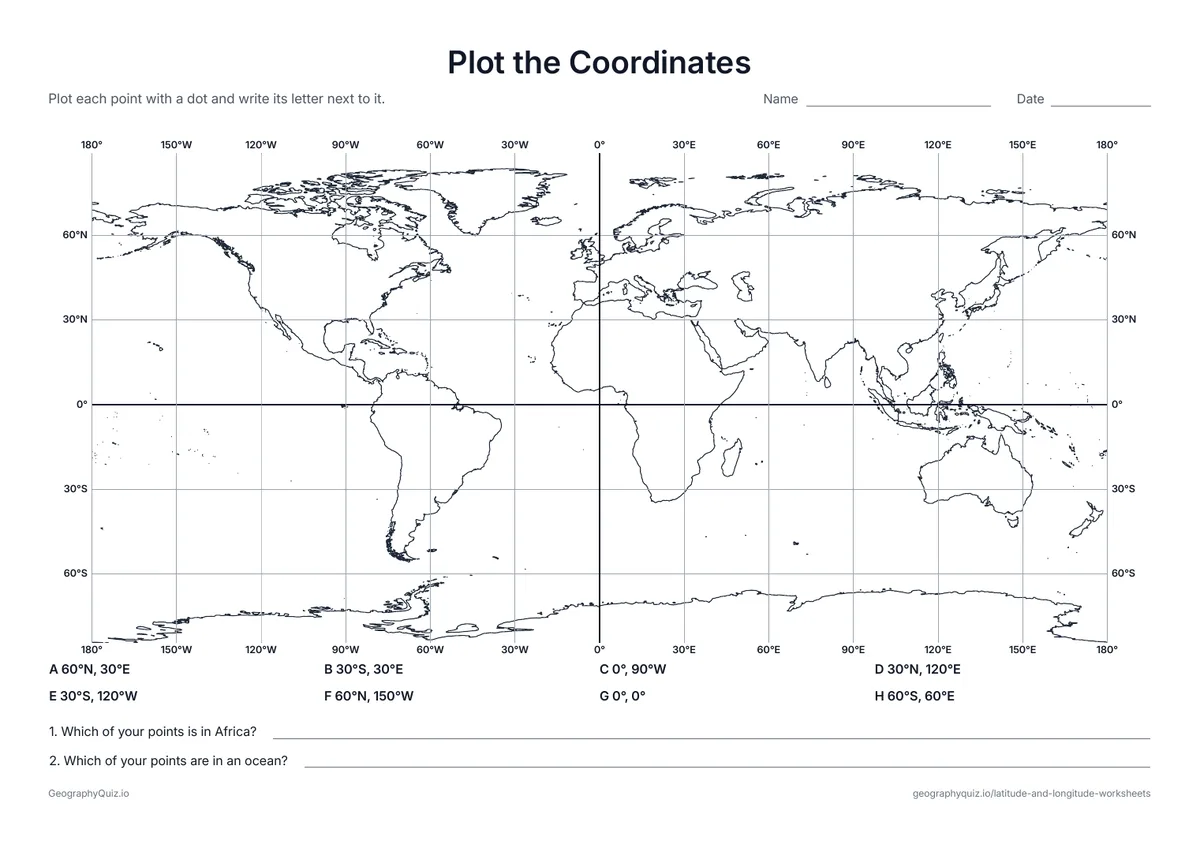
US Letter landscape · 1 page · Map activity
Eight coordinates to plot on a world grid, then two questions about where the points landed.
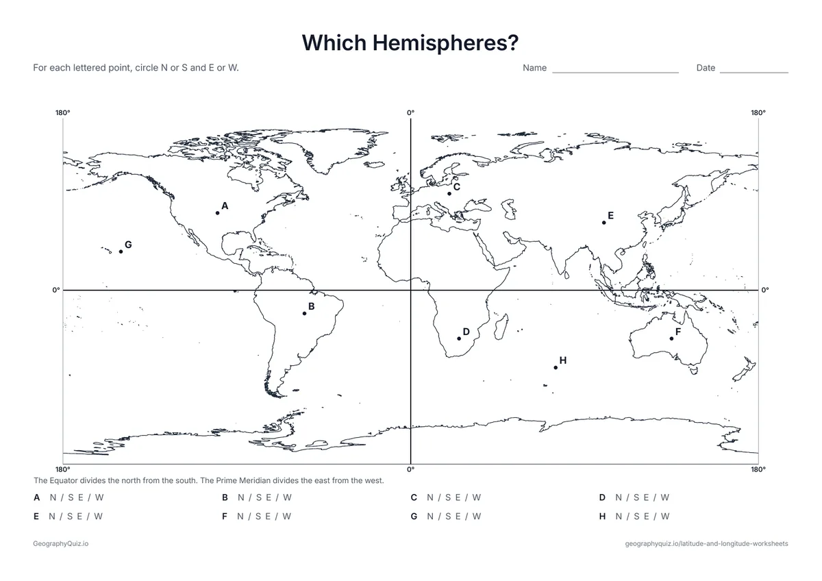
US Letter landscape · 1 page · Map activity
The Equator and Prime Meridian split the map into four. Students circle N or S and E or W for eight lettered points.
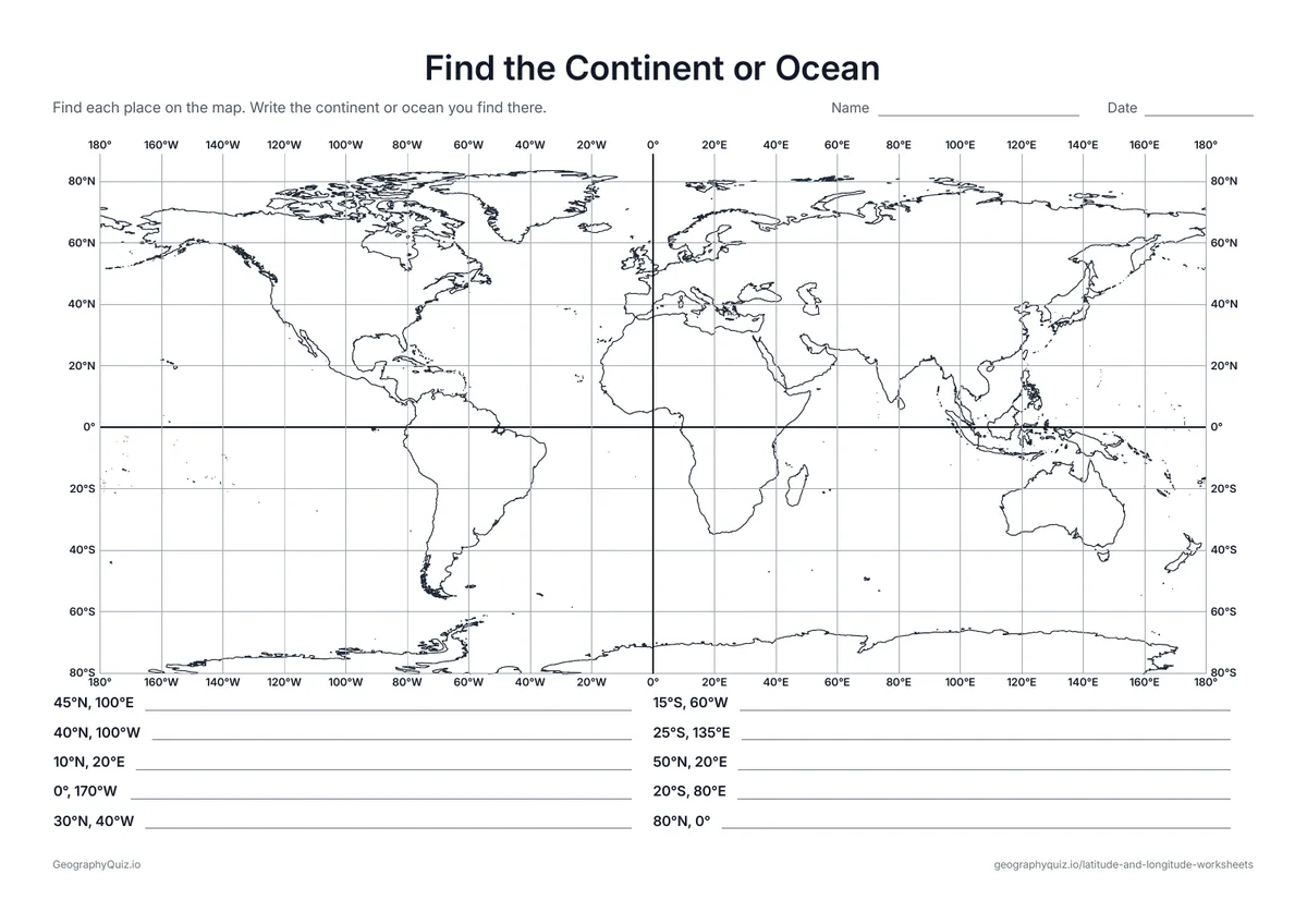
US Letter landscape · 1 page · Map activity
Ten coordinates on a 20° grid. Students find each one and write the continent or ocean they land in.
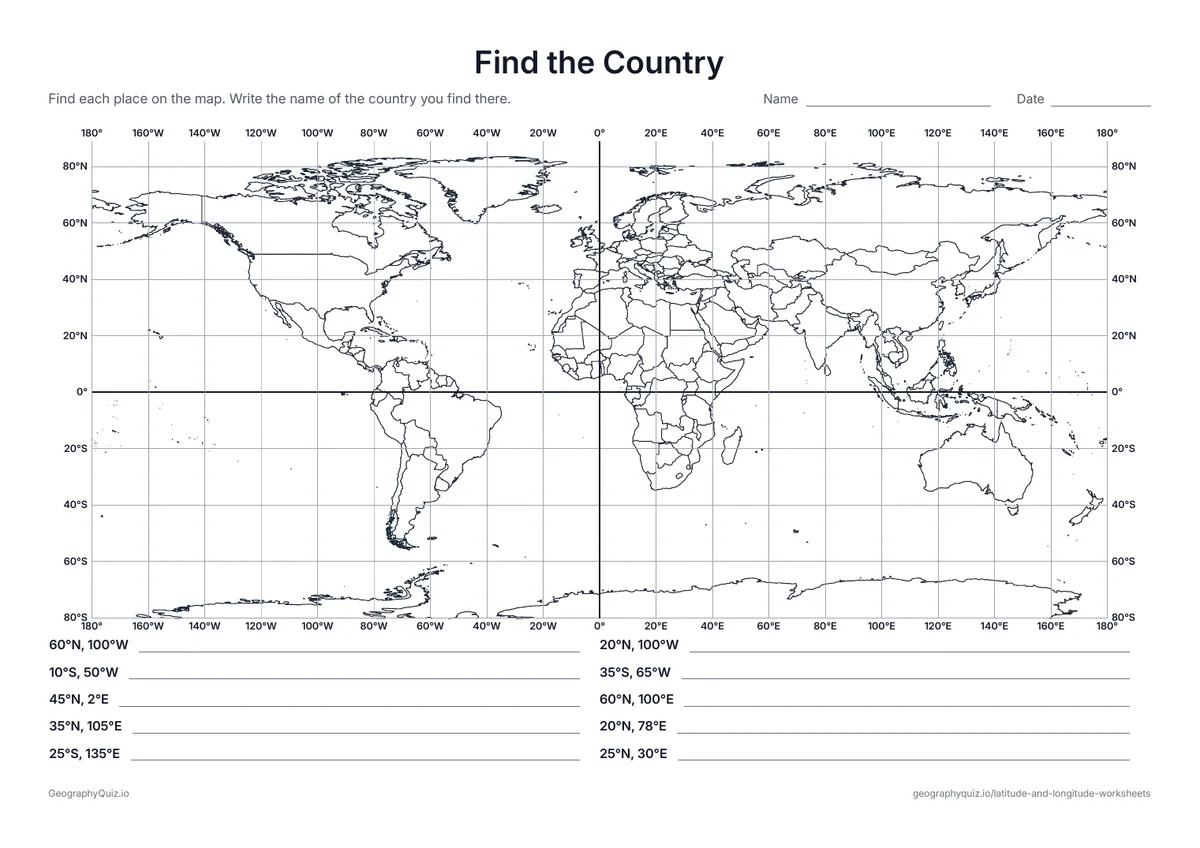
US Letter landscape · 1 page · Map activity
Ten coordinates on a world map with country borders. Students find each one and name the country.
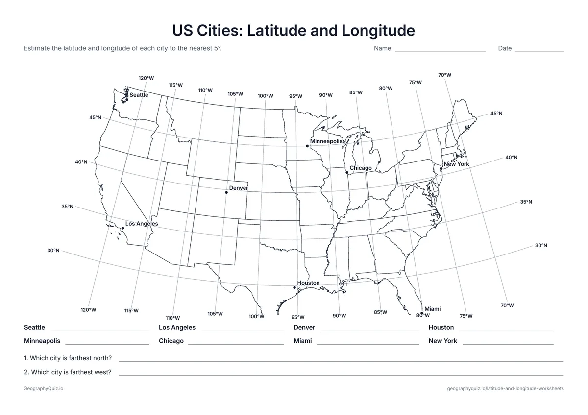
US Letter landscape · 1 page · Map activity
A map of the 48 contiguous states with lines every 5°. Students estimate the coordinates of eight cities.
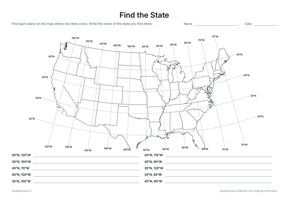
US Letter landscape · 1 page · Map activity
Ten coordinates on a map of the 48 contiguous states. Students find each one and name the state.
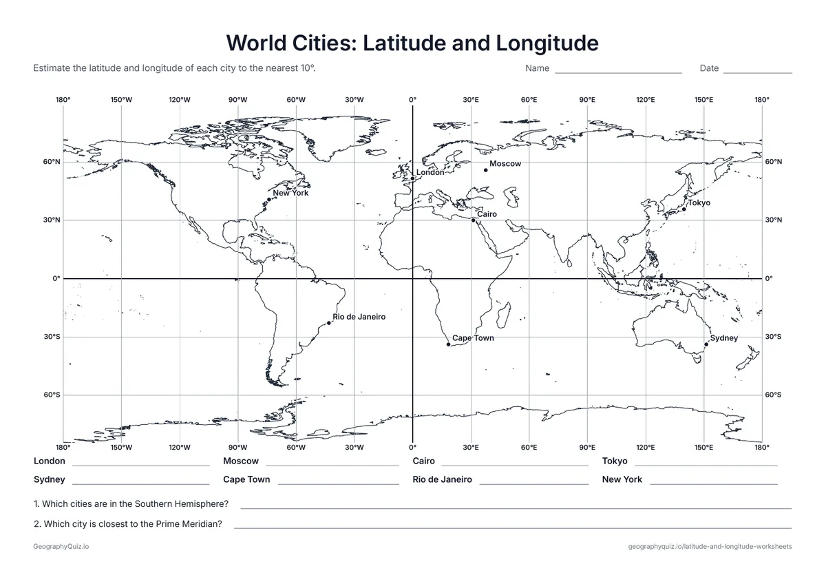
US Letter landscape · 1 page · Map activity
Eight world cities on a 30° grid. Students estimate the latitude and longitude of each one.
For teachers
The world sheets use a straight grid, so lines of latitude run across the page and lines of longitude run up and down, with every line labeled at both ends. Start with the globe, latitude and longitude sheets in grades 3 and 4; the coordinates sheets suit grades 4 to 6, and the city sheets ask students to estimate between the lines. There are no answer sheets: check answers on the map as a class.
Each activity has its instructions, a key to colour in and space for pupils' answers printed on the sheet. The maps are crisp black line drawings with no names, so they photocopy cleanly and pupils do the finding themselves.
Work through the sheets in order. Start with the globe to name the Equator, the Prime Meridian, the poles and the two kinds of lines, then practice reading lines of latitude and lines of longitude on their own. Next, write and plot coordinates on the world grid, find the continent, ocean or country at a set of coordinates, and finish by estimating the coordinates of US and world cities between the lines.
Lines of latitude run east and west, like the rungs of a ladder, and measure how far north or south of the Equator a place is. Lines of longitude run from pole to pole and measure how far east or west of the Prime Meridian a place is. Coordinates give latitude first: 30°N, 90°W is near New Orleans.
Students often swap latitude and longitude, forget the N, S, E or W, or count lines in the wrong direction on the western or southern side of the map. Remind them that numbers grow away from the Equator and away from the Prime Meridian on both sides.
The globe, latitude and longitude practice sheets suit grades 3 and 4. Writing and plotting coordinates and the hemispheres sheet fit grades 4 to 6, and estimating city coordinates suits grades 5 to 7.
Latitude measures how far north or south of the Equator a place is, from 0° to 90°. Longitude measures how far east or west of the Prime Meridian a place is, from 0° to 180°.
Lines of latitude are flat, like the rungs of a ladder – "ladder-tude". Lines of longitude are long and run from pole to pole.
Write latitude first, then longitude, each with its direction: 40°N, 74°W. The Equator and the Prime Meridian are simply 0°.
The point where the Equator meets the Prime Meridian is in the Atlantic Ocean, in the Gulf of Guinea off the coast of West Africa.
Most US students meet latitude and longitude in grades 4 to 6, often after learning the continents, oceans and compass directions.
No. The points sit where grid lines cross or near well-known cities, so you can check answers together on the map or on a globe.
Print it, then play it