US geography · interactive map
US Territories Map
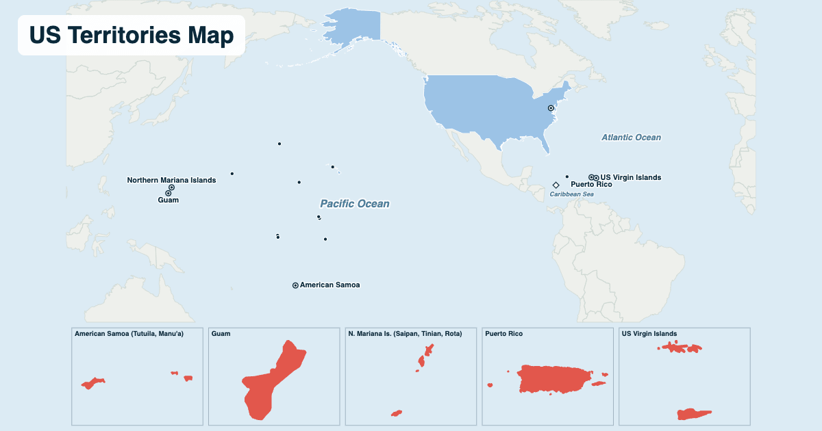
Besides the 50 states and Washington, D.C., the United States has 14 territories: five with people (Puerto Rico, Guam, the US Virgin Islands, the Northern Mariana Islands and American Samoa) and nine small, uninhabited islands, spread from the Caribbean to the western Pacific. Hover over or tap a territory for details; the boxes along the bottom show each inhabited one up close.
- The 50 states
- Inhabited territories (close-ups below the map)
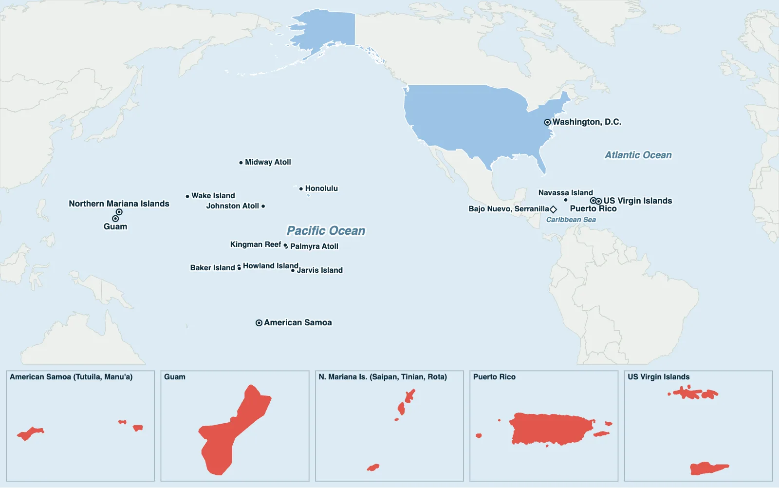
Hover over or tap a state, line or place for details.
Test yourself on this map
Find US States on the Map · Click each state we name
Printable US Territories Map
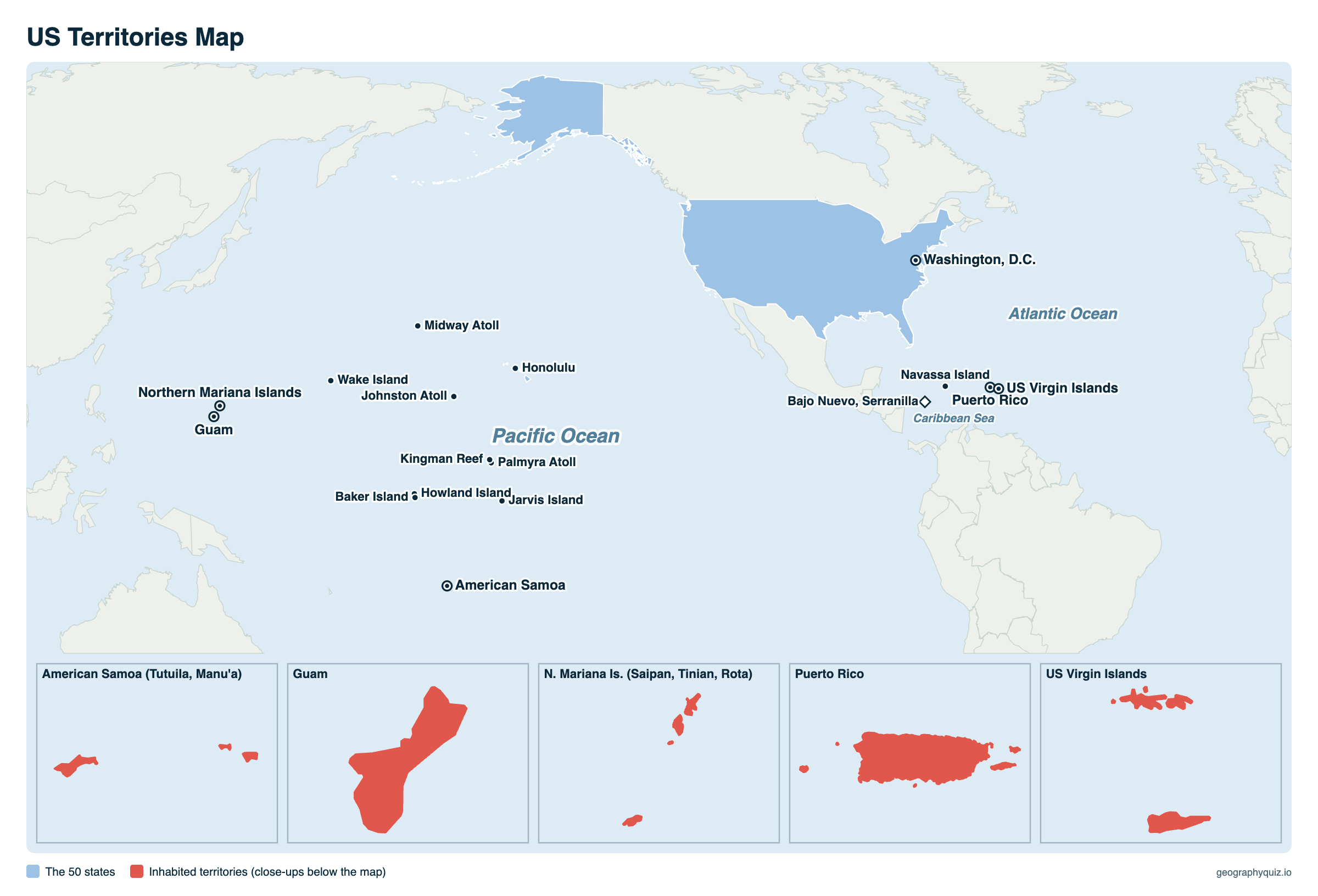
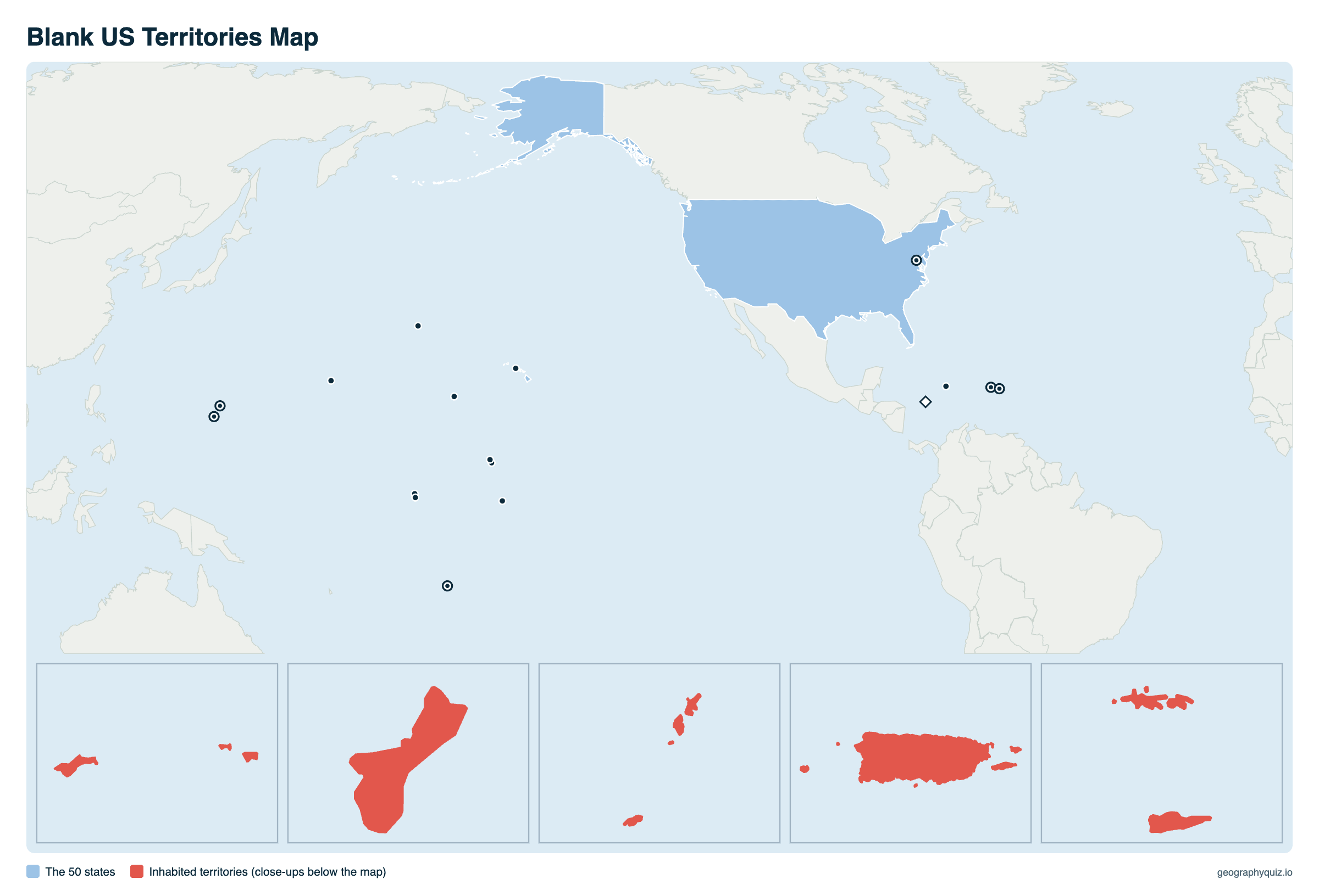
Free to print for class and home: the US territories on a Pacific-centered world map with a close-up of each inhabited territory, on one landscape A4 or US Letter page. On the blank map, students can name each territory from its marker and close-up. The blank version has the same map with no names on it, for labeling in class.
Key facts
- Territories
- 14: 5 inhabited, 9 uninhabited (plus 2 disputed reefs)
- Largest
- Puerto Rico, 3,424 sq mi and 3.3 million people
- People in the territories
- About 3.6 million (2020 Census)
- Westernmost (by longitude)
- Guam, about 6,000 miles west of California, across the International Date Line
- South of the equator
- American Samoa (and uninhabited Jarvis Island)
- Not a territory
- Washington, D.C. is a federal district; Hawaii and Alaska became states in 1959
The 5 inhabited US territories
| Territory | Status | Capital | Population (2020) | Land (sq mi) | Part of the US since | Citizenship |
|---|---|---|---|---|---|---|
| Puerto Rico | Commonwealth (unincorporated, organized) | San Juan | 3,285,874 | 3,424 | 1898, from Spain | US citizens since 1917 |
| Guam | Unincorporated, organized territory | Hagåtña | 153,836 | 210 | 1898, from Spain | US citizens since 1950 |
| US Virgin Islands | Unincorporated, organized territory | Charlotte Amalie | 87,146 | 134 | 1917, bought from Denmark | US citizens since 1927 |
| Northern Mariana Islands | Commonwealth (unincorporated, organized) | Saipan (Capitol Hill) | 47,329 | 182 | 1986 (US-administered from 1947; a commonwealth from 1978) | US citizens since 1986 |
| American Samoa | Unincorporated, unorganized territory | Pago Pago | 49,710 | 76 | 1900 (Tutuila), 1904 (Manu'a) | US nationals, not citizens by birth |
The uninhabited US territories
The nine US Minor Outlying Islands have no permanent population; most are national wildlife refuges, and Wake Island has a military airfield. The United States also claims two reefs in the Caribbean, Bajo Nuevo Bank and Serranilla Bank, that are disputed with Colombia and other countries.
| Island | Ocean | Today |
|---|---|---|
| Midway Atoll | Pacific Ocean | Wildlife refuge, site of the 1942 Battle of Midway; no permanent residents |
| Wake Island | Pacific Ocean | Air Force airfield; no permanent residents |
| Johnston Atoll | Pacific Ocean | Wildlife refuge, former military base |
| Palmyra Atoll | Pacific Ocean | The only incorporated US territory; a nature preserve |
| Kingman Reef | Pacific Ocean | Wildlife refuge, mostly under water |
| Howland Island | Pacific Ocean | Wildlife refuge; Amelia Earhart was flying to it when she disappeared in 1937 |
| Baker Island | Pacific Ocean | Wildlife refuge |
| Jarvis Island | Pacific Ocean | Wildlife refuge |
| Navassa Island | Caribbean Sea | Uninhabited island in the Caribbean, also claimed by Haiti |
What is a US territory?
A territory is land under US sovereignty that is not part of a state. Congress governs the territories under the Constitution's Territory Clause and decides what rights and self-government each one has. The five inhabited territories elect their own governors and legislatures and send a delegate to the House of Representatives who can serve on committees but cannot vote on final passage of bills. They have no senators and do not vote for president, though their parties take part in the presidential primaries.
People born in Puerto Rico, Guam, the US Virgin Islands and the Northern Mariana Islands are US citizens; people born in American Samoa are US nationals, who can live and work anywhere in the US but must apply to become citizens. Puerto Ricans have voted several times on statehood, independence or keeping commonwealth status, without Congress acting on the result.
Places that are not US territories
Three Pacific countries next to Guam and Wake Island are often taken for US territories but are independent: the Federated States of Micronesia, the Marshall Islands and Palau. They were part of the US-run Trust Territory of the Pacific Islands after World War II and now have Compacts of Free Association with the United States (since 1986 for Micronesia and the Marshall Islands, 1994 for Palau): the US is responsible for their defense, and their citizens can live and work in the United States without a visa.
The Philippines was a US territory from 1898 until it became independent on July 4, 1946. Hawaii and Alaska were territories until they became states in 1959, and Washington, D.C. is a federal district, not a territory.
Frequently asked questions
How many US territories are there?
Fourteen: five inhabited (Puerto Rico, Guam, the US Virgin Islands, the Northern Mariana Islands and American Samoa) and nine uninhabited islands (Baker, Howland, Jarvis, Johnston, Kingman Reef, Midway, Navassa, Palmyra and Wake). The US also claims two disputed reefs, Bajo Nuevo and Serranilla Bank.
Is Puerto Rico a state or a territory?
A territory: an unincorporated, self-governing commonwealth of the United States since 1952, under US rule since 1898. Puerto Ricans are US citizens but have no voting member of Congress and do not vote for president.
Which US territories don't have US citizenship?
Only American Samoa. People born in Puerto Rico, Guam, the US Virgin Islands and the Northern Mariana Islands are US citizens at birth; people born in American Samoa are US nationals, not citizens.
Where is Guam?
In the western Pacific Ocean, the southernmost of the Mariana Islands, about 1,500 miles south of Tokyo and about 6,000 miles west of California. Because it is across the International Date Line, its day starts before any US state's: "Where America's day begins."
Are Palau, the Marshall Islands and Micronesia US territories?
No. They are independent countries in free association with the United States: the US handles their defense, and their citizens can live and work in the US without a visa. They were part of a US-run UN trust territory after World War II.
Is the Philippines a US territory?
Not anymore. The United States took the Philippines from Spain in 1898, and it became an independent country on July 4, 1946.
Is Washington, D.C. a territory?
No. It is a federal district, the seat of the national government, set up under the Constitution. Like the territories, it has a non-voting delegate in Congress, but its residents do vote for president.
Which US territory is the largest?
Puerto Rico, with 3,424 square miles of land and about 3.3 million people, more than 20 of the states. Guam is second by population.
Sources
- Territory shapes: US Census Bureau, cartographic boundary files (2024); other land: world country boundaries, on a world map centered on the Pacific.
- Population and land area: US Census Bureau, 2020 Census (Island Areas) and cartographic boundary files.
- Status and citizenship: US Department of the Interior, Office of Insular Affairs; US Government Accountability Office.