Interactive map
Rhineland-Palatinate Map
Every district, city and town in Rhineland-Palatinate on one zoomable map, with its main highways, rivers and lakes. Switch on towns and districts above the map and zoom in for every name; tap a district to see its population, area and largest towns.
Loading the map…
Printable maps of Rhineland-Palatinate
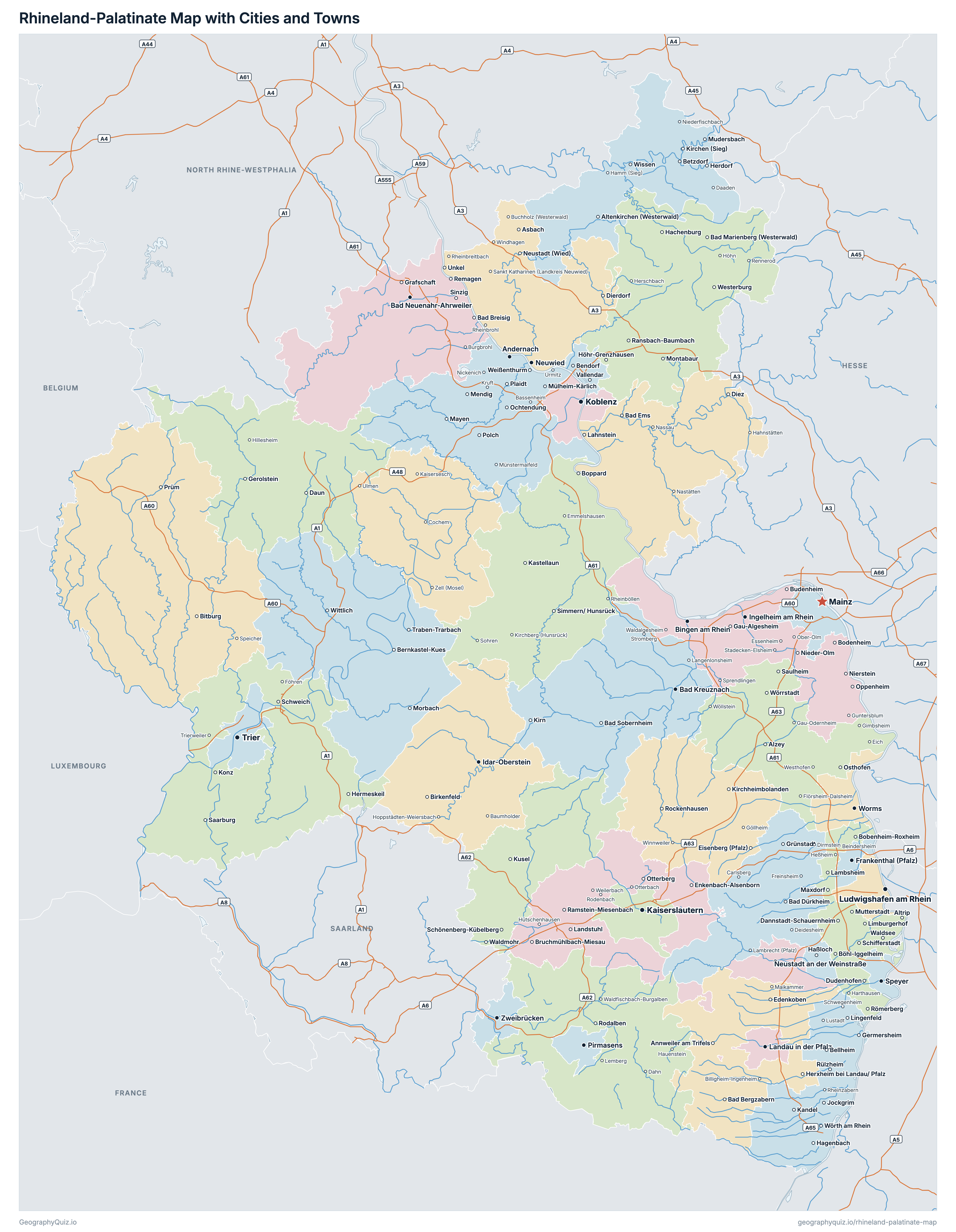
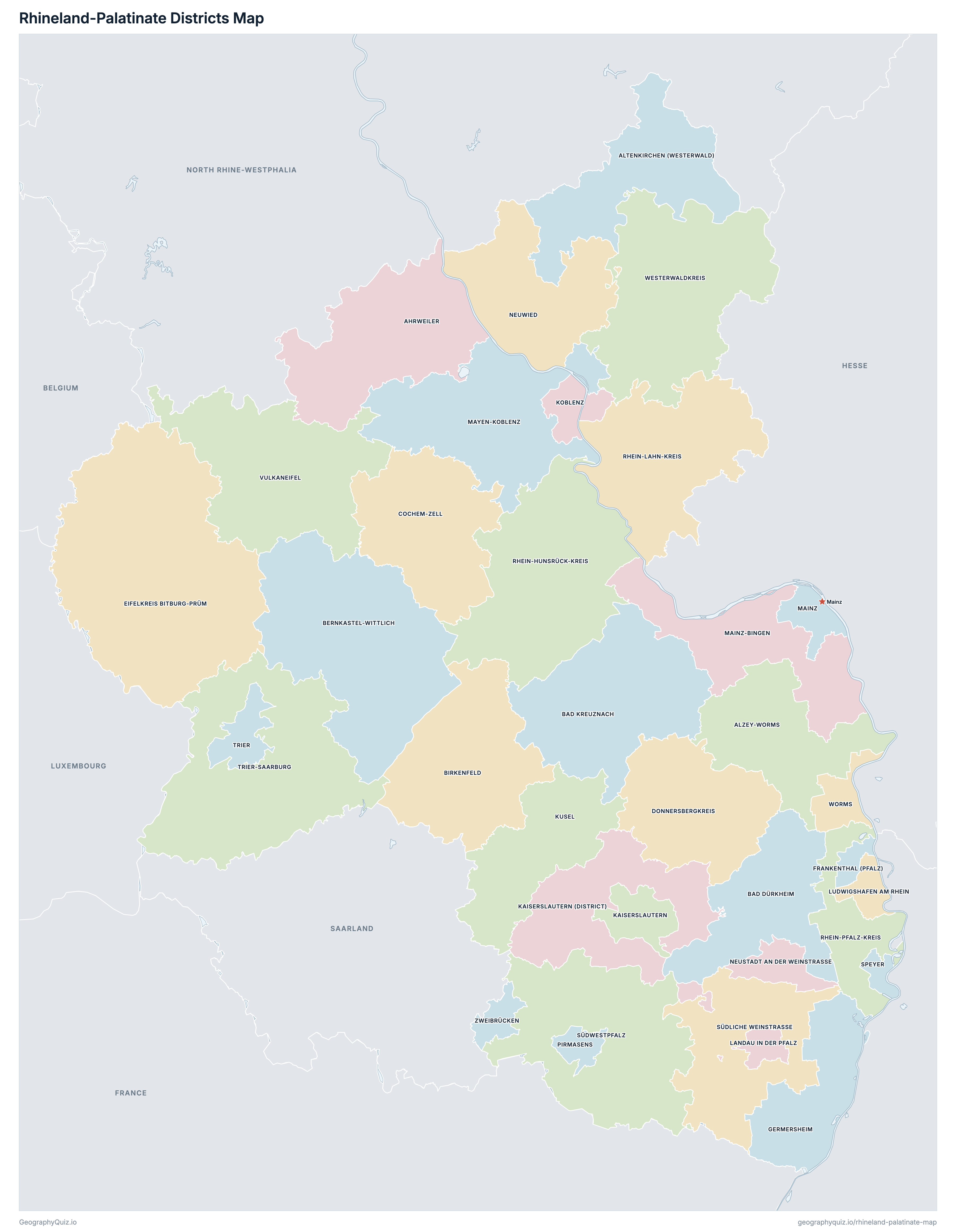
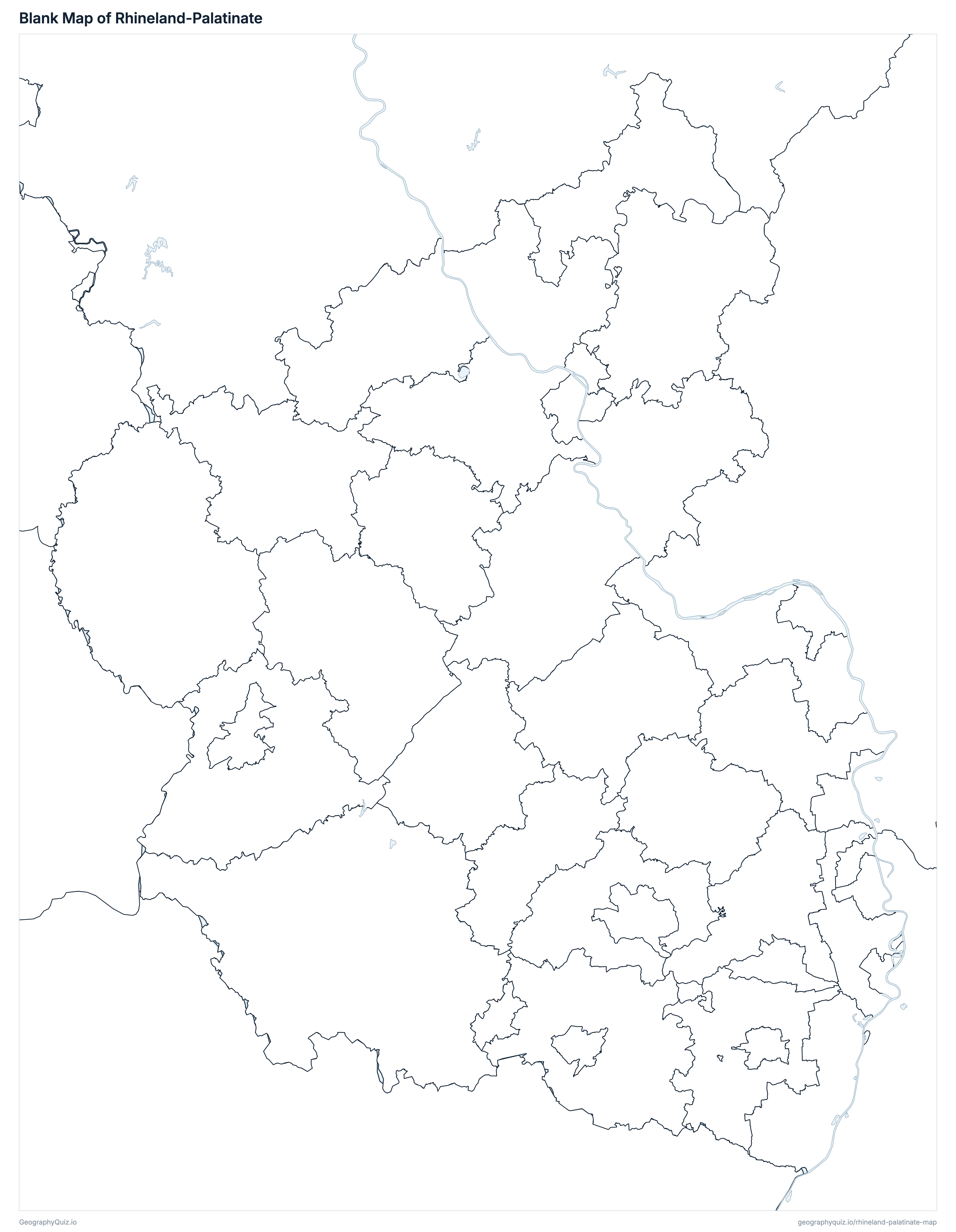
Free to print for class and home: Rhineland-Palatinate with its cities and towns, a map of its districts, and a blank outline map. PDFs fit one A4 or US Letter page.
Rhineland-Palatinate map with cities
Rhineland-Palatinate districts map
Key facts
- Capital
- Mainz
- Largest city
- Mainz (223,888)
- Population
- 4,123,022 (2025)
- Area
- 19,852 km² (7,665 sq mi)
- Districts of Rhineland-Palatinate
- 36
- Most populous district
- Mainz (223,888)
- Largest district by area
- Eifelkreis Bitburg-Prüm, 1,627 km² (628 sq mi)
About Rhineland-Palatinate
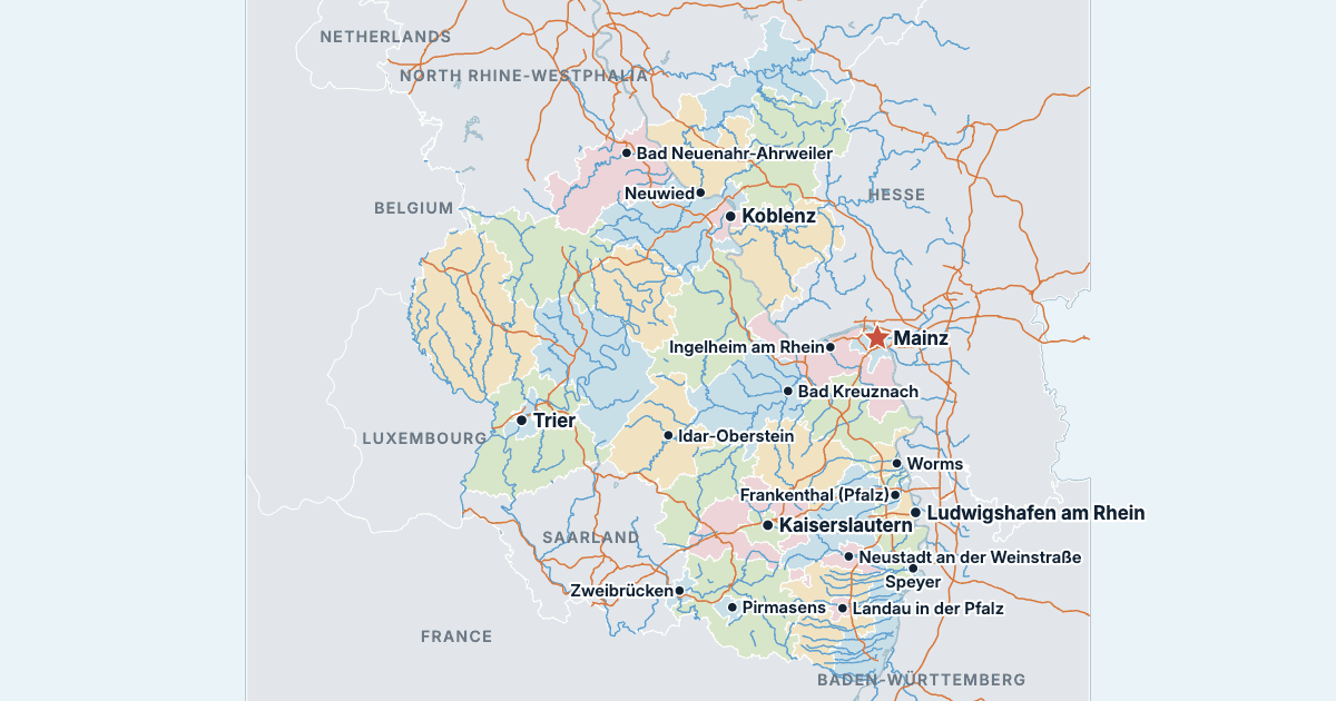
Rhineland-Palatinate has 36 districts and about 4,123,022 people (2025) on 19,852 km² (7,665 sq mi). Mainz is both the capital and the largest city, with 223,888 people. It borders North Rhine-Westphalia, Hesse, Baden-Württemberg, Saarland, France, Luxembourg and Belgium.
Mainz is the most populous district (223,888 people) and Zweibrücken the least (33,178); Eifelkreis Bitburg-Prüm is the largest by area (1,627 km²) and Speyer the smallest (43 km²).
Largest cities in Rhineland-Palatinate
The 25 most populous cities and towns. All 211 are on the map above: switch on Towns and zoom in to see them.
| # | City | District | Population |
|---|---|---|---|
| 1 | Mainz | Mainz | 223,888 |
| 2 | Ludwigshafen am Rhein | Ludwigshafen am Rhein | 177,355 |
| 3 | Koblenz | Koblenz | 113,020 |
| 4 | Trier | Trier | 105,054 |
| 5 | Kaiserslautern | Kaiserslautern | 100,247 |
| 6 | Worms | Worms | 86,921 |
| 7 | Neuwied | Neuwied | 67,201 |
| 8 | Bad Kreuznach | Bad Kreuznach | 54,347 |
| 9 | Neustadt an der Weinstraße | Neustadt an der Weinstraße | 52,882 |
| 10 | Speyer | Speyer | 49,035 |
| 11 | Landau in der Pfalz | Landau in der Pfalz | 48,280 |
| 12 | Frankenthal (Pfalz) | Frankenthal (Pfalz) | 48,134 |
| 13 | Pirmasens | Pirmasens | 39,389 |
| 14 | Ingelheim am Rhein | Mainz-Bingen | 34,903 |
| 15 | Zweibrücken | Zweibrücken | 33,178 |
| 16 | Idar-Oberstein | Birkenfeld | 30,074 |
| 17 | Andernach | Mayen-Koblenz | 29,920 |
| 18 | Bad Neuenahr-Ahrweiler | Ahrweiler | 28,264 |
| 19 | Bingen am Rhein | Mainz-Bingen | 25,424 |
| 20 | Germersheim | Germersheim | 21,532 |
| 21 | Schifferstadt | Rhein-Pfalz-Kreis | 21,392 |
| 22 | Haßloch | Bad Dürkheim | 20,395 |
| 23 | Mayen | Mayen-Koblenz | 19,794 |
| 24 | Alzey | Alzey-Worms | 19,305 |
| 25 | Wittlich | Bernkastel-Wittlich | 19,186 |
Populations are the Federal Statistical Office's population on 31 December 2025, carried forward from the 2022 census, counted in the municipalities of that day; a district's population and area are the sums of its municipalities', and the districts add up to the state's 4,123,022. Towns are whole municipalities (Gemeinden), so a city's figure stops at its boundary.
Districts of Rhineland-Palatinate
All 36 districts. Select one to show it on the map.
| Landkreis | 129,763 | 787 | |
| Landkreis | 132,055 | 642 | |
| Landkreis | 131,076 | 588 | |
| Landkreis | 133,863 | 595 | |
| Landkreis | 164,822 | 864 | |
| Landkreis | 112,751 | 1,168 | |
| Landkreis | 82,304 | 777 | |
| Landkreis | 61,380 | 692 | |
| Landkreis | 74,588 | 645 | |
| Landkreis | 99,589 | 1,627 | |
| Kreisfreie Stadt | 48,134 | 44 | |
| Landkreis | 130,765 | 463 | |
| Kreisfreie Stadt | 100,247 | 140 | |
| Landkreis | 106,317 | 640 | |
| Kreisfreie Stadt | 113,020 | 105 | |
| Landkreis | 68,738 | 574 | |
| Kreisfreie Stadt | 48,280 | 83 | |
| Kreisfreie Stadt | 177,355 | 77 | |
| Kreisfreie Stadt | 223,888 | 98 | |
| Landkreis | 206,603 | 605 | |
| Landkreis | 216,796 | 818 | |
| Kreisfreie Stadt | 52,882 | 117 | |
| Landkreis | 189,146 | 627 | |
| Kreisfreie Stadt | 39,389 | 61 | |
| Landkreis | 106,726 | 991 | |
| Landkreis | 125,160 | 782 | |
| Landkreis | 155,710 | 305 | |
| Kreisfreie Stadt | 49,035 | 43 | |
| Landkreis | 112,597 | 640 | |
| Landkreis | 89,402 | 954 | |
| Kreisfreie Stadt | 105,054 | 117 | |
| Landkreis | 148,645 | 1,102 | |
| Landkreis | 59,160 | 912 | |
| Landkreis | 207,683 | 989 | |
| Kreisfreie Stadt | 86,921 | 109 | |
| Kreisfreie Stadt | 33,178 | 71 |
Quizzes and worksheets
Sources
- Districts, states and Germany's border: Federal Agency for Cartography and Geodesy (BKG), Verwaltungsgebiete 1:250 000 (VG250), the boundaries of 1 January 2026, daten.gdz.bkg.bund.de (dl-de/by-2-0).
- Populations, areas and town locations: Federal Statistical Office (Destatis) for the Statistical Offices of the Federation and the Länder, Gemeindeverzeichnis (GV-ISys), all municipalities on 31 December 2025, population on the basis of the 2022 census.
- Autobahns, rivers and lakes: BKG, Digitales Landschaftsmodell 1:1 000 000 (DLM1000), daten.gdz.bkg.bund.de (dl-de/by-2-0).