Interactive map
Mecklenburg-Western Pomerania Map
Every district, city and town in Mecklenburg-Western Pomerania on one zoomable map, with its main highways, rivers and lakes. Switch on towns and districts above the map and zoom in for every name; tap a district to see its population, area and largest towns.
Loading the map…
Printable maps of Mecklenburg-Western Pomerania
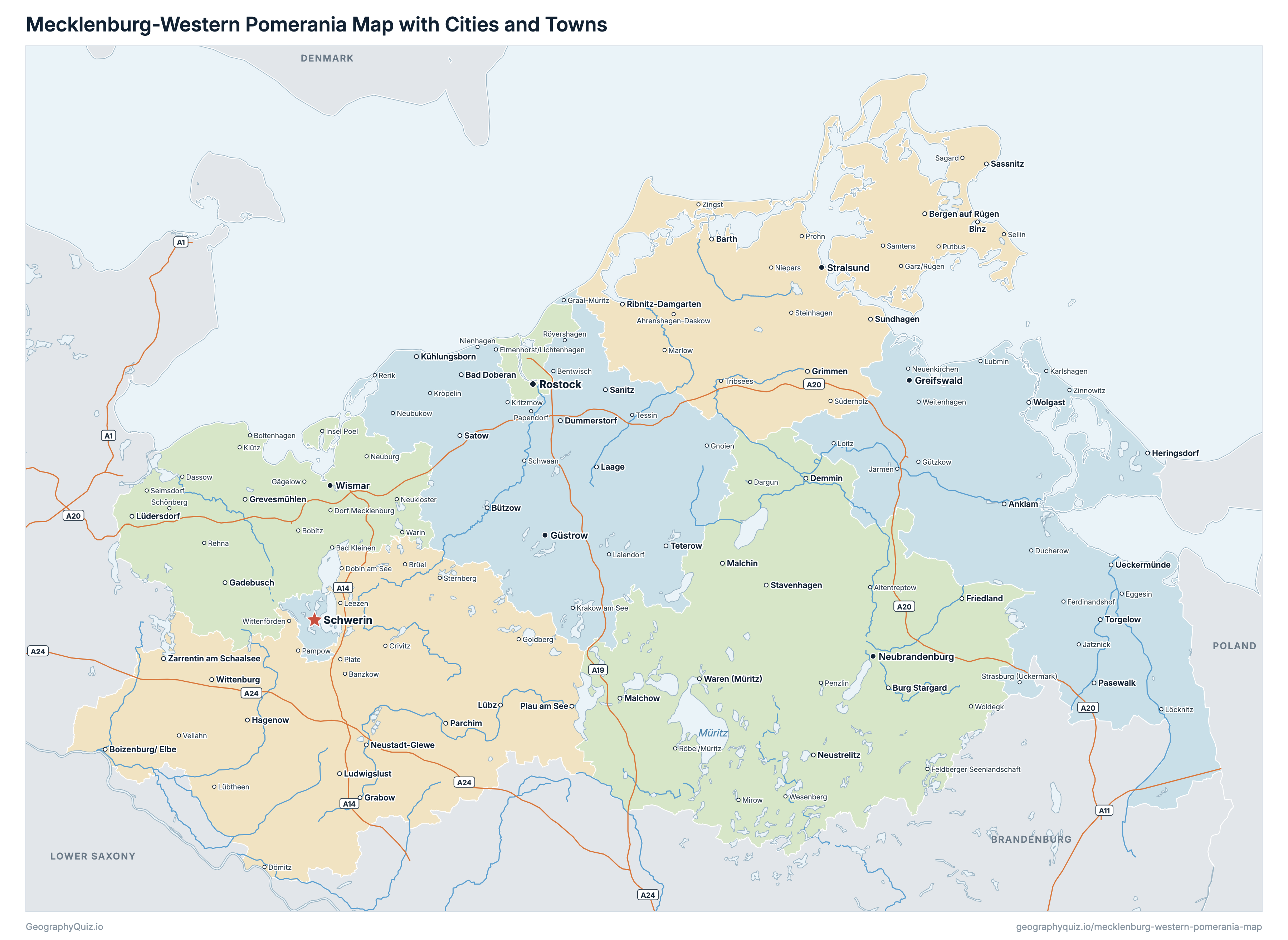
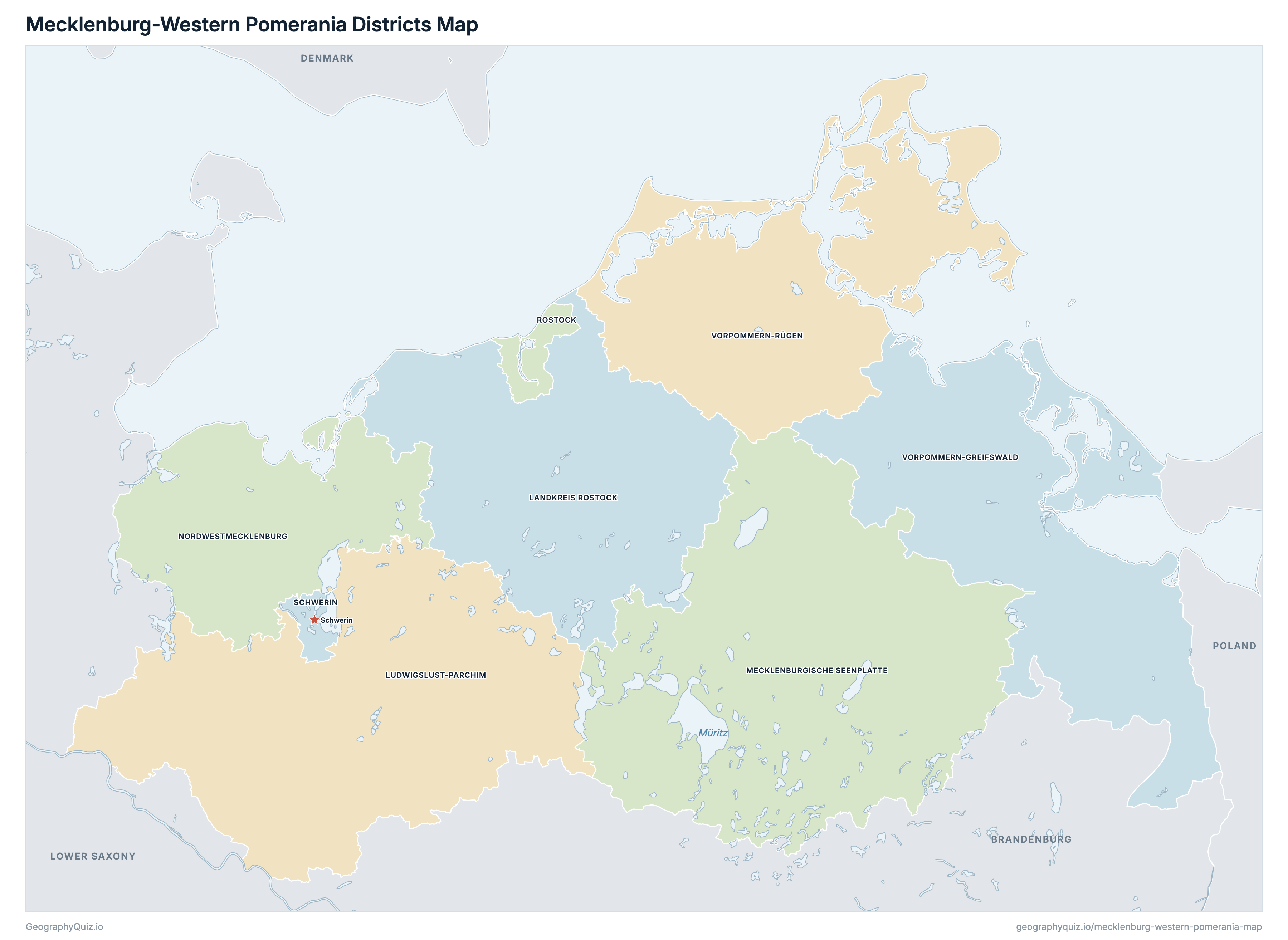
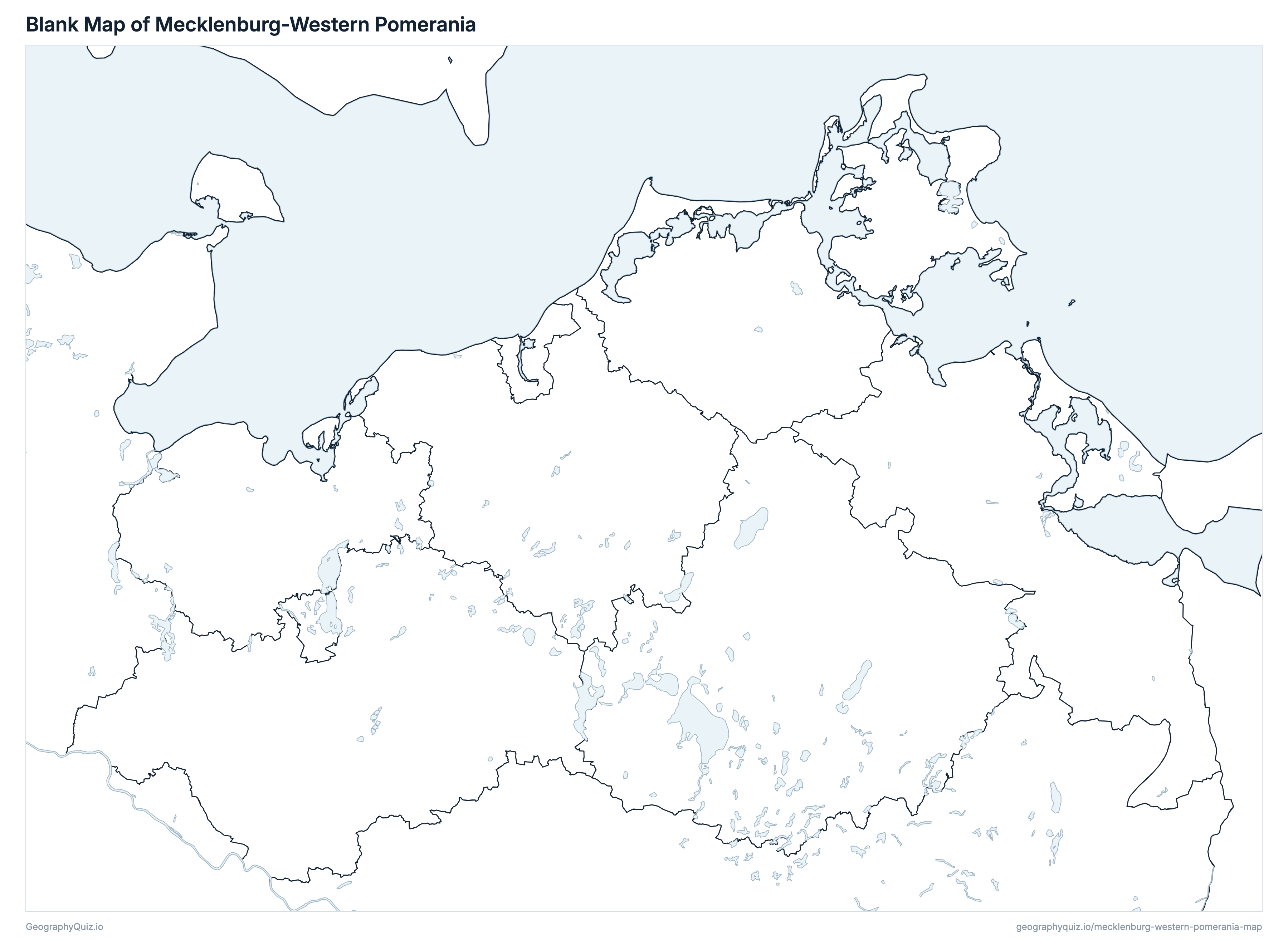
Free to print for class and home: Mecklenburg-Western Pomerania with its cities and towns, a map of its districts, and a blank outline map. PDFs fit one A4 or US Letter page.
Mecklenburg-Western Pomerania map with cities
Mecklenburg-Western Pomerania districts map
Key facts
- Capital
- Schwerin
- Largest city
- Rostock (204,929)
- Population
- 1,573,685 (2025)
- Area
- 23,294 km² (8,994 sq mi)
- Districts of Mecklenburg-Western Pomerania
- 8
- Most populous district
- Mecklenburgische Seenplatte (245,998)
- Largest district by area
- Mecklenburgische Seenplatte, 5,495 km² (2,122 sq mi)
About Mecklenburg-Western Pomerania
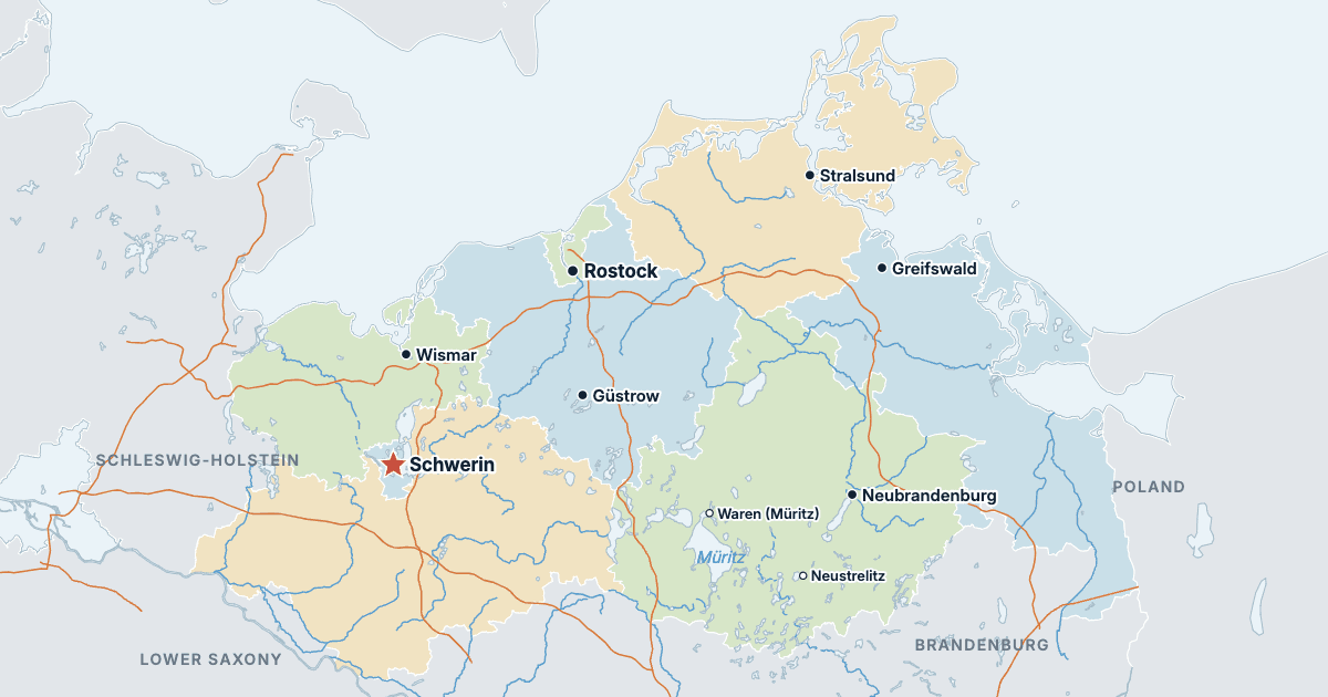
Mecklenburg-Western Pomerania has 8 districts and about 1,573,685 people (2025) on 23,294 km² (8,994 sq mi). The capital is Schwerin; the largest city is Rostock, with 204,929 people. It borders Schleswig-Holstein, Lower Saxony, Brandenburg and Poland.
Mecklenburgische Seenplatte is the most populous district (245,998 people) and Schwerin the least (97,922); Mecklenburgische Seenplatte is the largest by area (5,495 km²) and Schwerin the smallest (131 km²).
Largest cities in Mecklenburg-Western Pomerania
The 25 most populous cities and towns. All 131 are on the map above: switch on Towns and zoom in to see them.
| # | City | District | Population |
|---|---|---|---|
| 1 | Rostock | Rostock | 204,929 |
| 2 | Schwerin | Schwerin | 97,922 |
| 3 | Neubrandenburg | Mecklenburgische Seenplatte | 59,494 |
| 4 | Greifswald | Vorpommern-Greifswald | 56,154 |
| 5 | Stralsund | Vorpommern-Rügen | 55,481 |
| 6 | Wismar | Nordwestmecklenburg | 43,103 |
| 7 | Güstrow | Landkreis Rostock | 28,861 |
| 8 | Waren (Müritz) | Mecklenburgische Seenplatte | 20,211 |
| 9 | Neustrelitz | Mecklenburgische Seenplatte | 20,136 |
| 10 | Parchim | Ludwigslust-Parchim | 17,825 |
| 11 | Ribnitz-Damgarten | Vorpommern-Rügen | 15,297 |
| 12 | Bergen auf Rügen | Vorpommern-Rügen | 13,394 |
| 13 | Bad Doberan | Landkreis Rostock | 13,059 |
| 14 | Hagenow | Ludwigslust-Parchim | 11,987 |
| 15 | Anklam | Vorpommern-Greifswald | 11,793 |
| 16 | Ludwigslust | Ludwigslust-Parchim | 11,778 |
| 17 | Boizenburg/ Elbe | Ludwigslust-Parchim | 11,147 |
| 18 | Wolgast | Vorpommern-Greifswald | 10,859 |
| 19 | Grevesmühlen | Nordwestmecklenburg | 10,082 |
| 20 | Demmin | Mecklenburgische Seenplatte | 10,001 |
| 21 | Pasewalk | Vorpommern-Greifswald | 9,590 |
| 22 | Grimmen | Vorpommern-Rügen | 9,274 |
| 23 | Sassnitz | Vorpommern-Rügen | 8,879 |
| 24 | Torgelow | Vorpommern-Greifswald | 8,755 |
| 25 | Ueckermünde | Vorpommern-Greifswald | 8,651 |
Populations are the Federal Statistical Office's population on 31 December 2025, carried forward from the 2022 census, counted in the municipalities of that day; a district's population and area are the sums of its municipalities', and the districts add up to the state's 1,573,685. Towns are whole municipalities (Gemeinden), so a city's figure stops at its boundary.
Districts of Mecklenburg-Western Pomerania
All 8 districts. Select one to show it on the map.
| Landkreis | 218,123 | 3,431 | |
| Landkreis | 207,160 | 4,767 | |
| Landkreis | 245,998 | 5,495 | |
| Landkreis | 155,869 | 2,127 | |
| Kreisfreie Stadt | 204,929 | 181 | |
| Kreisfreie Stadt | 97,922 | 131 | |
| Landkreis | 225,867 | 3,946 | |
| Landkreis | 217,817 | 3,216 |
Quizzes and worksheets
Sources
- Districts, states and Germany's border: Federal Agency for Cartography and Geodesy (BKG), Verwaltungsgebiete 1:250 000 (VG250), the boundaries of 1 January 2026, daten.gdz.bkg.bund.de (dl-de/by-2-0).
- Populations, areas and town locations: Federal Statistical Office (Destatis) for the Statistical Offices of the Federation and the Länder, Gemeindeverzeichnis (GV-ISys), all municipalities on 31 December 2025, population on the basis of the 2022 census.
- Autobahns, rivers and lakes: BKG, Digitales Landschaftsmodell 1:1 000 000 (DLM1000), daten.gdz.bkg.bund.de (dl-de/by-2-0).