Interactive map
North Rhine-Westphalia Map
Every district, city and town in North Rhine-Westphalia on one zoomable map, with its main highways, rivers and lakes. Switch on towns and districts above the map and zoom in for every name; tap a district to see its population, area and largest towns.
Loading the map…
Printable maps of North Rhine-Westphalia
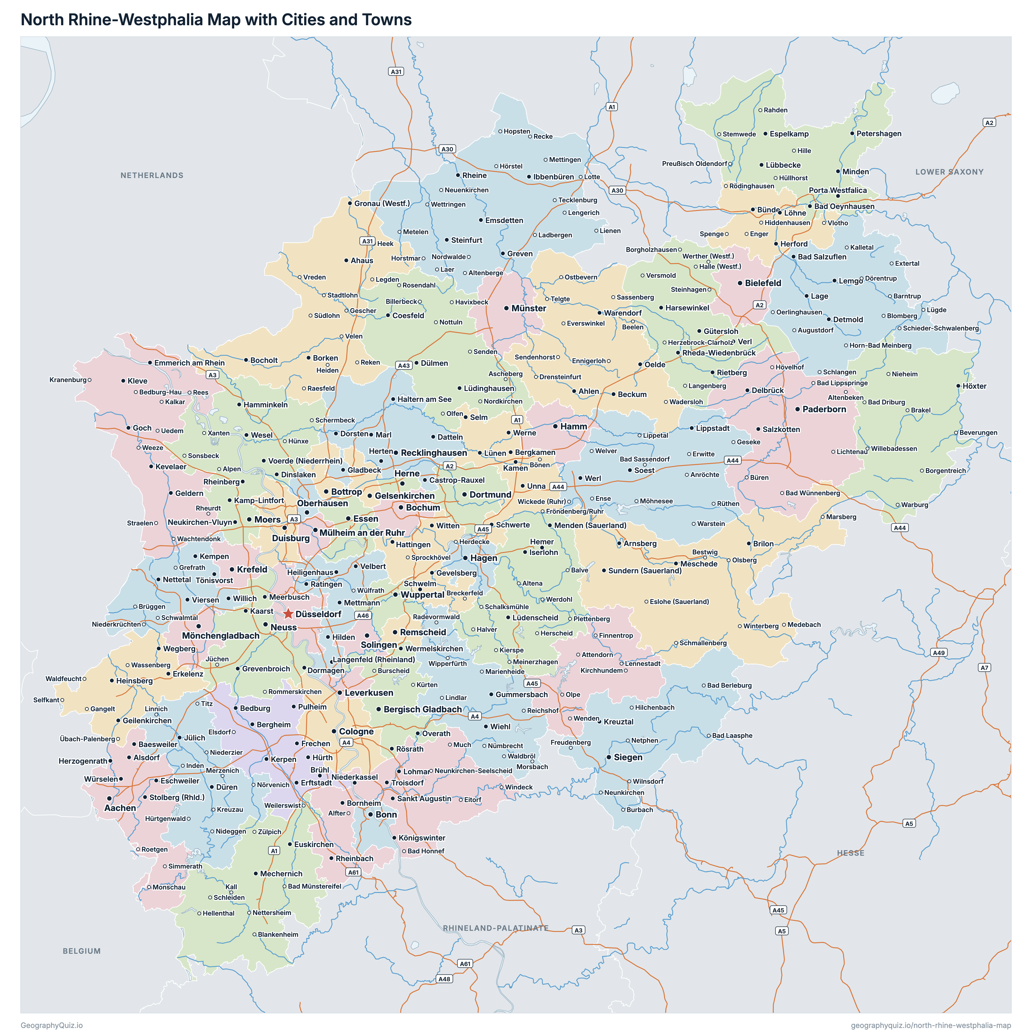
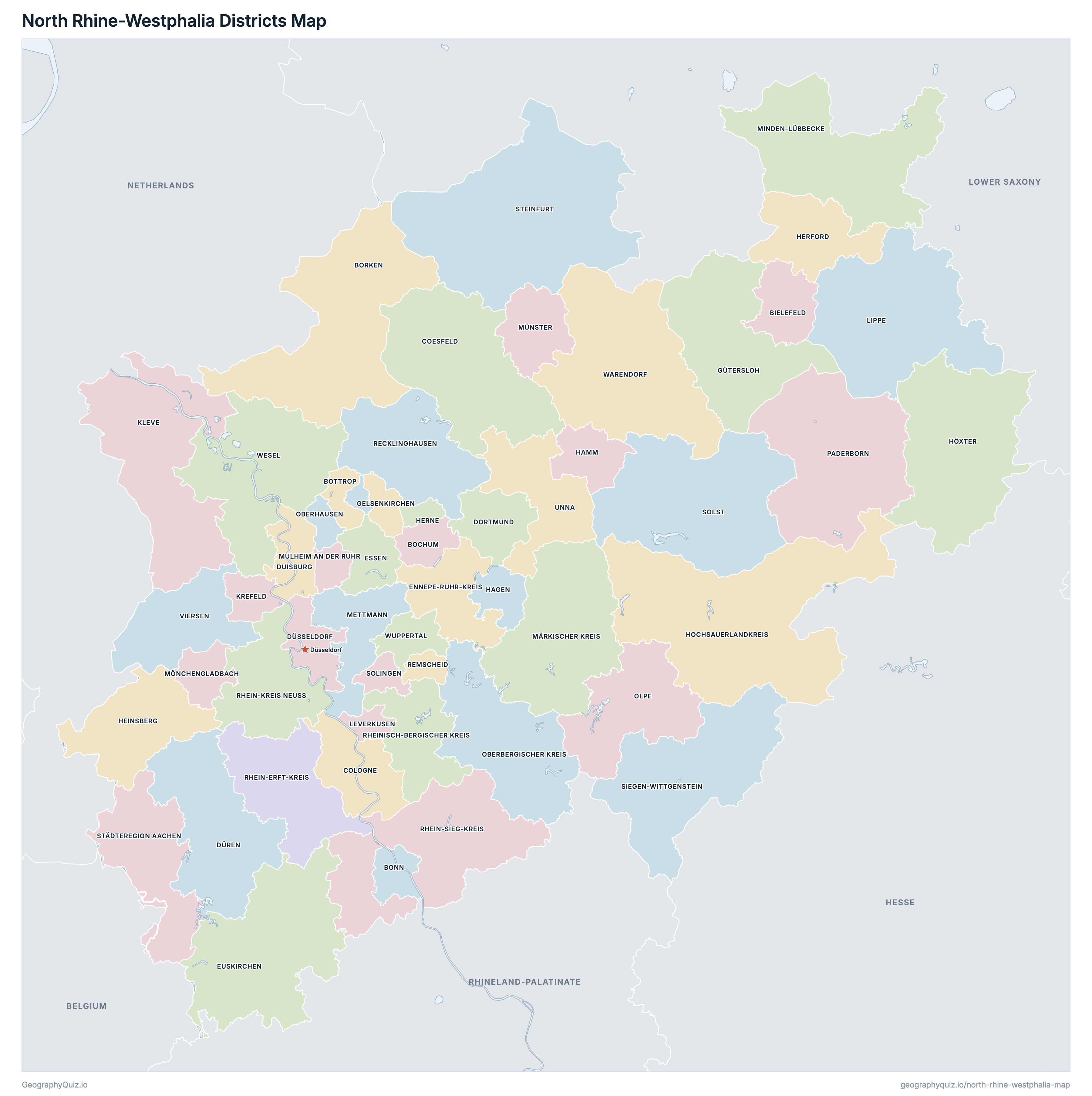
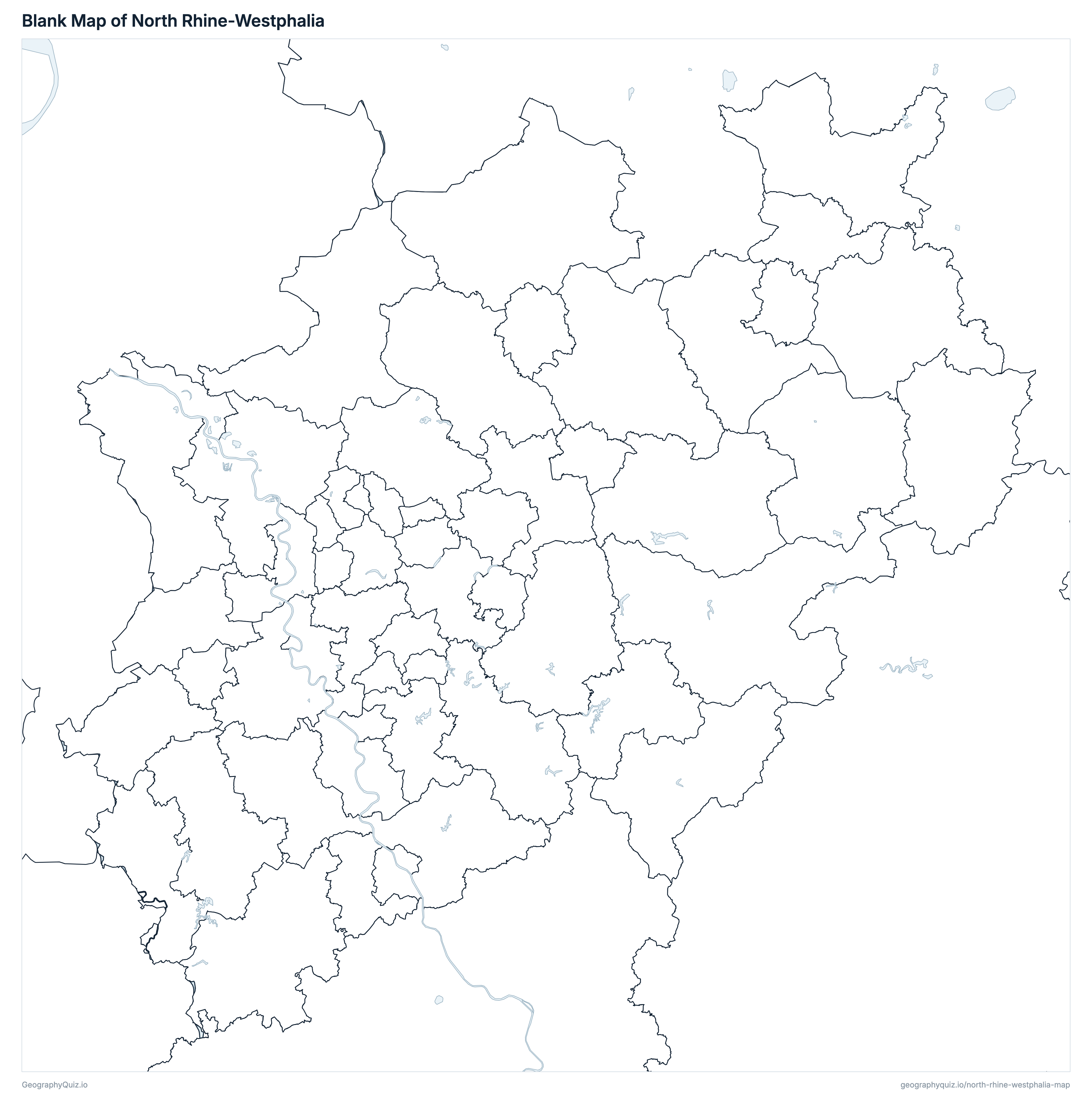
Free to print for class and home: North Rhine-Westphalia with its cities and towns, a map of its districts, and a blank outline map. PDFs fit one A4 or US Letter page.
North Rhine-Westphalia map with cities
North Rhine-Westphalia districts map
Key facts
- Capital
- Düsseldorf
- Largest city
- Cologne (1,025,523)
- Population
- 17,986,214 (2025)
- Area
- 34,112 km² (13,171 sq mi)
- Districts of North Rhine-Westphalia
- 53
- Most populous district
- Cologne (1,025,523)
- Largest district by area
- Hochsauerlandkreis, 1,960 km² (757 sq mi)
About North Rhine-Westphalia
North Rhine-Westphalia has 53 districts and about 17,986,214 people (2025) on 34,112 km² (13,171 sq mi). The capital is Düsseldorf; the largest city is Cologne, with 1,025,523 people. It borders Lower Saxony, Hesse, Rhineland-Palatinate, Belgium and Netherlands.
Cologne is the most populous district (1,025,523 people) and Remscheid the least (113,333); Hochsauerlandkreis is the largest by area (1,960 km²) and Herne the smallest (51 km²).
Largest cities in North Rhine-Westphalia
The 25 most populous cities and towns. All 392 are on the map above: switch on Towns and zoom in to see them.
| # | City | District | Population |
|---|---|---|---|
| 1 | Cologne | Cologne | 1,025,523 |
| 2 | Düsseldorf | Düsseldorf | 619,444 |
| 3 | Dortmund | Dortmund | 600,880 |
| 4 | Essen | Essen | 573,618 |
| 5 | Duisburg | Duisburg | 500,810 |
| 6 | Bochum | Bochum | 358,880 |
| 7 | Wuppertal | Wuppertal | 357,243 |
| 8 | Bielefeld | Bielefeld | 331,419 |
| 9 | Bonn | Bonn | 323,587 |
| 10 | Münster | Münster | 306,368 |
| 11 | Mönchengladbach | Mönchengladbach | 267,176 |
| 12 | Gelsenkirchen | Gelsenkirchen | 266,199 |
| 13 | Aachen | Städteregion Aachen | 263,703 |
| 14 | Krefeld | Krefeld | 230,738 |
| 15 | Oberhausen | Oberhausen | 213,178 |
| 16 | Hagen | Hagen | 189,983 |
| 17 | Hamm | Hamm | 179,108 |
| 18 | Mülheim an der Ruhr | Mülheim an der Ruhr | 171,674 |
| 19 | Leverkusen | Leverkusen | 168,299 |
| 20 | Solingen | Solingen | 164,621 |
| 21 | Herne | Herne | 156,266 |
| 22 | Paderborn | Paderborn | 155,906 |
| 23 | Neuss | Rhein-Kreis Neuss | 153,767 |
| 24 | Bottrop | Bottrop | 118,482 |
| 25 | Recklinghausen | Recklinghausen | 114,851 |
Populations are the Federal Statistical Office's population on 31 December 2025, carried forward from the 2022 census, counted in the municipalities of that day; a district's population and area are the sums of its municipalities', and the districts add up to the state's 17,986,214. Towns are whole municipalities (Gemeinden), so a city's figure stops at its boundary.
Districts of North Rhine-Westphalia
All 53 districts. Select one to show it on the map.
| Kreisfreie Stadt | 331,419 | 259 | |
| Kreisfreie Stadt | 358,880 | 146 | |
| Kreisfreie Stadt | 323,587 | 141 | |
| Kreis | 379,561 | 1,421 | |
| Kreisfreie Stadt | 118,482 | 101 | |
| Kreis | 227,168 | 1,112 | |
| Kreisfreie Stadt | 1,025,523 | 405 | |
| Kreisfreie Stadt | 600,880 | 281 | |
| Kreisfreie Stadt | 500,810 | 233 | |
| Kreis | 279,492 | 941 | |
| Kreisfreie Stadt | 619,444 | 217 | |
| Kreis | 313,003 | 410 | |
| Kreisfreie Stadt | 573,618 | 210 | |
| Kreis | 201,636 | 1,249 | |
| Kreisfreie Stadt | 266,199 | 105 | |
| Kreis | 362,443 | 969 | |
| Kreisfreie Stadt | 189,983 | 160 | |
| Kreisfreie Stadt | 179,108 | 226 | |
| Kreis | 263,507 | 628 | |
| Kreis | 253,431 | 450 | |
| Kreisfreie Stadt | 156,266 | 51 | |
| Kreis | 259,176 | 1,960 | |
| Kreis | 138,156 | 1,201 | |
| Kreis | 320,368 | 1,233 | |
| Kreisfreie Stadt | 230,738 | 138 | |
| Kreisfreie Stadt | 168,299 | 79 | |
| Kreis | 346,212 | 1,246 | |
| Kreis | 405,164 | 1,061 | |
| Kreis | 489,147 | 407 | |
| Kreis | 319,491 | 1,152 | |
| Kreisfreie Stadt | 267,176 | 170 | |
| Kreisfreie Stadt | 171,674 | 91 | |
| Kreisfreie Stadt | 306,368 | 303 | |
| Kreis | 273,368 | 919 | |
| Kreisfreie Stadt | 213,178 | 77 | |
| Kreis | 131,265 | 712 | |
| Kreis | 314,527 | 1,247 | |
| Kreis | 618,865 | 761 | |
| Kreisfreie Stadt | 113,333 | 75 | |
| Kreis | 476,913 | 705 | |
| Kreis | 455,615 | 576 | |
| Kreis | 603,456 | 1,153 | |
| Kreis | 283,775 | 437 | |
| Kreis | 272,509 | 1,133 | |
| Kreis | 298,457 | 1,329 | |
| Kreisfreie Stadt | 164,621 | 90 | |
| Städteregion | 583,325 | 707 | |
| Kreis | 451,004 | 1,796 | |
| Kreis | 392,266 | 543 | |
| Kreis | 297,193 | 563 | |
| Kreis | 281,872 | 1,319 | |
| Kreis | 457,020 | 1,043 | |
| Kreisfreie Stadt | 357,243 | 168 |
Quizzes and worksheets
Sources
- Districts, states and Germany's border: Federal Agency for Cartography and Geodesy (BKG), Verwaltungsgebiete 1:250 000 (VG250), the boundaries of 1 January 2026, daten.gdz.bkg.bund.de (dl-de/by-2-0).
- Populations, areas and town locations: Federal Statistical Office (Destatis) for the Statistical Offices of the Federation and the Länder, Gemeindeverzeichnis (GV-ISys), all municipalities on 31 December 2025, population on the basis of the 2022 census.
- Autobahns, rivers and lakes: BKG, Digitales Landschaftsmodell 1:1 000 000 (DLM1000), daten.gdz.bkg.bund.de (dl-de/by-2-0).