Interactive map
Federal District of Brazil Map
Every administrative region, city and town in the Federal District of Brazil on one zoomable map, with its main highways, rivers and lakes. Switch on towns and administrative regions above the map and zoom in for every name; tap a administrative region to see its population, area and largest towns.
Loading the map…
Printable maps of the Federal District of Brazil
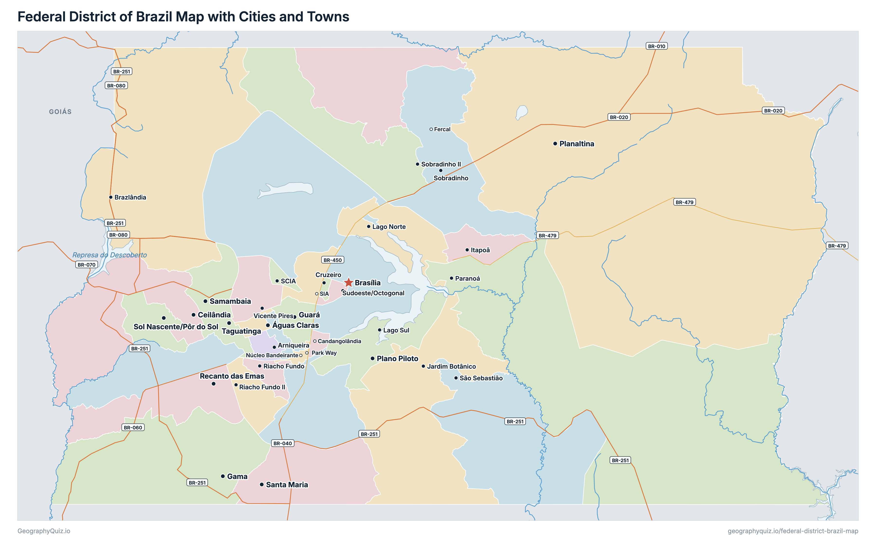
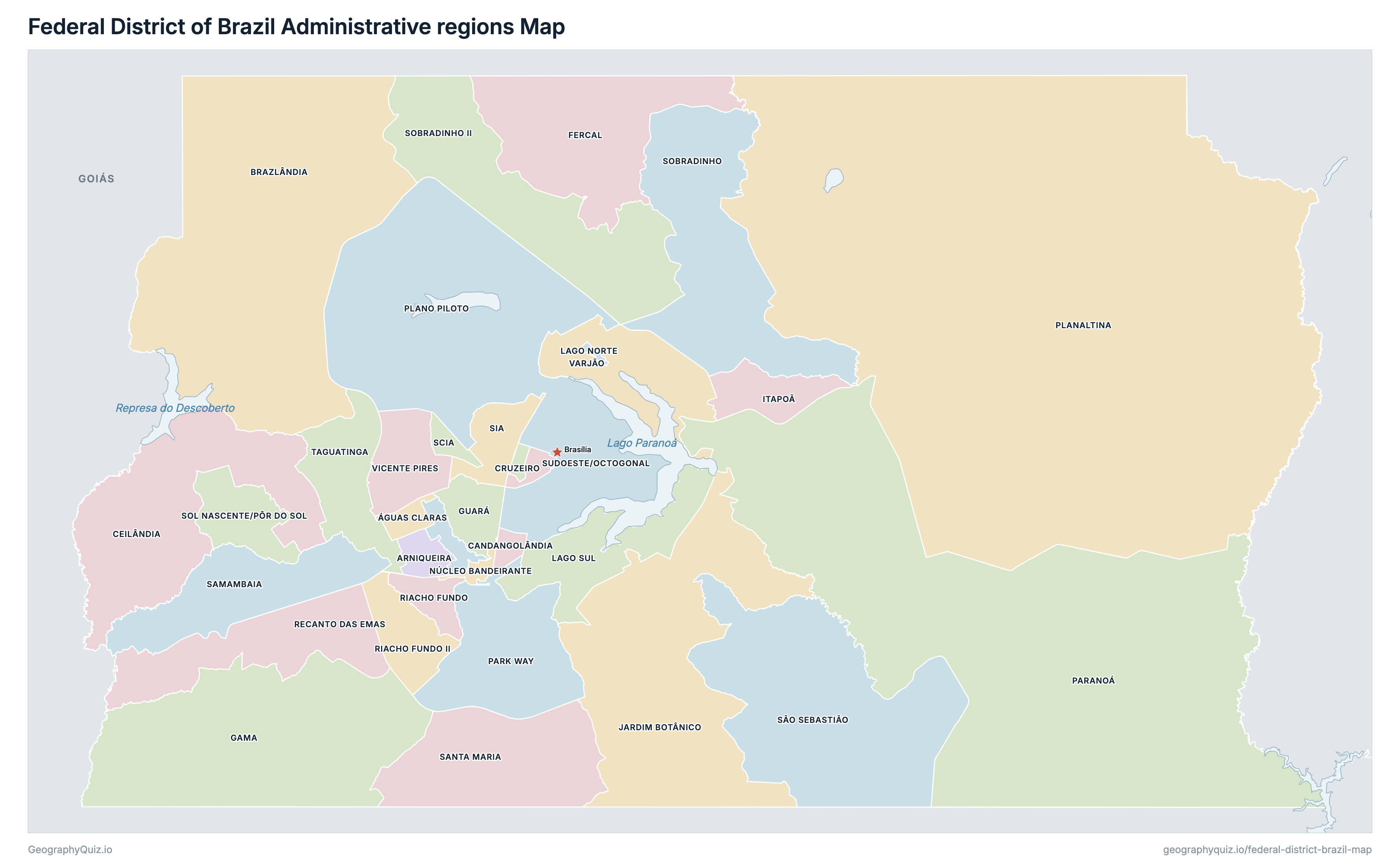
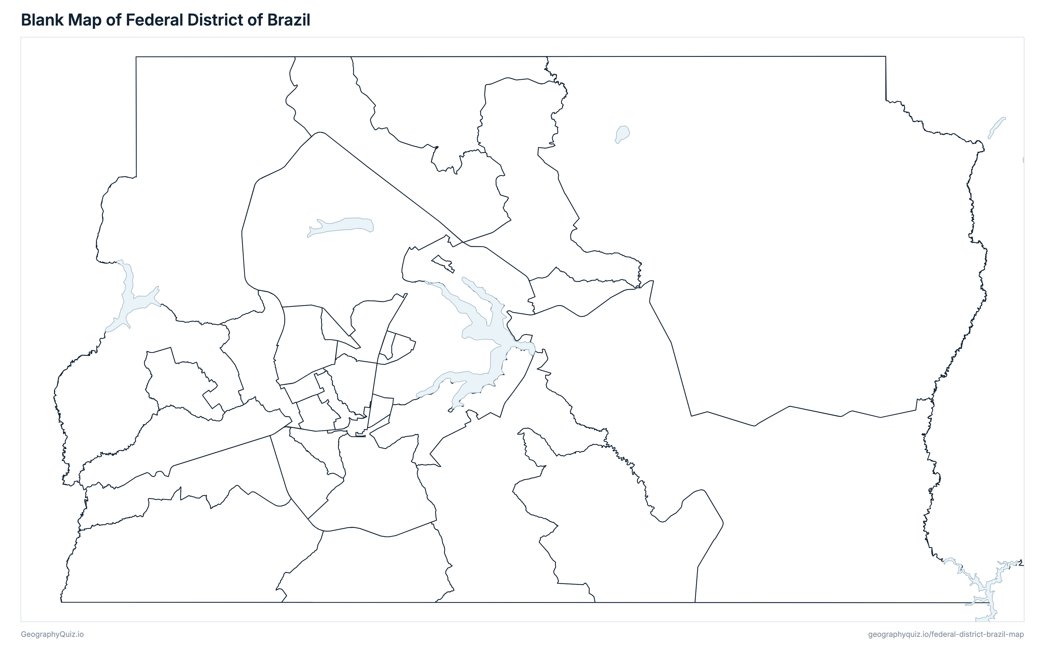
Free to print for class and home: the Federal District of Brazil with its cities and towns, a map of its administrative regions, and a blank outline map. PDFs fit one A4 or US Letter page.
Federal District of Brazil map with cities
Federal District of Brazil administrative regions map
Key facts
- Capital
- Brasília
- Largest city
- Brasília (2,817,381)
- Population
- 2,817,381 (2022)
- Area
- 5,761 km² (2,224 sq mi)
- Administrative regions of the Federal District of Brazil
- 33
- Most populous administrative region
- Ceilândia (287,023)
- Largest administrative region by area
- Planaltina, 1,530 km² (591 sq mi)
About the Federal District of Brazil
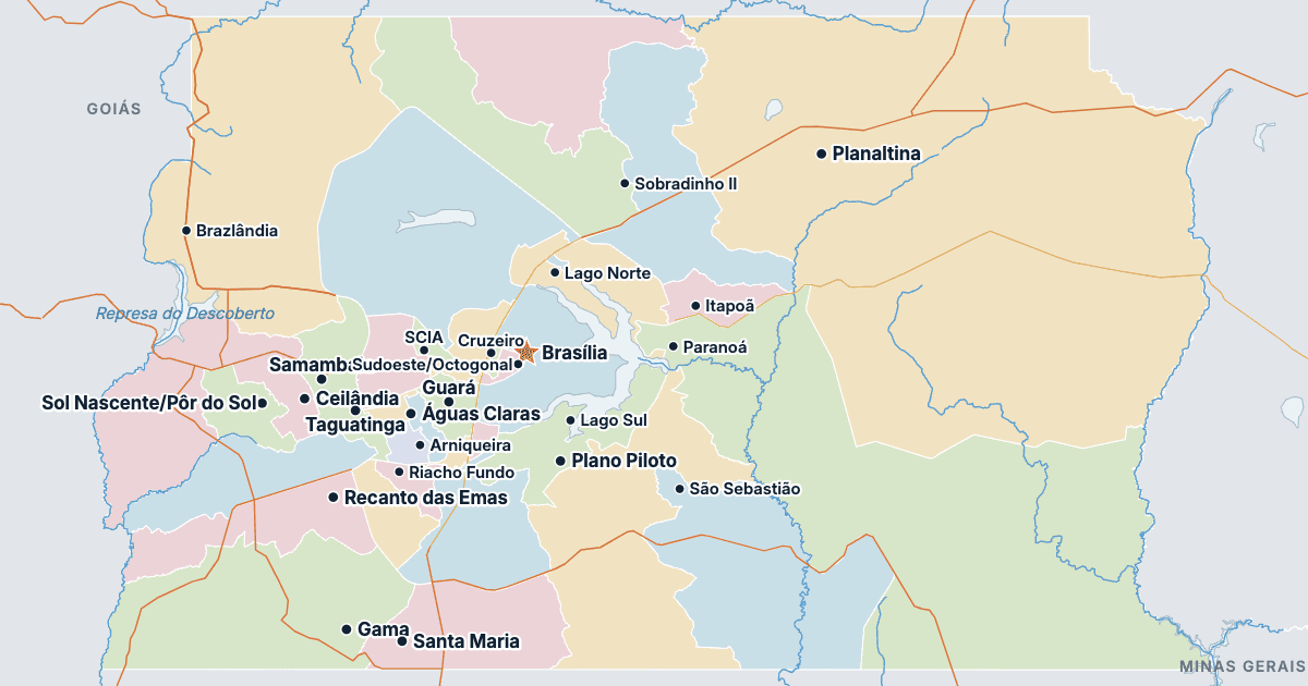
The Federal District of Brazil has 33 administrative regions and about 2,817,381 people (2022) on 5,761 km² (2,224 sq mi). Brasília is both the capital and the largest city, with 2,817,381 people. It borders Goiás and Minas Gerais.
Ceilândia is the most populous administrative region (287,023 people) and SIA the least (5,131); Planaltina is the largest by area (1,530 km²) and Varjão the smallest (1.7 km²).
Largest cities in the Federal District of Brazil
The 25 most populous cities and towns. All 34 are on the map above: switch on Towns and zoom in to see them.
| # | City | Administrative region | Population |
|---|---|---|---|
| 1 | Brasília | Plano Piloto | 2,817,381 |
| 2 | Ceilândia | Ceilândia | 287,023 |
| 3 | Samambaia | Samambaia | 218,840 |
| 4 | Plano Piloto | Plano Piloto | 198,697 |
| 5 | Taguatinga | Taguatinga | 193,367 |
| 6 | Planaltina | Planaltina | 179,989 |
| 7 | Gama | Gama | 139,467 |
| 8 | Águas Claras | Águas Claras | 128,486 |
| 9 | Guará | Guará | 120,641 |
| 10 | Santa Maria | Santa Maria | 116,622 |
| 11 | Recanto das Emas | Recanto das Emas | 115,550 |
| 12 | Sol Nascente/Pôr do Sol | Sol Nascente/Pôr do Sol | 101,866 |
| 13 | São Sebastião | São Sebastião | 98,612 |
| 14 | Vicente Pires | Vicente Pires | 96,871 |
| 15 | Sobradinho II | Sobradinho II | 82,785 |
| 16 | Jardim Botânico | Jardim Botânico | 77,767 |
| 17 | Sobradinho | Sobradinho | 72,244 |
| 18 | Riacho Fundo II | Riacho Fundo II | 65,658 |
| 19 | Itapoã | Itapoã | 65,408 |
| 20 | Paranoá | Paranoá | 63,923 |
| 21 | Brazlândia | Brazlândia | 55,561 |
| 22 | Sudoeste/Octogonal | Sudoeste/Octogonal | 44,354 |
| 23 | Arniqueira | Arniqueira | 42,320 |
| 24 | Lago Norte | Lago Norte | 41,778 |
| 25 | Riacho Fundo | Riacho Fundo | 39,552 |
The Federal District has no municipalities: it is one territory, governed from Brasília and divided into administrative regions, which IBGE's 2022 census counts as subdistricts. Populations are the 2022 census's resident population of its 33 regions, which add up to the Federal District's 2,817,381; IBGE's estimate for 1 July 2026, the figure on the Brazil map, is 3,009,996. Arapoanga and Água Quente, regions created since the census, are counted in the regions they were part of.
Administrative regions of the Federal District of Brazil
All 33 administrative regions. Select one to show it on the map.
| Administrative region | 128,486 | 9.1 | |
| Administrative region | 42,320 | 13 | |
| Administrative region | 55,561 | 470 | |
| Administrative region | 14,040 | 6.6 | |
| Administrative region | 287,023 | 193 | |
| Administrative region | 25,741 | 3.2 | |
| Administrative region | 10,268 | 155 | |
| Administrative region | 139,467 | 275 | |
| Administrative region | 120,641 | 25 | |
| Administrative region | 65,408 | 34 | |
| Administrative region | 77,767 | 290 | |
| Administrative region | 41,778 | 76 | |
| Administrative region | 26,244 | 76 | |
| Administrative region | 21,636 | 5 | |
| Administrative region | 63,923 | 830 | |
| Administrative region | 22,289 | 118 | |
| Administrative region | 179,989 | 1,530 | |
| Administrative region | 198,697 | 436 | |
| Administrative region | 115,550 | 102 | |
| Administrative region | 39,552 | 18 | |
| Administrative region | 65,658 | 38 | |
| Administrative region | 218,840 | 100 | |
| Administrative region | 116,622 | 131 | |
| Administrative region | 98,612 | 262 | |
| Administrative region | 36,042 | 7.4 | |
| Administrative region | 5,131 | 29 | |
| Administrative region | 72,244 | 193 | |
| Administrative region | 82,785 | 181 | |
| Administrative region | 101,866 | 40 | |
| Administrative region | 44,354 | 6.6 | |
| Administrative region | 193,367 | 63 | |
| Administrative region | 8,609 | 1.7 | |
| Administrative region | 96,871 | 43 |
Quizzes and worksheets
Sources
- Administrative regions: IBGE (Brazilian Institute of Geography and Statistics), Censo Demográfico 2022, the census tracts (Malha de Setores Censitários 2022) joined by subdistrict; the neighbouring states: IBGE, Malha Municipal 2025.
- Populations: IBGE, Censo Demográfico 2022, resident population by subdistrict (SIDRA table 9923); the Federal District's estimate for 1 July 2026 (in the note): IBGE, Estimativas da População (SIDRA table 6579).
- Locations of Brasília and the administrative regions: IBGE, Localidades do Brasil 2022.
- Federal highways (BR-xxx), rivers, lakes and reservoirs: IBGE, Base Cartográfica Contínua do Brasil 1:250 000 (BC250), edition 2025.