Interactive map
California Map
Every county, city and town in California on one zoomable map, with interstates, US highways, rivers and lakes. Switch on towns and counties above the map and zoom in for every name; tap a county to see its seat, population and largest towns.
Loading the map…
Printable maps of California
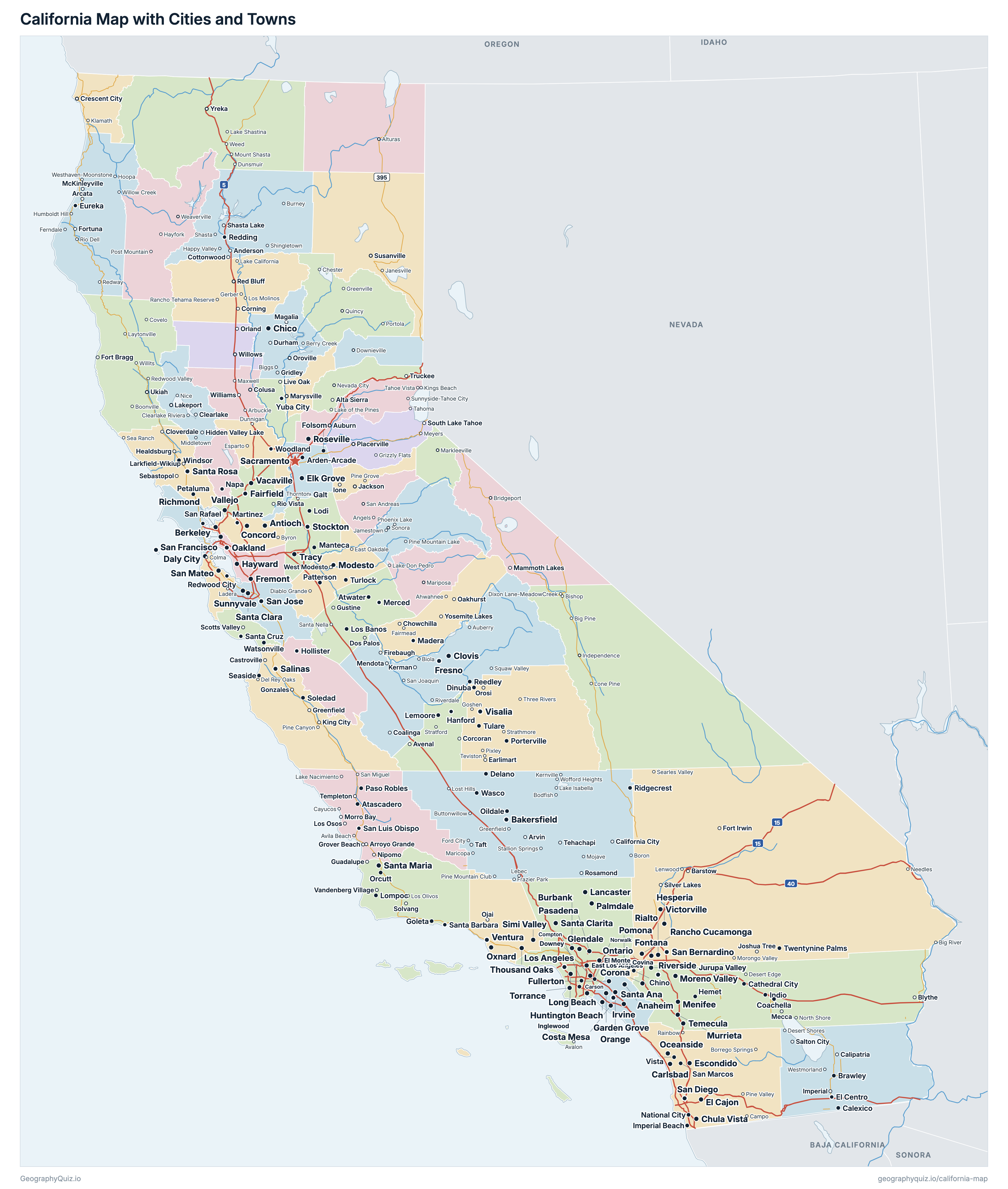
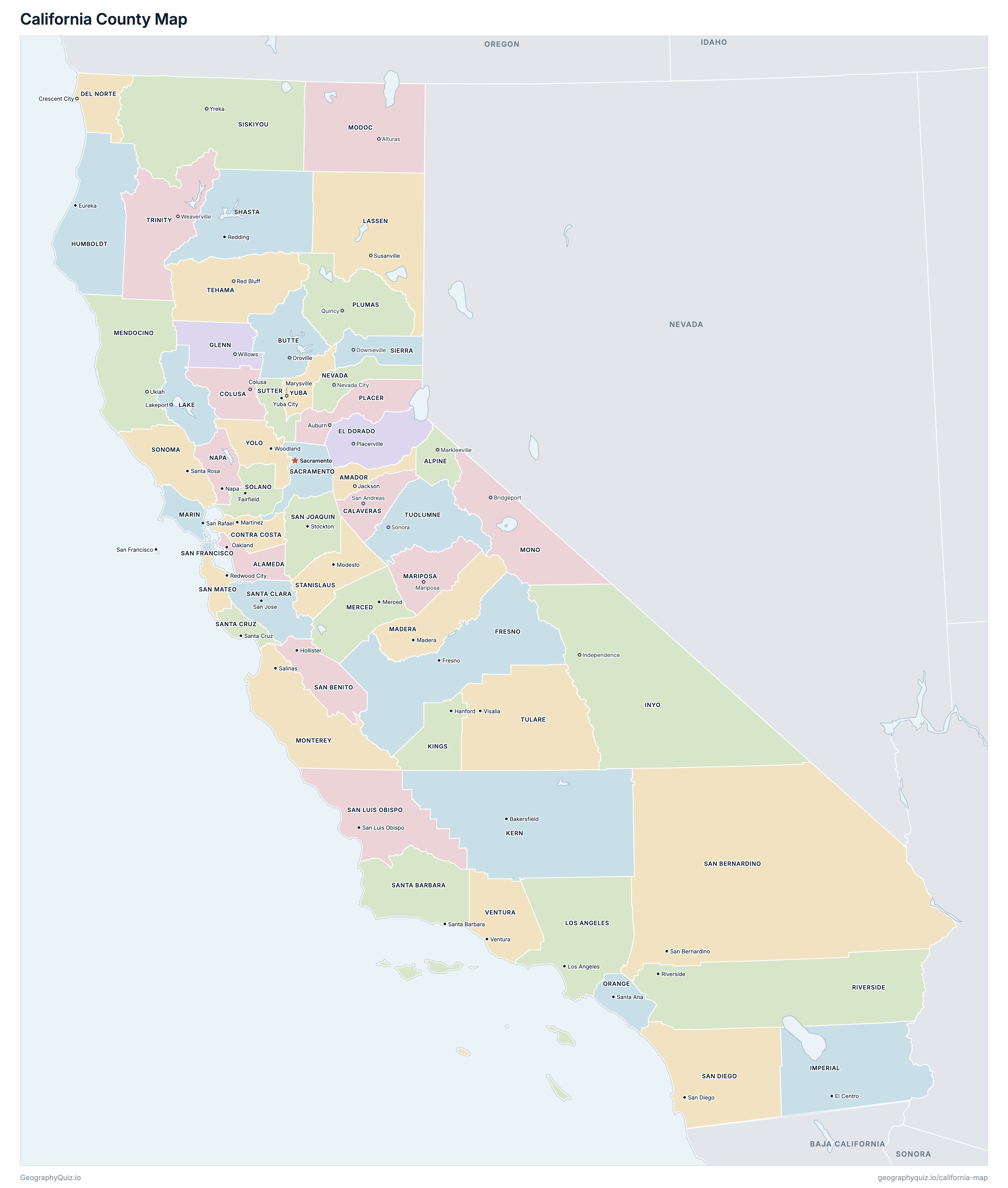
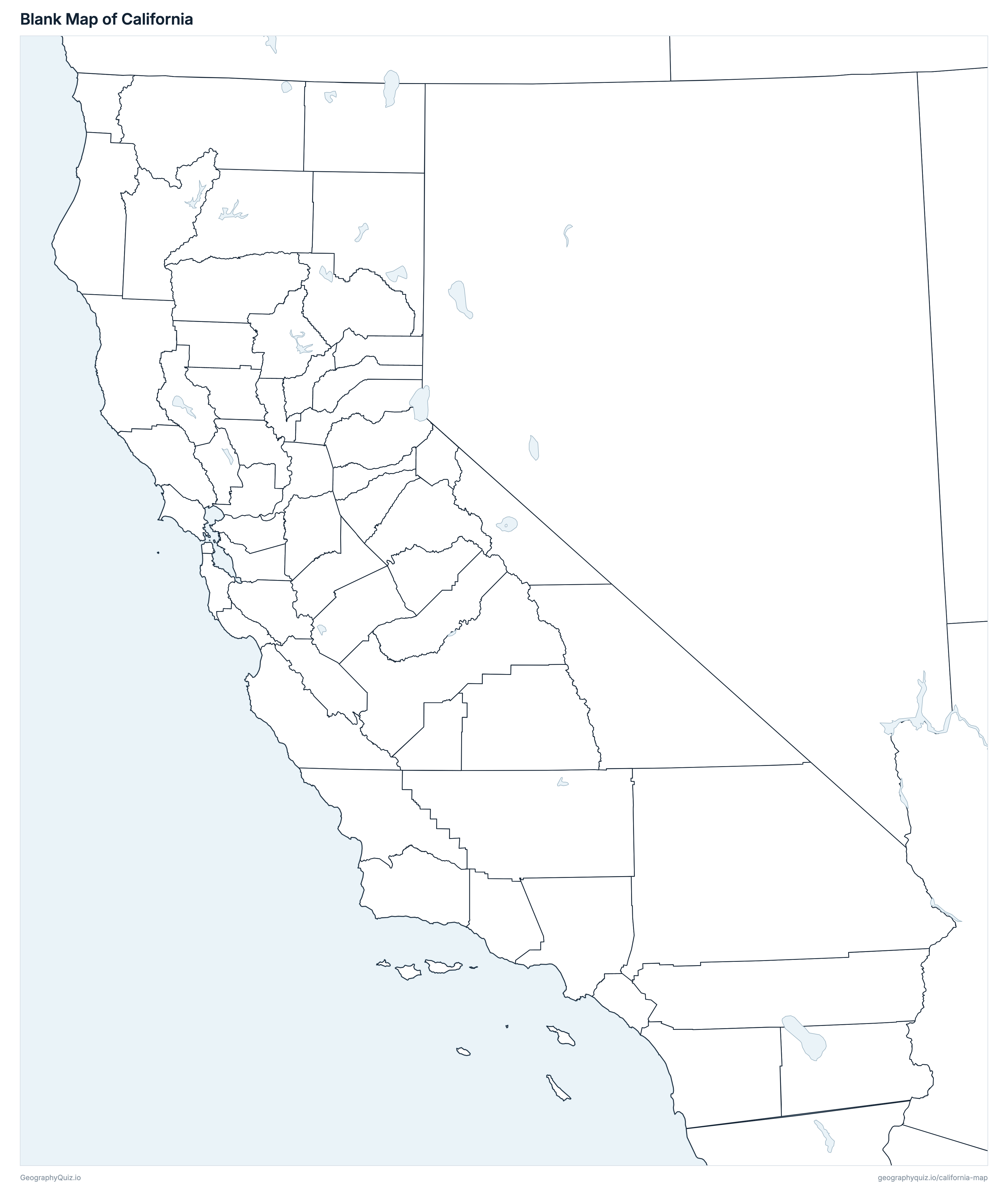
Free to print for class and home: California with its cities and towns, a county map with every county and county seat, and a blank outline map. PDFs fit one A4 or US Letter page.
California map with cities
California county map
About California
California has 58 counties, 462 cities, 21 towns and 1,123 Census-designated communities, and about 39,355,309 people (2025 estimate) on 403,673 km² (155,859 sq mi) of land. The capital is Sacramento; the largest city is Los Angeles, with 3,869,089 people. It borders Arizona, Nevada and Oregon, and the Mexican state of Baja California.
Los Angeles County is the most populous county (9,694,934 people) and Alpine County the least (1,043); San Bernardino County is the largest by land area (51,976 km²) and San Francisco County the smallest (121 km²).
Largest cities in California
The 25 most populous cities and towns. All 1,606 are on the map above: switch on Towns and zoom in to see them.
| # | City | County | Population |
|---|---|---|---|
| 1 | Los Angeles | Los Angeles County | 3,869,089 |
| 2 | San Diego | San Diego County | 1,406,106 |
| 3 | San Jose | Santa Clara County | 989,814 |
| 4 | San Francisco | San Francisco County | 826,079 |
| 5 | Fresno | Fresno County | 555,549 |
| 6 | Sacramento | Sacramento County | 536,449 |
| 7 | Long Beach | Los Angeles County | 450,469 |
| 8 | Oakland | Alameda County | 440,838 |
| 9 | Bakersfield | Kern County | 422,165 |
| 10 | Anaheim | Orange County | 341,008 |
| 11 | Stockton | San Joaquin County | 324,597 |
| 12 | Riverside | Riverside County | 323,057 |
| 13 | Irvine | Orange County | 318,764 |
| 14 | Santa Ana | Orange County | 315,586 |
| 15 | Chula Vista | San Diego County | 275,533 |
| 16 | Santa Clarita | Los Angeles County | 228,430 |
| 17 | Fremont | Alameda County | 226,442 |
| 18 | San Bernardino | San Bernardino County | 222,044 |
| 19 | Fontana | San Bernardino County | 221,223 |
| 20 | Modesto | Stanislaus County | 219,652 |
| 21 | Moreno Valley | Riverside County | 214,263 |
| 22 | Oxnard | Ventura County | 199,651 |
| 23 | Huntington Beach | Orange County | 191,451 |
| 24 | Glendale | Los Angeles County | 187,160 |
| 25 | Ontario | San Bernardino County | 187,013 |
Populations are US Census Bureau estimates for July 2025, within city or town limits.
Counties of California
All 58 counties with their county seats. Select one to show it on the map.
| Oakland | 1,636,630 | 1,910 | |
| Markleeville | 1,043 | 1,912 | |
| Jackson | 41,876 | 1,540 | |
| Oroville | 209,211 | 4,238 | |
| San Andreas | 46,605 | 2,642 | |
| Colusa | 21,836 | 2,980 | |
| Martinez | 1,170,070 | 1,857 | |
| Crescent City | 26,410 | 2,606 | |
| Placerville | 192,323 | 4,423 | |
| Fresno | 1,035,456 | 15,432 | |
| Willows | 28,141 | 3,403 | |
| Eureka | 131,647 | 9,241 | |
| El Centro | 181,411 | 10,815 | |
| Independence | 18,158 | 26,411 | |
| Bakersfield | 927,068 | 21,069 | |
| Hanford | 154,327 | 3,603 | |
| Lakeport | 67,772 | 3,251 | |
| Susanville | 28,117 | 11,762 | |
| Los Angeles | 9,694,934 | 10,516 | |
| Madera | 167,927 | 5,535 | |
| San Rafael | 253,694 | 1,347 | |
| Mariposa | 16,918 | 3,752 | |
| Ukiah | 88,122 | 9,083 | |
| Merced | 297,260 | 5,019 | |
| Alturas | 8,426 | 10,226 | |
| Bridgeport | 12,505 | 7,897 | |
| Salinas | 433,729 | 8,500 | |
| Napa | 132,949 | 1,948 | |
| Nevada City | 101,911 | 2,481 | |
| Santa Ana | 3,149,507 | 2,053 | |
| Auburn | 442,081 | 3,644 | |
| Quincy | 18,583 | 6,612 | |
| Riverside | 2,544,916 | 18,672 | |
| Sacramento | 1,618,460 | 2,500 | |
| Hollister | 70,082 | 3,597 | |
| San Bernardino | 2,224,091 | 51,976 | |
| San Diego | 3,282,248 | 10,905 | |
| San Francisco | 826,079 | 121 | |
| Stockton | 823,815 | 3,606 | |
| San Luis Obispo | 282,367 | 8,549 | |
| Redwood City | 743,568 | 1,162 | |
| Santa Barbara | 442,065 | 7,081 | |
| San Jose | 1,914,391 | 3,344 | |
| Santa Cruz | 258,852 | 1,153 | |
| Redding | 181,648 | 9,779 | |
| Downieville | 3,098 | 2,469 | |
| Yreka | 42,013 | 16,262 | |
| Fairfield | 455,376 | 2,128 | |
| Santa Rosa | 486,444 | 4,080 | |
| Modesto | 557,719 | 3,875 | |
| Yuba City | 98,787 | 1,561 | |
| Red Bluff | 64,665 | 7,638 | |
| Weaverville | 15,720 | 8,234 | |
| Visalia | 485,146 | 12,494 | |
| Sonora | 53,160 | 5,752 | |
| Ventura | 830,851 | 4,768 | |
| Woodland | 224,410 | 2,624 | |
| Marysville | 88,691 | 1,637 |
Practise US geography
Sources
- Counties, state borders, city and town locations and highways: US Census Bureau cartographic boundary files, Gazetteer files and TIGER/Line roads (2023).
- Populations: US Census Bureau Population Estimates, Vintage 2025; Census-designated communities: 2020 Census.
- County seats and founding years: National Association of Counties (NACo) County Explorer.