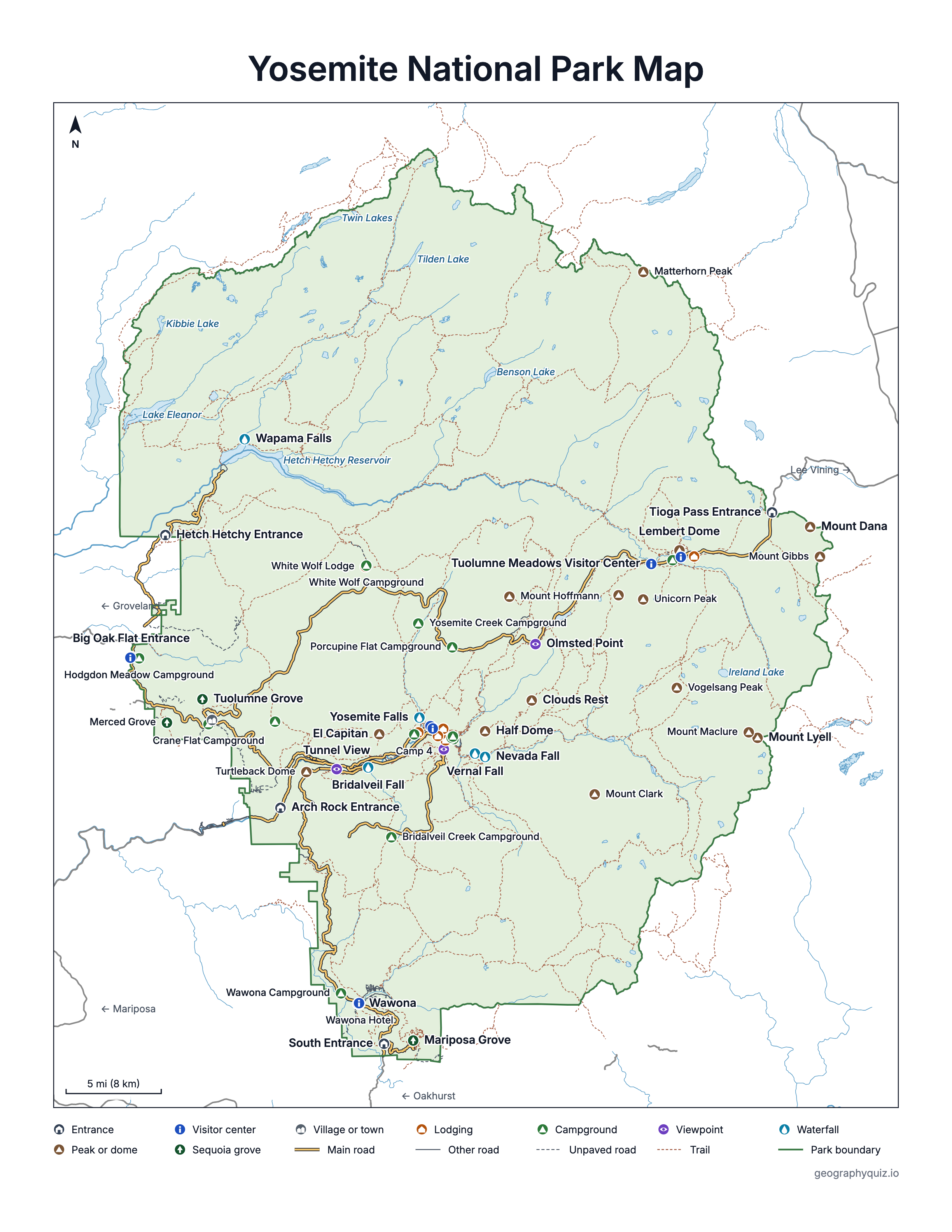
A fast, zoomable map of all of Yosemite: shaded relief, every road and trail, the five entrances, visitor centers, campgrounds, lodging, viewpoints, waterfalls, peaks and giant sequoia groves. Search for a place such as Half Dome or Glacier Point, jump to Yosemite Valley or Tuolumne Meadows, and tap anything for its elevation and directions.
Loading the map…
Tap or click a point, trail or road for details and directions. Pinch, ⌘/Ctrl + scroll, or use + and − to zoom; drag to move.Tap a point or trail · pinch to zoom.
Terrain
Trails
Roads
Main road
Other paved
Unpaved
Tunnel
Park boundary
Places
Data: National Park Service, USGS. Roads open and close with the seasons; check current conditions with the park before you go.
Printable Yosemite map
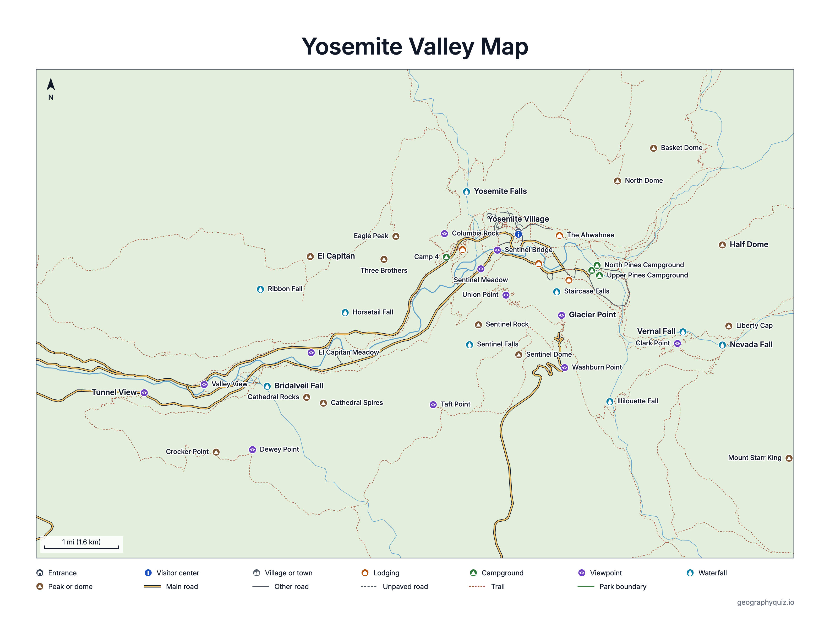
Free to print: the whole park on one page with its roads, entrances, areas and best-known sights, a close-up Yosemite Valley map, and a worksheet to label Yosemite's famous places.
October 1, 1890 (Yosemite Valley and Mariposa Grove were protected in 1864)
Elevation
About 2,000 ft near El Portal to 13,114 ft on Mount Lyell
Entrances
5: Arch Rock (CA-140), South (CA-41), Big Oak Flat (CA-120 west), Tioga Pass (CA-120 east), Hetch Hetchy
Wilderness
Nearly 95% of the park
Campgrounds
13 run by the National Park Service
World Heritage Site
Since 1984
Busiest month
July (616,551 visits in 2025); quietest: February
On this map
13 campgrounds, 54 trailheads, 14 viewpoints, 11 waterfalls and about 990 mi of trails
Map of Yosemite National Park with shaded relief, roads, trails, Yosemite Valley, Tuolumne Meadows, Wawona and Hetch Hetchy
Yosemite Valley map
The heart of the park and the place most visitors mean by Yosemite: a glacier-carved valley about 7 miles long and a mile wide, at about 4,000 ft, walled by El Capitan, Half Dome and Sentinel Rock. Yosemite, Bridalveil, Vernal and Nevada falls pour into it. Yosemite Village has the Welcome Center, the museum and stores; The Ahwahnee, Yosemite Valley Lodge, Curry Village and Housekeeping Camp, and four campgrounds, are here too. Free shuttle buses run in the eastern half of the valley.
Glacier Point, Tunnel View, Sentinel Meadow, Washburn Point, Dewey Point, Sentinel Bridge, Taft Point, Clark Point, Union Point, El Capitan Meadow, Columbia Rock and Valley View
Waterfalls
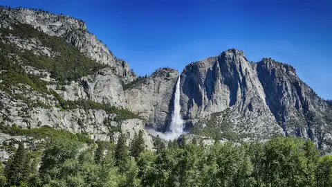
Yosemite Falls, Bridalveil Fall, Vernal Fall, Nevada Fall, Illilouette Fall, Staircase Falls, Ribbon Fall, Horsetail Fall and Sentinel Falls
Peaks and domes
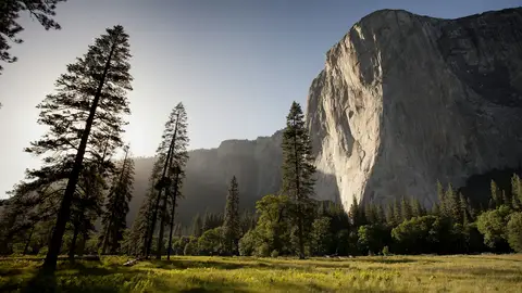
Half Dome, El Capitan, Three Brothers, Sentinel Dome, Eagle Peak, North Dome, Liberty Cap, Sentinel Rock, Cathedral Rocks, Cathedral Spires and Crocker Point
Lodging
Yosemite Valley Lodge, The Ahwahnee, Curry Village and Housekeeping Camp
Campgrounds
Upper Pines Campground, Lower Pines Campground, North Pines Campground and Camp 4
Visitor centers
Yosemite Valley Wilderness Center and Yosemite Valley Welcome Center
The main areas of Yosemite
Glacier Point
The viewpoint at the end of Glacier Point Road, 7,214 ft high and 3,214 ft above Curry Village, looks straight across at Half Dome and up the canyon to Vernal and Nevada falls and the High Sierra. On the way, short trails lead to Sentinel Dome and Taft Point, and Washburn Point has a second view of Half Dome. The road branches off Wawona Road at Chinquapin and is usually closed past Badger Pass from November to late May or June.
A wide subalpine meadow at about 8,600 ft along the Tuolumne River, ringed by granite domes and peaks: Lembert Dome, Cathedral Peak and Unicorn Peak, with Mount Dana and Tioga Pass to the east. It has a visitor center, a wilderness center, a campground and a lodge, and trailheads for Cathedral Lakes, Elizabeth Lake, Dog Lake and Gaylor Lakes. Like Tioga Road, it is usually reachable by car only from late May or June to November.
Near the South Entrance, Mariposa Grove is the park's largest grove of giant sequoias, with over 500 mature trees, among them the Grizzly Giant, thought to be about 3,000 years old. North of it, Wawona has the Wawona Hotel, a campground, the Yosemite History Center and the Wawona Visitor Center at Hill's Studio, and the trail to Chilnualna Falls. The road to the grove usually closes in winter, from about the end of November to mid-April, when the grove is reached on foot or skis.
In the quiet northwest of the park, the Tuolumne River is held back by O'Shaughnessy Dam (first finished in 1923 and raised in 1938) into Hetch Hetchy Reservoir, about 8 miles long and the largest body of water in the park. From the dam a trail crosses to Wapama Falls. The road in, through the Hetch Hetchy Entrance, is open from sunrise to sunset.
CA-120 through the high country: 47 miles from Crane Flat to Tioga Pass (9,945 ft), the park's highest road. Stops along it include the Tuolumne Grove of giant sequoias, White Wolf, Olmsted Point, with its view of Half Dome's back and Clouds Rest, Tenaya Lake, the largest lake in Yosemite's frontcountry, and Tuolumne Meadows. It usually closes from November to late May or early June.
Viewpoints: Olmsted Point
Sequoia groves: Tuolumne Grove
Lodging: White Wolf Lodge
Campgrounds: Porcupine Flat Campground, Yosemite Creek Campground, Crane Flat Campground, White Wolf Campground and Tamarack Flat Campground
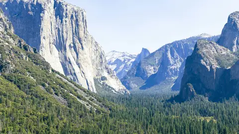
The classic first look at Yosemite Valley, at the east end of the Wawona Tunnel on CA-41: El Capitan on the left, Bridalveil Fall on the right and Half Dome in the distance.
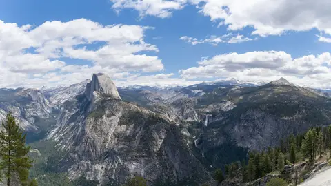
At 7,214 ft, the best-known viewpoint above the valley: Half Dome face to face, Vernal and Nevada falls, and the High Sierra behind. About an hour's drive from the valley floor.
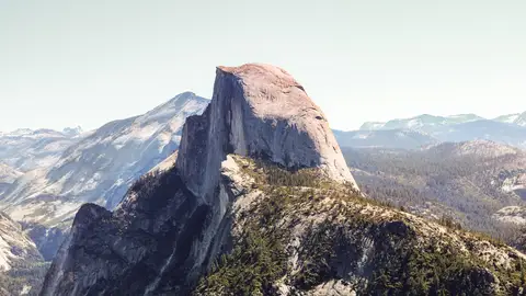
Yosemite's emblem, 8,842 ft high and 4,733 ft above its base, at the east end of the valley. Seen from Glacier Point, Sentinel Bridge, Tunnel View and, from behind, Olmsted Point.
One of the largest high-elevation meadows in the Sierra Nevada, at about 8,600 ft along the Tuolumne River, with Lembert Dome and Soda Springs close by.
Two short hikes from one trailhead on Glacier Point Road: a 360-degree view from the dome, and a cliff-edge view of El Capitan and the valley floor from Taft Point.
Round-trip distances, climbs and times are approximate, as the National Park Service gives them on its Yosemite trail pages. Difficulty is the NPS rating for the Yosemite Valley and Mariposa Grove hikes and ours for the rest. Times are for steady walking without long stops. Elevation profiles follow the mapped trail one way, with elevations from the USGS 3D Elevation Program, so their climb can differ a little from the NPS figure.
Getting there and the entrances
Arch Rock Entrance
CA-140 (El Portal Road)From Merced, Mariposa, El Portal
The lowest and usually the least snowy way in, along the Merced River; about 30 minutes from El Portal to the valley.
Approximate driving distances and times as the National Park Service gives them, without stops or traffic.
Towns near Yosemite
El Portal (Arch Rock Entrance, CA-140): 14 mi (30 min) from the valley, just outside the park on the Merced River; hotels and the closest stay to the valley outside it.
Mariposa (CA-140): 44 mi (1 h 15 min): a historic gold-rush town with the most motels on the year-round CA-140 route; Midpines is on the way.
Fish Camp (South Entrance, CA-41): 39 mi (1 h 15 min) from the valley but just minutes from Mariposa Grove and Wawona.
Oakhurst (CA-41): 55 mi (1 h 30 min): the biggest town on the south side, with plenty of stores and lodging, on the way from Fresno.
Groveland (Big Oak Flat Entrance, CA-120): 49 mi (1 h 15 min): the gateway from the Bay Area, handy for Hetch Hetchy and Tioga Road; Buck Meadows is closer.
Lee Vining (Tioga Pass Entrance, CA-120 east): 74 mi (about 2 h) from the valley over Tioga Road, beside Mono Lake; the base for Tuolumne Meadows in summer and fall.
When to go: Yosemite by season
Spring (April to June)
Waterfalls are at their fullest, with peak flow typically in May or June. Yosemite Valley, Wawona and Hetch Hetchy are open; Glacier Point Road and Tioga Road usually open in late May or June, once they are cleared of snow.
Summer (July and August)
The busiest months, and the only time every road and high-country trail is usually open. Tuolumne Meadows and Tioga Road are at their best; by August, Yosemite Falls can shrink to a trickle. The Half Dome cables are typically up from the Friday before Memorial Day to the day after the second Monday in October.
Fall (September to November)
Fewer people, cooler days and fall color in the valley. Waterfalls are low or dry. Tioga Road and Glacier Point Road usually close in November, sometimes earlier after a big storm.
Winter (December to March)
Snow on the high country. The roads into Yosemite Valley stay open, though chains may be required. Badger Pass, on the first 5 miles of Glacier Point Road, is open for skiing in winter, and Mariposa Grove is reached on foot or skis. In mid- to late February, Horsetail Fall on El Capitan can glow orange at sunset.
Visits by month in 2025: busiest in July (616,551), quietest in February (120,601).
Frequently asked questions
How big is Yosemite National Park?
About 1,190 square miles (761,748 acres), and nearly 95% of it is designated wilderness. Most visitors see only a small part: Yosemite Valley, about 7 miles long and a mile wide, is only about 1% of it. In 2025 the park had 4.3 million recreation visits.
How long does it take to drive up Yosemite?
From Yosemite Valley, at about 4,000 ft, the drive up to Glacier Point (7,214 ft) is 30 miles and takes about an hour, and the drive to Tuolumne Meadows (about 8,600 ft) is 55 miles, about 1 hour 30 minutes. Tioga Pass, the park's highest road at 9,945 ft, is 62 miles and about 1 hour 45 minutes from the valley. Both high roads are usually open only from late May or June to November.
How long does it take to drive through Yosemite?
Crossing the park from west to east on Tioga Road, from Crane Flat to Tioga Pass, is 47 miles. From Yosemite Valley to Lee Vining on the east side is 74 miles and about 2 hours without stops, while the road is open (usually late May or June to November). From the Arch Rock or Big Oak Flat entrance to the valley takes about 30 to 45 minutes, and from the South Entrance about an hour.
What is the most beautiful part of Yosemite?
Most people would say Yosemite Valley, best seen first from Tunnel View, where El Capitan, Bridalveil Fall and Half Dome appear together. Glacier Point gives the grandest view from above. For high mountain scenery with fewer crowds, Tuolumne Meadows, Tenaya Lake and Olmsted Point on Tioga Road are hard to beat, and Mariposa Grove has the park's largest giant sequoias.
How many days in Yosemite is enough?
One full day covers the Yosemite Valley highlights: Tunnel View, Yosemite Falls, Bridalveil Fall, El Capitan and a short hike such as the Vernal Fall footbridge. Two or three days let you add Glacier Point, Mariposa Grove and, in summer, Tioga Road and Tuolumne Meadows. Big hikes such as Half Dome or Upper Yosemite Fall each take most of a day on their own.
What town is best to stay in for Yosemite?
Inside the park, Yosemite Valley is the most convenient, with The Ahwahnee, Yosemite Valley Lodge, Curry Village, Housekeeping Camp and campgrounds. Just outside, El Portal is closest to the valley (14 miles, about 30 minutes), and Mariposa is a larger town on the same year-round CA-140 route. Fish Camp and Oakhurst suit Mariposa Grove and Wawona, Groveland suits visitors from the Bay Area and Hetch Hetchy, and Lee Vining is the base for Tuolumne Meadows when Tioga Road is open.
Where is Half Dome in Yosemite?
Half Dome stands at the east end of Yosemite Valley, above Mirror Lake and Curry Village, 8,842 ft high. It is in full view from Glacier Point, Sentinel Bridge and Tunnel View, and from behind at Olmsted Point on Tioga Road. The hike to the top starts at Happy Isles: 14 to 16 miles round trip with about 4,800 ft of climbing, and a permit is required while the cables are up.
Where is Yosemite National Park?
In the Sierra Nevada mountains of central California, about 195 miles east of San Francisco and 313 miles north of Los Angeles by road. The park lies in Mariposa, Tuolumne, Madera and Mono counties.
Which entrance to Yosemite is best?
It depends on where you are coming from and what you want to see. From the San Francisco Bay Area, the Big Oak Flat Entrance (CA-120); from Merced and Mariposa, Arch Rock (CA-140), the lowest and usually least snowy way in; from Fresno and Los Angeles, the South Entrance (CA-41), next to Mariposa Grove; and from the east, the Tioga Pass Entrance, in summer and fall only.
When are Tioga Road and Glacier Point Road open?
Both usually close for the winter in November and reopen in late May or early June, once the snow is cleared; the exact dates change every year with the weather, so check the park's road conditions before you go. The first 5 miles of Glacier Point Road, to Badger Pass, usually stay open in winter.
Is there a printable Yosemite map?
Yes: download the Yosemite map above as a PDF (Letter or A4) or a PNG image, with the main roads, entrances, areas and highlights, a printable Yosemite Valley map, and a worksheet to label Yosemite's best-known places.
National parks near Yosemite
Kings Canyon National Park (California): about 80 mi away in a straight line. One of the deepest canyons in the US, and the General Grant Tree, a giant sequoia known as the Nation's Christmas Tree.
Sequoia National Park (California): about 105 mi away in a straight line. The General Sherman Tree, the largest tree on Earth by volume, and Mount Whitney on the park's eastern edge.
Pinnacles National Park (California): about 130 mi away in a straight line. Rock spires left by an ancient volcano, talus caves and California condors.
Sources
Data: National Park Service and USGS. Park boundary: NPS Land Resources Division. Roads, trails and points of interest: NPS public roads, trails and points of interest datasets. Area: NPS Listing of Acreage. Visitors: NPS Visitor Use Statistics.
Shaded relief and elevations: USGS 3D Elevation Program. Peaks and place names: USGS Geographic Names Information System. Rivers and lakes: USGS National Hydrography Dataset. Highways outside the park: US Census Bureau.
Heights, hike distances, drive times and seasons: nps.gov/yose. Road openings change every year: check the park's current conditions before you go.
Map data generated 2026-10-21. Elevations on the map are from the USGS 3D Elevation Program or, for Half Dome, El Capitan and Glacier Point and a few others, as the NPS gives them.