Interactive map
Washington, D.C. Map
Washington, D.C. is a federal district, not a state. Its 8 wards and 132 neighbourhoods are on one zoomable map, with interstates, US highways and the Potomac and Anacostia rivers. Tap a ward to see its population, area and neighbourhoods, and zoom in for every name.
Loading the map…
Printable maps of Washington, D.C.
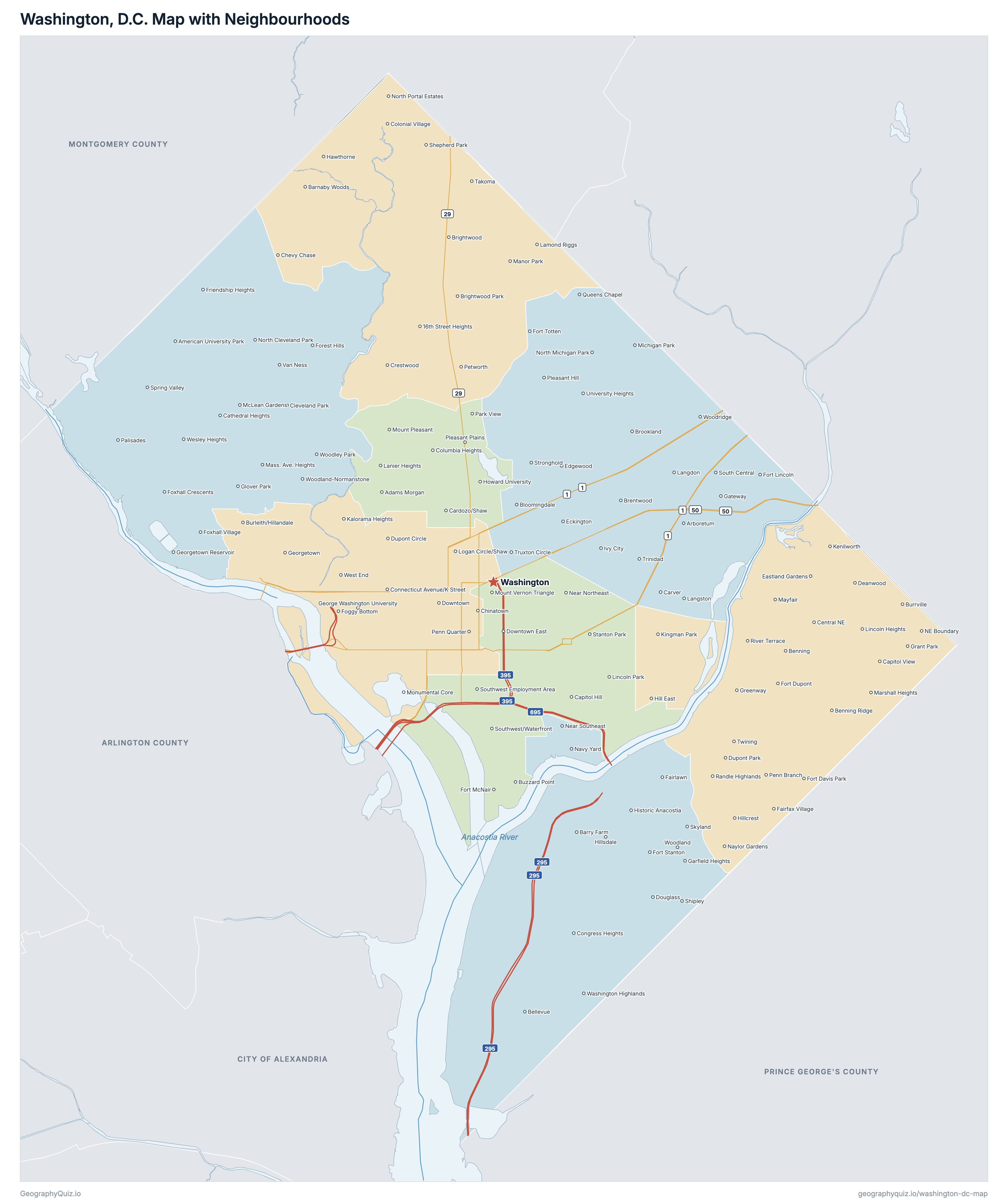
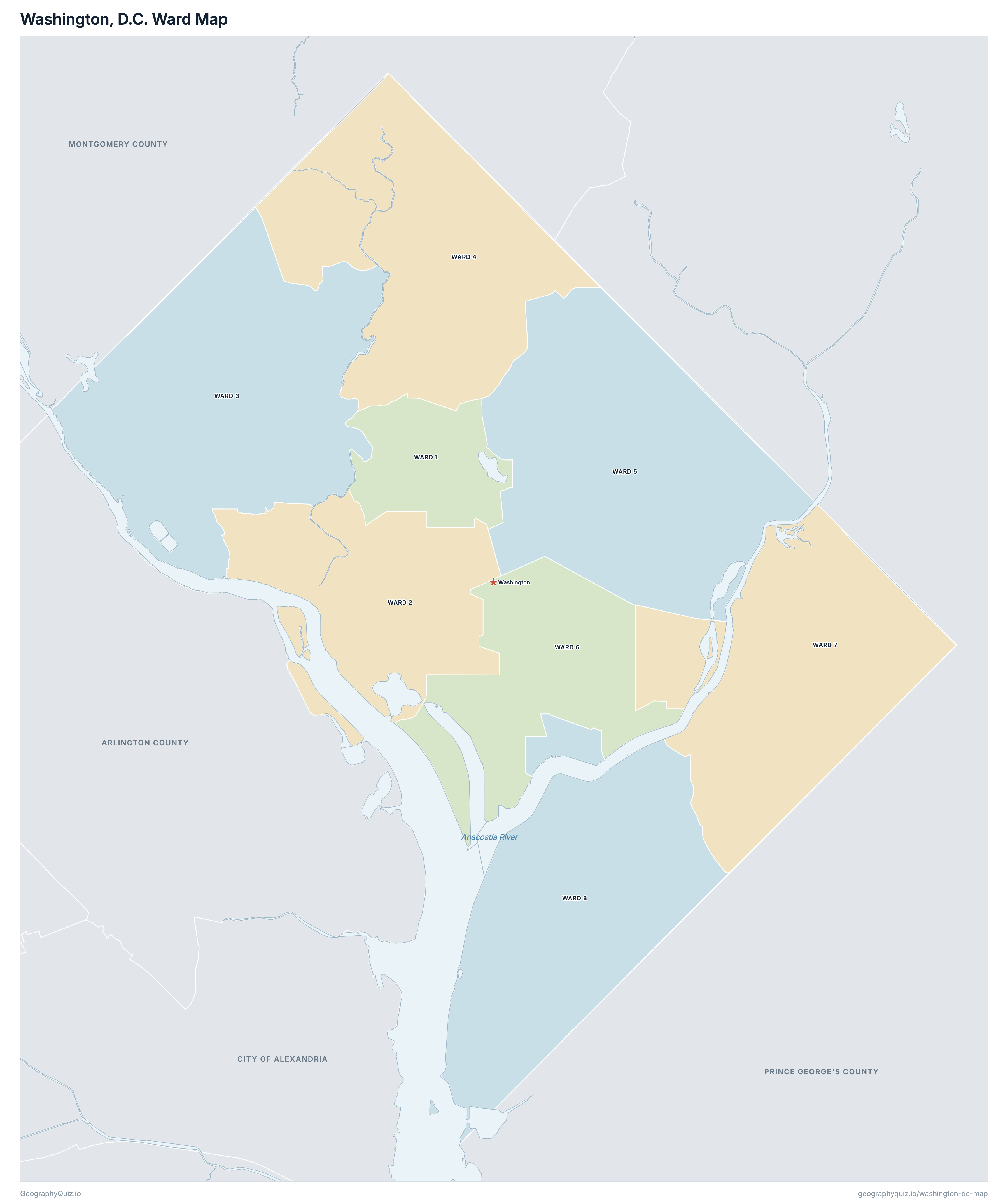
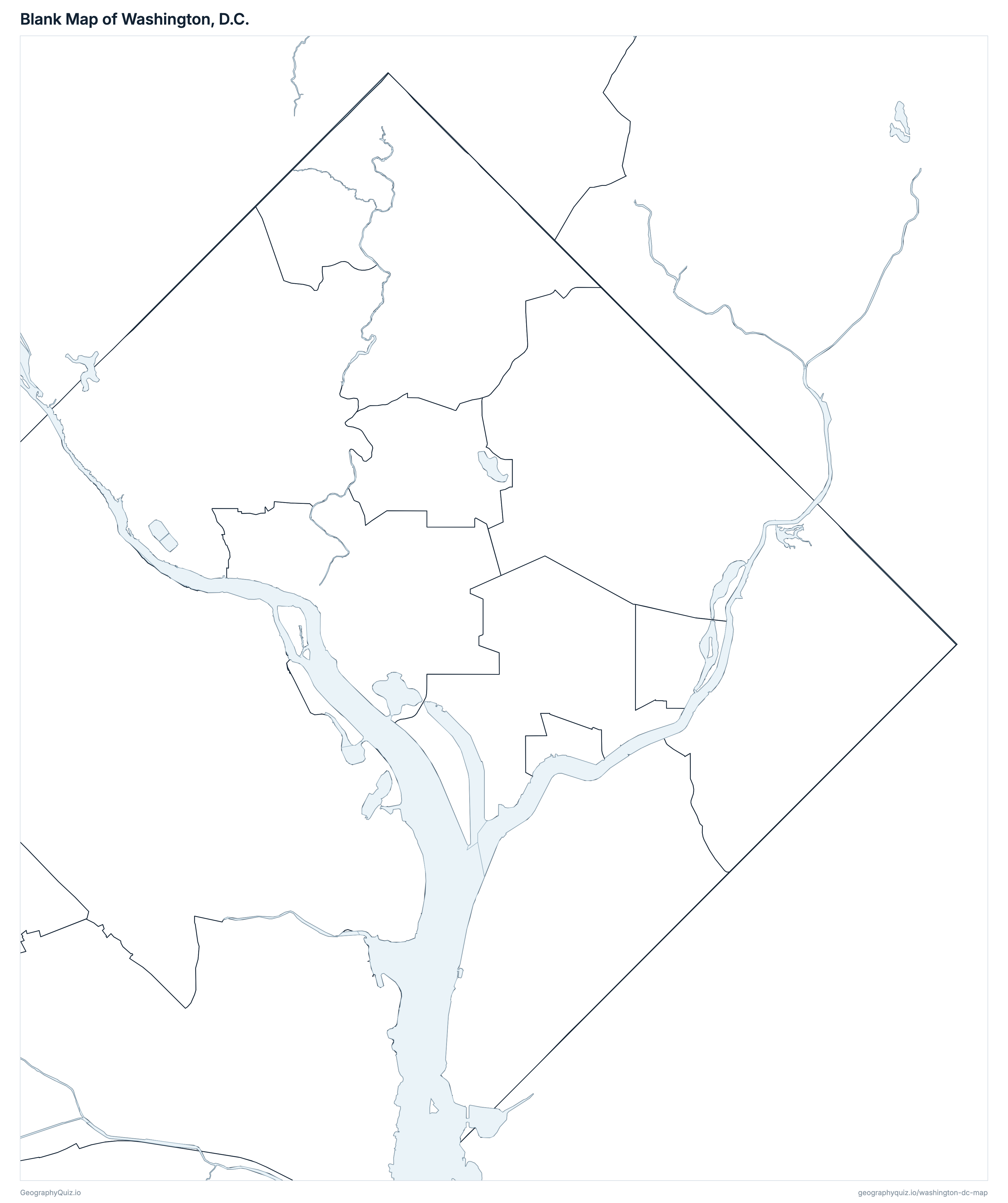
Free to print for class and home: Washington, D.C. with its neighbourhoods, a ward map with all 8 wards, and a blank outline map. PDFs fit one A4 or US Letter page.
Washington, D.C. map with neighbourhoods
Washington, D.C. ward map
About Washington, D.C.
Washington, D.C. is a federal district, not a state: the District of Columbia was created under the Constitution as the seat of the US government and is part of no state. The city of Washington covers the whole District, so the capital is the whole city. It has about 693,645 people (2025 estimate) on 158 km² (61 sq mi) of land, and borders Maryland (Montgomery and Prince George's counties) and Virginia (Arlington County and the City of Alexandria).
The District is divided into 8 wards, each electing one member of the Council of the District of Columbia. The wards are redrawn after every census to hold about the same number of people: the current wards, in use since 2022, had about 86,000 each at the 2020 Census. Ward 5 had the most (89,617) and Ward 6 the fewest (84,266); Ward 3 is the largest by land area (27 km²) and Ward 1 the smallest (6.4 km²).
The map names 132 neighbourhoods, as the DC Office of Planning labels them; their edges are informal, so the map shows each as a point. The border with Virginia follows the Potomac River's Virginia shore, so the river itself is in the District; the Anacostia River flows through the east of the city to meet it at Hains Point.
Neighbourhoods of Washington, D.C.
All 132 neighbourhoods on the map, A to Z, with the ward each is in. Neighbourhoods have no official borders or population counts of their own.
| Neighbourhood | Ward |
|---|---|
| 16th Street Heights | Ward 4 |
| Adams Morgan | Ward 1 |
| American University Park | Ward 3 |
| Arboretum | Ward 5 |
| Barnaby Woods | Ward 4 |
| Barry Farm | Ward 8 |
| Bellevue | Ward 8 |
| Benning | Ward 7 |
| Benning Ridge | Ward 7 |
| Bloomingdale | Ward 5 |
| Brentwood | Ward 5 |
| Brightwood | Ward 4 |
| Brightwood Park | Ward 4 |
| Brookland | Ward 5 |
| Burleith/Hillandale | Ward 2 |
| Burrville | Ward 7 |
| Buzzard Point | Ward 6 |
| Capitol Hill | Ward 6 |
| Capitol View | Ward 7 |
| Cardozo/Shaw | Ward 1 |
| Carver | Ward 5 |
| Cathedral Heights | Ward 3 |
| Central NE | Ward 7 |
| Chevy Chase | Ward 4 |
| Chinatown | Ward 2 |
| Cleveland Park | Ward 3 |
| Colonial Village | Ward 4 |
| Columbia Heights | Ward 1 |
| Congress Heights | Ward 8 |
| Connecticut Avenue/K Street | Ward 2 |
| Crestwood | Ward 4 |
| Deanwood | Ward 7 |
| Douglass | Ward 8 |
| Downtown | Ward 2 |
| Downtown East | Ward 6 |
| Dupont Circle | Ward 2 |
| Dupont Park | Ward 7 |
| Eastland Gardens | Ward 7 |
| Eckington | Ward 5 |
| Edgewood | Ward 5 |
| Fairfax Village | Ward 7 |
| Fairlawn | Ward 8 |
| Foggy Bottom | Ward 2 |
| Forest Hills | Ward 3 |
| Fort Davis Park | Ward 7 |
| Fort Dupont | Ward 7 |
| Fort Lincoln | Ward 5 |
| Fort McNair | Ward 6 |
| Fort Stanton | Ward 8 |
| Fort Totten | Ward 5 |
| Foxhall Crescents | Ward 3 |
| Foxhall Village | Ward 3 |
| Friendship Heights | Ward 3 |
| Garfield Heights | Ward 8 |
| Gateway | Ward 5 |
| George Washington University | Ward 2 |
| Georgetown | Ward 2 |
| Georgetown Reservoir | Ward 3 |
| Glover Park | Ward 3 |
| Grant Park | Ward 7 |
| Greenway | Ward 7 |
| Hawthorne | Ward 4 |
| Hill East | Ward 7 |
| Hillcrest | Ward 7 |
| Hillsdale | Ward 8 |
| Historic Anacostia | Ward 8 |
| Howard University | Ward 1 |
| Ivy City | Ward 5 |
| Kalorama Heights | Ward 2 |
| Kenilworth | Ward 7 |
| Kingman Park | Ward 7 |
| Knox Hill/Buena Vista | Ward 8 |
| Lamond Riggs | Ward 4 |
| Langdon | Ward 5 |
| Langston | Ward 5 |
| Lanier Heights | Ward 1 |
| Le Droit Park | Ward 1 |
| Lincoln Heights | Ward 7 |
| Lincoln Park | Ward 6 |
| Logan Circle/Shaw | Ward 2 |
| Manor Park | Ward 4 |
| Marshall Heights | Ward 7 |
| Mass. Ave. Heights | Ward 3 |
| Mayfair | Ward 7 |
| McLean Gardens | Ward 3 |
| Michigan Park | Ward 5 |
| Monumental Core | Ward 2 |
| Mount Pleasant | Ward 1 |
| Mount Vernon Square | Ward 2 |
| Mount Vernon Triangle | Ward 6 |
| Navy Yard | Ward 8 |
| Naylor Gardens | Ward 7 |
| NE Boundary | Ward 7 |
| Near Northeast | Ward 6 |
| Near Southeast | Ward 8 |
| North Capitol Street | Ward 6 |
| North Cleveland Park | Ward 3 |
| North Michigan Park | Ward 5 |
| North Portal Estates | Ward 4 |
| Palisades | Ward 3 |
| Park View | Ward 1 |
| Penn Branch | Ward 7 |
| Penn Quarter | Ward 2 |
| Petworth | Ward 4 |
| Pleasant Hill | Ward 5 |
| Pleasant Plains | Ward 1 |
| Queens Chapel | Ward 5 |
| Randle Highlands | Ward 7 |
| River Terrace | Ward 7 |
| Shepherd Park | Ward 4 |
| Shipley | Ward 8 |
| Skyland | Ward 8 |
| South Central | Ward 5 |
| Southwest Employment Area | Ward 6 |
| Southwest/Waterfront | Ward 6 |
| Spring Valley | Ward 3 |
| Stanton Park | Ward 6 |
| Stronghold | Ward 5 |
| Takoma | Ward 4 |
| Tenleytown | Ward 3 |
| Trinidad | Ward 5 |
| Truxton Circle | Ward 5 |
| Twining | Ward 7 |
| University Heights | Ward 5 |
| Van Ness | Ward 3 |
| Washington Highlands | Ward 8 |
| Wesley Heights | Ward 3 |
| West End | Ward 2 |
| Woodland | Ward 8 |
| Woodland-Normanstone | Ward 3 |
| Woodley Park | Ward 3 |
| Woodridge | Ward 5 |
Wards of Washington, D.C.
All 8 wards, with their 2020 Census populations. Select one to show it on the map.
| 85,285 | 6.4 | |
| 89,485 | 15 | |
| 85,301 | 27 | |
| 84,660 | 23 | |
| 89,617 | 26 | |
| 84,266 | 14 | |
| 85,685 | 23 | |
| 85,246 | 24 |
Practise US geography
Sources
- Wards (2022 boundaries) and neighbourhood names: District of Columbia Office of the Chief Technology Officer, DC GIS open data (Ward - 2022; the DC Office of Planning's Neighborhood Labels).
- Potomac and Anacostia rivers: DC GIS Hydrography Centerline.
- Land and water, the Maryland and Virginia counties, Washington's location and highways: US Census Bureau TIGER/Line files and Gazetteer (2023).
- Populations: US Census Bureau, Population Estimates Vintage 2025 for the District; ward populations are 2020 Census block counts (TIGER/Line 2020 blocks) added up by ward.