Interactive map
Canada Map
All of Canada's provinces and territories on one zoomable map, with every capital, the cities of 10,000 people or more, the Trans-Canada Highway and the National Highway System, rivers and lakes. Tap a province or territory to see its capital, population, area and largest cities.
Loading the map…
Printable maps of Canada
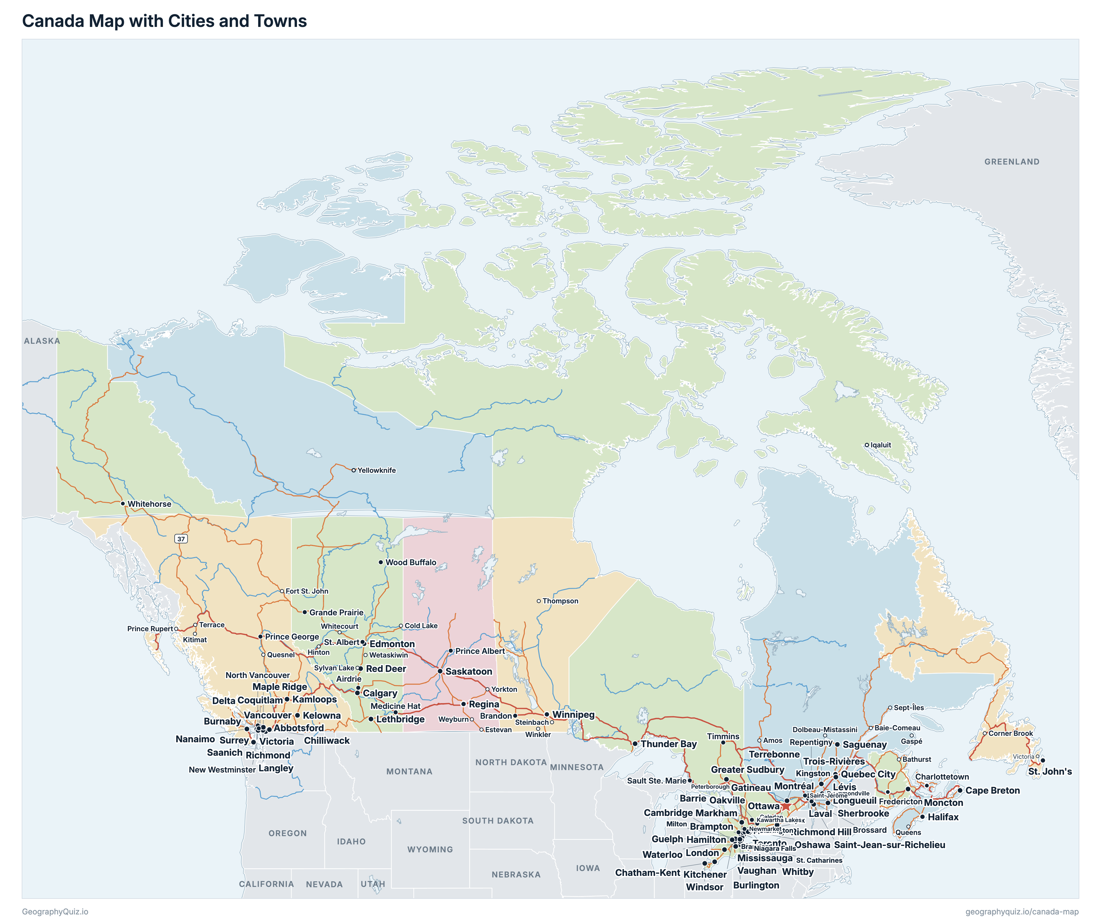
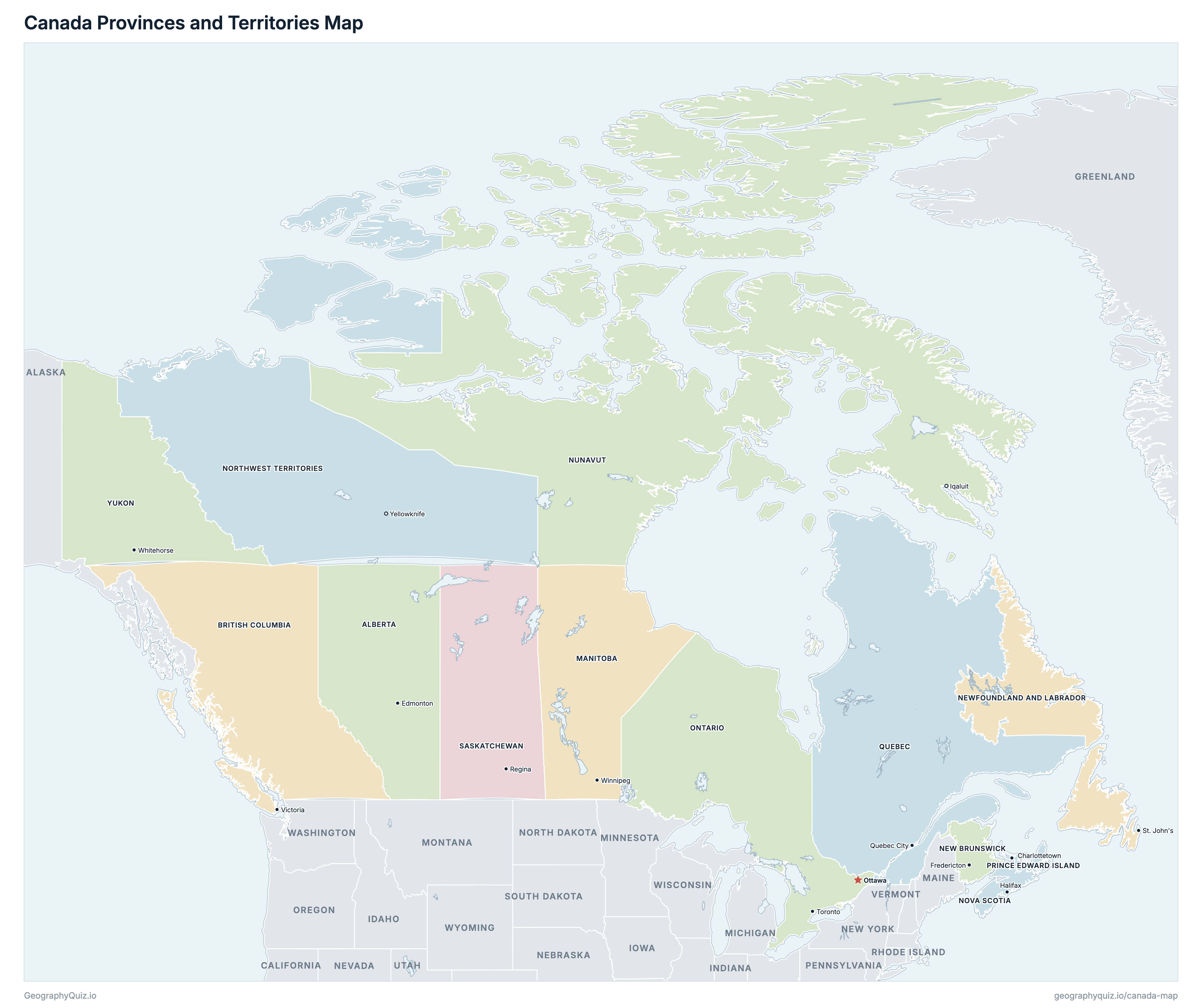
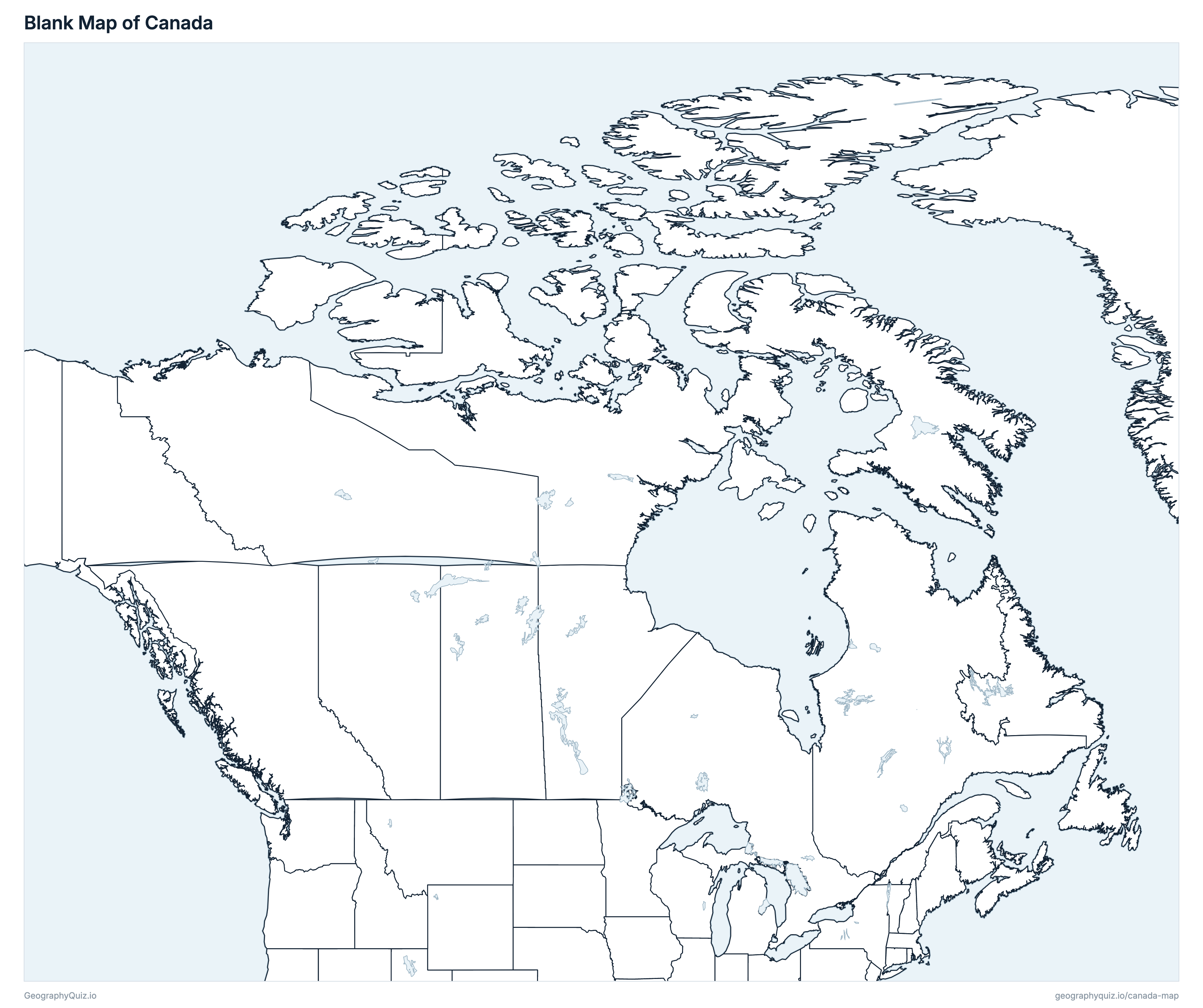
Free to print for class and home: Canada with its cities and towns, a map of its provinces and territories, and a blank outline map. PDFs fit one A4 or US Letter page.
Canada map with cities
Canada provinces and territories map
About Canada
Canada has 10 provinces and 3 territories, and about 41,651,653 people (2025 estimate) on 8,788,703 km² (3,393,336 sq mi) of land, the second-largest country in the world by total area. The capital is Ottawa; the largest city is Toronto, with 3,271,830 people. Its only land border is with the United States, from Alaska to Maine.
Ontario is the most populous province (16,258,260 people) and Nunavut the least populous (41,830); Nunavut is the largest by land area (1,836,994 km²) and Prince Edward Island the smallest (5,681 km²).
Largest cities in Canada
The 25 most populous cities. All 422 are on the map above.
| # | City | Province | Population |
|---|---|---|---|
| 1 | Toronto | Ontario | 3,271,830 |
| 2 | Montréal | Quebec | 1,915,366 |
| 3 | Calgary | Alberta | 1,612,834 |
| 4 | Edmonton | Alberta | 1,238,295 |
| 5 | Ottawa | Ontario | 1,188,114 |
| 6 | Winnipeg | Manitoba | 850,260 |
| 7 | Brampton | Ontario | 777,759 |
| 8 | Mississauga | Ontario | 764,597 |
| 9 | Vancouver | British Columbia | 740,454 |
| 10 | Surrey | British Columbia | 703,531 |
| 11 | Hamilton | Ontario | 640,465 |
| 12 | Quebec City | Quebec | 592,658 |
| 13 | Halifax | Nova Scotia | 516,822 |
| 14 | London | Ontario | 494,785 |
| 15 | Laval | Quebec | 461,509 |
| 16 | Markham | Ontario | 371,504 |
| 17 | Vaughan | Ontario | 358,535 |
| 18 | Kitchener | Ontario | 323,917 |
| 19 | Saskatoon | Saskatchewan | 318,067 |
| 20 | Gatineau | Quebec | 306,105 |
| 21 | Burnaby | British Columbia | 299,682 |
| 22 | Windsor | Ontario | 269,614 |
| 23 | Longueuil | Quebec | 268,530 |
| 24 | Regina | Saskatchewan | 263,419 |
| 25 | Oakville | Ontario | 243,107 |
Populations are Statistics Canada estimates for July 1, 2025, within municipal limits (the census subdivision).
Provinces and territories of Canada
All 13 provinces and territories. Select one to show it on the map.
| Edmonton | 5,029,346 | 634,658 | |
| Victoria | 5,697,536 | 920,687 | |
| Winnipeg | 1,509,702 | 540,310 | |
| Fredericton | 869,682 | 71,248 | |
| St. John's | 549,911 | 358,170 | |
| Yellowknife | 45,950 | 1,127,712 | |
| Halifax | 1,093,245 | 52,825 | |
| Iqaluit | 41,830 | 1,836,994 | |
| Toronto | 16,258,260 | 892,412 | |
| Charlottetown | 182,657 | 5,681 | |
| Quebec City | 9,058,297 | 1,298,600 | |
| Regina | 1,266,959 | 577,060 | |
| Whitehorse | 48,278 | 472,345 |
Practise Canadian geography
Sources
- Provinces and territories, census divisions, municipalities and population centres: Statistics Canada, 2021 Census cartographic boundary files.
- Populations: Statistics Canada, population estimates for July 1, 2025 (table 17-10-0155-01).
- Highways: Statistics Canada, Road Network File (2025).
- US states: US Census Bureau cartographic boundary files.