US roads · interactive map
US Interstate Map
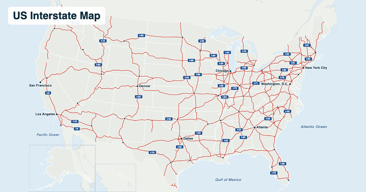
The Interstate Highway System links almost every big American city with about 49,000 miles of divided highway. Even numbers run east–west and odd numbers north–south, so I-10 crosses the South and I-90 the North, while I-5 runs up the West Coast and I-95 up the East Coast. Hover over or tap a city to see which Interstates meet there.
The lower 48 states. Hawaii's three Interstates (H-1, H-2 and H-3, on Oahu) are too short to show at this scale, and the routes in Alaska and Puerto Rico are not signed as Interstates.
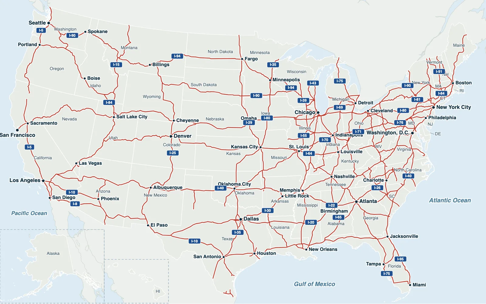
Hover over or tap a state, line or place for details. Use the key to show or hide lines.
Test yourself on this map
Find US States on the Map · Click each state we name
Printable US Interstate Map
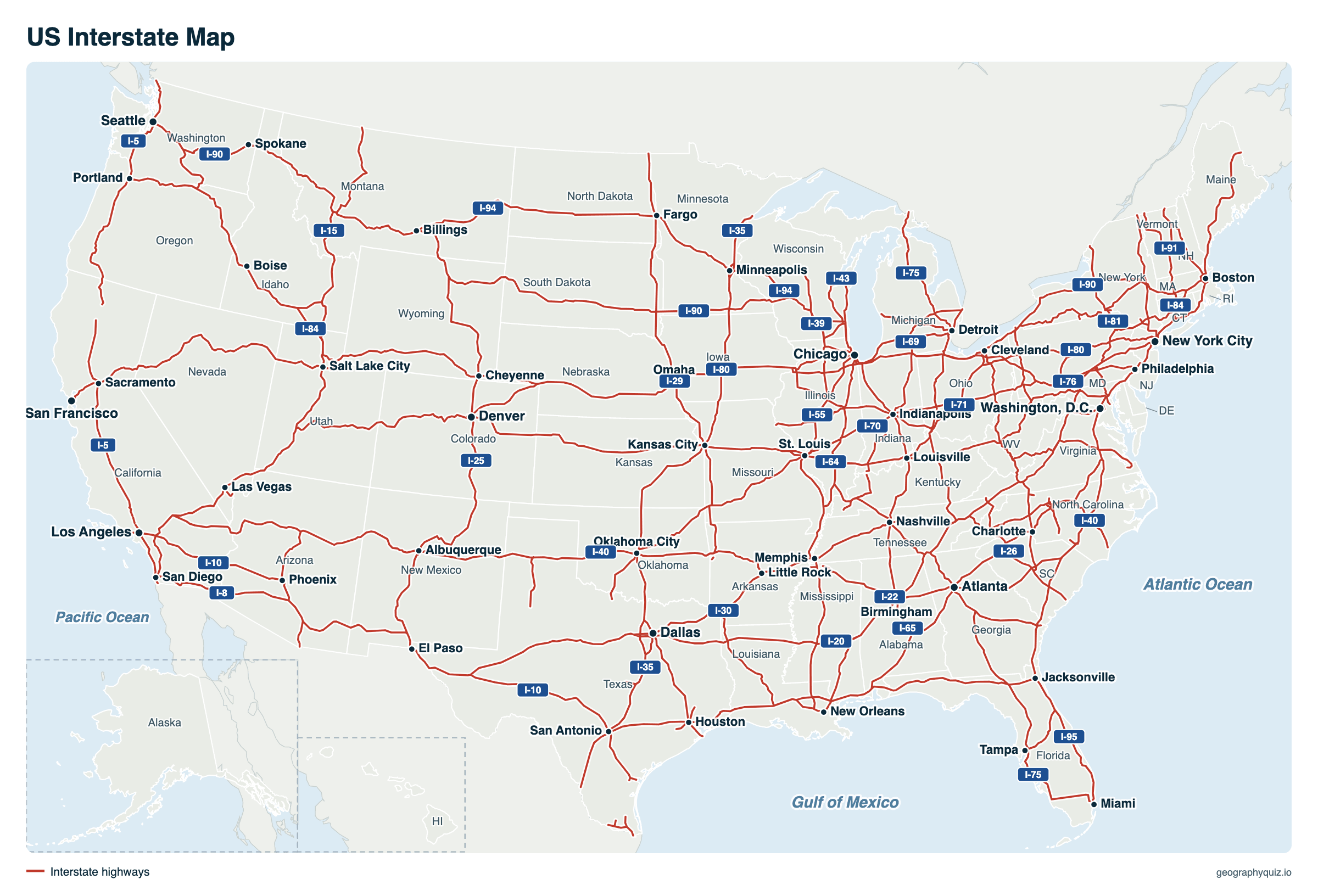
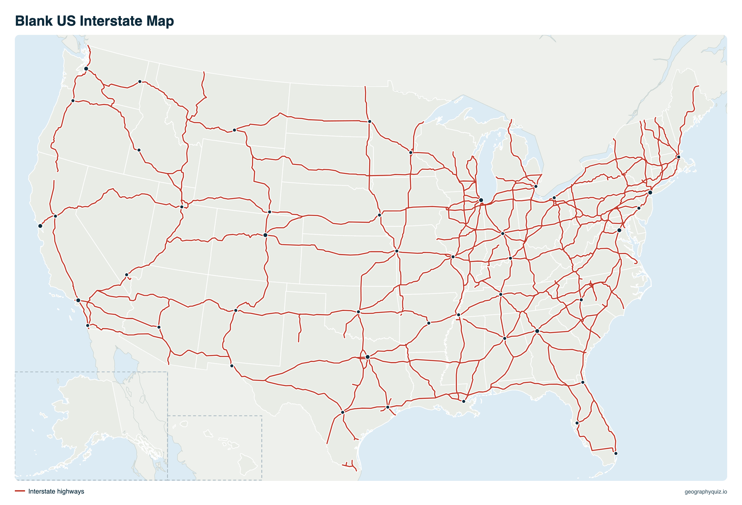
Free to print for class and road trips: the Interstate network with its route numbers and the big cities it links, on one landscape page, labeled or blank. The blank version has the same map with no names on it, for labeling in class.
Key facts
- Length
- About 49,000 miles
- Created
- Federal-Aid Highway Act, signed by President Eisenhower on June 29, 1956
- Longest
- I-90, about 3,020 mi from Seattle to Boston; in the federal route log, which counts shared miles once, I-80 is longest (2,892 mi)
- Most states
- I-95: 15 states and Washington, D.C.
- East–west routes
- Even numbers, from I-10 in the south to I-90 and I-94 in the north
- North–south routes
- Odd numbers, from I-5 in the west to I-95 in the east
How Interstate numbers work
- Odd numbers run north–south, lowest in the west: I-5 along the Pacific coast, I-35 through the middle, I-95 along the Atlantic.
- Even numbers run east–west, lowest in the south: I-10 from California to Florida, I-40 across the middle, I-90 across the north.
- Numbers ending in 0 (east–west) and 5 (north–south) are the main cross-country routes.
- Three-digit numbers are branches of the two-digit route they end in. An even first digit (I-495, I-695) means a loop or bypass that rejoins the main route; an odd first digit (I-395, I-580) means a spur into a city.
- Exits are usually numbered by the mile, counted from the state's southern or western border, so exit 112 is about 112 miles into the state.
- Alaska, Hawaii and Puerto Rico have Interstates too (H-1, H-2 and H-3 in Hawaii), though they don't link to the rest of the network.
The main Interstates and the states they cross
The routes numbered in 0s and 5s are the long-distance backbone of the system. Each is listed with the states it crosses, from south to north or west to east.
| Route | Direction | States, in order |
|---|---|---|
| I-5 | North–south | California, Oregon, Washington |
| I-10 | East–west | California, Arizona, New Mexico, Texas, Louisiana, Mississippi, Alabama, Florida |
| I-15 | North–south | California, Nevada, Arizona, Utah, Idaho, Montana |
| I-20 | East–west | Texas, Louisiana, Mississippi, Alabama, Georgia, South Carolina |
| I-25 | North–south | New Mexico, Colorado, Wyoming |
| I-30 | East–west | Texas, Arkansas |
| I-35 | North–south | Texas, Oklahoma, Kansas, Missouri, Iowa, Minnesota |
| I-40 | East–west | California, Arizona, New Mexico, Texas, Oklahoma, Arkansas, Tennessee, North Carolina |
| I-45 | North–south | Texas (Galveston – Houston – Dallas) |
| I-55 | North–south | Louisiana, Mississippi, Tennessee, Arkansas, Missouri, Illinois |
| I-65 | North–south | Alabama, Tennessee, Kentucky, Indiana |
| I-70 | East–west | Utah, Colorado, Kansas, Missouri, Illinois, Indiana, Ohio, West Virginia, Pennsylvania, Maryland |
| I-75 | North–south | Florida, Georgia, Tennessee, Kentucky, Ohio, Michigan |
| I-80 | East–west | California, Nevada, Utah, Wyoming, Nebraska, Iowa, Illinois, Indiana, Ohio, Pennsylvania, New Jersey |
| I-85 | North–south | Alabama, Georgia, South Carolina, North Carolina, Virginia |
| I-90 | East–west | Washington, Idaho, Montana, Wyoming, South Dakota, Minnesota, Wisconsin, Illinois, Indiana, Ohio, Pennsylvania, New York, Massachusetts |
| I-95 | North–south | Florida, Georgia, South Carolina, North Carolina, Virginia, D.C., Maryland, Delaware, Pennsylvania, New Jersey, New York, Connecticut, Rhode Island, Massachusetts, New Hampshire, Maine |
Longest Interstates
Lengths from the Federal Highway Administration's route log (January 2026). The log credits a stretch shared by two Interstates to one of them: I-90, about 3,000 miles from Seattle to Boston by road, is listed at 2,706 miles because 136 miles in Indiana and 143 in Ohio are counted under I-80.
| Route | Miles | States | From – to |
|---|---|---|---|
| I-80 | 2,891.6 | 11 | San Francisco, California – Teaneck, New Jersey (near New York City) |
| I-90 | 2,706.0 | 13 | Seattle, Washington – Boston, Massachusetts |
| I-40 | 2,552.9 | 8 | Barstow, California – Wilmington, North Carolina |
| I-10 | 2,457.6 | 8 | Santa Monica, California – Jacksonville, Florida |
| I-70 | 2,061.2 | 10 | Cove Fort, Utah – Baltimore, Maryland |
| I-95 | 1,904.6 | 15 and D.C. | Miami, Florida – Houlton, Maine (Canadian border) |
| I-75 | 1,693.5 | 6 | Miami area, Florida – Sault Ste. Marie, Michigan |
| I-35 | 1,494.5 | 6 | Laredo, Texas – Duluth, Minnesota |
| I-94 | 1,441.8 | 7 | Billings, Montana – Port Huron, Michigan |
| I-15 | 1,438.6 | 6 | San Diego, California – Sweetgrass, Montana (Canadian border) |
| I-20 | 1,409.8 | 6 | Kent, Texas – Florence, South Carolina |
| I-5 | 1,381.4 | 3 | San Ysidro, California (Mexican border) – Blaine, Washington (Canadian border) |
| I-25 | 1,060.6 | 3 | Las Cruces, New Mexico – Buffalo, Wyoming |
| I-84 | 965.5 | 7 | Two separate routes: Portland, Oregon – Echo, Utah, and Dunmore, Pennsylvania – Sturbridge, Massachusetts |
| I-55 | 940.1 | 6 | LaPlace, Louisiana – Chicago, Illinois |
History of the Interstate Highway System
As a young officer in 1919, Dwight D. Eisenhower crossed the country with an army convoy that took two months on bad roads; in World War II he saw Germany's autobahns. As president he backed the Federal-Aid Highway Act of 1956, which he signed on June 29, 1956, creating a national network of limited-access highways, with the federal government paying 90% of the cost. Missouri and Kansas both claim the first project, in August 1956.
The original system was declared complete in 1992, when the last section of I-70 through Glenwood Canyon, Colorado, opened, though new routes are still being added. It is officially the Dwight D. Eisenhower National System of Interstate and Defense Highways, and it carries about a quarter of all the miles Americans drive.
Frequently asked questions
What is the longest Interstate in the US?
I-90 is the longest Interstate drive, about 3,000 miles from Seattle to Boston. In the Federal Highway Administration's route log, which counts each shared stretch under only one route, I-80 (San Francisco to New Jersey) is the longest at 2,892 miles.
Do odd-numbered Interstates run north–south?
Yes. Odd numbers run north–south, from I-5 on the West Coast to I-95 on the East Coast; even numbers run east–west, from I-10 in the south to I-90 and I-94 in the north.
Which Interstate goes through the most states?
I-95, through 15 states and Washington, D.C., from Miami, Florida, to the Canadian border at Houlton, Maine.
Which Interstates go from coast to coast?
Three: I-10 from Santa Monica, California, to Jacksonville, Florida; I-80 from San Francisco to the New York City area; and I-90 from Seattle to Boston. I-40 and I-70 cross most of the country but end inland, at Barstow, California, and Cove Fort, Utah.
What is the shortest Interstate?
Among the main two-digit routes, I-97 in Maryland, about 17.6 miles between Annapolis and Baltimore, is the shortest in the Federal Highway Administration's route log.
Which state capitals are not on an Interstate?
Four: Juneau, Alaska; Dover, Delaware; Jefferson City, Missouri; and Pierre, South Dakota. Every other state capital is directly served by the Interstate System.
When was the Interstate Highway System built?
It was created by the Federal-Aid Highway Act, signed on June 29, 1956. Most of it was built in the 1960s and 1970s, and the original plan was declared complete in 1992.
Does Hawaii have Interstates?
Yes: H-1, H-2 and H-3 on the island of Oahu. Alaska and Puerto Rico also have Interstate routes that are paid for under the program but not signed with Interstate shields.
What do three-digit Interstate numbers mean?
They are branches of the main route in their last two digits. An even first digit, like I-495, is a loop or bypass that rejoins the main route; an odd first digit, like I-395, is a spur that leads off it.
Sources
- Interstates: US Census Bureau, TIGER/Line primary roads (2023), in the projection of our US map; state boundaries: US Census Bureau, cartographic boundary files (2024); city locations: US Census Bureau Gazetteer.
- Route lengths, states and ends: Federal Highway Administration, Route Log and Finder List, Table 1, main routes (January 2026).
- History, numbering and state capitals: Federal Highway Administration, Interstate System, Interstate FAQ and Highway History.