Interactive map
South Africa Map
Every province, city and town in South Africa on one zoomable map, with its main highways, rivers and lakes. Switch on towns and provinces above the map and zoom in for every name; tap a province to see its population, area and largest towns.
Loading the map…
Printable maps of South Africa
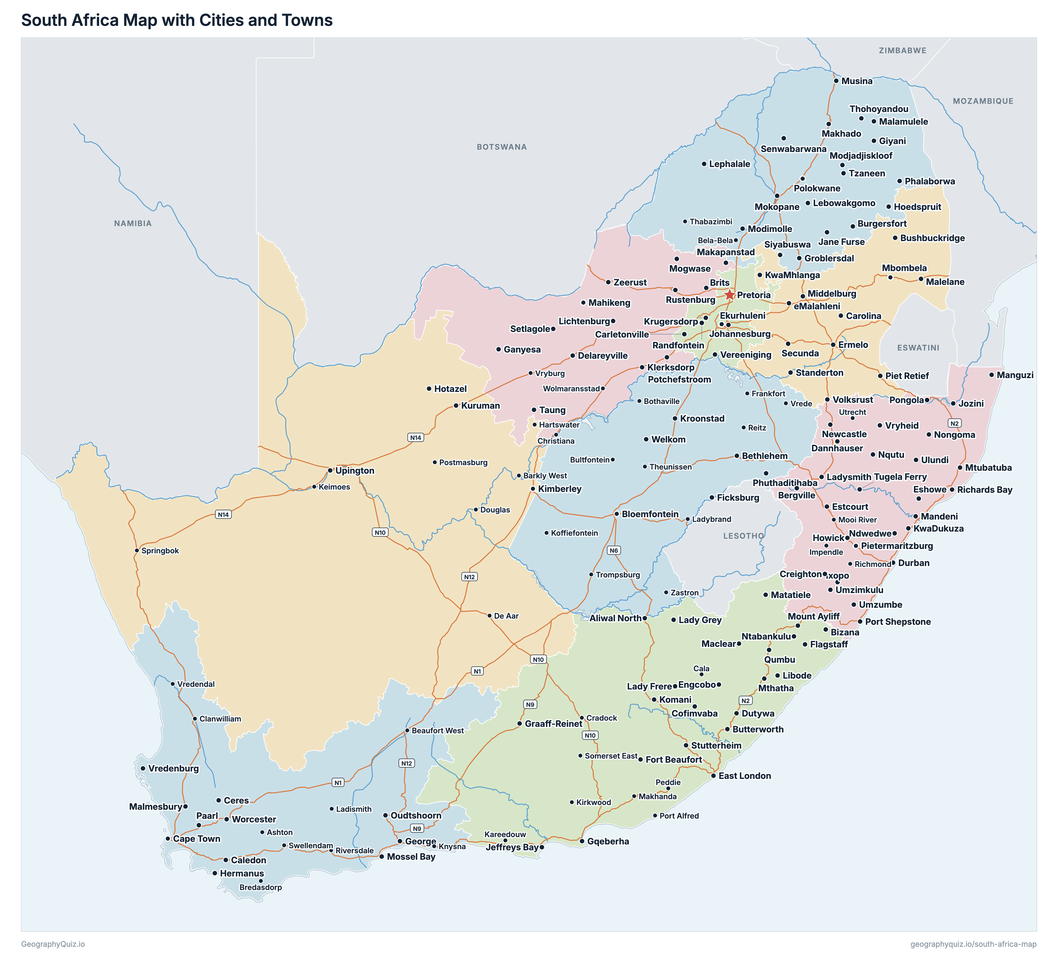
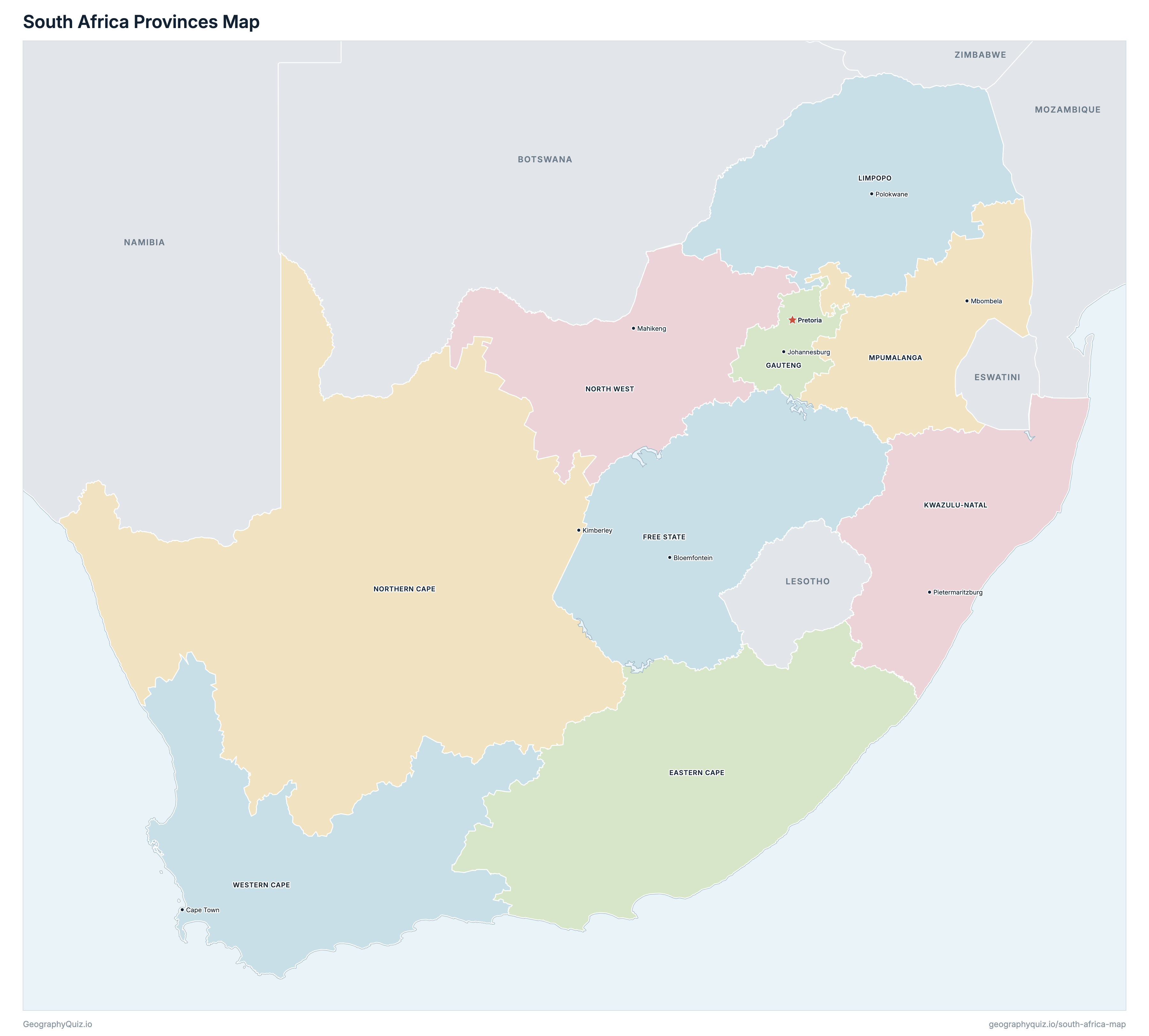
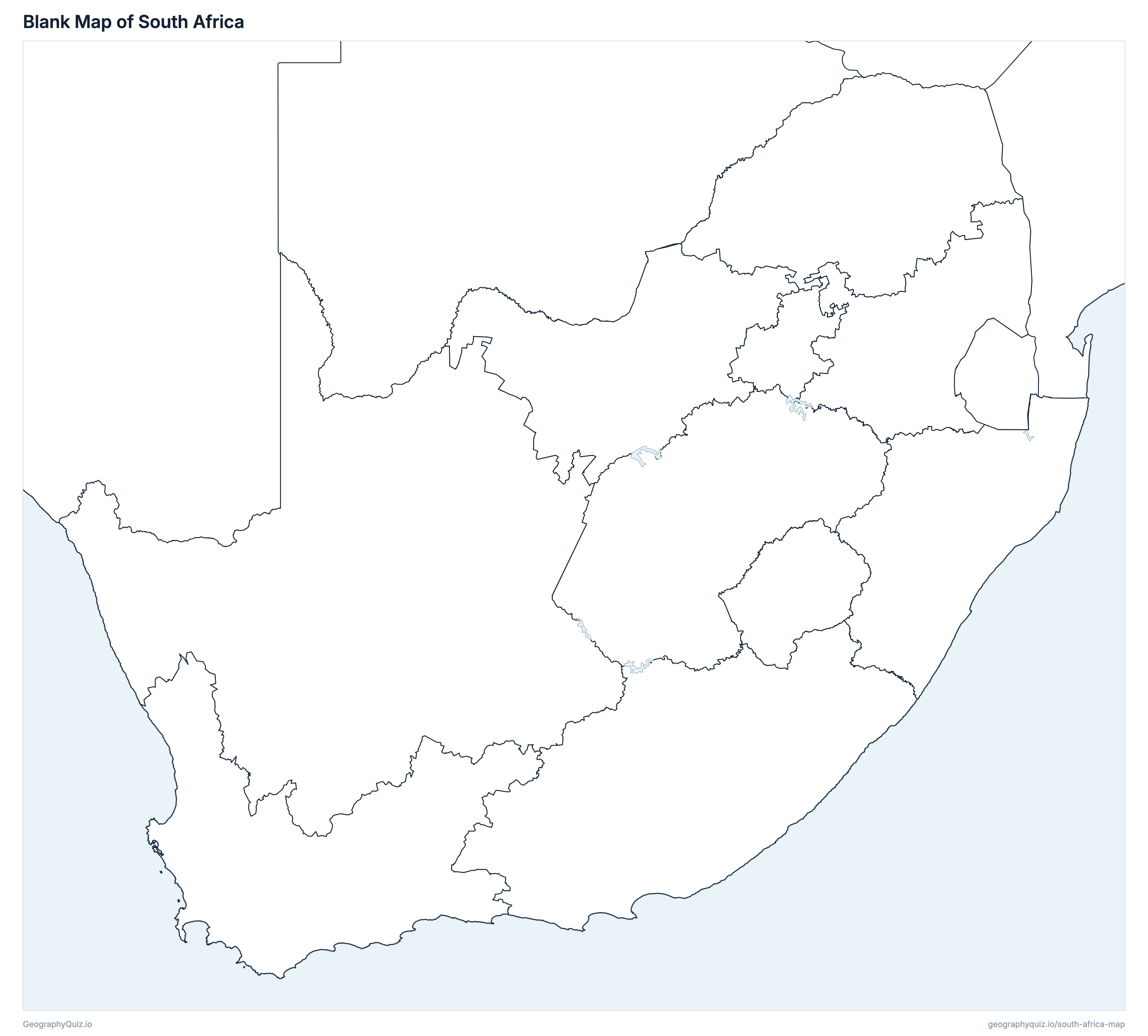
Free to print for class and home: South Africa with its cities and towns, a map of its provinces, and a blank outline map. PDFs fit one A4 or US Letter page.
South Africa map with cities
South Africa provinces map
About South Africa
South Africa has 9 provinces and about 62,027,503 people (2022) on 1,220,813 km² (471,358 sq mi). The capital is Pretoria; the largest city is Johannesburg, with 4,803,262 people. It borders Namibia, Botswana, Zimbabwe, Mozambique, Eswatini and Lesotho.
Gauteng is the most populous province (15,099,422 people) and Northern Cape the least (1,355,945); Northern Cape is the largest by area (372,889 km²) and Gauteng the smallest (18,178 km²).
Largest cities in South Africa
The 25 most populous cities and towns. All 195 are on the map above: switch on Towns and zoom in to see them.
| # | City | Province | Population |
|---|---|---|---|
| 1 | Johannesburg | Gauteng | 4,803,262 |
| 2 | Cape Town | Western Cape | 4,772,846 |
| 3 | Durban | KwaZulu-Natal | 4,239,901 |
| 4 | Ekurhuleni | Gauteng | 4,066,691 |
| 5 | Pretoria | Gauteng | 4,040,315 |
| 6 | Gqeberha | Eastern Cape | 1,190,496 |
| 7 | East London | Eastern Cape | 975,255 |
| 8 | Vereeniging | Gauteng | 945,650 |
| 9 | Polokwane | Limpopo | 843,459 |
| 10 | Mbombela | Mpumalanga | 818,925 |
| 11 | Pietermaritzburg | KwaZulu-Natal | 817,725 |
| 12 | Bloemfontein | Free State | 811,431 |
| 13 | Bushbuckridge | Mpumalanga | 750,821 |
| 14 | Malelane | Mpumalanga | 591,928 |
| 15 | Burgersfort | Limpopo | 575,960 |
| 16 | Thohoyandou | Limpopo | 575,929 |
| 17 | Rustenburg | North West | 562,031 |
| 18 | Brits | North West | 522,566 |
| 19 | Newcastle | KwaZulu-Natal | 507,710 |
| 20 | Makhado | Limpopo | 502,397 |
| 21 | Tzaneen | Limpopo | 478,254 |
| 22 | Mthatha | Eastern Cape | 476,558 |
| 23 | Malamulele | Limpopo | 443,798 |
| 24 | Welkom | Free State | 439,034 |
| 25 | Krugersdorp | Gauteng | 438,217 |
Populations are from Census 2022 (Statistics South Africa). Towns are shown with the population of the metropolitan or local municipality they are the main town of, so Pretoria is the City of Tshwane and Durban is eThekwini. South Africa has three capitals: Pretoria (executive, shown as the capital), Cape Town (legislative) and Bloemfontein (judicial). The Prince Edward Islands, part of the Western Cape far to the south-east, are off the map.
Provinces of South Africa
All 9 provinces. Select one to show it on the map.
| Bhisho | 7,230,204 | 168,966 | |
| Bloemfontein | 2,964,412 | 129,825 | |
| Johannesburg | 15,099,422 | 18,178 | |
| Pietermaritzburg | 12,423,907 | 94,361 | |
| Polokwane | 6,572,721 | 125,755 | |
| Mbombela | 5,143,324 | 76,495 | |
| Mahikeng | 3,804,548 | 104,882 | |
| Kimberley | 1,355,945 | 372,889 | |
| Cape Town | 7,433,020 | 129,462 |
Quizzes and worksheets
Sources
- Provinces: Municipal Demarcation Board, Local Municipalities 2021 (the municipalities of Census 2022), joined into provinces; areas from the Municipal Demarcation Board's Provinces layer.
- Populations: Statistics South Africa, Census 2022, total population by province and by metropolitan and local municipality (census.statssa.gov.za).
- Town locations and names: National Geo-spatial Information (Department of Agriculture, Land Reform and Rural Development), South Africa Placenames.
- National roads: Department of Agriculture, Land Reform and Rural Development, National Roads (the N routes).