Interactive map
Netherlands Map
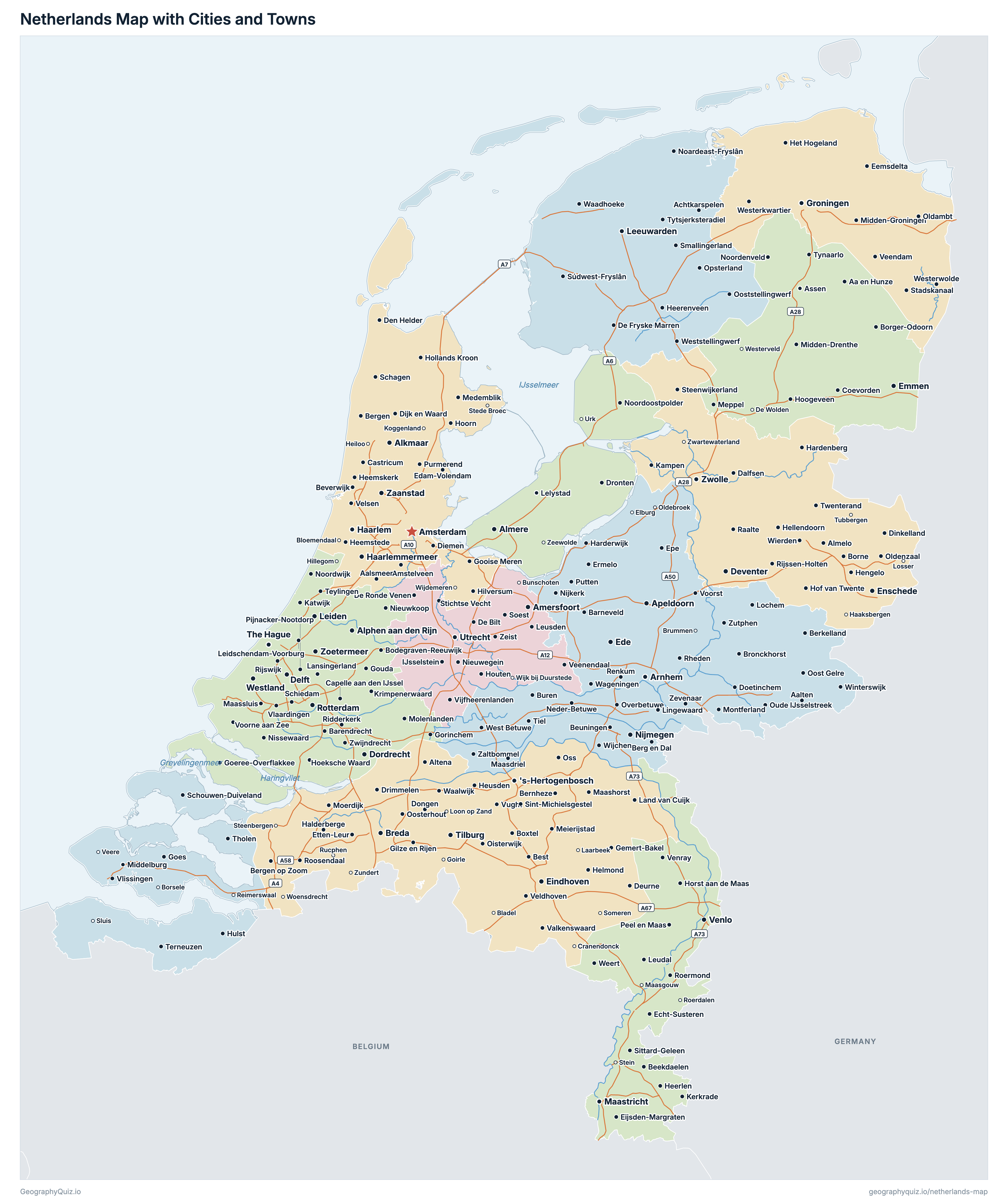
Every province, city and town in the Netherlands on one zoomable map, with its main highways, rivers and lakes. Switch on towns and provinces above the map and zoom in for every name; tap a province to see its population, area and largest towns.
Loading the map…
Printable maps of the Netherlands
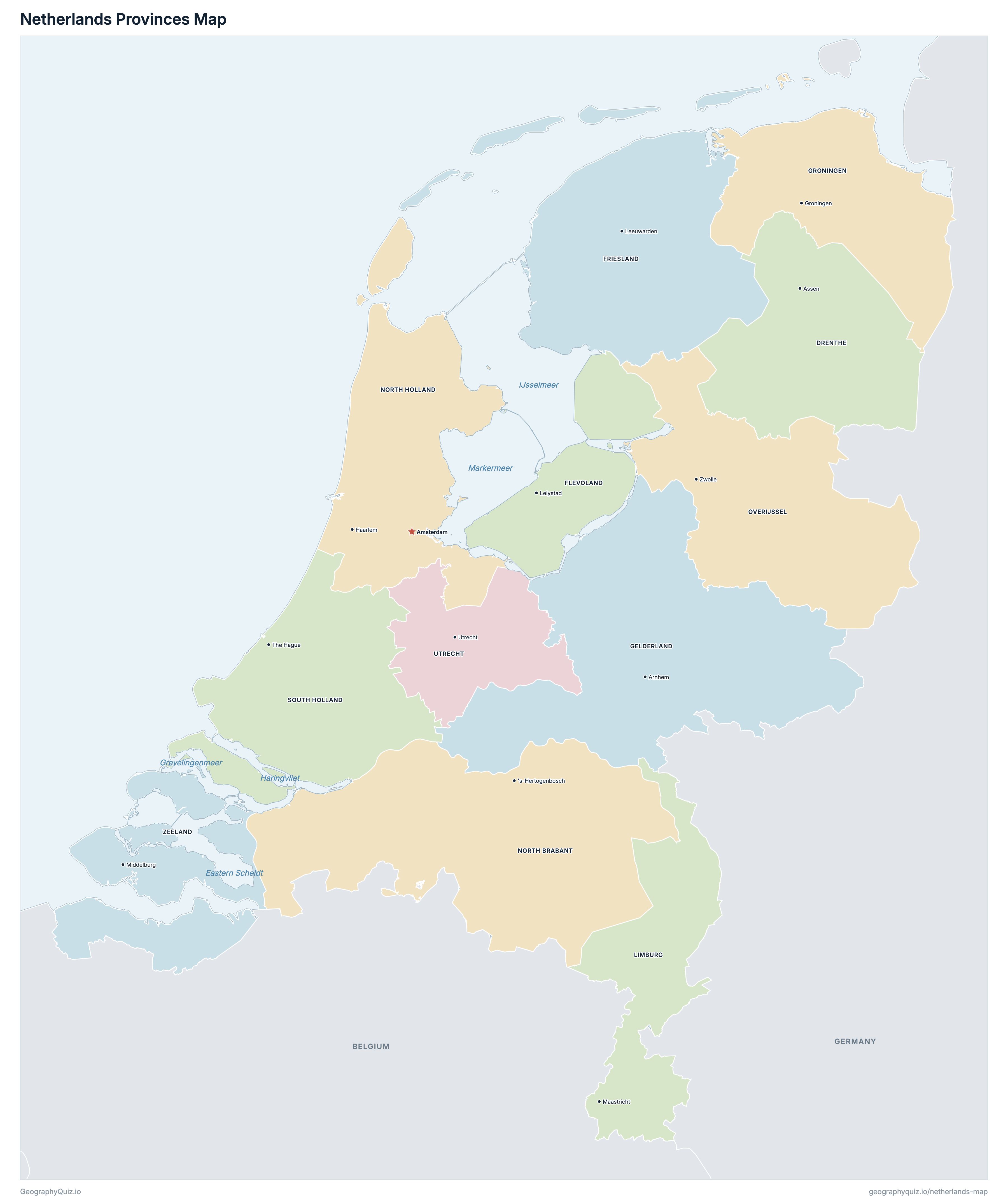
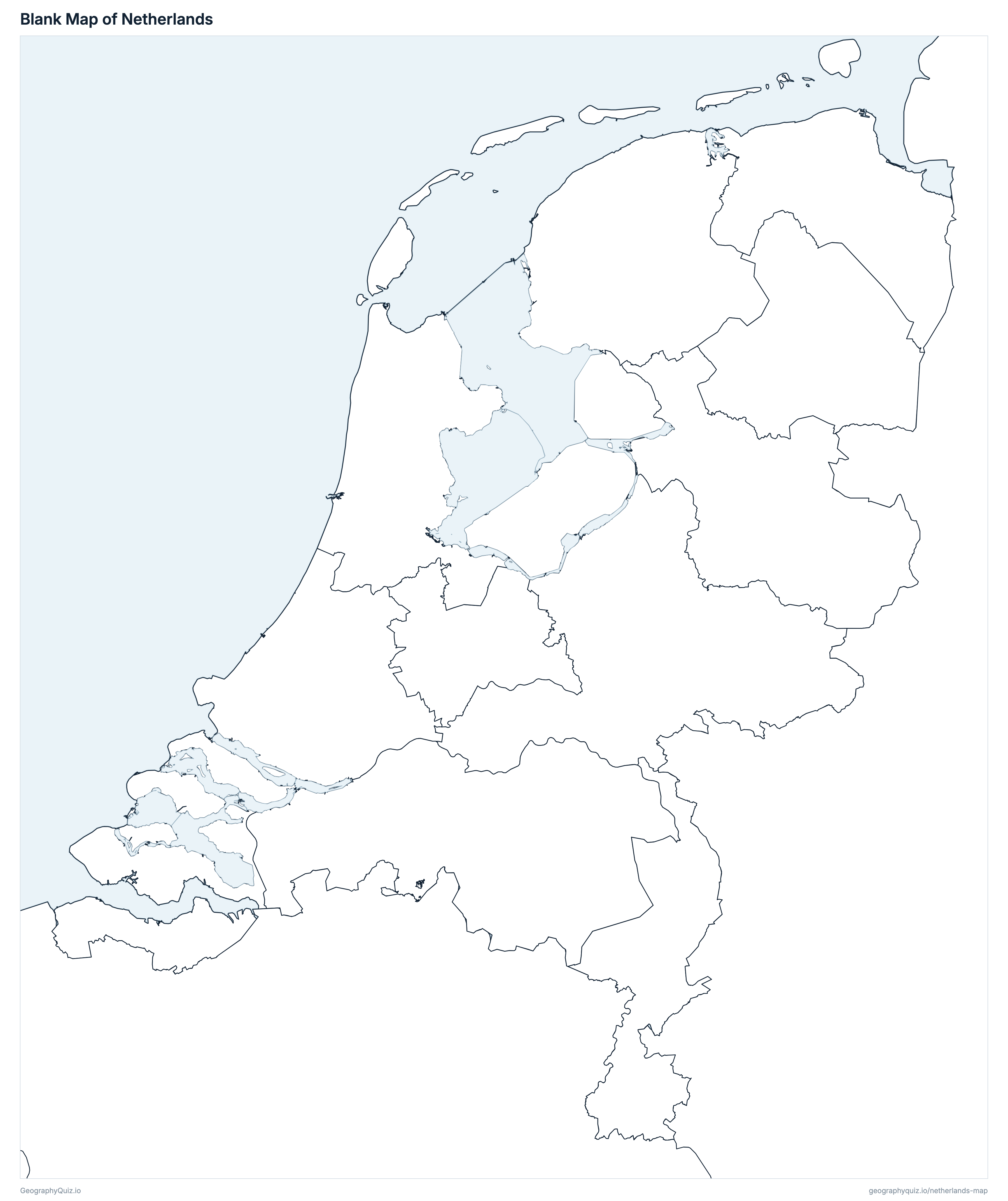
Free to print for class and home: the Netherlands with its cities and towns, a map of its provinces, and a blank outline map. PDFs fit one A4 or US Letter page.
Netherlands map with cities
Netherlands provinces map
About the Netherlands
The Netherlands has 12 provinces and about 18,130,208 people (2026) on 33,647 km² (12,991 sq mi). Amsterdam is both the capital and the largest city, with 941,927 people. It borders Germany and Belgium.
South Holland is the most populous province (3,882,708 people) and Zeeland the least (394,538); Gelderland is the largest by area (4,960 km²) and Flevoland the smallest (1,410 km²).
Largest cities in the Netherlands
The 25 most populous cities and towns. All 278 are on the map above: switch on Towns and zoom in to see them.
| # | City | Province | Population |
|---|---|---|---|
| 1 | Amsterdam | North Holland | 941,927 |
| 2 | Rotterdam | South Holland | 673,804 |
| 3 | The Hague | South Holland | 569,468 |
| 4 | Utrecht | Utrecht | 378,121 |
| 5 | Eindhoven | North Brabant | 249,783 |
| 6 | Groningen | Groningen | 244,427 |
| 7 | Almere | Flevoland | 232,619 |
| 8 | Tilburg | North Brabant | 230,746 |
| 9 | Breda | North Brabant | 190,204 |
| 10 | Nijmegen | Gelderland | 189,871 |
| 11 | Arnhem | Gelderland | 171,822 |
| 12 | Apeldoorn | Gelderland | 169,212 |
| 13 | Haarlem | North Holland | 168,898 |
| 14 | Haarlemmermeer | North Holland | 166,978 |
| 15 | Zaanstad | North Holland | 165,201 |
| 16 | Amersfoort | Utrecht | 163,764 |
| 17 | Enschede | Overijssel | 162,683 |
| 18 | 's-Hertogenbosch | North Brabant | 162,295 |
| 19 | Zwolle | Overijssel | 134,147 |
| 20 | Zoetermeer | South Holland | 130,836 |
| 21 | Leiden | South Holland | 130,328 |
| 22 | Leeuwarden | Friesland | 130,162 |
| 23 | Maastricht | Limburg | 126,026 |
| 24 | Ede | Gelderland | 125,331 |
| 25 | Dordrecht | South Holland | 122,991 |
Populations are CBS's population on 1 January 2026 (StatLine table 03759ned) for the European Netherlands, without the Caribbean Netherlands; towns are whole municipalities (gemeenten), so a city's figure stops at its boundary and a municipality such as Westland or Súdwest-Fryslân is a group of towns. Amsterdam is the capital, while The Hague is the seat of the government.
Provinces of the Netherlands
All 12 provinces. Select one to show it on the map.
| Assen | 508,109 | 2,633 | |
| Lelystad | 462,816 | 1,410 | |
| Leeuwarden | 665,208 | 3,340 | |
| Arnhem | 2,173,349 | 4,960 | |
| Groningen | 601,286 | 2,316 | |
| Maastricht | 1,138,374 | 2,145 | |
| 's-Hertogenbosch | 2,676,955 | 4,902 | |
| Haarlem | 3,009,386 | 2,663 | |
| Zwolle | 1,202,375 | 3,317 | |
| The Hague | 3,882,708 | 2,698 | |
| Utrecht | 1,415,104 | 1,484 | |
| Middelburg | 394,538 | 1,780 |
Quizzes and worksheets
Sources
- Provinces and municipalities: Statistics Netherlands (CBS), CBS gebiedsindelingen 2026 (generalised; the boundaries of 1 January 2026, land only), with CBS's municipality label points, via PDOK (CC BY 4.0).
- Populations: CBS StatLine, table 03759ned, population on 1 January 2026 by province and municipality (opendata.cbs.nl).
- Land and water areas: CBS StatLine, table 70072ned (Regionale kerncijfers Nederland), 2025.
- The IJsselmeer, the Markermeer, the Eastern Scheldt and the other lakes: Kadaster, Bestuurlijke gebieden (the territory, land and water) less CBS's land, named with Kadaster's TOP10NL, via PDOK; the Wadden Sea and the Western Scheldt are drawn as sea.
- Motorways and rivers: Rijkswaterstaat, Nationaal Wegenbestand (NWB) Wegen and Vaarwegen, via PDOK.
- Amsterdam is the capital; The Hague is the seat of the government and parliament. The Caribbean Netherlands (Bonaire, Sint Eustatius and Saba) are not on the map or in its figures.