Interactive map
Greece Map
Every region, city and town in Greece on one zoomable map, with its main highways, rivers and lakes. Switch on towns and regions above the map and zoom in for every name; tap a region to see its population, area and largest towns.
Loading the map…
Printable maps of Greece
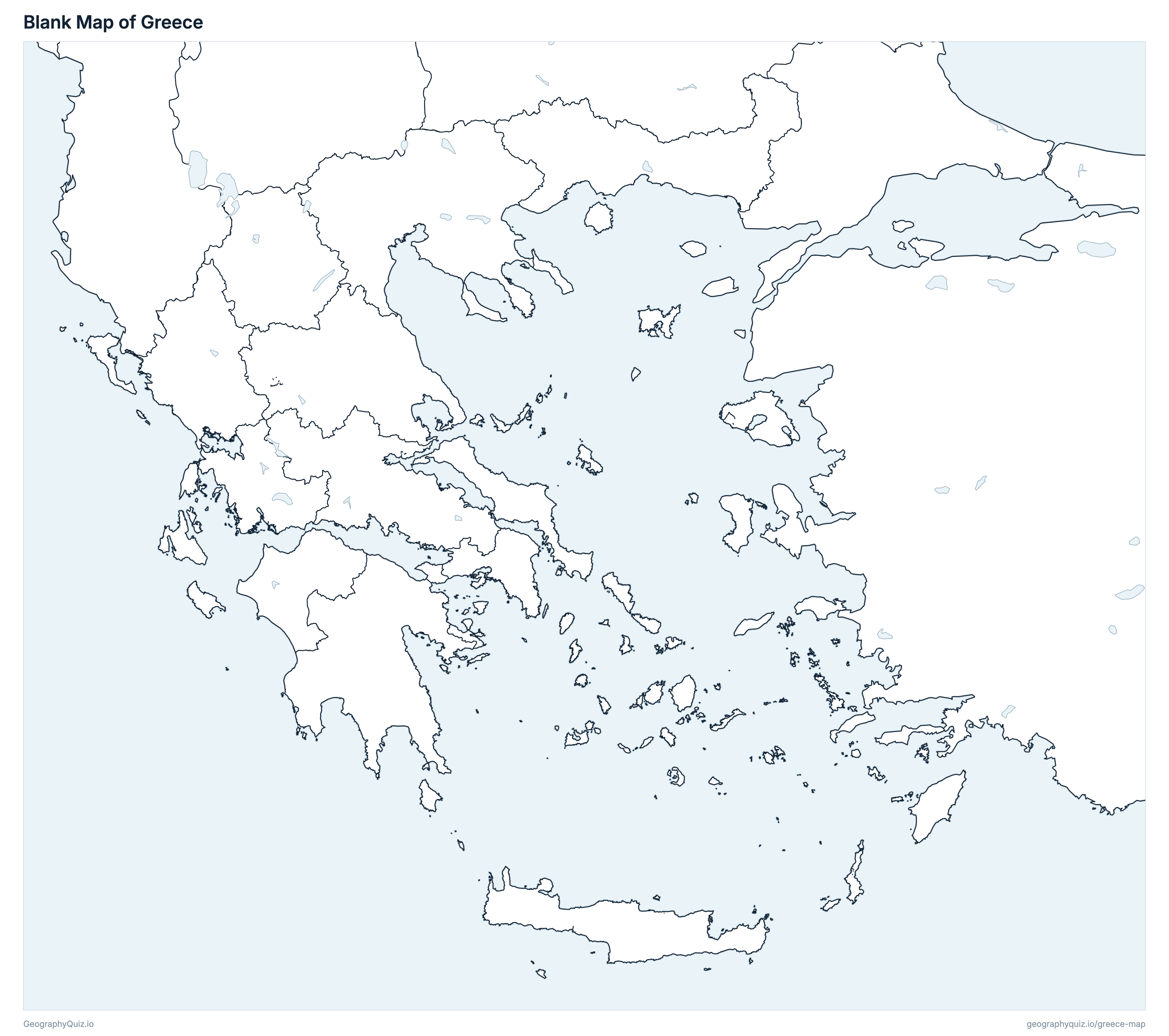
Free to print for class and home: Greece with its cities and towns, a map of its regions, and a blank outline map. PDFs fit one A4 or US Letter page.
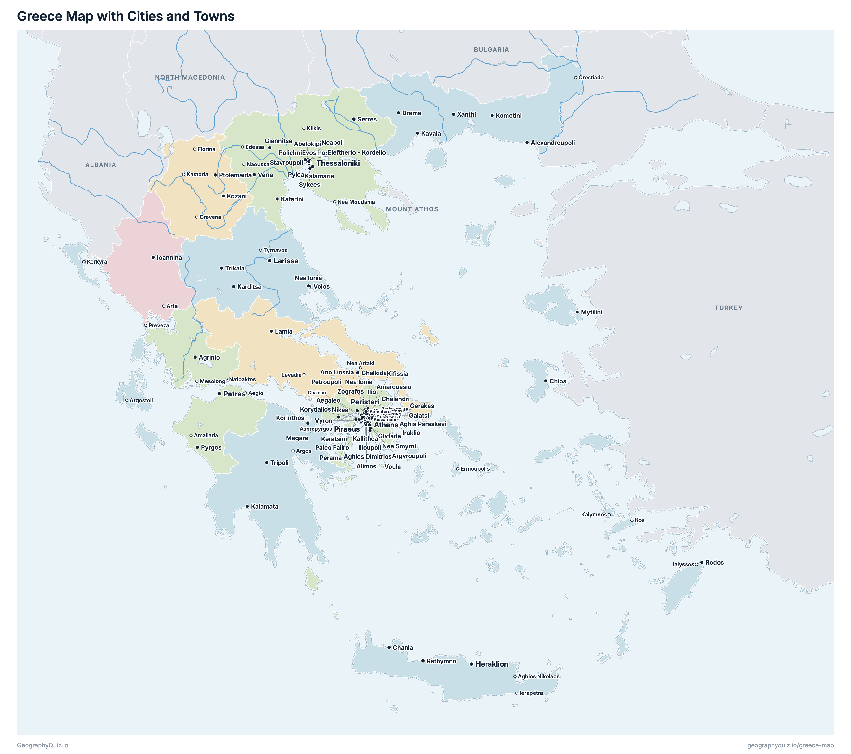
Greece map with cities
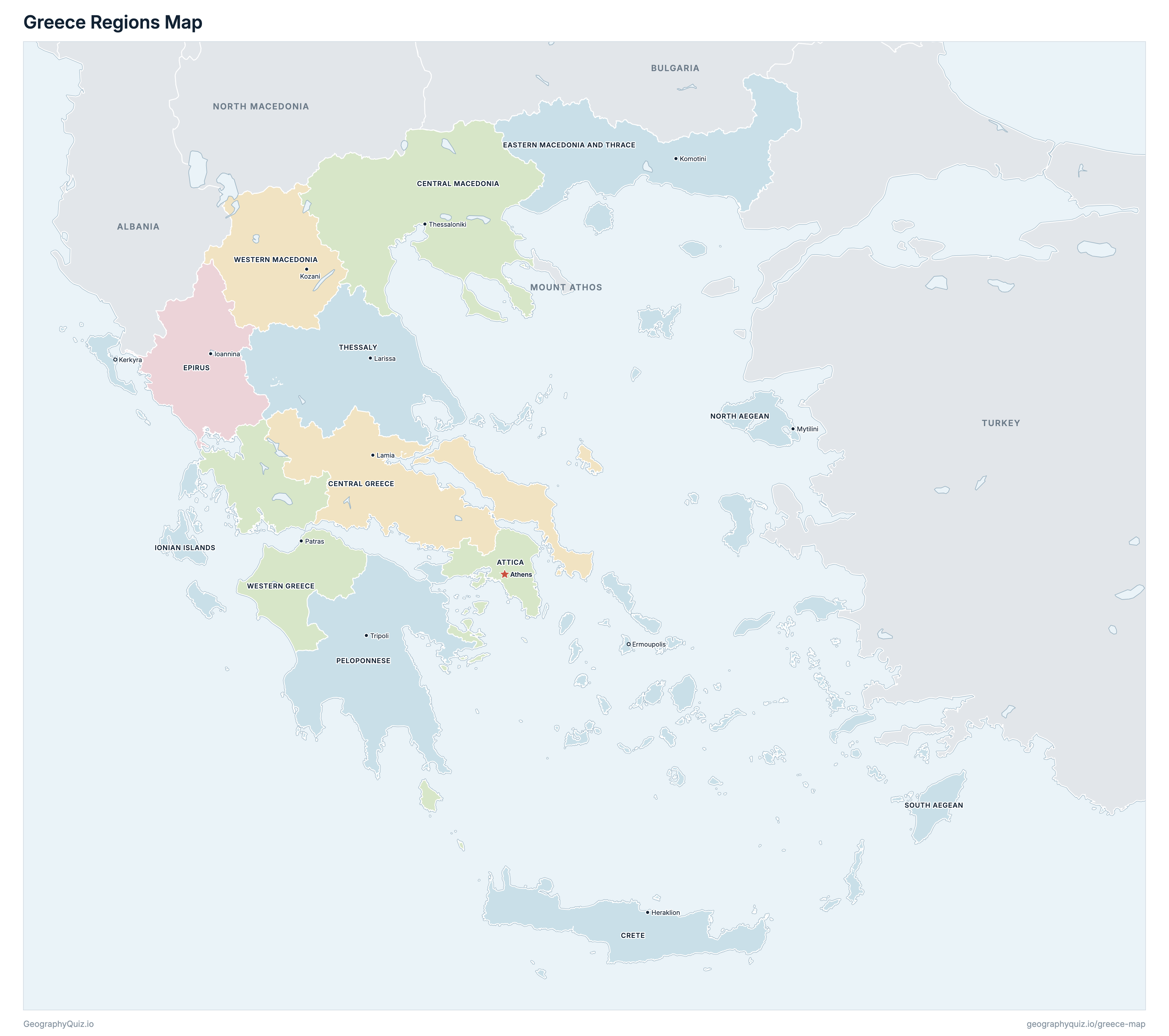
Greece regions map
About Greece
Greece has 13 regions and about 10,482,487 people (2021) on 132,032 km² (50,978 sq mi). Athens is both the capital and the largest city, with 643,452 people. It borders Albania, North Macedonia, Bulgaria, Turkey and Mount Athos.
Attica is the most populous region (3,814,064 people) and North Aegean the least (194,943); Central Macedonia is the largest by area (19,172 km²) and Ionian Islands the smallest (2,302 km²).
Largest cities in Greece
The 25 most populous cities and towns. All 153 are on the map above: switch on Towns and zoom in to see them.
| # | City | Region | Population |
|---|---|---|---|
| 1 | Athens | Attica | 643,452 |
| 2 | Thessaloniki | Central Macedonia | 309,617 |
| 3 | Patras | Western Greece | 169,886 |
| 4 | Piraeus | Attica | 168,151 |
| 5 | Larissa | Thessaly | 146,377 |
| 6 | Heraklion | Crete | 145,440 |
| 7 | Peristeri | Attica | 133,630 |
| 8 | Acharnes | Attica | 98,893 |
| 9 | Kallithea | Attica | 97,616 |
| 10 | Kalamaria | Central Macedonia | 92,248 |
| 11 | Glyfada | Attica | 89,597 |
| 12 | Nikea | Attica | 88,077 |
| 13 | Volos | Thessaly | 85,803 |
| 14 | Ilio | Attica | 84,004 |
| 15 | Evosmos | Central Macedonia | 79,221 |
| 16 | Chalandri | Attica | 77,102 |
| 17 | Ilioupoli | Attica | 76,730 |
| 18 | Keratsini | Attica | 75,721 |
| 19 | Nea Smyrni | Attica | 72,853 |
| 20 | Amaroussio | Attica | 71,830 |
| 21 | Aghios Dimitrios | Attica | 71,664 |
| 22 | Zografos | Attica | 69,874 |
| 23 | Aegaleo | Attica | 65,831 |
| 24 | Ioannina | Epirus | 64,896 |
| 25 | Paleo Faliro | Attica | 64,863 |
Populations are the resident population of the 2021 Population-Housing Census (ELSTAT, census day 21 October 2021). A town's figure is its settlement (the town itself, without the villages of its municipality), so Athens, Piraeus and the other municipalities of the Athens and Thessaloniki urban areas are counted separately. Mount Athos, a self-governing monastic community drawn on its own, is counted by ELSTAT with Central Macedonia (1,746 people), and so is its area.
Regions of Greece
All 13 regions. Select one to show it on the map.
| Athens | 3,814,064 | 3,814 | |
| Lamia | 508,254 | 15,561 | |
| Thessaloniki | 1,795,669 | 19,172 | |
| Heraklion | 624,408 | 8,346 | |
| Komotini | 562,201 | 14,188 | |
| Ioannina | 319,991 | 9,150 | |
| Kerkyra | 204,532 | 2,302 | |
| Mytilini | 194,943 | 3,848 | |
| Tripoli | 539,535 | 15,508 | |
| Ermoupolis | 327,820 | 5,313 | |
| Larissa | 688,255 | 14,053 | |
| Patras | 648,220 | 11,315 | |
| Kozani | 254,595 | 9,461 |
Quizzes and worksheets
Sources
- Regions, municipalities and Mount Athos: ELSTAT (Hellenic Statistical Authority), digital cartographic data of the 2021 Population-Housing Census (municipalities and municipal units, with their areas), statistics.gr.
- Populations: ELSTAT, 2021 Population-Housing Census, resident population by region, regional unit and municipality (17 March 2023) and by settlement (29 March 2024), statistics.gr.
- Town locations: ELSTAT, digital cartographic data of the 2021 census, settlements (Settlements2021).