Interactive map
Colombia Map
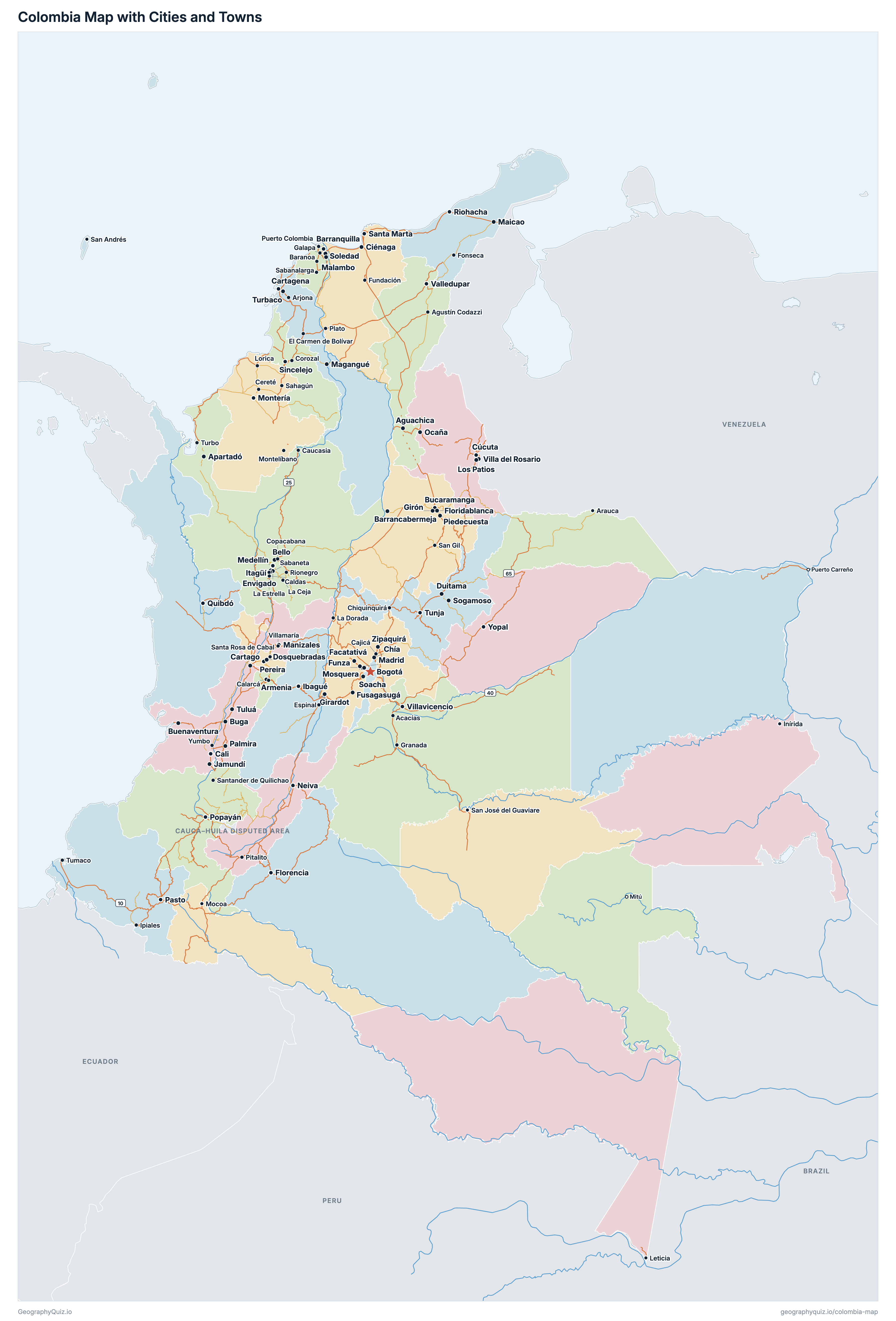
Every department, city and town in Colombia on one zoomable map, with its main highways, rivers and lakes. Switch on towns and departments above the map and zoom in for every name; tap a department to see its population, area and largest towns.
Loading the map…
Printable maps of Colombia
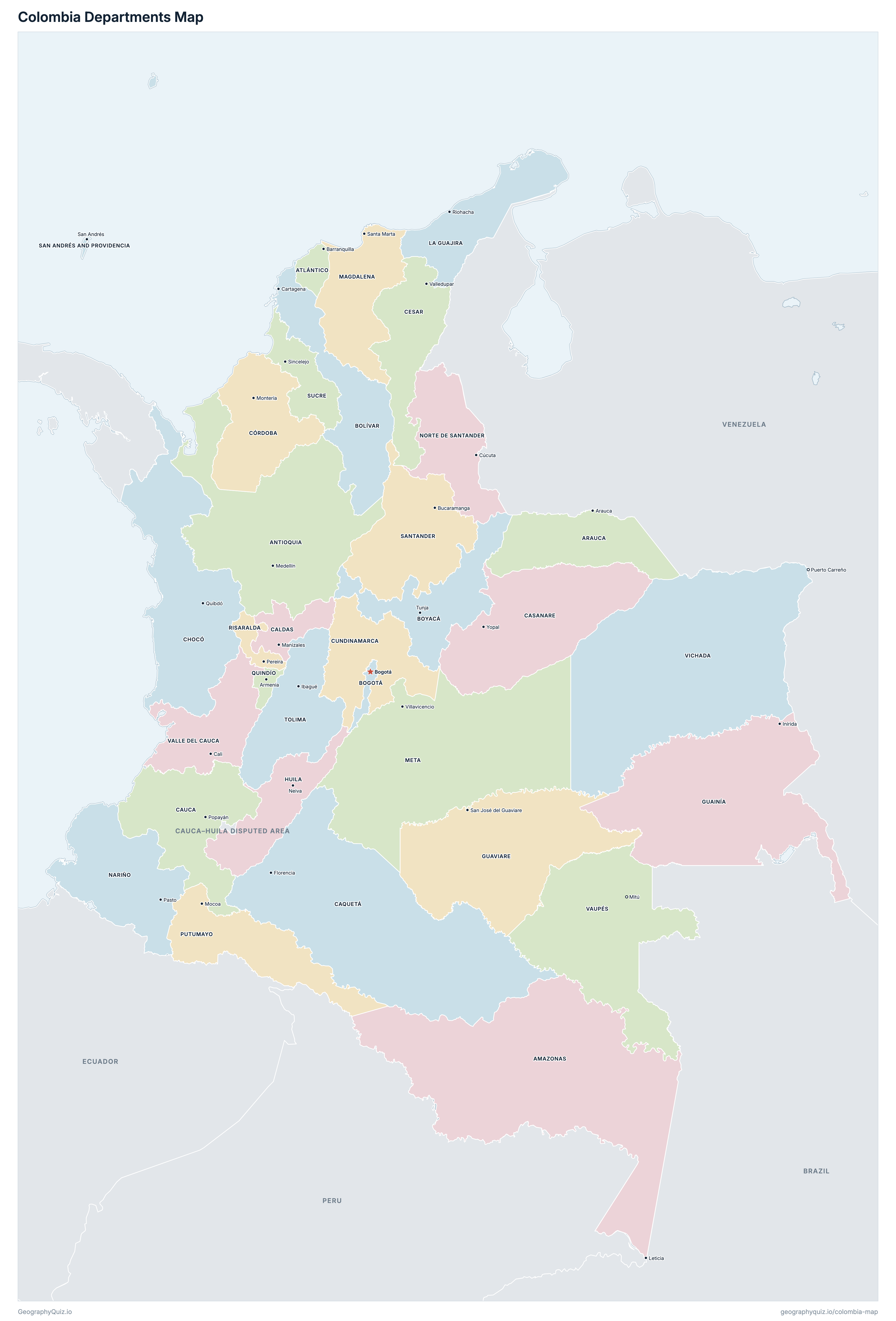
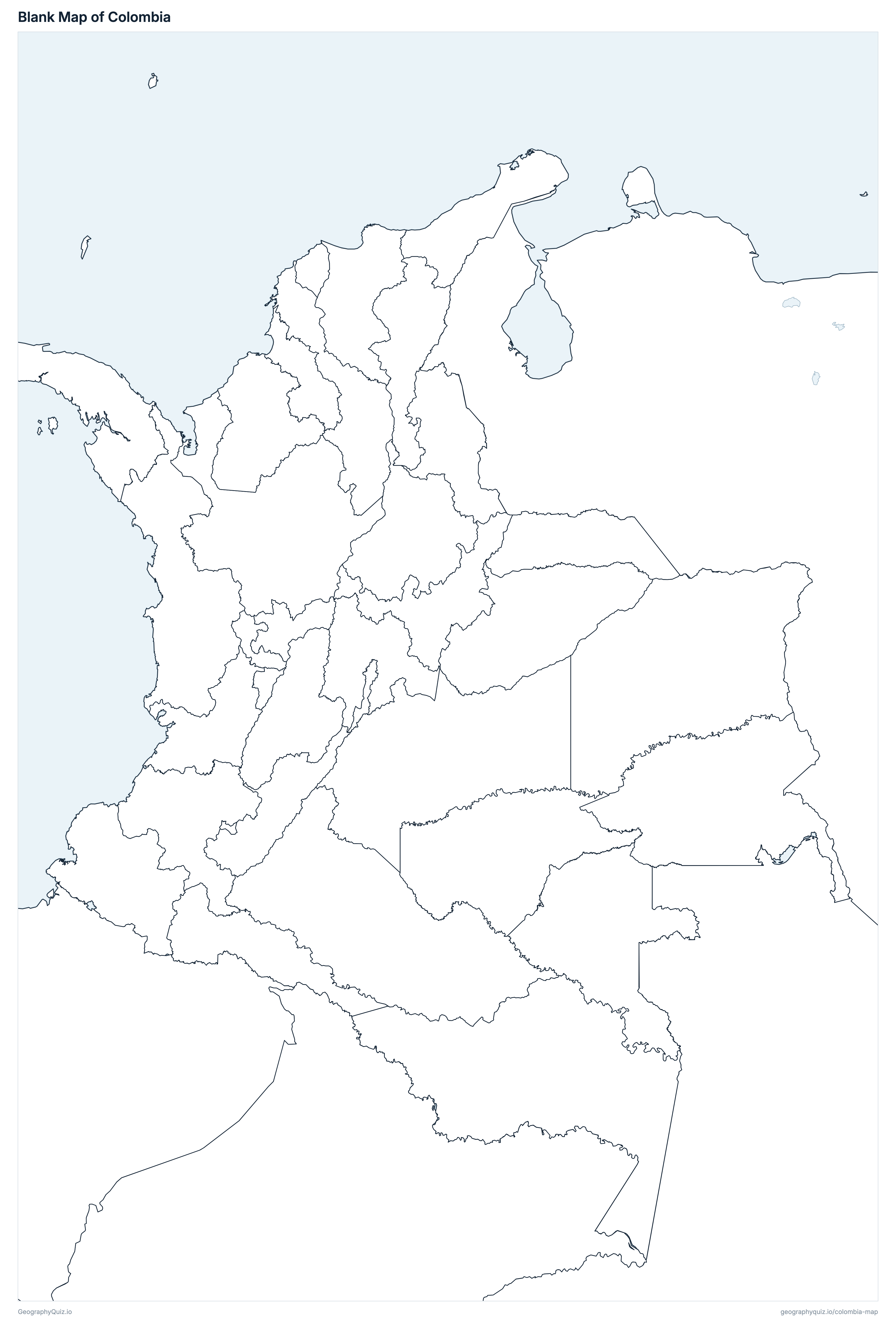
Free to print for class and home: Colombia with its cities and towns, a map of its departments, and a blank outline map. PDFs fit one A4 or US Letter page.
Colombia map with cities
Colombia departments map
About Colombia
Colombia has 33 departments and about 53,399,171 people (2026) on 1,136,274 km² (438,718 sq mi). Bogotá is both the capital and the largest city, with 7,914,911 people. It borders Cauca–Huila disputed area, Venezuela, Brazil, Peru, Ecuador and Panama.
Bogotá is the most populous department (7,945,996 people) and Vaupés the least (44,490); Amazonas is the largest by area (107,988 km²) and San Andrés and Providencia the smallest (50 km²).
Largest cities in Colombia
The 25 most populous cities and towns. All 107 are on the map above: switch on Towns and zoom in to see them.
| # | City | Department | Population |
|---|---|---|---|
| 1 | Bogotá | Bogotá | 7,914,911 |
| 2 | Medellín | Antioquia | 2,478,217 |
| 3 | Cali | Valle del Cauca | 2,217,353 |
| 4 | Barranquilla | Atlántico | 1,275,180 |
| 5 | Cartagena | Bolívar | 902,411 |
| 6 | Soacha | Cundinamarca | 888,398 |
| 7 | Cúcuta | Norte de Santander | 761,043 |
| 8 | Soledad | Atlántico | 732,525 |
| 9 | Bucaramanga | Santander | 607,951 |
| 10 | Bello | Antioquia | 587,840 |
| 11 | Valledupar | Cesar | 552,094 |
| 12 | Villavicencio | Meta | 541,221 |
| 13 | Santa Marta | Magdalena | 526,978 |
| 14 | Ibagué | Tolima | 516,862 |
| 15 | Montería | Córdoba | 458,206 |
| 16 | Manizales | Caldas | 449,879 |
| 17 | Pereira | Risaralda | 409,683 |
| 18 | Neiva | Huila | 382,081 |
| 19 | Pasto | Nariño | 316,257 |
| 20 | Floridablanca | Santander | 302,462 |
| 21 | Armenia | Quindío | 298,815 |
| 22 | Palmira | Valle del Cauca | 296,852 |
| 23 | Sincelejo | Sucre | 294,007 |
| 24 | Popayán | Cauca | 291,391 |
| 25 | Itagüí | Antioquia | 277,025 |
Populations are DANE's projections for 2026 (based on the 2018 Census, updated in July 2025). A department's figure is the sum of its municipalities; a city's is its urban seat (cabecera municipal) only, without the rest of its municipality. San Andrés and Providencia is drawn as an enlarged inset off the north coast: it really lies some 700 km north-west of the mainland, off Nicaragua.
Departments of Colombia
All 33 departments. Select one to show it on the map.
| Leticia | 85,896 | 107,988 | |
| Medellín | 6,963,990 | 62,786 | |
| Arauca | 280,022 | 23,717 | |
| Barranquilla | 2,885,904 | 3,313 | |
| Bogotá | 7,945,996 | 1,618 | |
| Cartagena | 2,251,190 | 26,663 | |
| Tunja | 1,295,848 | 23,078 | |
| Manizales | 1,056,839 | 7,422 | |
| Florencia | 431,867 | 92,709 | |
| Yopal | 477,966 | 44,267 | |
| Popayán | 1,613,329 | 30,919 | |
| Valledupar | 1,493,824 | 22,531 | |
| Quibdó | 599,468 | 48,428 | |
| Montería | 2,014,312 | 25,084 | |
| Bogotá | 3,601,277 | 22,345 | |
| Inírida | 61,065 | 70,918 | |
| San José del Guaviare | 84,833 | 55,403 | |
| Neiva | 1,221,847 | 18,137 | |
| Riohacha | 1,082,618 | 20,573 | |
| Santa Marta | 1,558,748 | 23,109 | |
| Villavicencio | 1,166,652 | 82,662 | |
| Pasto | 1,721,735 | 31,506 | |
| Cúcuta | 1,717,792 | 21,824 | |
| Mocoa | 395,590 | 25,701 | |
| Armenia | 557,850 | 1,933 | |
| Pereira | 1,006,785 | 3,557 | |
| San Andrés | 63,527 | 50 | |
| Bucaramanga | 2,410,700 | 30,512 | |
| Sincelejo | 1,047,052 | 10,585 | |
| Ibagué | 1,390,982 | 24,128 | |
| Cali | 4,714,987 | 20,672 | |
| Mitú | 44,490 | 53,061 | |
| Puerto Carreño | 154,190 | 99,073 |
Quizzes and worksheets
Sources
- Departments and the Capital District: Instituto Geográfico Agustín Codazzi (IGAC), departmental and municipal boundaries (with their areas), mapas.igac.gov.co.
- Populations: DANE, Proyecciones de población municipal por área geográfica 2018–2042 (based on the 2018 Census, updated July 2025), 2026, by municipality, summed by department.
- Town locations: DANE, DIVIPOLA – Códigos cabeceras – Centros poblados (December 2024), datos.gov.co.
- National roads: Instituto Nacional de Vías (INVÍAS), Red Vial (the national road network), datos.gov.co.