US Letter landscape · 1 page · Map activity
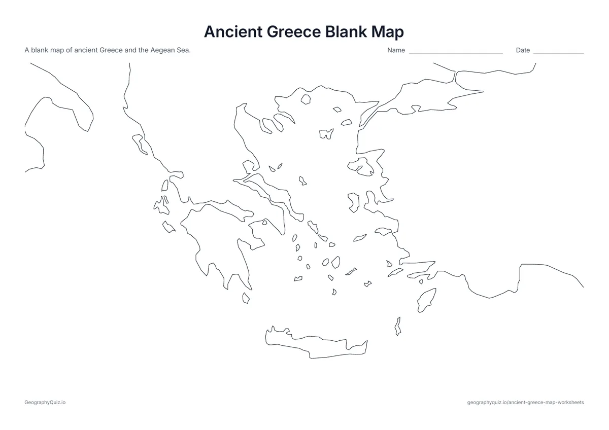
Ancient Greece Blank Map
The coast of Greece, the Aegean islands and Ionia with no names – ready for your own activity.
Free teacher resource
Seven map worksheets for a unit on ancient Greece: a blank map of Greece and the Aegean Sea, a labeled map of the cities, seas and regions, sheets for labeling the cities and Mount Olympus and the seas and regions, a page of map questions, and two maps of the Greek world from Massalia to Byzantium.
Every sheet comes as an A4 and a US Letter PDF.Print it, then play it
US Letter landscape · 1 page · Map activity
The coast of Greece, the Aegean islands and Ionia with no names – ready for your own activity.
US Letter landscape · 1 page · Map activity
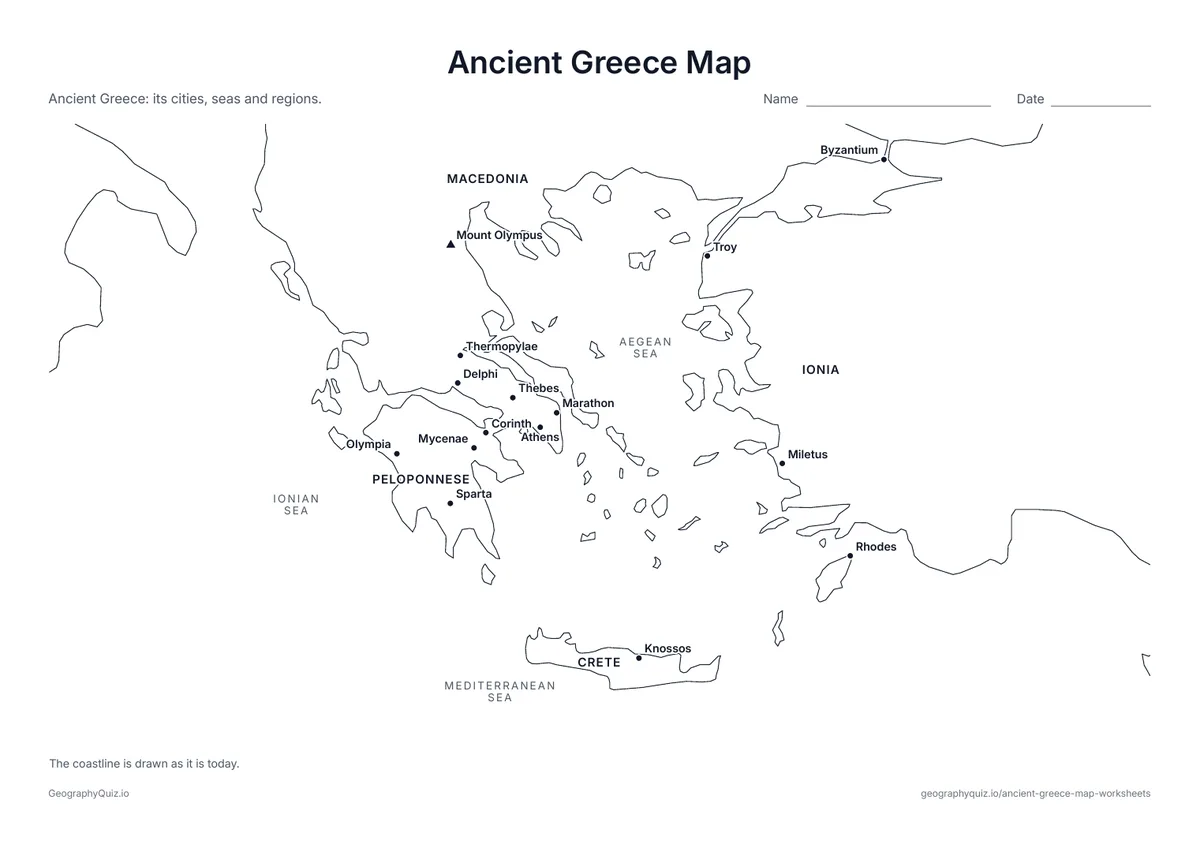
Athens, Sparta, Marathon, Delphi, Olympia, Knossos, Troy and other places, with Mount Olympus, the seas and the regions named.
US Letter landscape · 1 page · Map activity
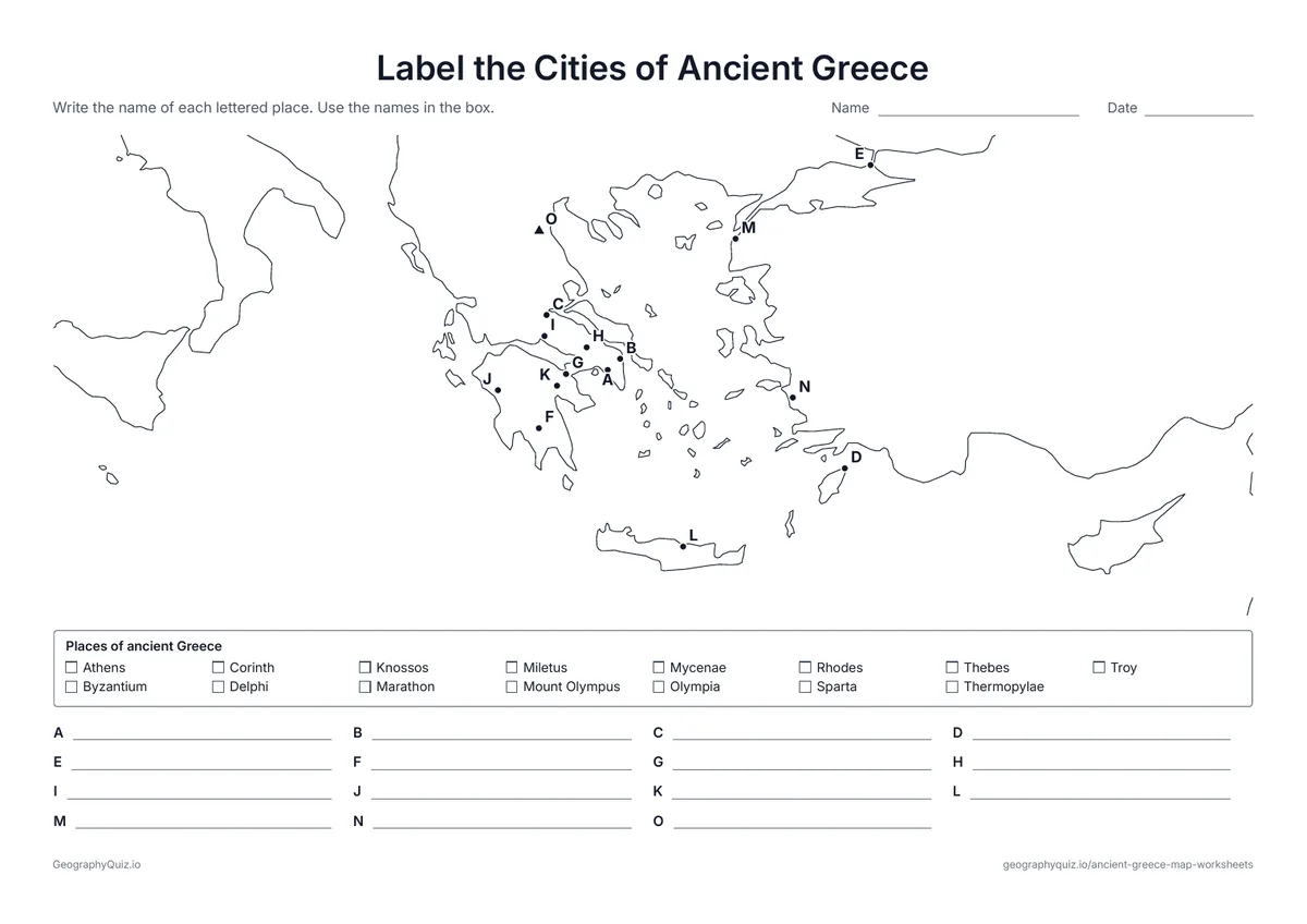
Fifteen lettered places, from Athens and Sparta to Marathon, Troy and Mount Olympus. Students name each one using the word bank.
US Letter landscape · 1 page · Map activity
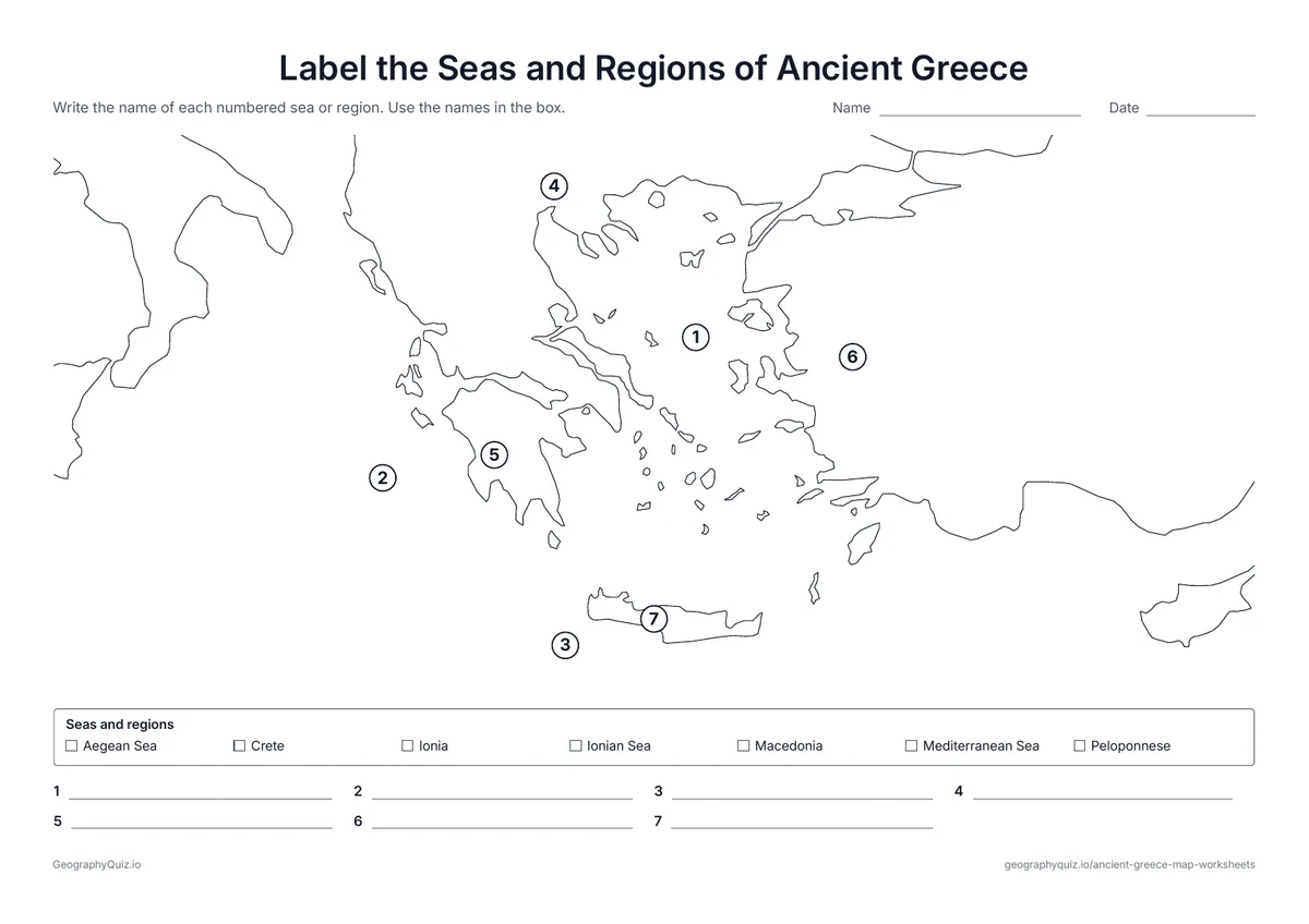
Students name the Aegean, Ionian and Mediterranean Seas and the regions of Macedonia, the Peloponnese, Ionia and Crete.
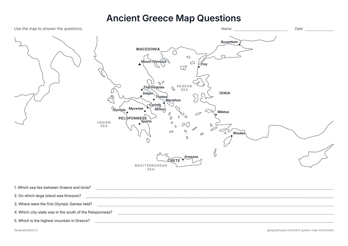
US Letter landscape · 1 page · Map activity
A labeled map and five questions about the Olympic Games, Sparta, Knossos, Mount Olympus and the Aegean Sea.
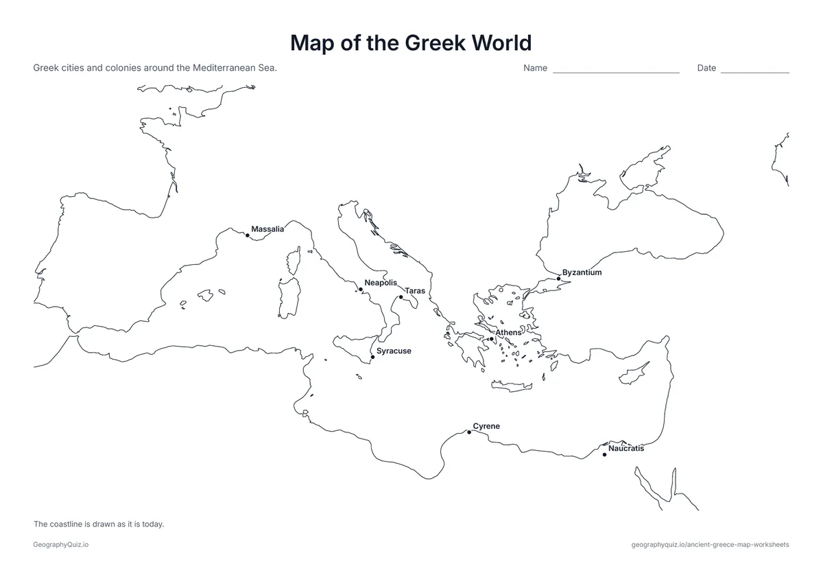
US Letter landscape · 1 page · Map activity
Greek cities and colonies around the Mediterranean, from Massalia in the west to Byzantium in the east.
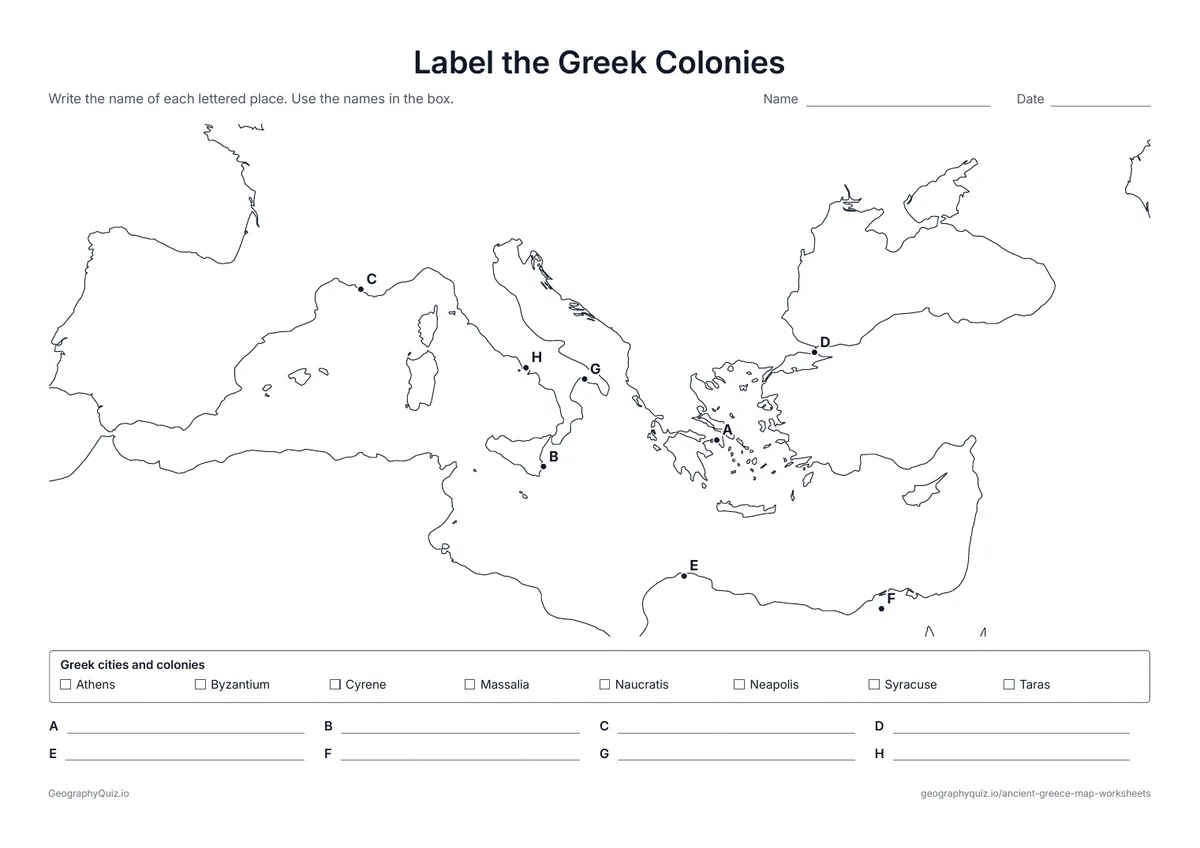
US Letter landscape · 1 page · Map activity
Eight lettered cities around the Mediterranean. Students name each Greek city and colony using the word bank.
For teachers
The maps show the coastline as it is today with no modern borders, so the city-states, Ionia and Macedonia sit on the land as the ancient Greeks knew it. Start with the labeled map, then use the labeling sheets and map questions to check what students remember; the Greek world sheets suit a lesson on trade and colonies. There are no answer sheets: the labeled maps work for checking.
Each activity has its instructions, a key to colour in and space for pupils' answers printed on the sheet. The maps are crisp black line drawings with no names, so they photocopy cleanly and pupils do the finding themselves.
Start with the labeled map so students can see where the city-states, seas and regions are, then use the labeling sheets and the map questions to check what they remember. The map of the Greek world shows how far the Greeks traded and founded colonies, from Massalia in France to Byzantium on the Black Sea, and works well with a lesson on why a mountainous land with a long coast turned its people toward the sea.
The maps put places from more than a thousand years of history together. Knossos on Crete and Mycenae belong to the Bronze Age; Athens, Sparta, Marathon and Thermopylae to the Classical age of the city-states and the Persian Wars. The coastline is drawn as it is today, so Miletus, a port in ancient times, now sits a few miles inland.
Ancient Greece is most often taught in sixth grade world history. The labeled map and blank map suit grades 3 to 6, and the labeling sheets, map questions and Greek world maps suit grades 5 to 7.
Athens and Sparta were the most powerful. Corinth, Thebes, Argos and Miletus were also important city-states.
Mountains and the sea divided the land into small valleys, plains and islands, so each city grew up on its own with its own government.
At Olympia, in the west of the Peloponnese, in 776 BC.
In the north of Greece, between Thessaly and Macedonia. At 9,570 feet (2,917 m), it is the highest mountain in Greece and, in myth, the home of the gods.
The Aegean Sea to the east, the Ionian Sea to the west and the Mediterranean Sea to the south.
No. The labeled ancient Greece map works for checking the labeling sheets.