Interactive map
Vietnam Map
Every province, city and town in Vietnam on one zoomable map, with its main highways, rivers and lakes. Switch on towns and provinces above the map and zoom in for every name; tap a province to see its population, area and largest towns.
Loading the map…
Printable maps of Vietnam
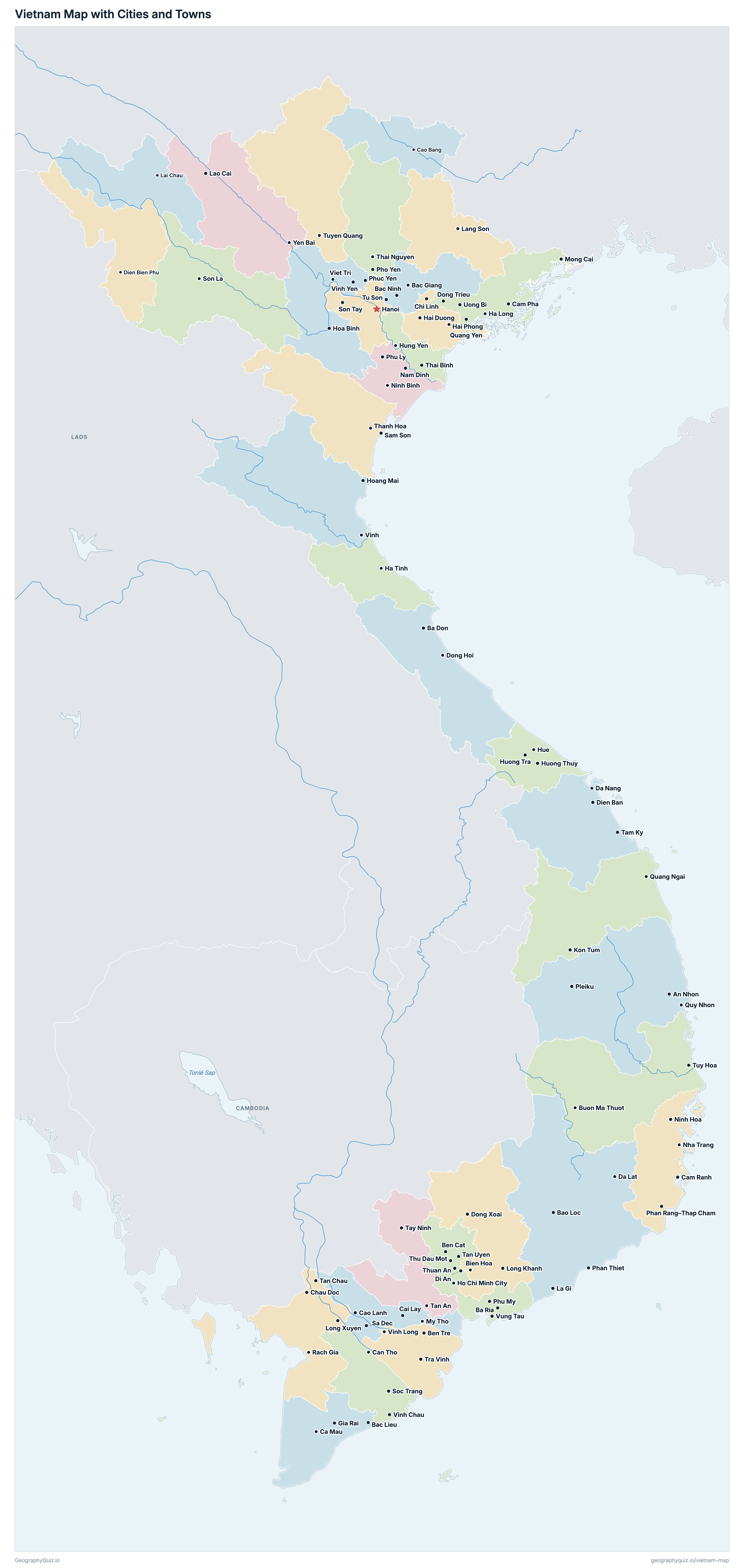
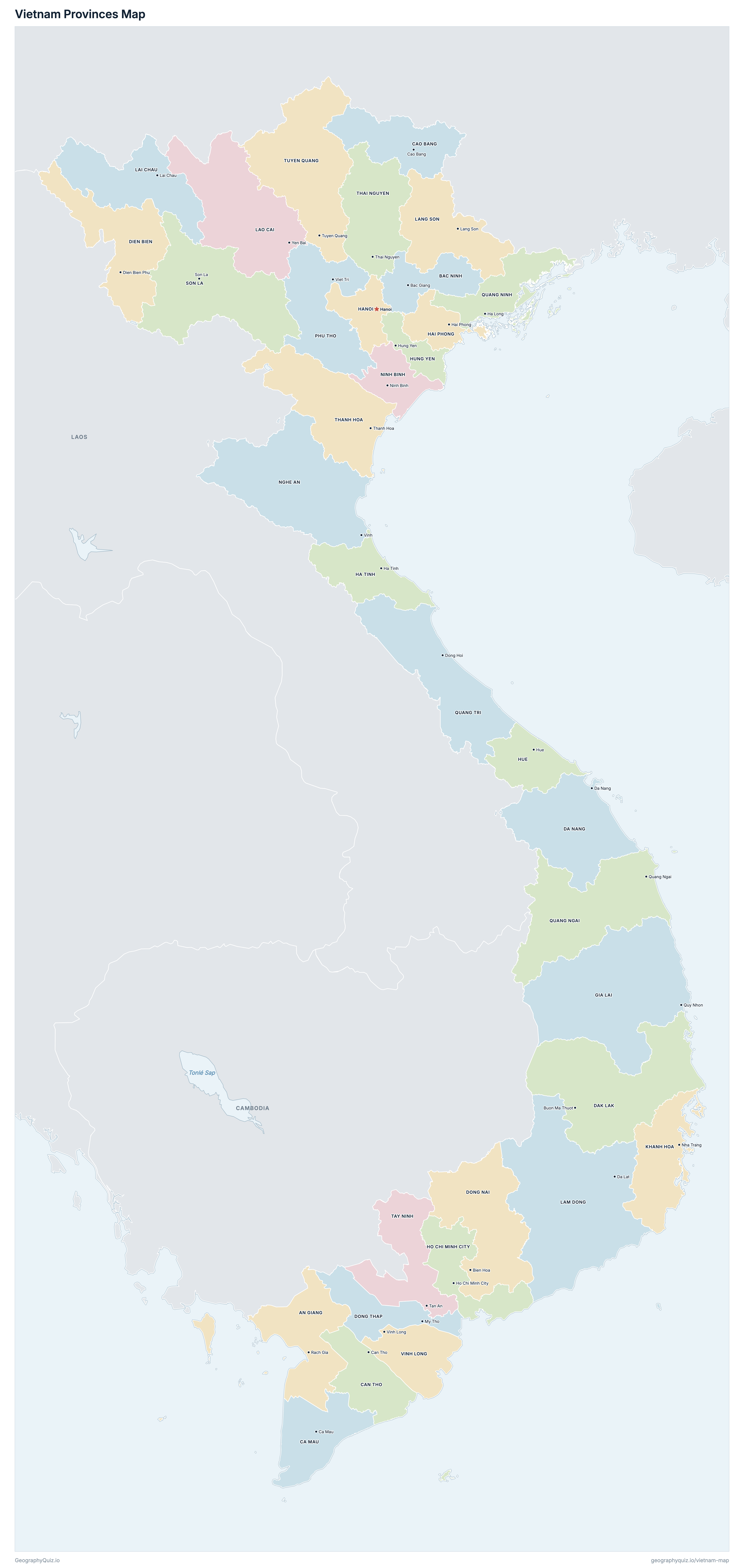
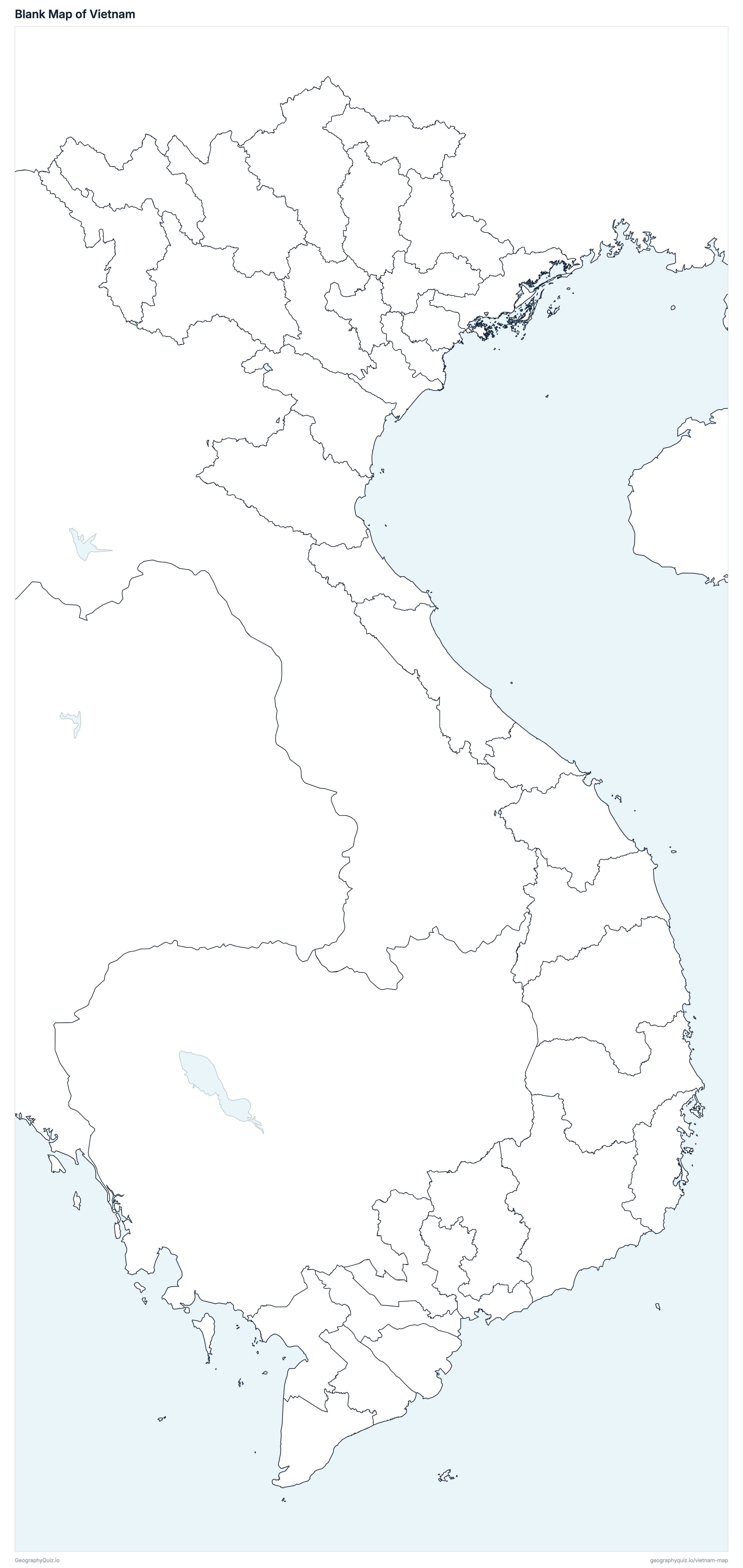
Free to print for class and home: Vietnam with its cities and towns, a map of its provinces, and a blank outline map. PDFs fit one A4 or US Letter page.
Vietnam map with cities
Vietnam provinces map
About Vietnam
Vietnam has 34 provinces and about 101,343,750 people (2024) on 331,326 km² (127,926 sq mi). The capital is Hanoi; the largest city is Ho Chi Minh City, with 7,004,921 people (2019). It borders China, Laos and Cambodia.
Ho Chi Minh City is the most populous province (13,608,890 people) and Lai Chau the least (495,470); Lam Dong is the largest by area (24,233 km²) and Hung Yen the smallest (2,515 km²).
Largest cities in Vietnam
The 25 most populous cities and towns. All 92 are on the map above: switch on Towns and zoom in to see them.
| # | City | Province | Population |
|---|---|---|---|
| 1 | Ho Chi Minh City | Ho Chi Minh City | 7,004,921 |
| 2 | Hanoi | Hanoi | 3,605,364 |
| 3 | Bien Hoa | Dong Nai | 1,055,414 |
| 4 | Da Nang | Da Nang | 988,561 |
| 5 | Hai Phong | Hai Phong | 841,520 |
| 6 | Can Tho | Can Tho | 812,088 |
| 7 | Thuan An | Ho Chi Minh City | 596,227 |
| 8 | Di An | Ho Chi Minh City | 474,681 |
| 9 | Nha Trang | Khanh Hoa | 422,601 |
| 10 | Buon Ma Thuot | Dak Lak | 375,590 |
| 11 | Tan Uyen | Ho Chi Minh City | 370,512 |
| 12 | Thanh Hoa | Thanh Hoa | 359,910 |
| 13 | Vung Tau | Ho Chi Minh City | 357,124 |
| 14 | Hue | Hue | 351,456 |
| 15 | Thai Nguyen | Thai Nguyen | 340,403 |
| 16 | Vinh | Nghe An | 339,114 |
| 17 | Thu Dau Mot | Ho Chi Minh City | 321,607 |
| 18 | Ben Cat | Ho Chi Minh City | 302,782 |
| 19 | Quy Nhon | Gia Lai | 290,053 |
| 20 | Long Xuyen | An Giang | 272,365 |
| 21 | Ha Long | Quang Ninh | 270,054 |
| 22 | Quang Ngai | Quang Ngai | 261,417 |
| 23 | Pleiku | Gia Lai | 254,802 |
| 24 | Bac Ninh | Bac Ninh | 247,702 |
| 25 | Hai Duong | Hai Phong | 241,373 |
Vietnam merged its 63 provinces and cities into 34 on 1 July 2025 and abolished its districts. Populations are the General Statistics Office's average population for 2024, of the 63 provinces of that year added up into the 34. Cities and towns are those of the 2019 Census (thành phố and thị xã, each with its whole district-level area), with their 2019 Census population; Hanoi, Ho Chi Minh City, Hai Phong, Da Nang and Can Tho are their urban districts (quận). The disputed Paracel (Hoàng Sa) and Spratly (Trường Sa) islands are not drawn.
Provinces of Vietnam
All 34 provinces. Select one to show it on the map.
| Rach Gia | 3,679,240 | 9,889 | |
| Bac Giang | 3,509,190 | 4,719 | |
| Ca Mau | 2,140,680 | 7,942 | |
| Can Tho | 3,207,070 | 6,361 | |
| Cao Bang | 558,460 | 6,700 | |
| Da Nang | 2,819,940 | 11,860 | |
| Buon Ma Thuot | 2,831,330 | 18,096 | |
| Dien Bien Phu | 656,710 | 9,540 | |
| Bien Hoa | 4,427,750 | 12,737 | |
| My Tho | 3,397,180 | 5,939 | |
| Quy Nhon | 3,153,350 | 21,577 | |
| Ha Tinh | 1,329,830 | 5,994 | |
| Hai Phong | 4,102,750 | 3,195 | |
| Hanoi | 8,717,630 | 3,360 | |
| Ho Chi Minh City | 13,608,890 | 6,773 | |
| Hue | 1,178,550 | 4,947 | |
| Hung Yen | 3,208,440 | 2,515 | |
| Nha Trang | 1,881,980 | 8,556 | |
| Lai Chau | 495,470 | 9,069 | |
| Da Lat | 3,324,370 | 24,233 | |
| Lang Son | 813,990 | 8,310 | |
| Yen Bai | 1,656,590 | 13,257 | |
| Vinh | 3,472,290 | 16,486 | |
| Ninh Binh | 3,818,760 | 3,943 | |
| Viet Tri | 3,663,670 | 9,361 | |
| Quang Ngai | 1,861,720 | 14,833 | |
| Ha Long | 1,396,520 | 6,208 | |
| Dong Hoi | 1,583,970 | 12,700 | |
| Son La | 1,330,580 | 14,109 | |
| Tan An | 2,959,020 | 8,536 | |
| Thai Nguyen | 1,694,510 | 8,375 | |
| Thanh Hoa | 3,764,240 | 11,115 | |
| Tuyen Quang | 1,731,650 | 13,796 | |
| Vinh Long | 3,367,430 | 6,296 |
Quizzes and worksheets
Sources
- Provinces and centrally run cities (the 34 since 1 July 2025, Resolution 202/2025/QH15): General Statistics Office of Viet Nam, administrative boundaries, as published by UN OCHA (COD-AB, cod-ab-vnm, version 02, September 2025).
- Populations and areas: General Statistics Office of Viet Nam, average population and area by province, 2024 (PX-Web table V02.01, pxweb.nso.gov.vn), the 63 provinces before the merger summed into the 34.
- Seats: Resolution 60-NQ/TW of the Party Central Committee (12 April 2025).
- Cities and towns: General Statistics Office of Viet Nam, Completed Results of the 2019 Viet Nam Population and Housing Census, table 1 (population by district), placed with the OCHA / Government of Viet Nam district boundaries (2020).