Interactive map
South Korea Map
Every province, city and town in South Korea on one zoomable map, with its main highways, rivers and lakes. Switch on towns and provinces and cities above the map and zoom in for every name; tap a province to see its population, area and largest towns.
Loading the map…
Printable maps of South Korea
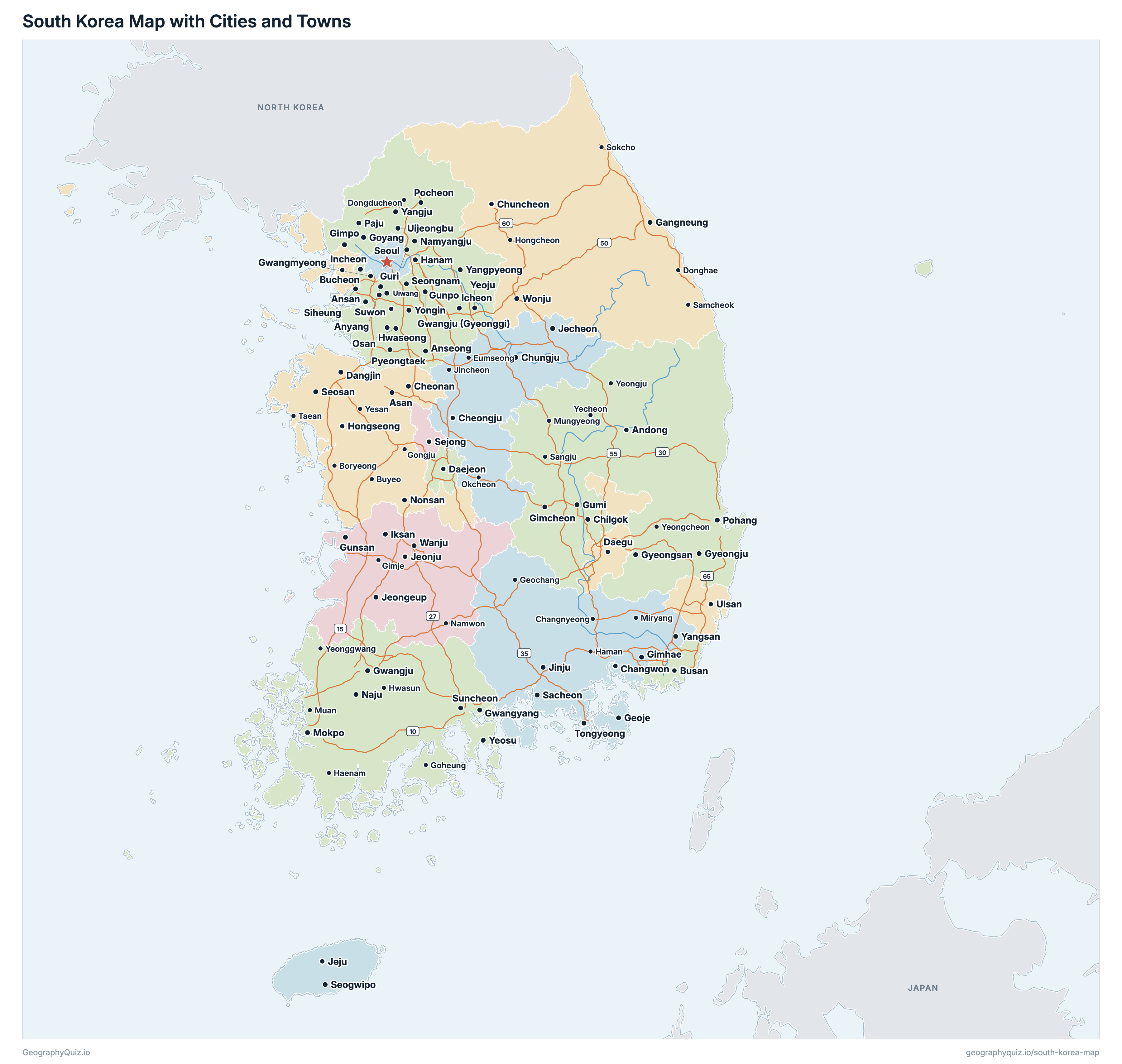
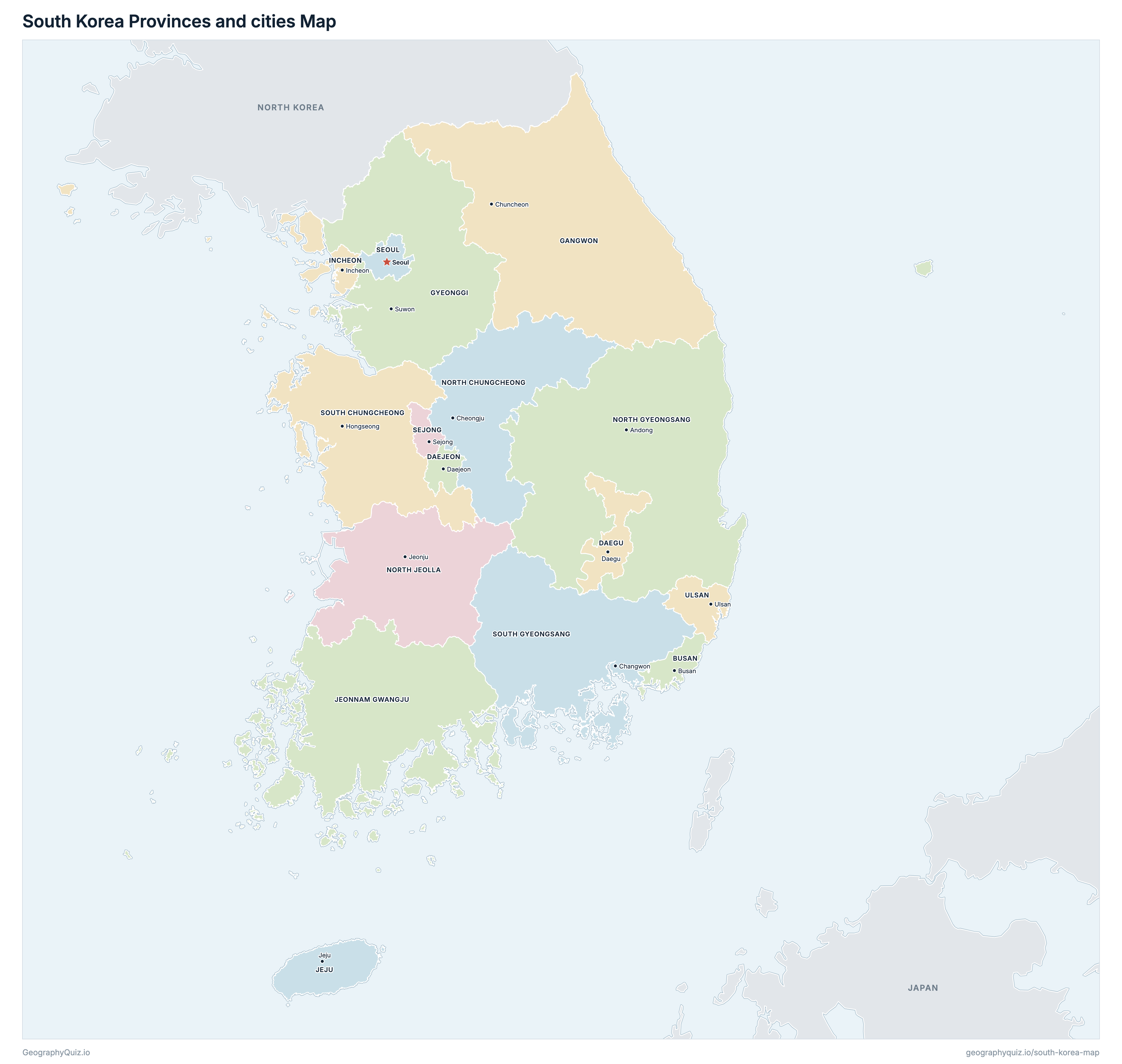
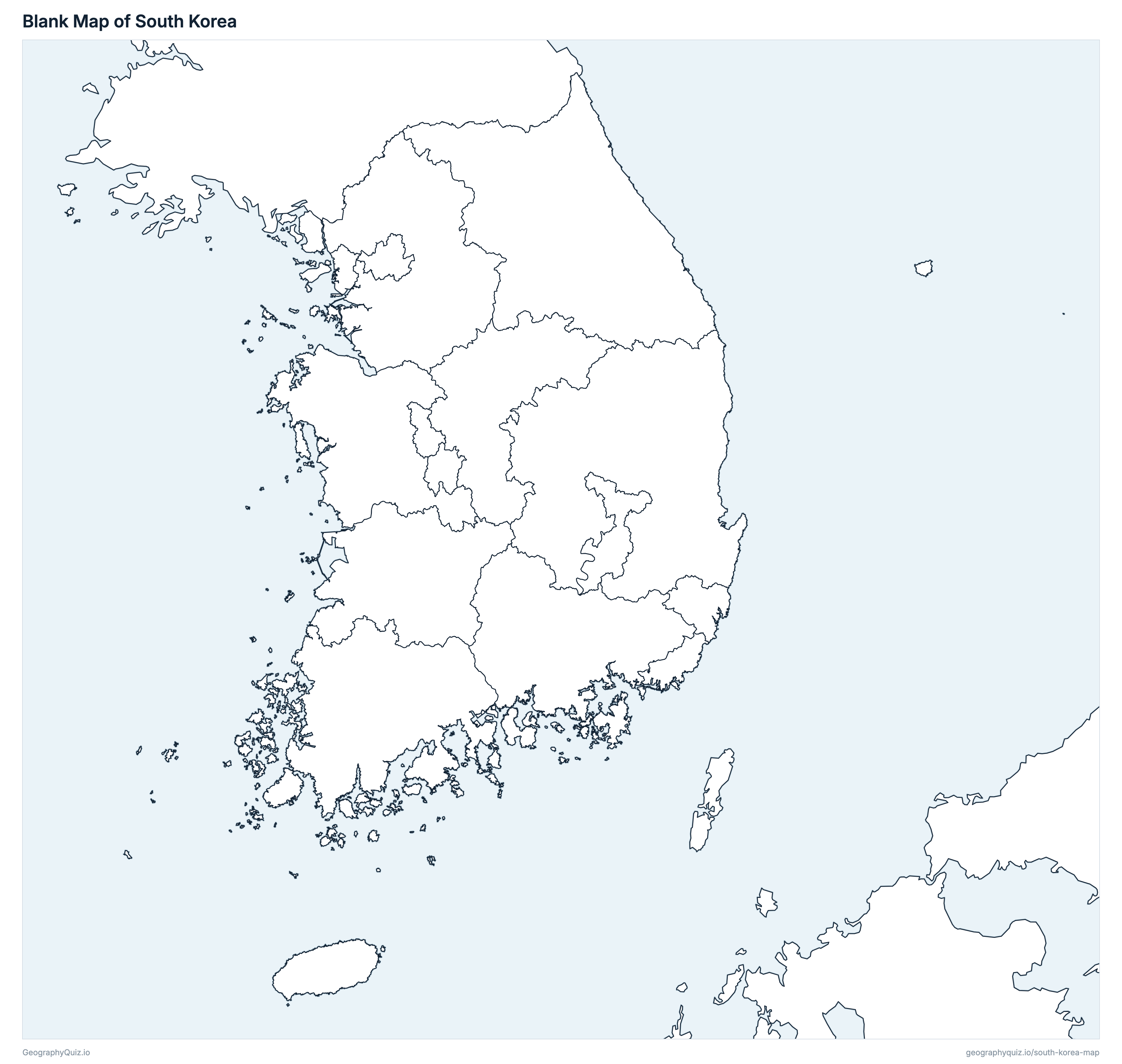
Free to print for class and home: South Korea with its cities and towns, a map of its provinces and cities, and a blank outline map. PDFs fit one A4 or US Letter page.
South Korea map with cities
South Korea provinces and cities map
About South Korea
South Korea has 16 provinces and cities and about 51,082,431 people (2026) on 100,871 km² (38,946 sq mi). Seoul is both the capital and the largest city, with 9,279,861 people. It borders North Korea.
Gyeonggi is the most populous province (13,777,186 people) and Sejong the least (390,585); North Gyeongsang is the largest by area (18,426 km²) and Sejong the smallest (465 km²).
Largest cities in South Korea
The 25 most populous cities and towns. All 104 are on the map above: switch on Towns and zoom in to see them.
| # | City | Province | Population |
|---|---|---|---|
| 1 | Seoul | Seoul | 9,279,861 |
| 2 | Busan | Busan | 3,228,188 |
| 3 | Incheon | Incheon | 3,068,328 |
| 4 | Daegu | Daegu | 2,345,828 |
| 5 | Daejeon | Daejeon | 1,443,122 |
| 6 | Gwangju | Jeonnam Gwangju | 1,383,318 |
| 7 | Suwon | Gyeonggi | 1,186,308 |
| 8 | Yongin | Gyeonggi | 1,090,103 |
| 9 | Ulsan | Ulsan | 1,086,077 |
| 10 | Goyang | Gyeonggi | 1,056,532 |
| 11 | Hwaseong | Gyeonggi | 1,001,559 |
| 12 | Changwon | South Gyeongsang | 984,721 |
| 13 | Seongnam | Gyeonggi | 899,160 |
| 14 | Cheongju | North Chungcheong | 860,937 |
| 15 | Bucheon | Gyeonggi | 753,731 |
| 16 | Namyangju | Gyeonggi | 727,066 |
| 17 | Cheonan | South Chungcheong | 666,700 |
| 18 | Pyeongtaek | Gyeonggi | 624,536 |
| 19 | Jeonju | North Jeolla | 618,328 |
| 20 | Ansan | Gyeonggi | 608,343 |
| 21 | Anyang | Gyeonggi | 562,140 |
| 22 | Paju | Gyeonggi | 536,640 |
| 23 | Gimhae | South Gyeongsang | 533,161 |
| 24 | Siheung | Gyeonggi | 515,633 |
| 25 | Pohang | North Gyeongsang | 486,788 |
Populations are the resident registration population of the Ministry of the Interior and Safety on 30 September 2026 (Korean citizens on the register; foreign residents are not counted). Cities and counties are whole si and gun, and the special and metropolitan cities are each one city, counties and all. On 1 July 2026 Gwangju Metropolitan City and South Jeolla Province were merged into Jeonnam Gwangju Integrated Special City, which has three offices (Gwangju, Muan and Suncheon) and no single seat; Gwangju is shown as its five districts together.
Provinces and cities of South Korea
All 16 provinces and cities. Select one to show it on the map.
| Busan | 3,228,188 | 785 | |
| Daegu | 2,345,828 | 1,493 | |
| Daejeon | 1,443,122 | 540 | |
| Chuncheon | 1,506,701 | 16,821 | |
| Suwon | 13,777,186 | 10,347 | |
| Incheon | 3,068,328 | 1,110 | |
| Jeju | 662,373 | 1,866 | |
| Gwangju, Muan and Suncheon | 3,154,398 | 12,951 | |
| Cheongju | 1,601,942 | 7,414 | |
| Andong | 2,491,506 | 18,426 | |
| Jeonju | 1,716,229 | 8,149 | |
| Sejong | 390,585 | 465 | |
| Seoul | 9,279,861 | 606 | |
| Hongseong | 2,139,558 | 8,271 | |
| Changwon | 3,190,549 | 10,564 | |
| Ulsan | 1,086,077 | 1,063 |
Quizzes and worksheets
Sources
- Provinces and cities, coasts and city centres: Statistics Korea (National Data Office), SGIS administrative-district statistics and boundaries, the boundaries of 30 June 2025, from the Public Data Portal (data.go.kr); areas are measured on them.
- Populations: Ministry of the Interior and Safety, resident registration population statistics (jumin.mois.go.kr), 30 September 2026.
- City and county names in English: Statistics Korea, Korean Administrative District Classification (1 October 2026).
- Expressways: Korea Expressway Corporation, road alignment (9 June 2026), from the Public Data Portal.