Interactive map
Portugal Map
Every district, city and town in Portugal on one zoomable map, with its main highways, rivers and lakes. Switch on towns and districts above the map and zoom in for every name; tap a district to see its population, area and largest towns.
Loading the map…
Printable maps of Portugal
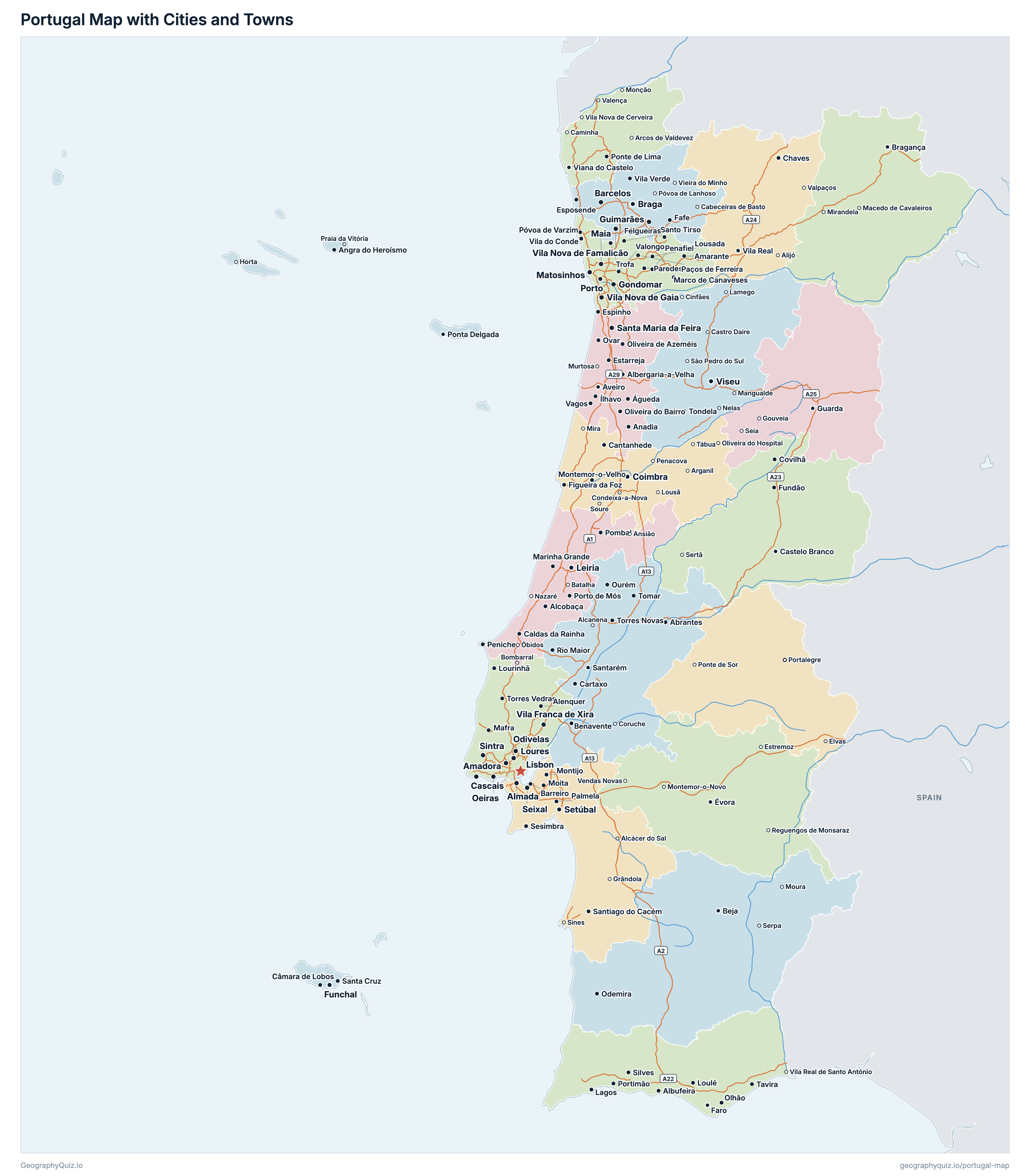
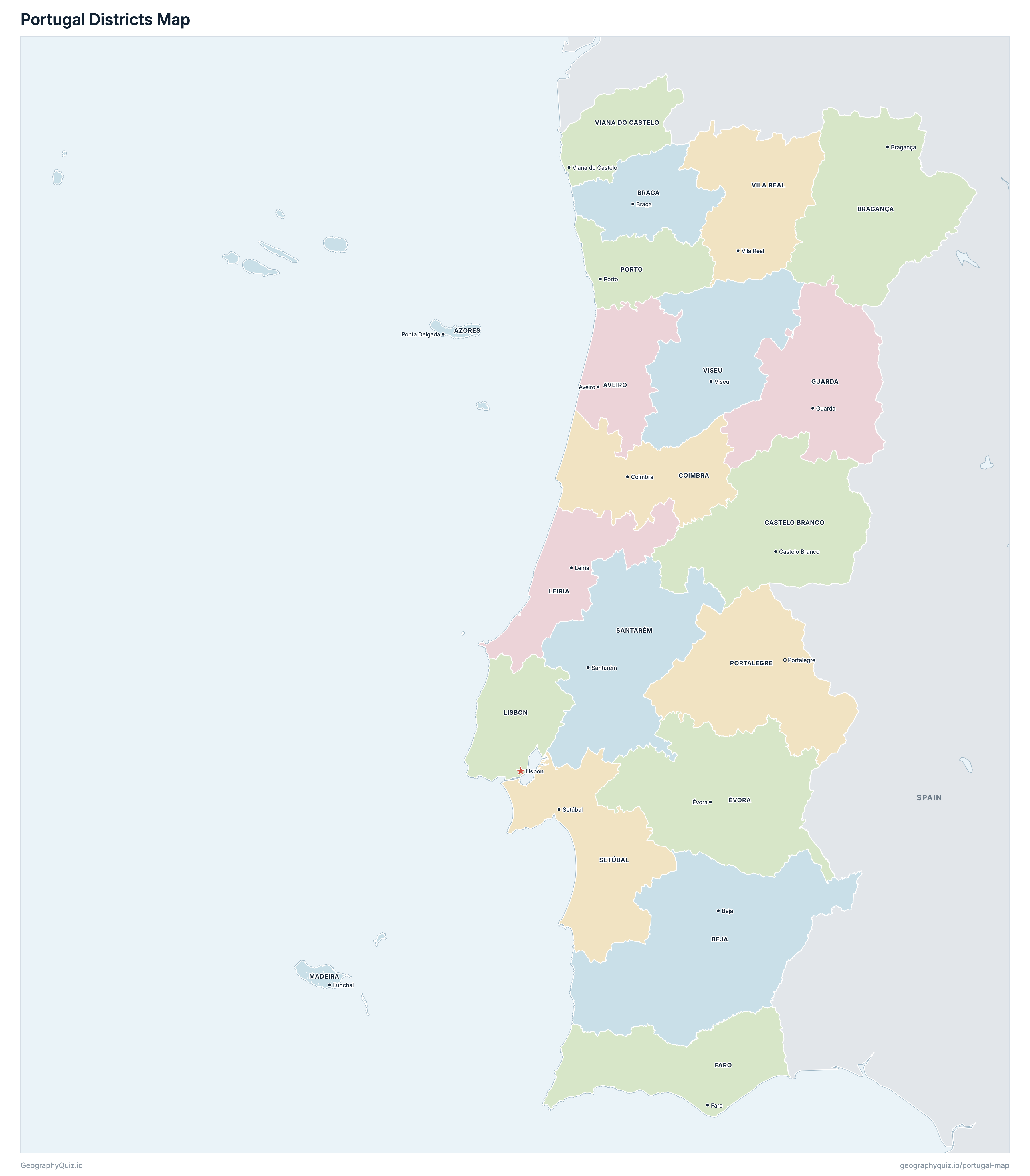
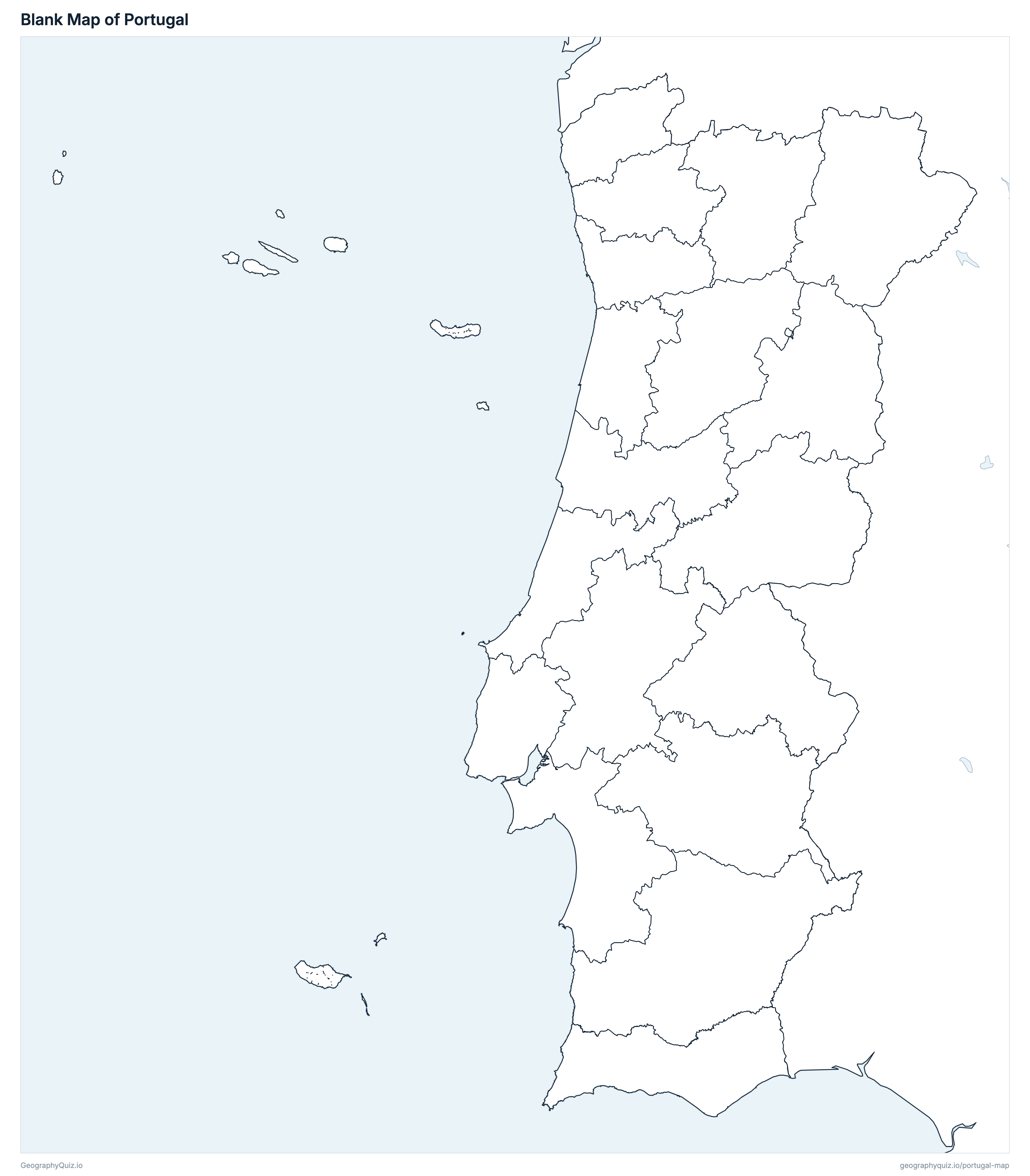
Free to print for class and home: Portugal with its cities and towns, a map of its districts, and a blank outline map. PDFs fit one A4 or US Letter page.
Portugal map with cities
Portugal districts map
About Portugal
Portugal has 20 districts and about 11,424,031 people (2025) on 92,225 km² (35,608 sq mi). Lisbon is both the capital and the largest city, with 658,236 people. It borders Spain.
Lisbon is the most populous district (2,655,832 people) and Portalegre the least (108,485); Beja is the largest by area (10,263 km²) and Madeira the smallest (801 km²).
Largest cities in Portugal
The 25 most populous cities and towns. All 188 are on the map above: switch on Towns and zoom in to see them.
| # | City | District | Population |
|---|---|---|---|
| 1 | Lisbon | Lisbon | 658,236 |
| 2 | Sintra | Lisbon | 449,956 |
| 3 | Vila Nova de Gaia | Porto | 323,202 |
| 4 | Porto | Porto | 273,476 |
| 5 | Cascais | Lisbon | 242,619 |
| 6 | Loures | Lisbon | 236,988 |
| 7 | Braga | Braga | 212,635 |
| 8 | Amadora | Lisbon | 205,517 |
| 9 | Almada | Setúbal | 202,896 |
| 10 | Seixal | Setúbal | 198,254 |
| 11 | Oeiras | Lisbon | 188,056 |
| 12 | Odivelas | Lisbon | 185,736 |
| 13 | Matosinhos | Porto | 181,930 |
| 14 | Gondomar | Porto | 170,597 |
| 15 | Guimarães | Braga | 165,554 |
| 16 | Coimbra | Coimbra | 156,359 |
| 17 | Vila Franca de Xira | Lisbon | 152,007 |
| 18 | Leiria | Leiria | 145,861 |
| 19 | Vila Nova de Famalicão | Braga | 143,801 |
| 20 | Santa Maria da Feira | Aveiro | 142,676 |
| 21 | Maia | Porto | 142,129 |
| 22 | Setúbal | Setúbal | 141,266 |
| 23 | Barcelos | Braga | 122,487 |
| 24 | Funchal | Madeira | 113,443 |
| 25 | Viseu | Viseu | 109,166 |
Populations are Statistics Portugal's (INE) resident population estimates for 31 December 2025 (provisional), counted in the municipalities, so a city's figure is its whole municipality. The 18 districts are the mainland's; the autonomous regions of the Azores and Madeira are drawn as insets, at a reduced scale, off the west coast: they really lie some 1,400 km west (the Azores) and 1,000 km south-west (Madeira) of Lisbon.
Districts of Portugal
All 20 districts. Select one to show it on the map.
| Aveiro | 748,716 | 2,801 | |
| Ponta Delgada | 245,328 | 2,322 | |
| Beja | 169,810 | 10,263 | |
| Braga | 901,282 | 2,706 | |
| Bragança | 123,642 | 6,599 | |
| Castelo Branco | 189,090 | 6,627 | |
| Coimbra | 438,242 | 3,974 | |
| Évora | 161,642 | 7,393 | |
| Faro | 578,032 | 4,997 | |
| Guarda | 138,823 | 5,535 | |
| Leiria | 514,503 | 3,506 | |
| Lisbon | 2,655,832 | 2,816 | |
| Funchal | 266,130 | 801 | |
| Portalegre | 108,485 | 6,084 | |
| Porto | 1,906,626 | 2,332 | |
| Santarém | 469,361 | 6,718 | |
| Setúbal | 1,012,127 | 5,214 | |
| Viana do Castelo | 244,343 | 2,219 | |
| Vila Real | 187,197 | 4,307 | |
| Viseu | 364,820 | 5,010 |
Quizzes and worksheets
Sources
- Districts, autonomous regions and municipalities: Direção-Geral do Território (DGT), Carta Administrativa Oficial de Portugal, CAOP 2025 (with their areas).
- Populations: Statistics Portugal (INE), Annual estimates of resident population, 31 December 2025 (provisional), by municipality (indicator 0012918), summed by district and autonomous region.
- Town locations: DGT, Toponímia de Portugal Continental 1:200 000; in the Azores and Madeira, the municipality's namesake parish in CAOP 2025.
- Motorways: Infraestruturas de Portugal, Rede Rodoviária Nacional (April 2026), dados.gov.pt.