Interactive map
Peru Map
Every department, city and town in Peru on one zoomable map, with its main highways, rivers and lakes. Switch on towns and departments above the map and zoom in for every name; tap a department to see its population, area and largest towns.
Loading the map…
Printable maps of Peru
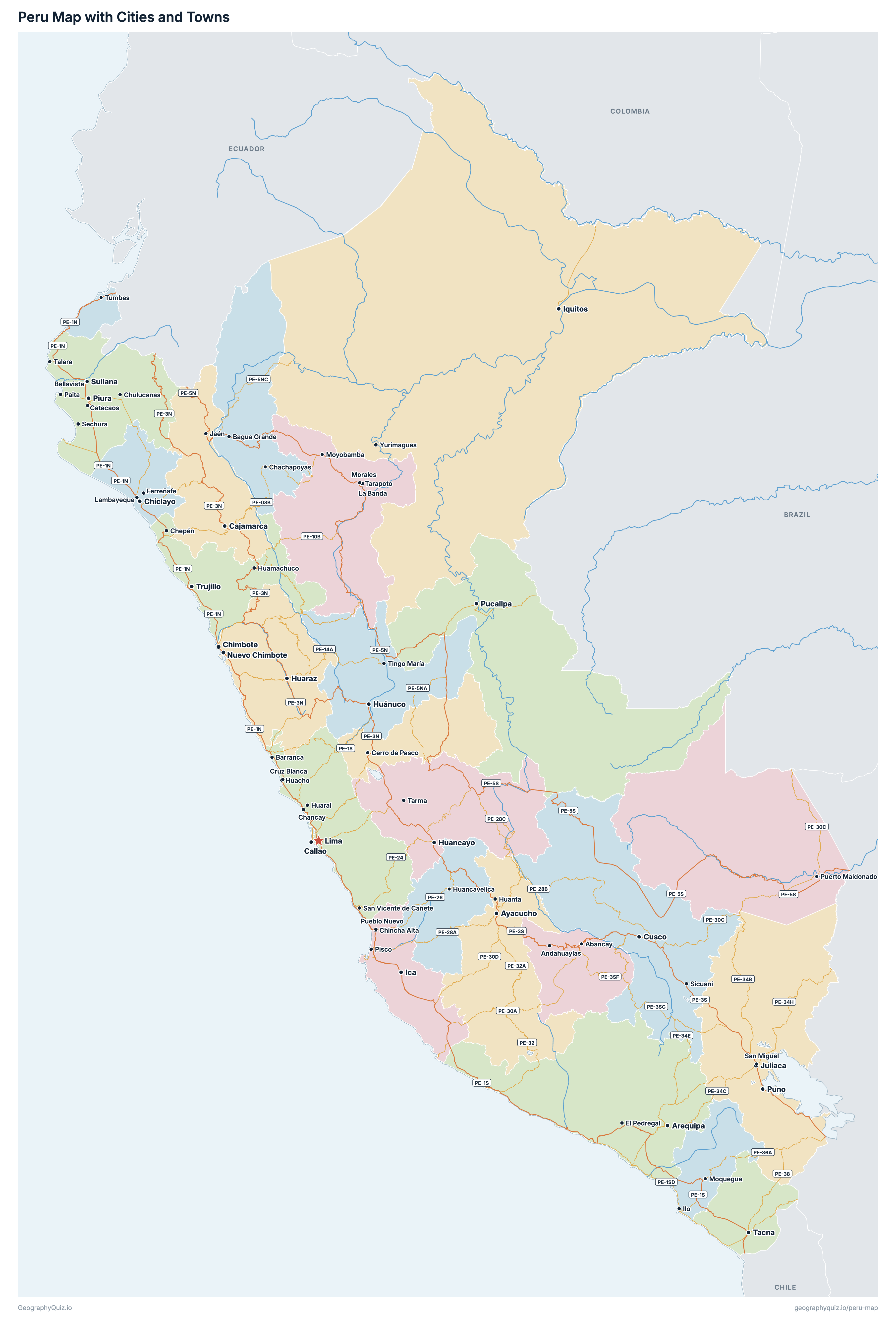
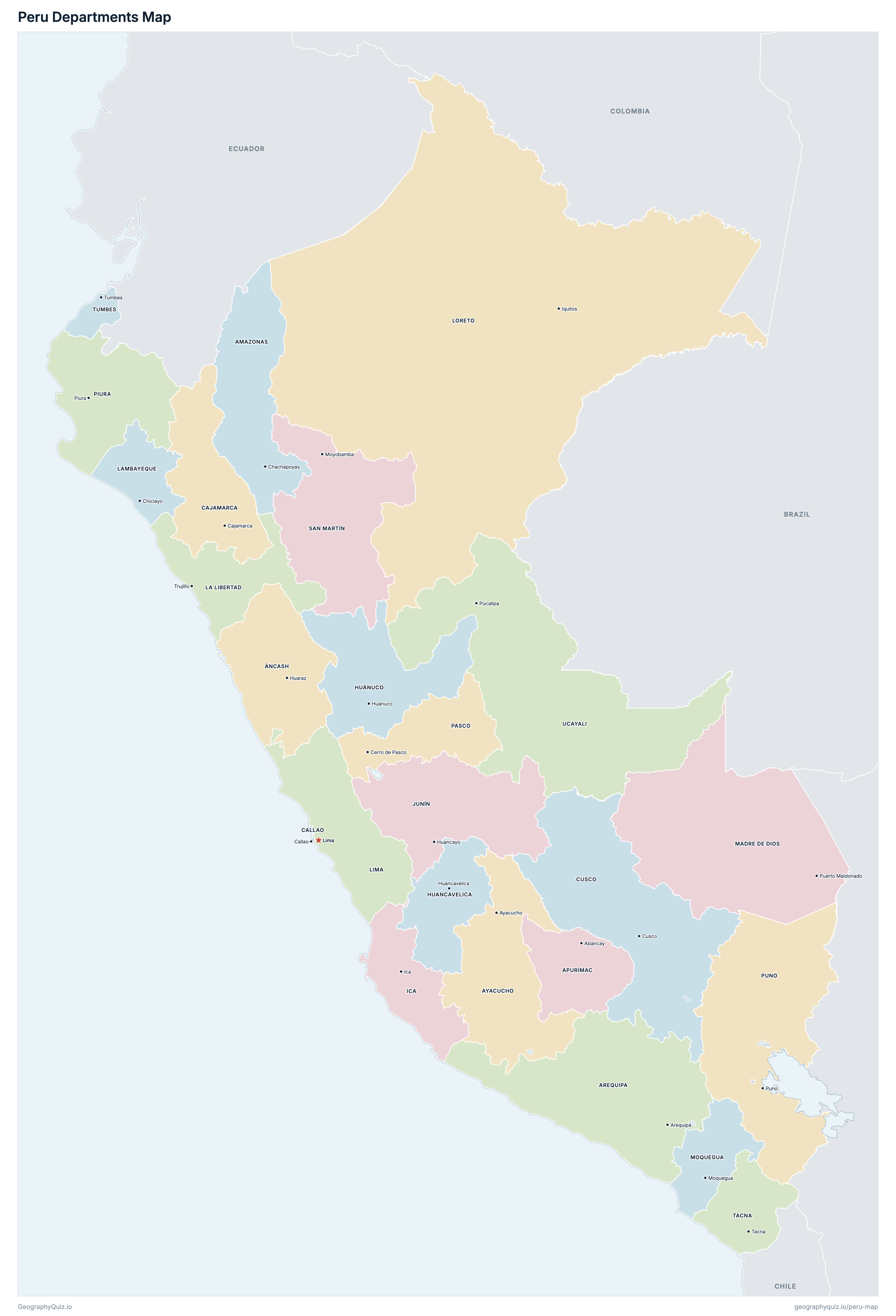
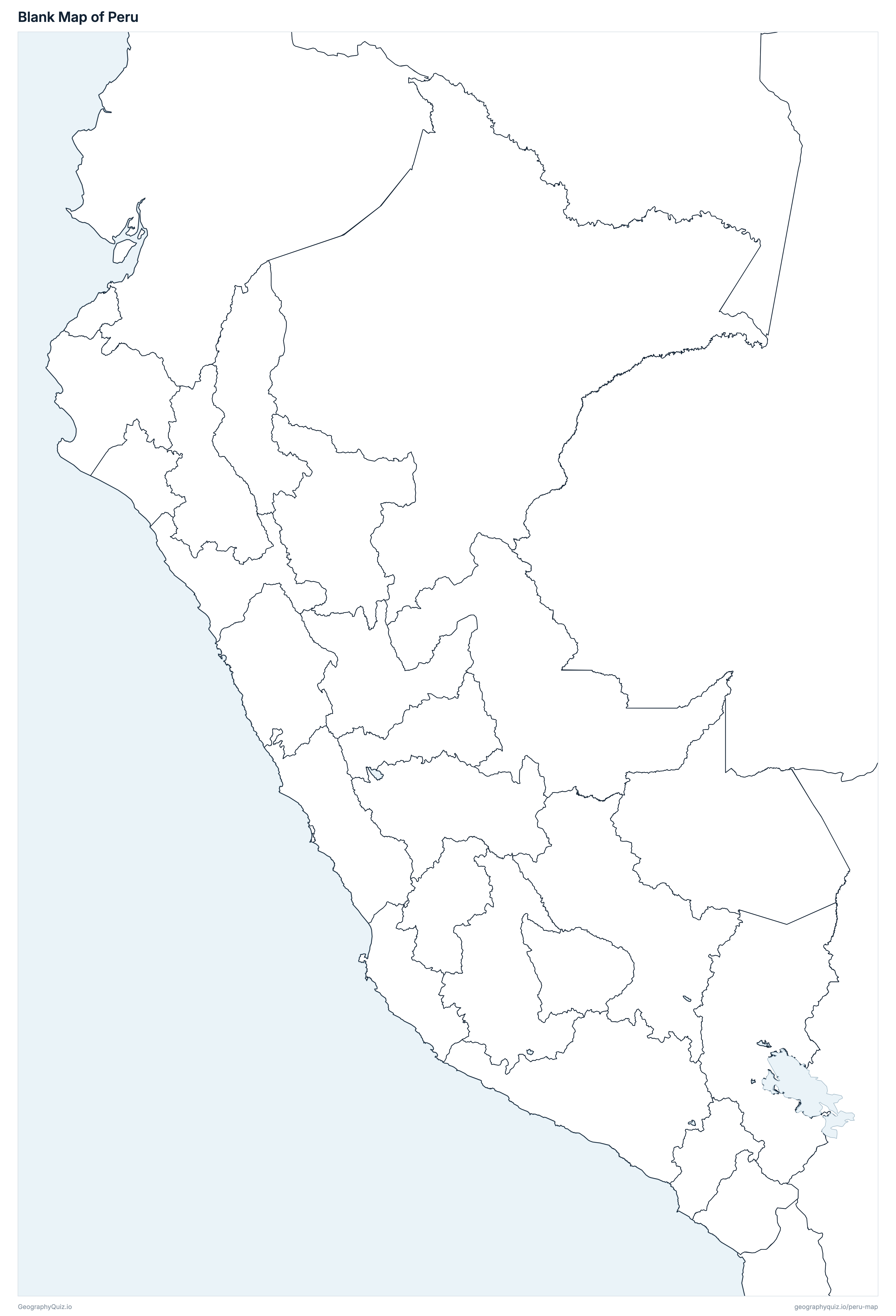
Free to print for class and home: Peru with its cities and towns, a map of its departments, and a blank outline map. PDFs fit one A4 or US Letter page.
Peru map with cities
Peru departments map
About Peru
Peru has 25 departments and about 29,381,884 people (2017) on 1,285,216 km² (496,224 sq mi). Lima is both the capital and the largest city, with 9,562,280 people. It borders Ecuador, Colombia, Brazil, Bolivia and Chile.
Lima is the most populous department (9,485,405 people) and Madre de Dios the least (141,070); Loreto is the largest by area (368,852 km²) and Callao the smallest (147 km²).
Largest cities in Peru
The 25 most populous cities and towns. All 62 are on the map above: switch on Towns and zoom in to see them.
| # | City | Department | Population |
|---|---|---|---|
| 1 | Lima | Lima | 9,562,280 |
| 2 | Arequipa | Arequipa | 1,008,290 |
| 3 | Trujillo | La Libertad | 919,899 |
| 4 | Chiclayo | Lambayeque | 552,508 |
| 5 | Piura | Piura | 473,025 |
| 6 | Huancayo | Junín | 456,250 |
| 7 | Callao | Callao | 451,260 |
| 8 | Cusco | Cusco | 428,450 |
| 9 | Iquitos | Loreto | 377,609 |
| 10 | Pucallpa | Ucayali | 326,040 |
| 11 | Tacna | Tacna | 286,240 |
| 12 | Ica | Ica | 282,407 |
| 13 | Juliaca | Puno | 217,743 |
| 14 | Ayacucho | Ayacucho | 216,444 |
| 15 | Cajamarca | Cajamarca | 201,329 |
| 16 | Huánuco | Huánuco | 196,627 |
| 17 | Chimbote | Áncash | 179,909 |
| 18 | Nuevo Chimbote | Áncash | 158,385 |
| 19 | Sullana | Piura | 136,446 |
| 20 | Puno | Puno | 128,637 |
| 21 | Huaraz | Áncash | 118,836 |
| 22 | Tumbes | Tumbes | 96,946 |
| 23 | Talara | Piura | 91,444 |
| 24 | Puerto Maldonado | Madre de Dios | 85,024 |
| 25 | Paita | Piura | 81,163 |
Populations are those counted in the 2017 census (Censos Nacionales 2017, INEI); INEI's estimate including the people the census missed is 31,237,385. Departmental capitals are shown with INEI's city figure, the city across its districts, so Lima is Lima Metropolitana, including Callao (Callao is also shown on its own); other towns are INEI's population centres (centros poblados), so a town spread over two districts, such as Juliaca and San Miguel or Chimbote and Nuevo Chimbote, is shown as two.
Departments of Peru
All 25 departments. Select one to show it on the map.
| Chachapoyas | 379,384 | 39,249 | |
| Huaraz | 1,083,519 | 35,915 | |
| Abancay | 405,759 | 20,896 | |
| Arequipa | 1,382,730 | 63,345 | |
| Ayacucho | 616,176 | 43,815 | |
| Cajamarca | 1,341,012 | 33,318 | |
| Callao | 994,494 | 147 | |
| Cusco | 1,205,527 | 71,986 | |
| Huancavelica | 347,639 | 22,131 | |
| Huánuco | 721,047 | 37,021 | |
| Ica | 850,765 | 21,328 | |
| Huancayo | 1,246,038 | 44,327 | |
| Trujillo | 1,778,080 | 25,500 | |
| Chiclayo | 1,197,260 | 14,231 | |
| Lima | 9,485,405 | 34,802 | |
| Iquitos | 883,510 | 368,852 | |
| Puerto Maldonado | 141,070 | 85,301 | |
| Moquegua | 174,863 | 15,734 | |
| Cerro de Pasco | 254,065 | 25,028 | |
| Piura | 1,856,809 | 35,892 | |
| Puno | 1,172,697 | 71,999 | |
| Moyobamba | 813,381 | 51,253 | |
| Tacna | 329,332 | 16,076 | |
| Tumbes | 224,863 | 4,669 | |
| Pucallpa | 496,459 | 102,400 |
Quizzes and worksheets
Sources
- Departments and the Constitutional Province of Callao: Instituto Nacional de Estadística e Informática (INEI), census boundaries (Departamento), ide.inei.gob.pe.
- Populations: INEI, Censos Nacionales 2017, population counted by department, province and district (Perú: Crecimiento y distribución de la población total, 2017).
- Areas: INEI, Compendio Estadístico Perú 2014, territorial area by department.
- Capital cities: INEI, Perú: Perfil Sociodemográfico, 2017, population counted in the departmental capitals (with Lima Metropolitana).
- Other towns and town locations: INEI, 2017 census population centres (centros poblados), as published by the Presidencia del Consejo de Ministros (SDOT), geosdot.servicios.gob.pe.
- National roads: Ministerio de Transportes y Comunicaciones (MTC), Red Vial Nacional (SINAC, 2019).