Interactive map
Japan Map
Every prefecture, city and town in Japan on one zoomable map, with its main highways, rivers and lakes. Switch on towns and prefectures above the map and zoom in for every name; tap a prefecture to see its population, area and largest towns.
Loading the map…
Printable maps of Japan
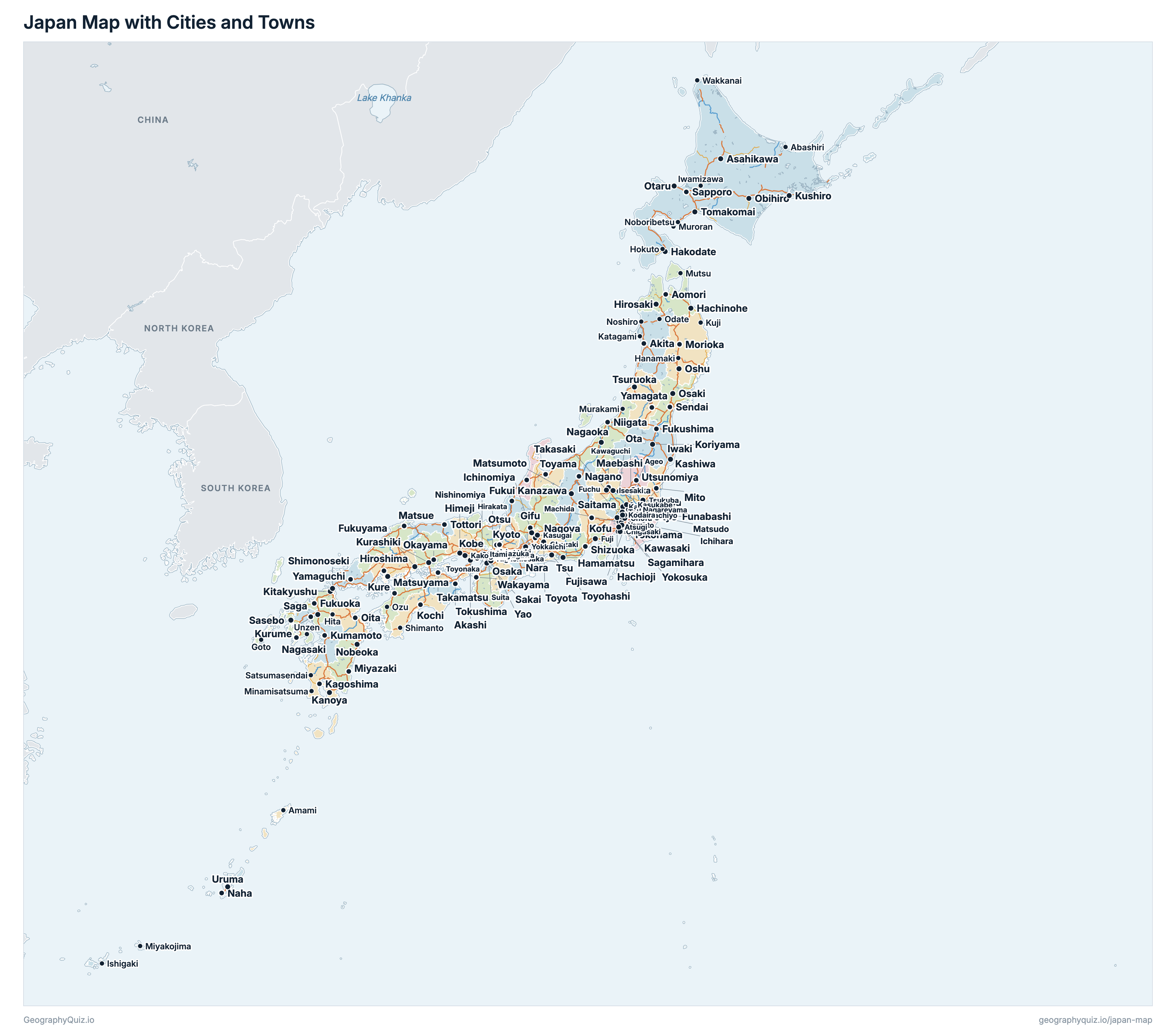
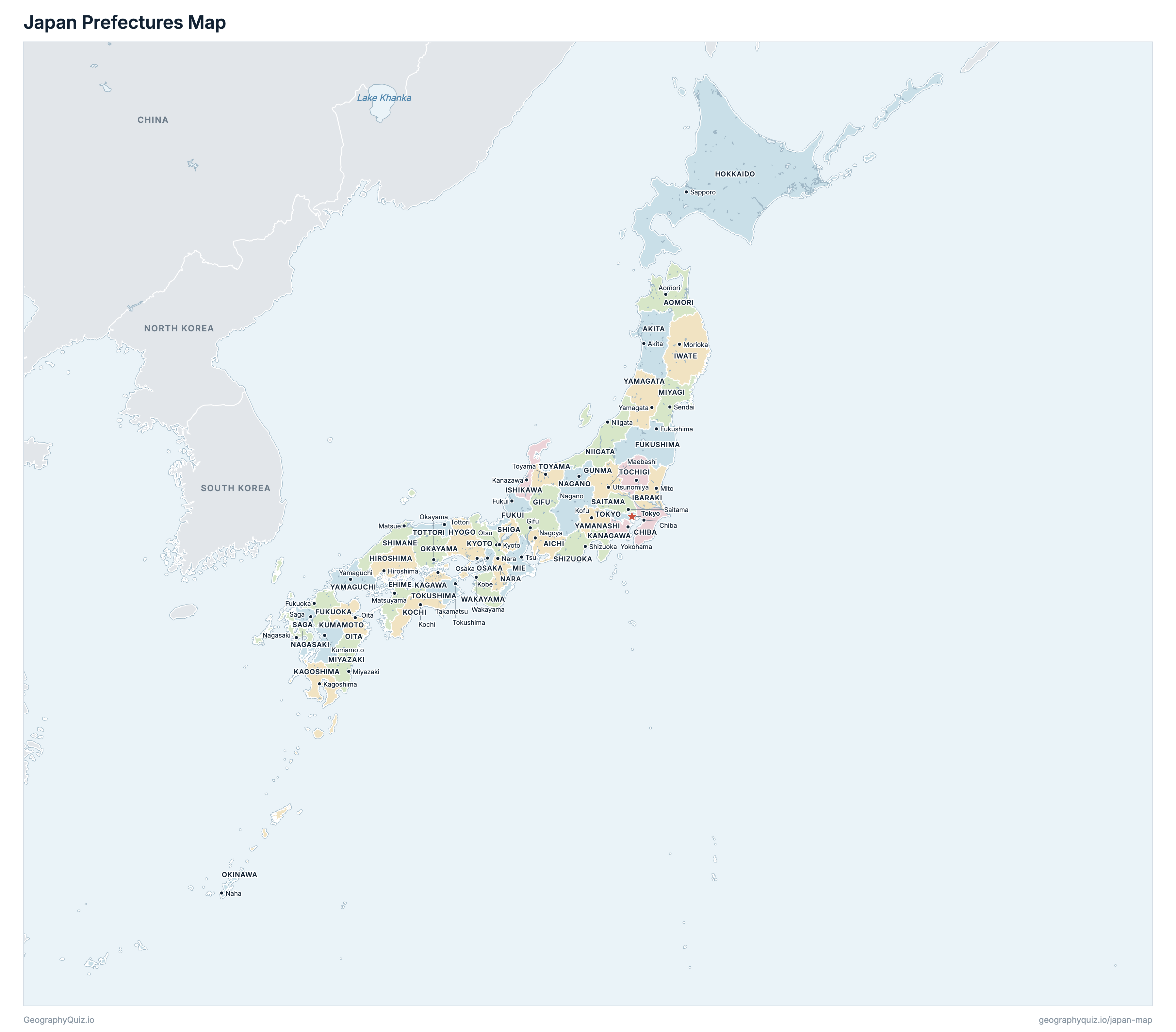
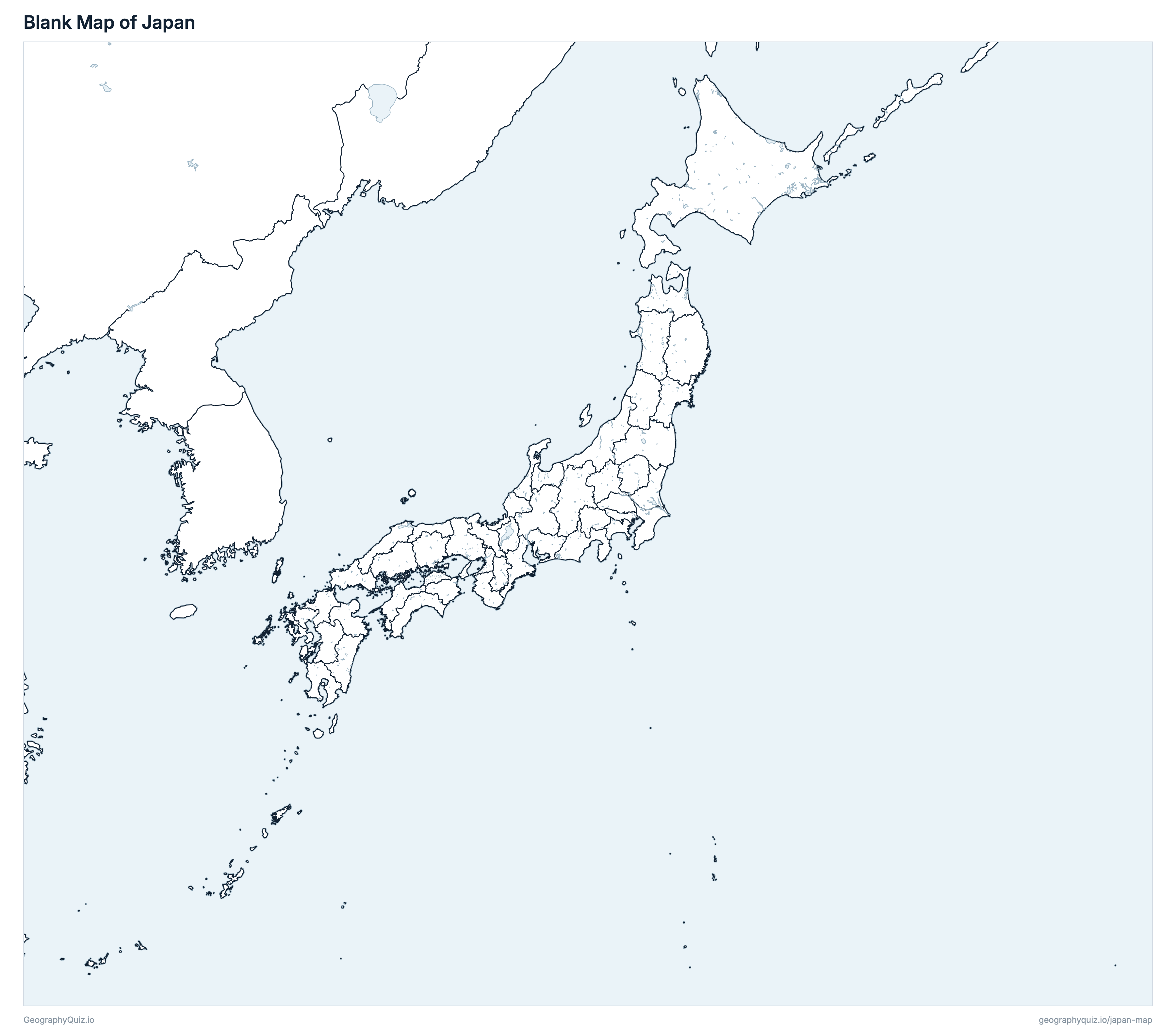
Free to print for class and home: Japan with its cities and towns, a map of its prefectures, and a blank outline map. PDFs fit one A4 or US Letter page.
Japan map with cities
Japan prefectures map
About Japan
Japan has 47 prefectures and about 126,146,099 people (2020) on 377,974 km² (145,937 sq mi). Tokyo is both the capital and the largest city, with 9,733,276 people.
Tokyo is the most populous prefecture (14,047,594 people) and Tottori the least (553,407); Hokkaido is the largest by area (83,422 km²) and Kagawa the smallest (1,876 km²).
Largest cities in Japan
The 25 most populous cities and towns. All 681 are on the map above: switch on Towns and zoom in to see them.
| # | City | Prefecture | Population |
|---|---|---|---|
| 1 | Tokyo | Tokyo | 9,733,276 |
| 2 | Yokohama | Kanagawa | 3,777,491 |
| 3 | Osaka | Osaka | 2,752,412 |
| 4 | Nagoya | Aichi | 2,332,176 |
| 5 | Sapporo | Hokkaido | 1,973,395 |
| 6 | Fukuoka | Fukuoka | 1,612,392 |
| 7 | Kawasaki | Kanagawa | 1,538,262 |
| 8 | Kobe | Hyogo | 1,525,152 |
| 9 | Kyoto | Kyoto | 1,463,723 |
| 10 | Saitama | Saitama | 1,324,025 |
| 11 | Hiroshima | Hiroshima | 1,200,754 |
| 12 | Sendai | Miyagi | 1,096,704 |
| 13 | Chiba | Chiba | 974,951 |
| 14 | Kitakyushu | Fukuoka | 939,029 |
| 15 | Sakai | Osaka | 826,161 |
| 16 | Hamamatsu | Shizuoka | 790,718 |
| 17 | Niigata | Niigata | 789,275 |
| 18 | Kumamoto | Kumamoto | 738,865 |
| 19 | Sagamihara | Kanagawa | 725,493 |
| 20 | Okayama | Okayama | 724,691 |
| 21 | Shizuoka | Shizuoka | 693,389 |
| 22 | Funabashi | Chiba | 642,907 |
| 23 | Kawaguchi | Saitama | 594,274 |
| 24 | Kagoshima | Kagoshima | 593,128 |
| 25 | Hachioji | Tokyo | 579,355 |
Populations are from the 2020 Population Census (1 October 2020), counted in the municipalities of 1 January 2026 (the same ones, but for Hamamatsu's wards). Cities are the municipalities that are shi, of 30,000 people or more; Tokyo is the 23 special wards together, which are not a city but are the capital, and the seat of the Tokyo Metropolitan Government (in Shinjuku).
Prefectures of Japan
All 47 prefectures. Select one to show it on the map.
| Nagoya | 7,542,415 | 5,173 | |
| Akita | 959,502 | 11,638 | |
| Aomori | 1,237,984 | 9,645 | |
| Chiba | 6,284,480 | 5,156 | |
| Matsuyama | 1,334,841 | 5,676 | |
| Fukui | 766,863 | 4,191 | |
| Fukuoka | 5,135,214 | 4,987 | |
| Fukushima | 1,833,152 | 13,783 | |
| Gifu | 1,978,742 | 10,621 | |
| Maebashi | 1,939,110 | 6,362 | |
| Hiroshima | 2,799,702 | 8,478 | |
| Sapporo | 5,224,614 | 83,422 | |
| Kobe | 5,465,002 | 8,401 | |
| Mito | 2,867,009 | 6,098 | |
| Kanazawa | 1,132,526 | 4,191 | |
| Morioka | 1,210,534 | 15,274 | |
| Takamatsu | 950,244 | 1,876 | |
| Kagoshima | 1,588,256 | 9,186 | |
| Yokohama | 9,237,337 | 2,417 | |
| Kochi | 691,527 | 7,102 | |
| Kumamoto | 1,738,301 | 7,409 | |
| Kyoto | 2,578,087 | 4,612 | |
| Tsu | 1,770,254 | 5,774 | |
| Sendai | 2,301,996 | 7,281 | |
| Miyazaki | 1,069,576 | 7,734 | |
| Nagano | 2,048,011 | 13,562 | |
| Nagasaki | 1,312,317 | 4,131 | |
| Nara | 1,324,473 | 3,691 | |
| Niigata | 2,201,272 | 12,584 | |
| Oita | 1,123,852 | 6,340 | |
| Okayama | 1,888,432 | 7,114 | |
| Naha | 1,467,480 | 2,282 | |
| Osaka | 8,837,685 | 1,905 | |
| Saga | 811,442 | 2,441 | |
| Saitama | 7,344,765 | 3,798 | |
| Otsu | 1,413,610 | 4,017 | |
| Matsue | 671,126 | 6,708 | |
| Shizuoka | 3,633,202 | 7,777 | |
| Utsunomiya | 1,933,146 | 6,408 | |
| Tokushima | 719,559 | 4,147 | |
| Tokyo | 14,047,594 | 2,200 | |
| Tottori | 553,407 | 3,507 | |
| Toyama | 1,034,814 | 4,248 | |
| Wakayama | 922,584 | 4,725 | |
| Yamagata | 1,068,027 | 9,323 | |
| Yamaguchi | 1,342,059 | 6,113 | |
| Kofu | 809,974 | 4,465 |
Quizzes and worksheets
Sources
- Prefectures: Ministry of Land, Infrastructure, Transport and Tourism (MLIT), National Land Numerical Information, Administrative Areas (N03), 1 January 2026; Hokkaido is drawn, as Japan's official data draws it, with the Northern Territories (administered by Russia).
- Prefecture areas: Geospatial Information Authority of Japan, Statistical Reports on the Land Area by Prefectures and Municipalities in Japan, 1 July 2026.
- Populations and city names: Statistics Bureau of Japan, 2020 Population Census, Basic Complete Tabulation on Population and Households, table 1-1 (e-Stat).
- City locations: MLIT, National Land Numerical Information, Municipal Office Locations (P34, 2014).
- Expressways: MLIT, National Land Numerical Information, Expressway Time-Series Data (N06, 2025): national expressways and the Honshu–Shikoku bridges, and other national-highway expressways.
- Rivers and lakes: Geospatial Information Authority of Japan, Global Map Japan version 2.2 (1:1,000,000).