Interactive map
Iceland Map
Every region, city and town in Iceland on one zoomable map, with its main highways, rivers and lakes. Switch on towns and regions above the map and zoom in for every name; tap a region to see its population, area and largest towns.
Loading the map…
Printable maps of Iceland
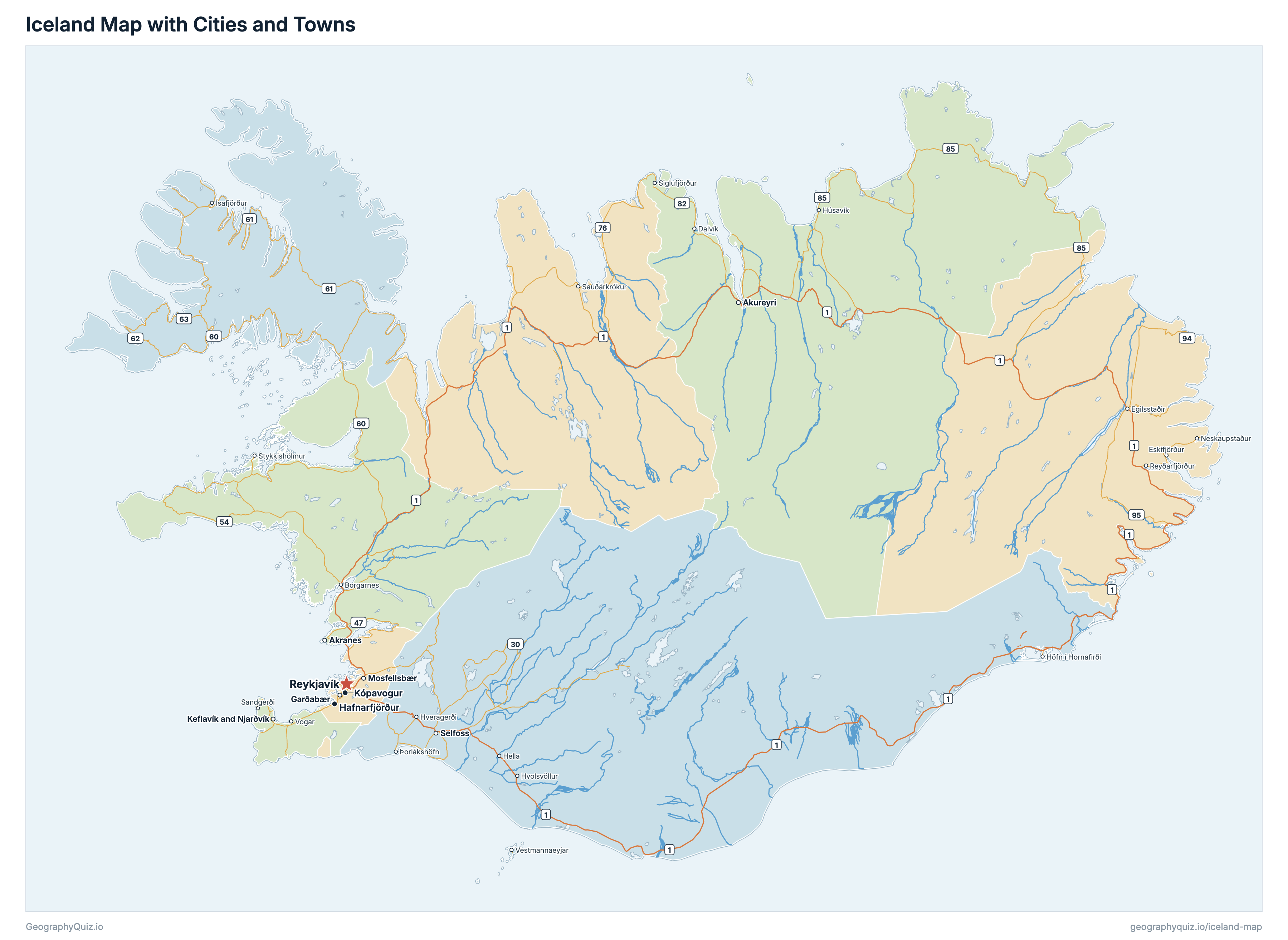
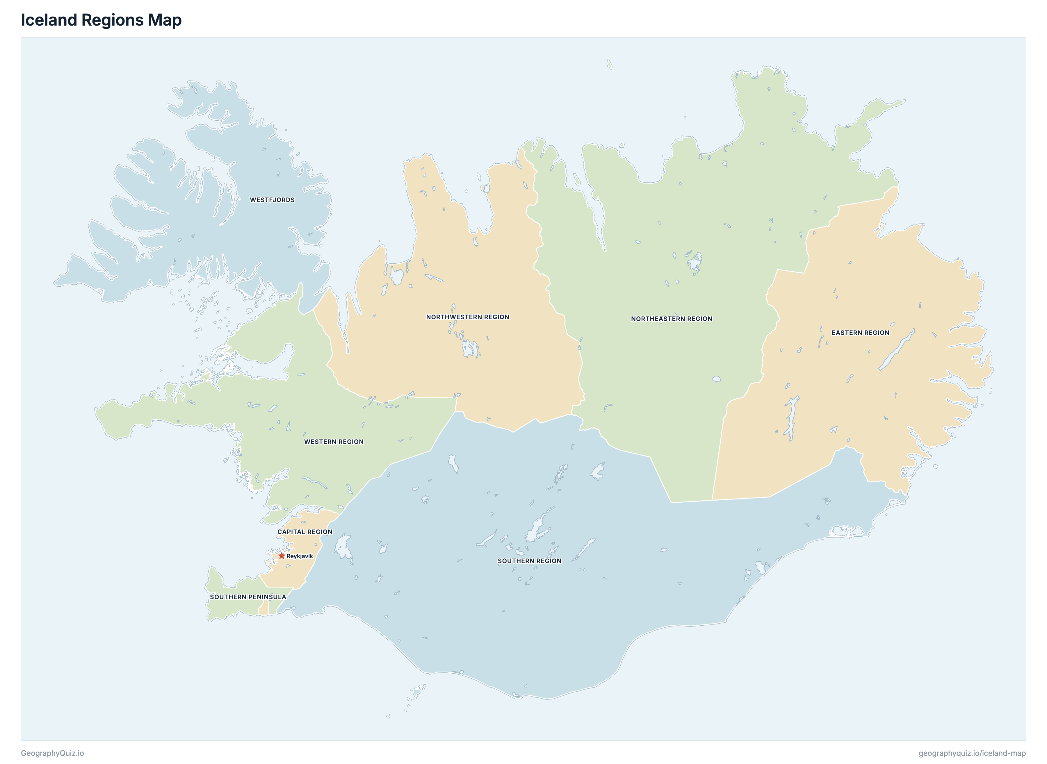
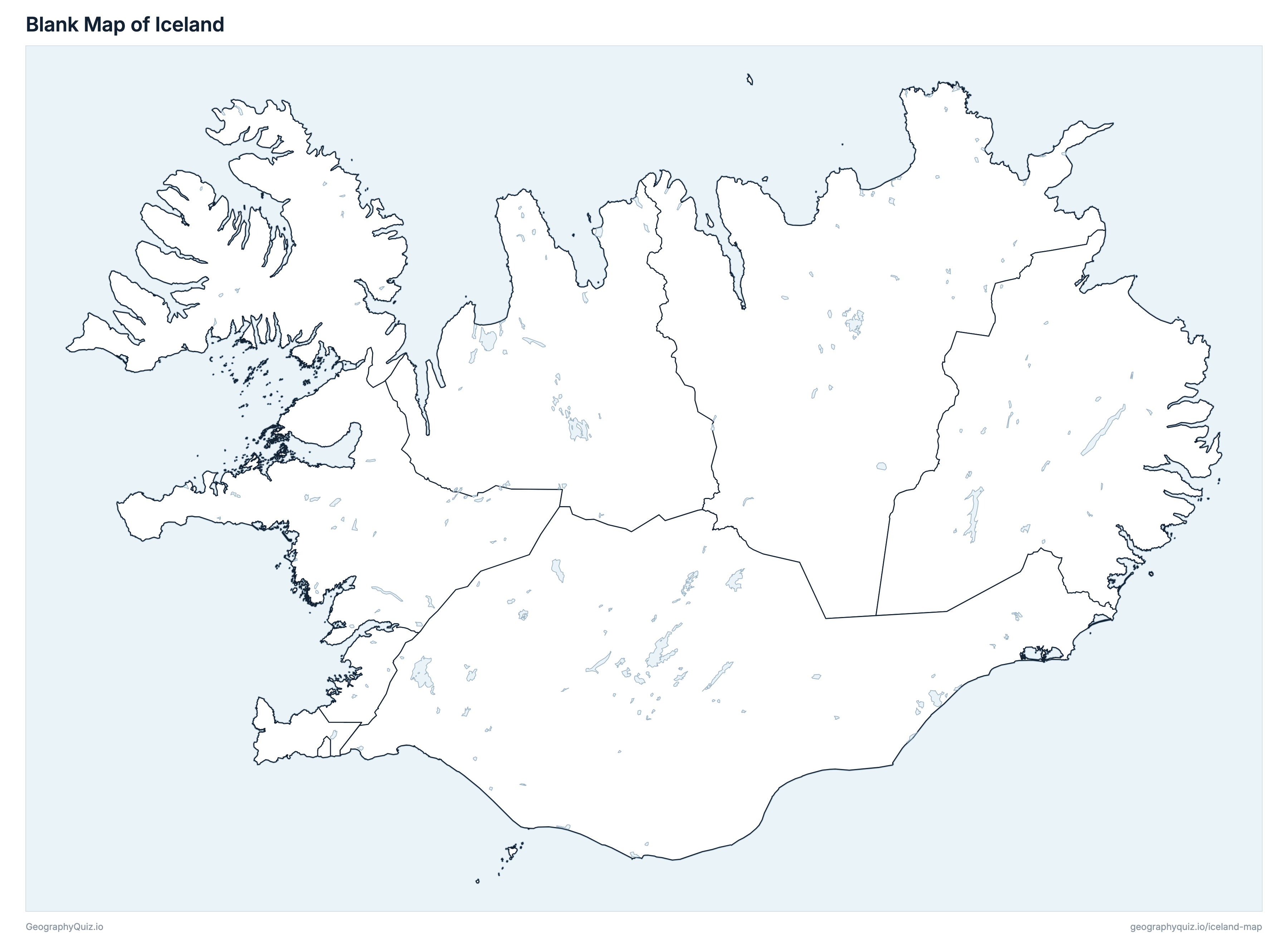
Free to print for class and home: Iceland with its cities and towns, a map of its regions, and a blank outline map. PDFs fit one A4 or US Letter page.
Iceland map with cities
Iceland regions map
About Iceland
Iceland has 8 regions and about 394,324 people (2026) on 102,659 km² (39,637 sq mi). Reykjavík is both the capital and the largest city, with 138,753 people.
Capital Region is the most populous region (251,912 people) and Westfjords the least (7,341); Southern Region is the largest by area (30,980 km²) and Southern Peninsula the smallest (815 km²).
Largest cities in Iceland
The 25 most populous cities and towns. All 73 are on the map above: switch on Towns and zoom in to see them.
| # | City | Region | Population |
|---|---|---|---|
| 1 | Reykjavík | Capital Region | 138,753 |
| 2 | Kópavogur | Capital Region | 40,228 |
| 3 | Hafnarfjörður | Capital Region | 32,398 |
| 4 | Keflavík and Njarðvík | Southern Peninsula | 22,572 |
| 5 | Akureyri | Northeastern Region | 20,067 |
| 6 | Garðabær | Capital Region | 17,755 |
| 7 | Mosfellsbær | Capital Region | 13,417 |
| 8 | Selfoss | Southern Region | 11,000 |
| 9 | Akranes | Western Region | 8,429 |
| 10 | Seltjarnarnes | Capital Region | 4,609 |
| 11 | Vestmannaeyjar | Southern Region | 4,518 |
| 12 | Hveragerði | Southern Region | 3,342 |
| 13 | Álftanes | Capital Region | 2,916 |
| 14 | Ísafjörður | Westfjords | 2,807 |
| 15 | Egilsstaðir | Eastern Region | 2,719 |
| 16 | Sauðárkrókur | Northwestern Region | 2,672 |
| 17 | Húsavík | Northeastern Region | 2,403 |
| 18 | Þorlákshöfn | Southern Region | 2,316 |
| 19 | Borgarnes | Western Region | 2,250 |
| 20 | Sandgerði | Southern Peninsula | 2,188 |
| 21 | Garður | Southern Peninsula | 2,006 |
| 22 | Vogar | Southern Peninsula | 1,818 |
| 23 | Höfn í Hornafirði | Southern Region | 1,813 |
| 24 | Neskaupstaður | Eastern Region | 1,478 |
| 25 | Reyðarfjörður | Eastern Region | 1,470 |
Populations are Statistics Iceland's figures for 1 January 2026. Towns are its urban nuclei (byggðakjarnar): the built-up places, with the Capital Region's towns (Reykjavík, Kópavogur, Hafnarfjörður and the others) counted separately, so a town is not the whole municipality around it.
Regions of Iceland
All 8 regions. Select one to show it on the map.
| Region | 251,912 | 1,045 | |
| Region | 11,211 | 15,702 | |
| Region | 32,296 | 22,686 | |
| Region | 7,353 | 13,106 | |
| Region | 29,644 | 815 | |
| Region | 36,570 | 30,980 | |
| Region | 17,997 | 9,500 | |
| Region | 7,341 | 8,825 |
Quizzes and worksheets
Sources
- Regions: Natural Science Institute of Iceland (formerly the National Land Survey of Iceland), IS 50V municipal boundaries (September 2026), joined into Statistics Iceland's eight regions; region areas from the land survey's region layer (gis.lmi.is).
- Region populations: Statistics Iceland (Hagstofa Íslands), population by region on 1 January 2026, table MAN03250, checked against table MAN02005 (population by municipality).
- Towns: Statistics Iceland, population by urban nuclei on 1 January 2026, table MAN030101; placed with IS 50V place names (built-up areas) and Statistics Iceland's urban-locality areas.
- Roads: the Ring Road (Route 1) and the other primary roads (stofnvegir), with the Icelandic Road and Coastal Administration's (Vegagerðin) numbers and classes, from IS 50V roads.
- Rivers and lakes: National Land Survey of Iceland, EuroRegionalMap 2023 (1:250,000).