Interactive map
Egypt Map
Every governorate, city and town in Egypt on one zoomable map, with its main highways, rivers and lakes. Switch on towns and governorates above the map and zoom in for every name; tap a governorate to see its population, area and largest towns.
Loading the map…
Printable maps of Egypt
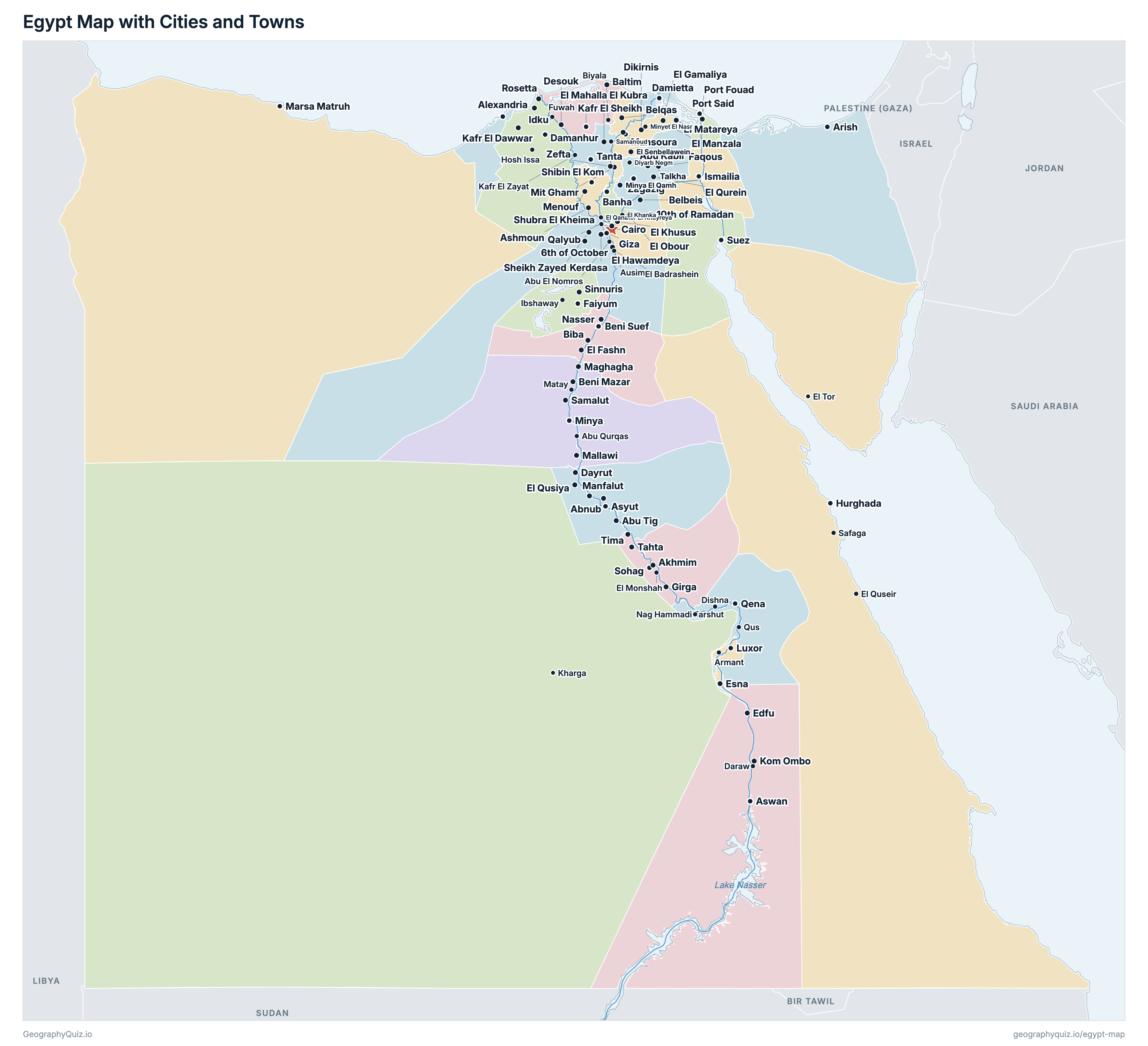
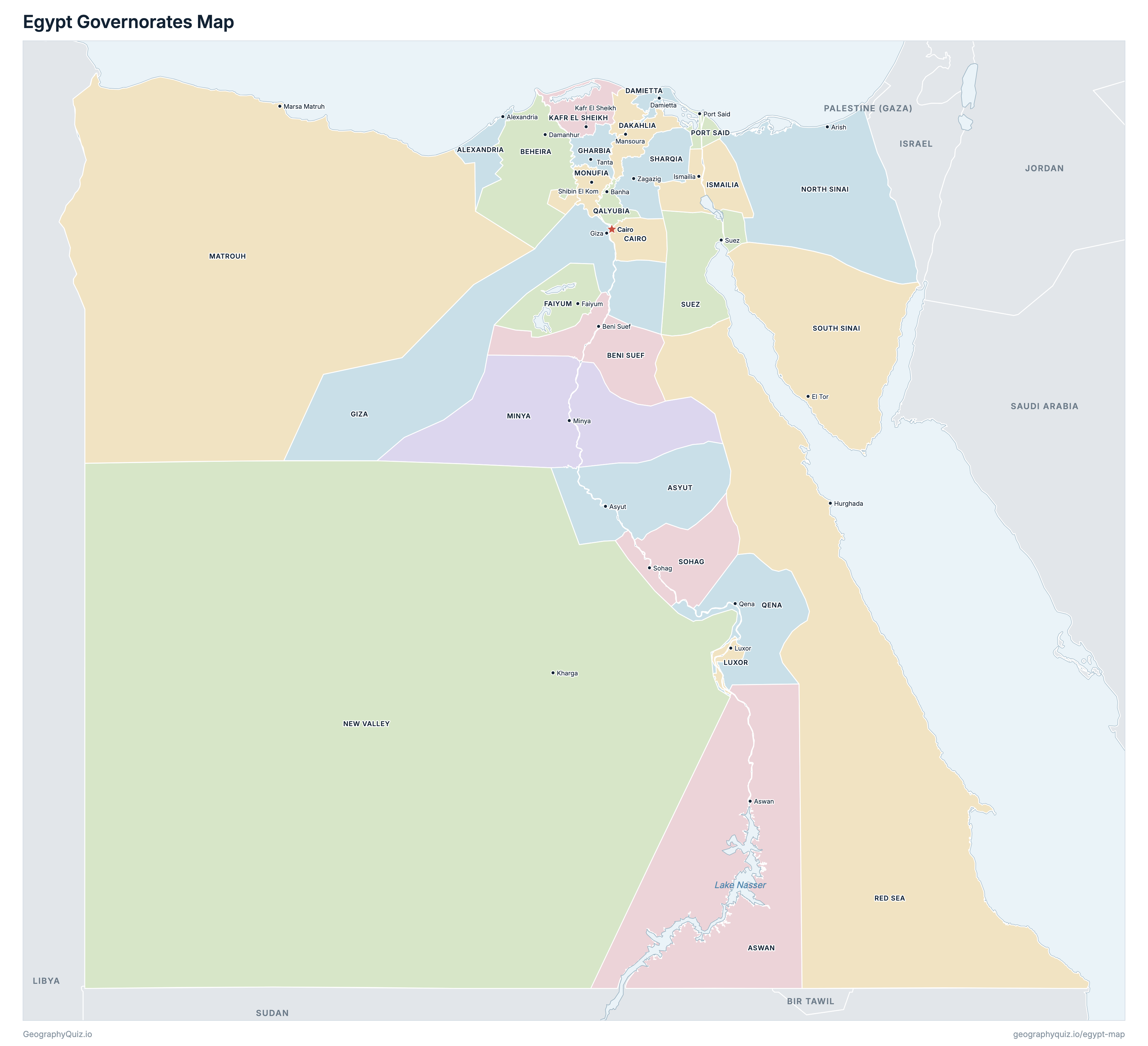
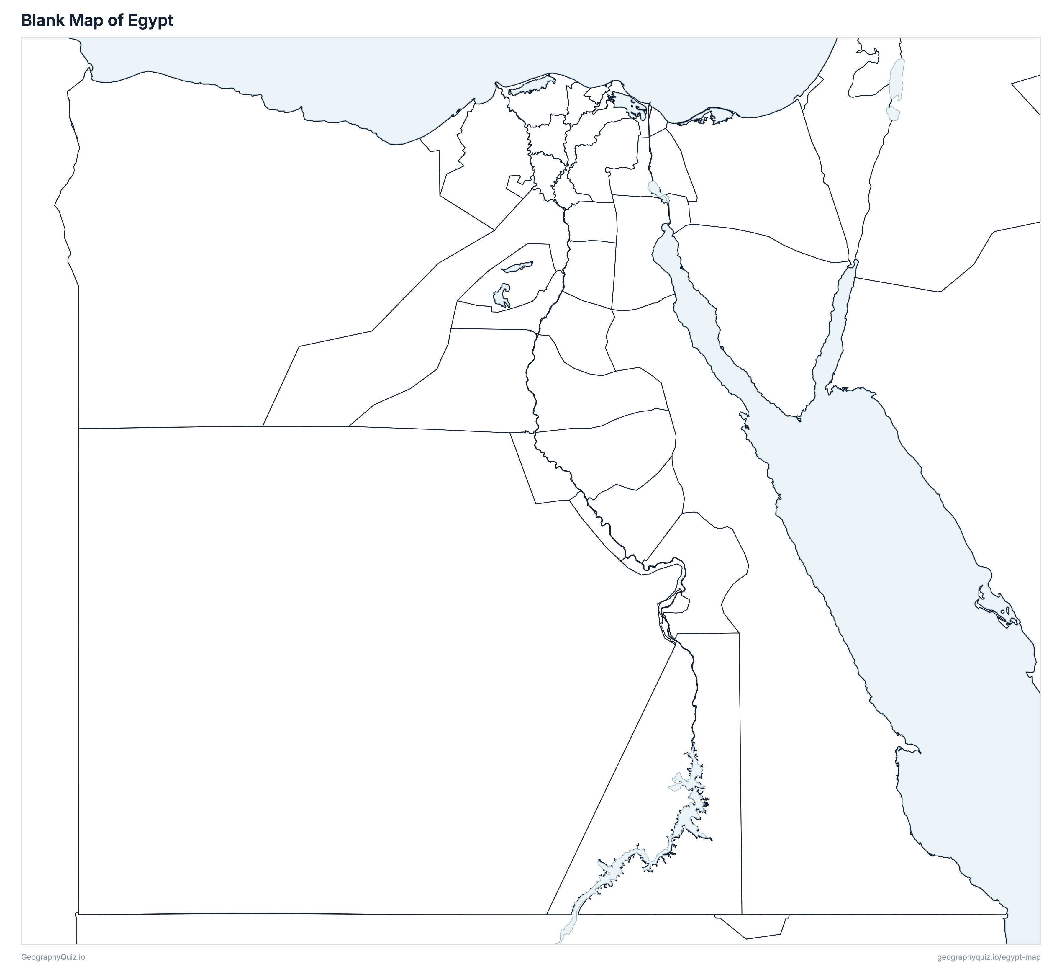
Free to print for class and home: Egypt with its cities and towns, a map of its governorates, and a blank outline map. PDFs fit one A4 or US Letter page.
Egypt map with cities
Egypt governorates map
About Egypt
Egypt has 27 governorates and about 108,613,296 people (2026) on 1,004,484 km² (387,833 sq mi). Cairo is both the capital and the largest city, with 10,478,084 people. It borders Libya, Sudan, Israel and Palestine (Gaza).
Cairo is the most populous governorate (10,478,084 people) and South Sinai the least (122,805); New Valley is the largest by area (429,151 km²) and Damietta the smallest (964 km²).
Largest cities in Egypt
The 25 most populous cities and towns. All 145 are on the map above: switch on Towns and zoom in to see them.
| # | City | Governorate | Population |
|---|---|---|---|
| 1 | Cairo | Cairo | 10,478,084 |
| 2 | Alexandria | Alexandria | 5,472,023 |
| 3 | Giza | Giza | 4,579,175 |
| 4 | Shubra El Kheima | Qalyubia | 1,306,280 |
| 5 | Suez | Suez | 812,384 |
| 6 | Port Said | Port Said | 691,775 |
| 7 | Mansoura | Dakahlia | 641,665 |
| 8 | El Mahalla El Kubra | Gharbia | 623,932 |
| 9 | Tanta | Gharbia | 607,153 |
| 10 | Asyut | Asyut | 582,256 |
| 11 | Faiyum | Faiyum | 546,117 |
| 12 | El Khusus | Qalyubia | 514,917 |
| 13 | Zagazig | Sharqia | 476,121 |
| 14 | Ismailia | Ismailia | 467,976 |
| 15 | Aswan | Aswan | 417,159 |
| 16 | 6th of October | Giza | 386,505 |
| 17 | Damietta | Damietta | 376,697 |
| 18 | Luxor | Luxor | 358,211 |
| 19 | Damanhur | Beheira | 341,455 |
| 20 | Minya | Minya | 308,980 |
| 21 | Beni Suef | Beni Suef | 306,974 |
| 22 | Sohag | Sohag | 290,117 |
| 23 | Shibin El Kom | Monufia | 286,281 |
| 24 | Qena | Qena | 274,922 |
| 25 | 10th of Ramadan | Sharqia | 272,238 |
Populations are CAPMAS's estimates of the people living in Egypt on 1 January 2026, built on the 2017 Census (Egyptians abroad are not counted). Cities and towns are shown with the urban population of the qisms named after them and of the markaz of the same name, so a markaz town may include smaller towns in its markaz. Cairo is the whole of Cairo governorate, with New Cairo, Helwan and Shorouk; Giza is the city's nine qisms (6th of October and Sheikh Zayed are shown on their own); Alexandria is the city without Borg El Arab. The Halaib Triangle, administered by Egypt and claimed by Sudan, is shown as part of Red Sea governorate, as in Egypt's official figures; Bir Tawil, the land south of the 22nd parallel that neither Egypt nor Sudan claims, is shown as unclaimed. Tiran and Sanafir, transferred to Saudi Arabia under the 2016 maritime agreement, are not drawn. Luxor includes Armant and Esna, its markazes since 2009.
Governorates of Egypt
All 27 governorates. Select one to show it on the map.
| Alexandria | 5,659,880 | 2,384 | |
| Aswan | 1,718,010 | 63,308 | |
| Asyut | 5,301,287 | 16,368 | |
| Damanhur | 7,106,969 | 10,644 | |
| Beni Suef | 3,742,952 | 10,209 | |
| Cairo | 10,478,084 | 2,837 | |
| Mansoura | 7,216,013 | 3,909 | |
| Damietta | 1,653,952 | 964 | |
| Faiyum | 4,243,628 | 5,250 | |
| Tanta | 5,568,575 | 1,946 | |
| Giza | 9,820,469 | 37,682 | |
| Ismailia | 1,502,169 | 5,376 | |
| Kafr El Sheikh | 3,824,812 | 3,681 | |
| Luxor | 1,456,560 | 5,428 | |
| Marsa Matruh | 595,272 | 160,252 | |
| Minya | 6,626,197 | 27,058 | |
| Shibin El Kom | 4,877,413 | 2,315 | |
| Kharga | 276,670 | 429,151 | |
| Arish | 531,333 | 26,121 | |
| Port Said | 802,465 | 1,373 | |
| Banha | 6,304,066 | 1,336 | |
| Qena | 3,799,294 | 11,034 | |
| Hurghada | 421,817 | 120,549 | |
| Zagazig | 8,155,414 | 4,906 | |
| Sohag | 5,994,806 | 10,401 | |
| El Tor | 122,805 | 30,948 | |
| Suez | 812,384 | 9,055 |
Quizzes and worksheets
Sources
- Populations: Central Agency for Public Mobilization and Statistics (CAPMAS), Population Estimates, the population in Egypt on 1 January 2026 by governorate and by qism and markaz (capmas.gov.eg).
- Governorate areas: CAPMAS (capmas.gov.eg).
- Governorate boundaries and town locations: CAPMAS administrative boundaries, as published by UN OCHA on the Humanitarian Data Exchange (Egypt COD-AB, cod-ab-egy), joined into the governorates.