Interactive map
Argentina Map
Every province, city and town in Argentina on one zoomable map, with its main highways, rivers and lakes. Switch on towns and provinces above the map and zoom in for every name; tap a province to see its population, area and largest towns.
Loading the map…
Printable maps of Argentina
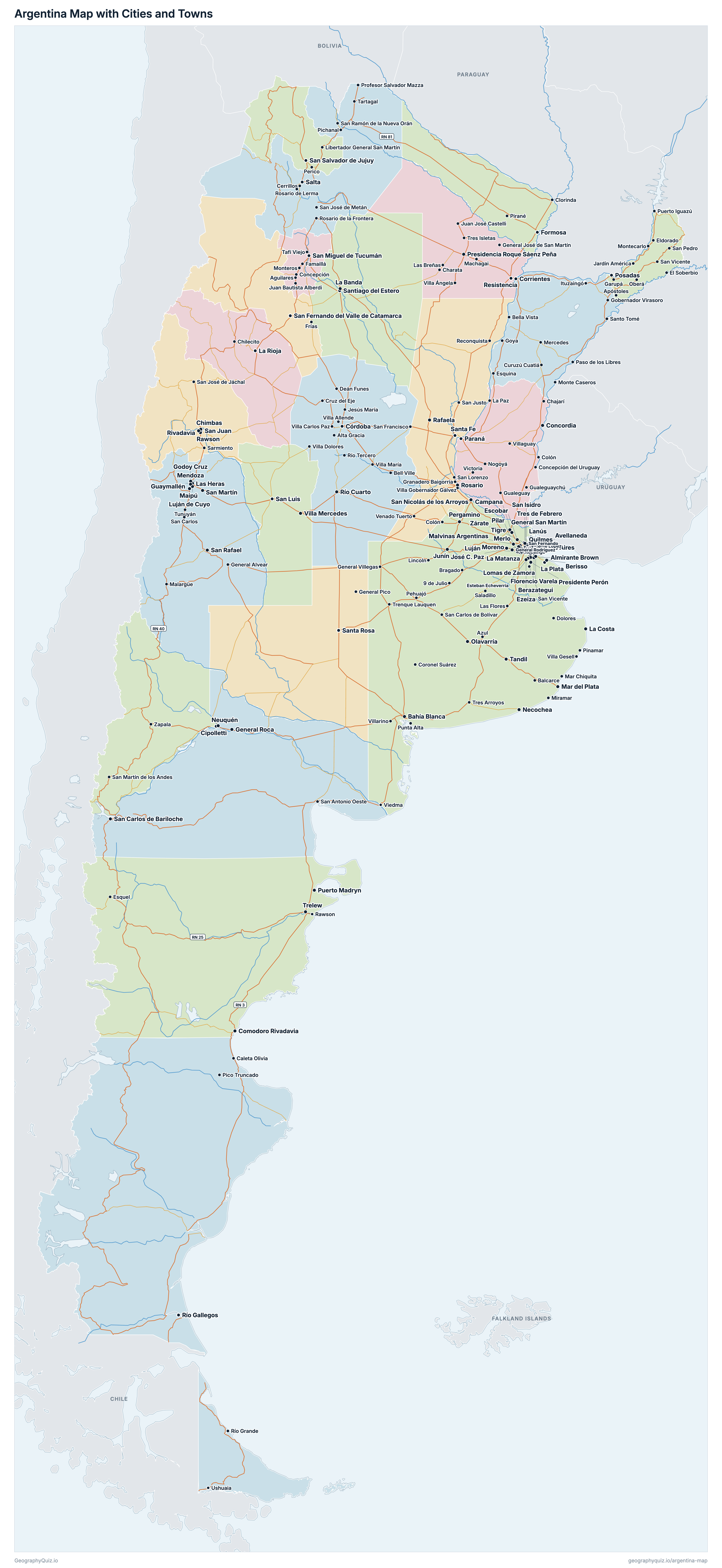
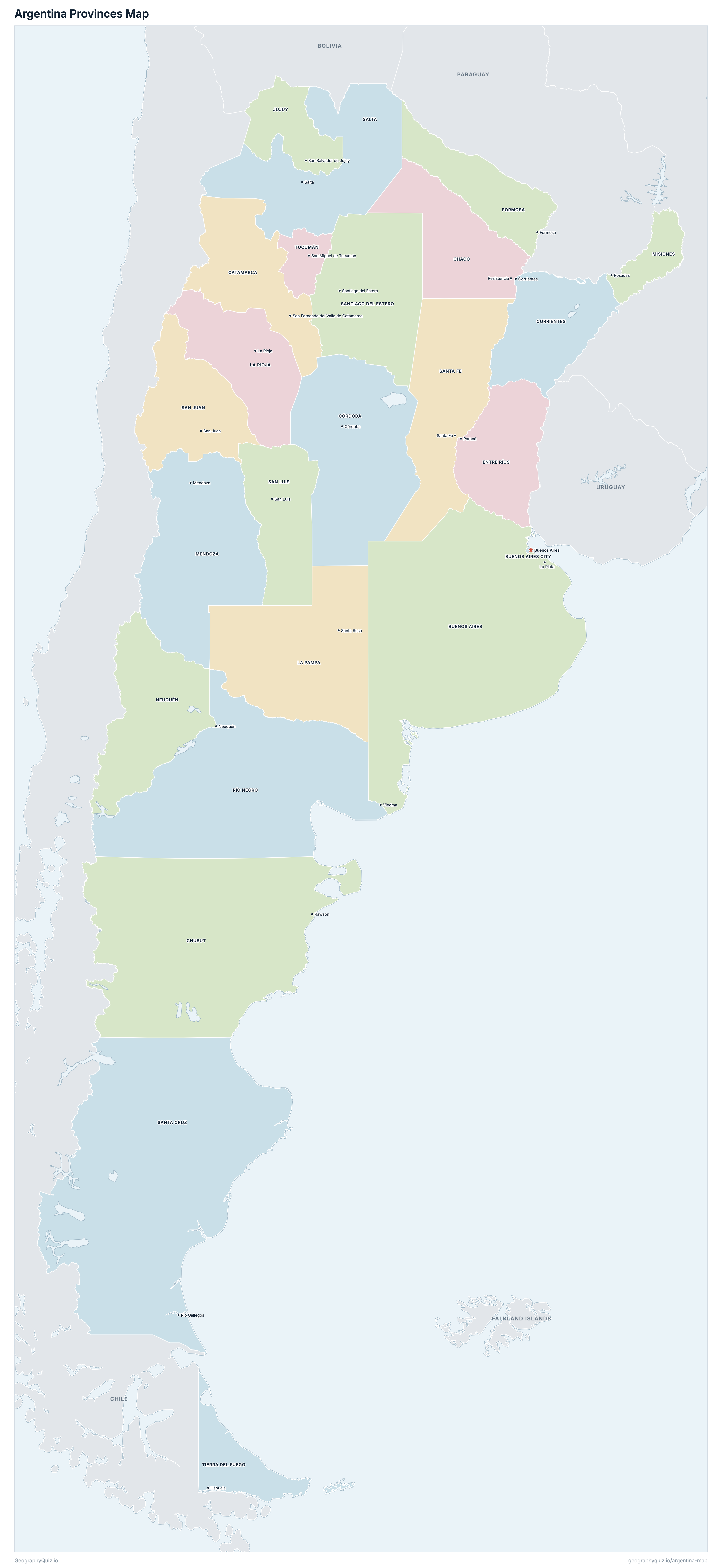
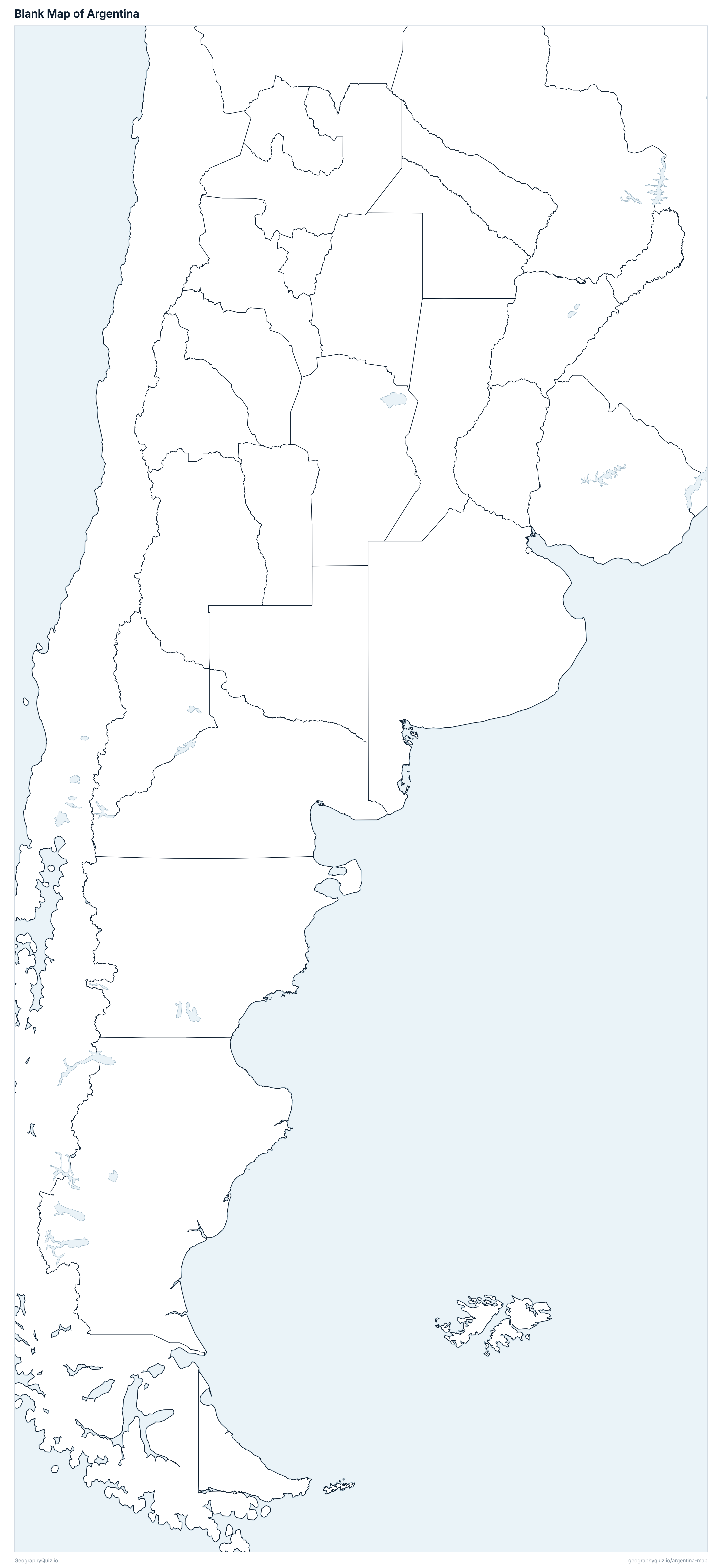
Free to print for class and home: Argentina with its cities and towns, a map of its provinces, and a blank outline map. PDFs fit one A4 or US Letter page.
Argentina map with cities
Argentina provinces map
About Argentina
Argentina has 24 provinces and about 45,892,285 people (2022) on 2,780,084 km² (1,073,396 sq mi). Buenos Aires is both the capital and the largest city, with 3,121,707 people. It borders Bolivia, Brazil, Chile, Paraguay and Uruguay.
Buenos Aires is the most populous province (17,523,996 people) and Tierra del Fuego the least (185,732); Buenos Aires is the largest by area (305,907 km²) and Buenos Aires City the smallest (206 km²).
Largest cities in Argentina
The 25 most populous cities and towns. All 268 are on the map above: switch on Towns and zoom in to see them.
| # | City | Province | Population |
|---|---|---|---|
| 1 | Buenos Aires | Buenos Aires City | 3,121,707 |
| 2 | La Matanza | Buenos Aires | 1,841,247 |
| 3 | Córdoba | Córdoba | 1,505,250 |
| 4 | Rosario | Santa Fe | 1,037,710 |
| 5 | La Plata | Buenos Aires | 768,547 |
| 6 | Lomas de Zamora | Buenos Aires | 690,480 |
| 7 | Mar del Plata | Buenos Aires | 667,082 |
| 8 | Quilmes | Buenos Aires | 633,391 |
| 9 | San Miguel de Tucumán | Tucumán | 601,888 |
| 10 | Salta | Salta | 594,772 |
| 11 | Almirante Brown | Buenos Aires | 584,827 |
| 12 | Merlo | Buenos Aires | 582,486 |
| 13 | Moreno | Buenos Aires | 576,632 |
| 14 | Florencio Varela | Buenos Aires | 496,433 |
| 15 | Lanús | Buenos Aires | 461,267 |
| 16 | General San Martín | Buenos Aires | 450,518 |
| 17 | Tigre | Buenos Aires | 446,949 |
| 18 | Corrientes | Corrientes | 430,170 |
| 19 | Santa Fe | Santa Fe | 408,572 |
| 20 | Pilar | Buenos Aires | 394,754 |
| 21 | Avellaneda | Buenos Aires | 367,554 |
| 22 | Tres de Febrero | Buenos Aires | 364,176 |
| 23 | Berazategui | Buenos Aires | 358,712 |
| 24 | Malvinas Argentinas | Buenos Aires | 350,674 |
| 25 | Esteban Echeverría | Buenos Aires | 338,480 |
Populations are from the 2022 National Census (INDEC, final results). Towns are counted by local government (municipio, partido or comuna), so a partido of Greater Buenos Aires such as La Matanza is counted whole and Buenos Aires is the whole Autonomous City. Tierra del Fuego's figure includes 81 people counted at Argentina's Antarctic bases; the census was not taken in the Falkland Islands, which are not counted.
Provinces of Argentina
All 24 provinces. Select one to show it on the map.
| La Plata | 17,523,996 | 305,907 | |
| Buenos Aires | 3,121,707 | 206 | |
| San Fernando del Valle de Catamarca | 429,562 | 101,486 | |
| Resistencia | 1,129,606 | 99,763 | |
| Rawson | 592,621 | 224,302 | |
| Córdoba | 3,840,905 | 164,708 | |
| Corrientes | 1,212,696 | 89,123 | |
| Paraná | 1,425,578 | 78,384 | |
| Formosa | 607,419 | 75,488 | |
| San Salvador de Jujuy | 811,611 | 53,244 | |
| Santa Rosa | 361,859 | 143,492 | |
| La Rioja | 383,865 | 91,494 | |
| Mendoza | 2,043,540 | 149,069 | |
| Posadas | 1,278,873 | 29,911 | |
| Neuquén | 710,814 | 94,422 | |
| Viedma | 750,768 | 202,169 | |
| Salta | 1,441,351 | 155,340 | |
| San Juan | 822,853 | 88,296 | |
| San Luis | 542,069 | 75,347 | |
| Río Gallegos | 337,226 | 244,458 | |
| Santa Fe | 3,544,908 | 133,249 | |
| Santiago del Estero | 1,060,906 | 136,934 | |
| Ushuaia | 185,732 | 20,698 | |
| San Miguel de Tucumán | 1,731,820 | 22,592 |
Quizzes and worksheets
Sources
- Provinces: Instituto Geográfico Nacional (IGN), provincia layer of its open geoservices (Capas SIG).
- Areas and capitals: IGN, División política, superficie y población (Informe de superficies de Argentina, 2021).
- Populations: INDEC, Censo Nacional de Población, Hogares y Viviendas 2022, resultados definitivos (by jurisdiction and by local government).
- Towns: placed with the Base de Asentamientos Humanos de la República Argentina (BAHRA; IGN and INDEC).
- National routes: IGN, vial_nacional layer (Dirección Nacional de Vialidad's national road network).