Interactive map
Venezuela Map
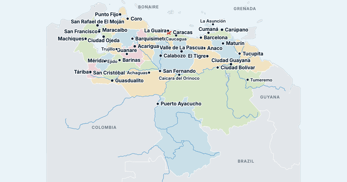
Every state, city and town in Venezuela on one zoomable map, with its main highways, rivers and lakes. Switch on towns and states above the map and zoom in for every name; tap a state to see its population, area and largest towns.
Loading the map…
Printable maps of Venezuela
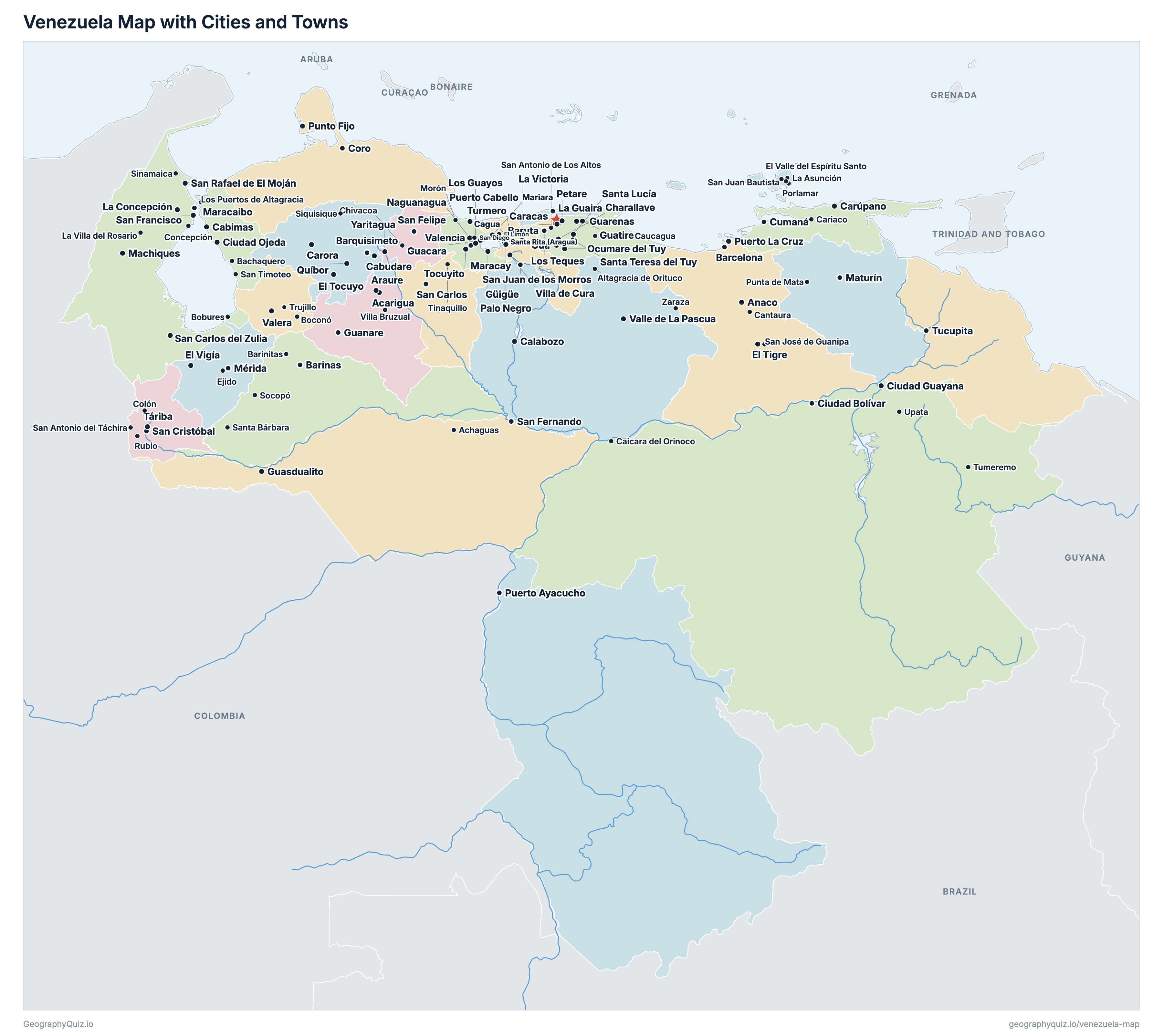
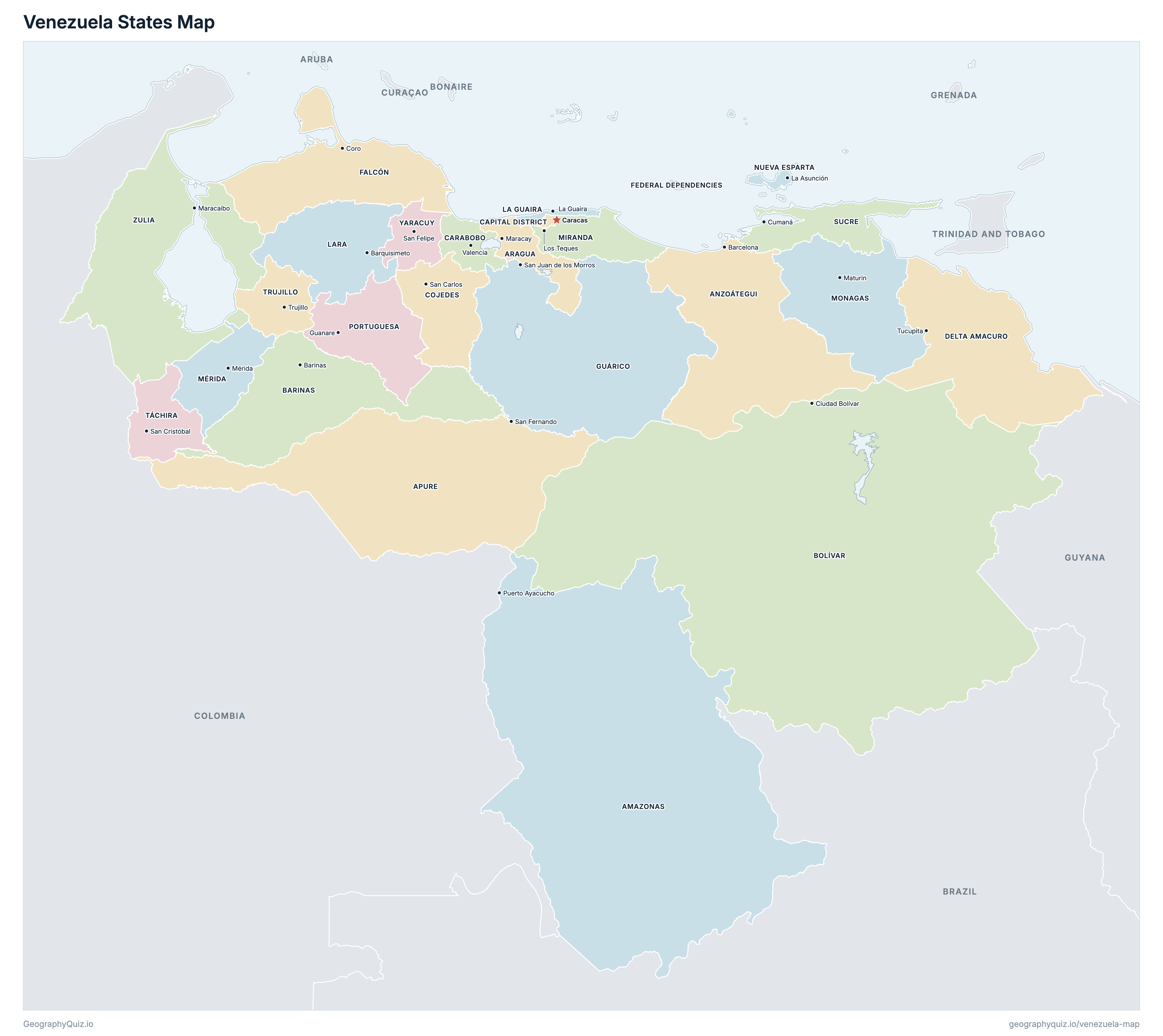
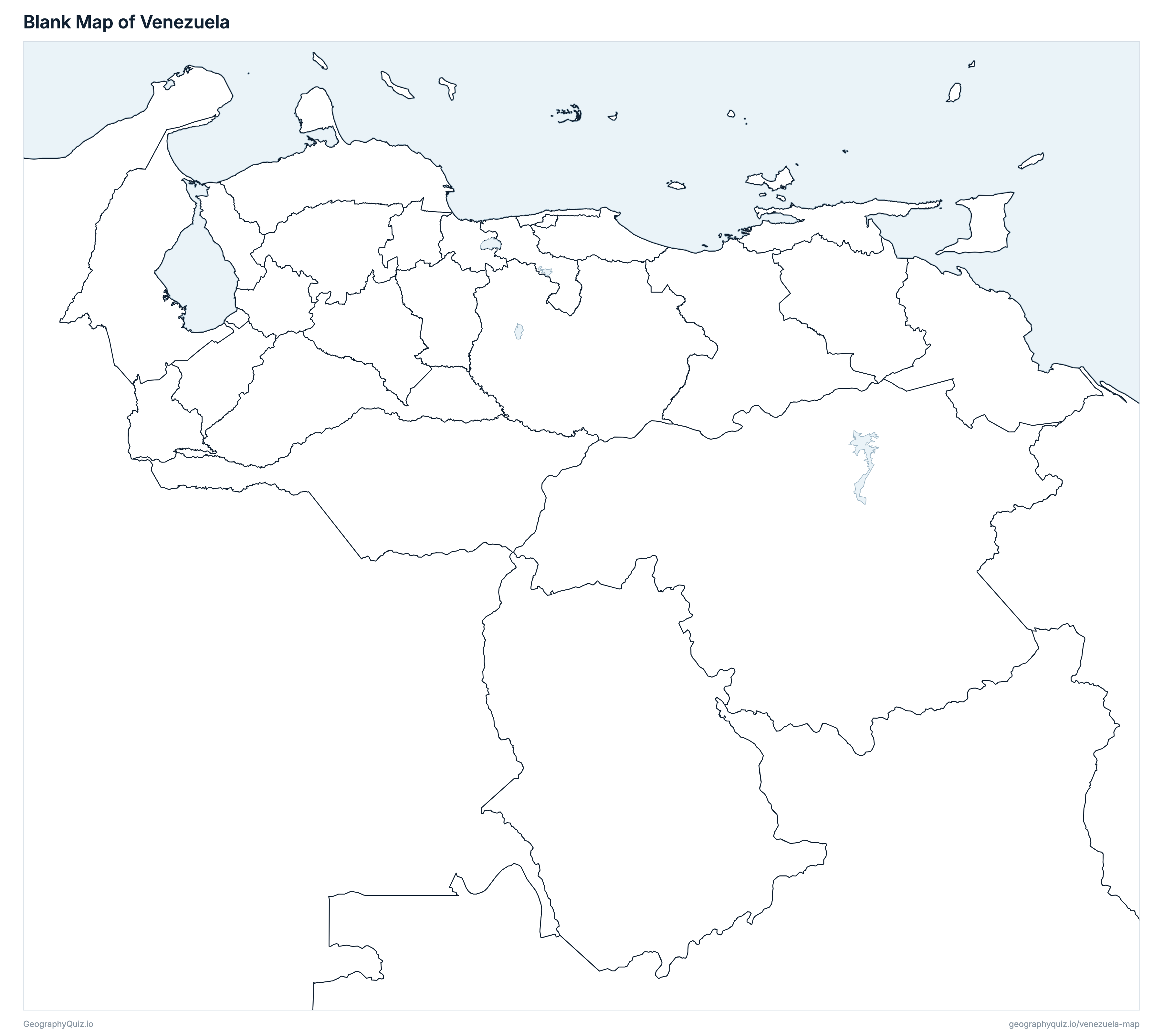
Free to print for class and home: Venezuela with its cities and towns, a map of its states, and a blank outline map. PDFs fit one A4 or US Letter page.
Venezuela map with cities
Venezuela states map
Key facts
- Capital
- Caracas
- Largest city
- Caracas (1,943,901)
- Population
- 27,227,930 (2011)
- Area
- 913,813 km² (352,825 sq mi)
- States of Venezuela
- 25
- Most populous state
- Zulia (3,704,404)
- Largest state by area
- Bolívar, 250,727 km² (96,806 sq mi)
About Venezuela
Venezuela has 25 states and about 27,227,930 people (2011) on 913,813 km² (352,825 sq mi). Caracas is both the capital and the largest city, with 1,943,901 people. It borders Brazil, Colombia and Guyana.
Zulia is the most populous state (3,704,404 people) and Federal Dependencies the least (2,155); Bolívar is the largest by area (250,727 km²) and Federal Dependencies the smallest (343 km²).
Largest cities in Venezuela
The 25 most populous cities and towns. All 123 are on the map above: switch on Towns and zoom in to see them.
| # | City | State | Population |
|---|---|---|---|
| 1 | Caracas | Capital District | 1,943,901 |
| 2 | Maracaibo | Zulia | 1,459,448 |
| 3 | Barquisimeto | Lara | 996,230 |
| 4 | Valencia | Carabobo | 829,856 |
| 5 | Ciudad Guayana | Bolívar | 706,736 |
| 6 | Petare | Miranda | 600,351 |
| 7 | Maturín | Monagas | 542,259 |
| 8 | San Francisco | Zulia | 446,757 |
| 9 | Barcelona | Anzoátegui | 421,424 |
| 10 | Maracay | Aragua | 407,109 |
| 11 | Cumaná | Sucre | 358,919 |
| 12 | Barinas | Barinas | 353,851 |
| 13 | La Guaira | La Guaira | 352,920 |
| 14 | Ciudad Bolívar | Bolívar | 342,280 |
| 15 | San Cristóbal | Táchira | 263,765 |
| 16 | Cabimas | Zulia | 263,056 |
| 17 | Los Teques | Miranda | 252,242 |
| 18 | Puerto La Cruz | Anzoátegui | 244,728 |
| 19 | Baruta | Miranda | 240,755 |
| 20 | Punto Fijo | Falcón | 239,444 |
| 21 | Mérida | Mérida | 217,537 |
| 22 | Coro | Falcón | 211,537 |
| 23 | Turmero | Aragua | 211,010 |
| 24 | Guarenas | Miranda | 209,987 |
| 25 | San Rafael de El Moján | Zulia | 207,221 |
Populations are those of the 2011 census, Venezuela's last, as published by INE. A town's figure is that of the whole municipality whose seat it is, which can include smaller towns nearby; Caracas is the Libertador municipality, which is the Capital District, and the rest of the city (the municipalities of Sucre, Baruta, Chacao and El Hatillo) lies in Miranda. Valencia's figure is Carabobo's total less its other municipalities, as INE's municipal table prints another municipality's figures for it. Areas are measured on INE's boundaries: Zulia's leaves out Lake Maracaibo. Venezuela is shown as it is administered; the Guayana Esequiba, which Venezuela claims and Guyana administers, is shown as part of Guyana.
States of Venezuela
All 25 states. Select one to show it on the map.
| Puerto Ayacucho | 146,480 | 180,066 | |
| Barcelona | 1,469,747 | 46,706 | |
| San Fernando | 459,025 | 73,407 | |
| Maracay | 1,630,308 | 7,119 | |
| Barinas | 816,264 | 36,815 | |
| Ciudad Bolívar | 1,413,115 | 250,727 | |
| Caracas | 1,943,901 | 376 | |
| Valencia | 2,245,744 | 4,848 | |
| San Carlos | 323,165 | 13,822 | |
| Tucupita | 165,525 | 38,487 | |
| Coro | 902,847 | 28,155 | |
| 2,155 | 343 | ||
| San Juan de los Morros | 747,739 | 64,862 | |
| La Guaira | 352,920 | 1,170 | |
| Barquisimeto | 1,774,867 | 19,464 | |
| Mérida | 828,592 | 11,857 | |
| Los Teques | 2,675,165 | 8,896 | |
| Maturín | 905,443 | 28,056 | |
| La Asunción | 491,610 | 1,026 | |
| Guanare | 876,496 | 17,425 | |
| Cumaná | 896,291 | 11,087 | |
| San Cristóbal | 1,168,908 | 9,960 | |
| Trujillo | 686,367 | 8,348 | |
| San Felipe | 600,852 | 6,081 | |
| Maracaibo | 3,704,404 | 44,712 |
Quizzes and worksheets
Sources
- Populations: Instituto Nacional de Estadística (INE), XIV Censo Nacional de Población y Vivienda 2011: population by federal entity (Resultados Nacionales, cuadro 2.2) and by municipality (ine.gob.ve).
- States, Capital District, Federal Dependencies and municipalities: INE boundaries, as published by UN OCHA on the Humanitarian Data Exchange (cod-ab-ven, CC BY-IGO); areas measured on those boundaries.
- State and municipal seats: INE, División Político Territorial de la República Bolivariana de Venezuela con fines estadísticos (ine.gob.ve).