Interactive map
Romania Map
Every county, city and town in Romania on one zoomable map, with its main highways, rivers and lakes. Switch on towns and counties above the map and zoom in for every name; tap a county to see its population, area and largest towns.
Loading the map…
Printable maps of Romania
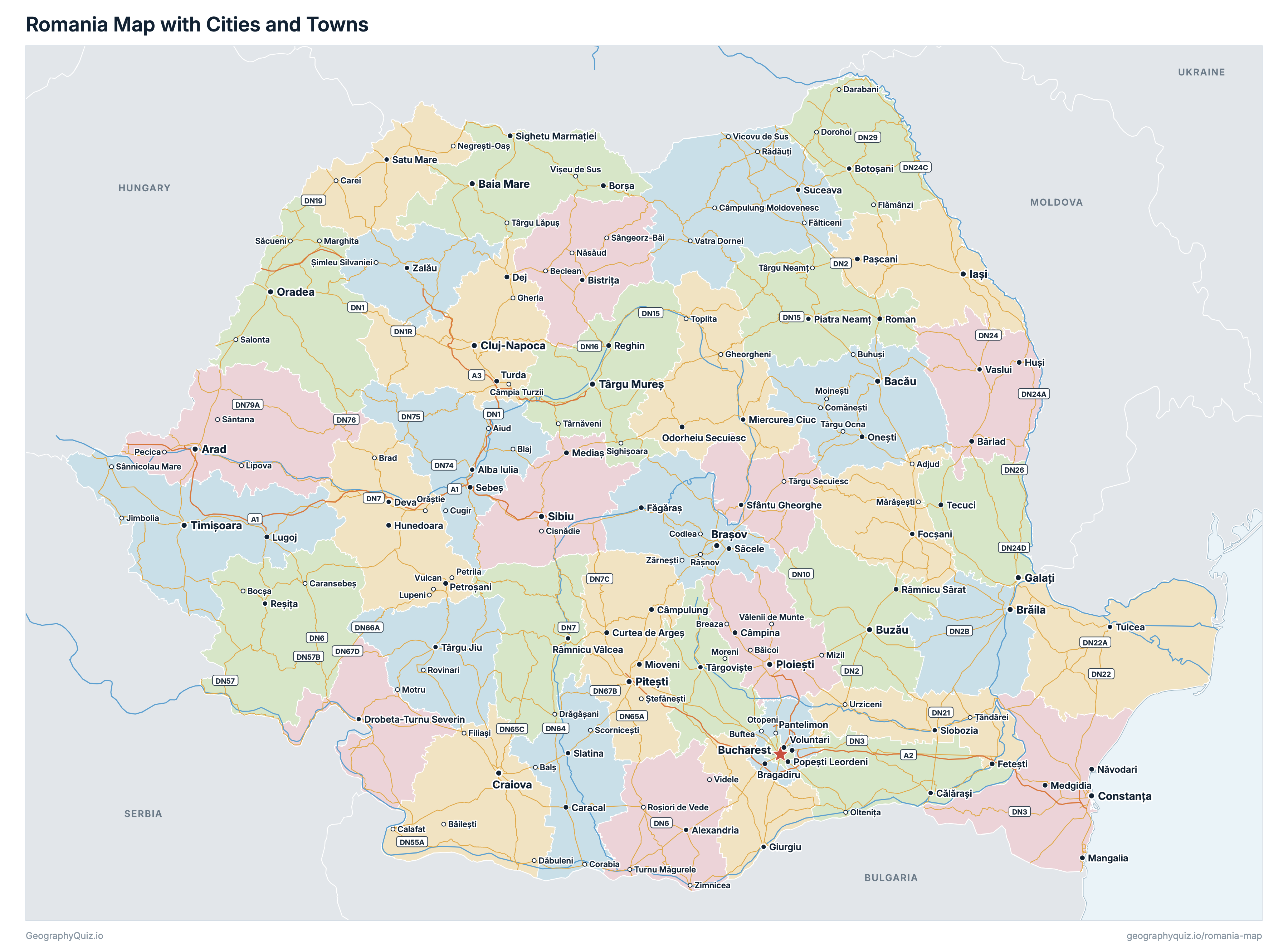
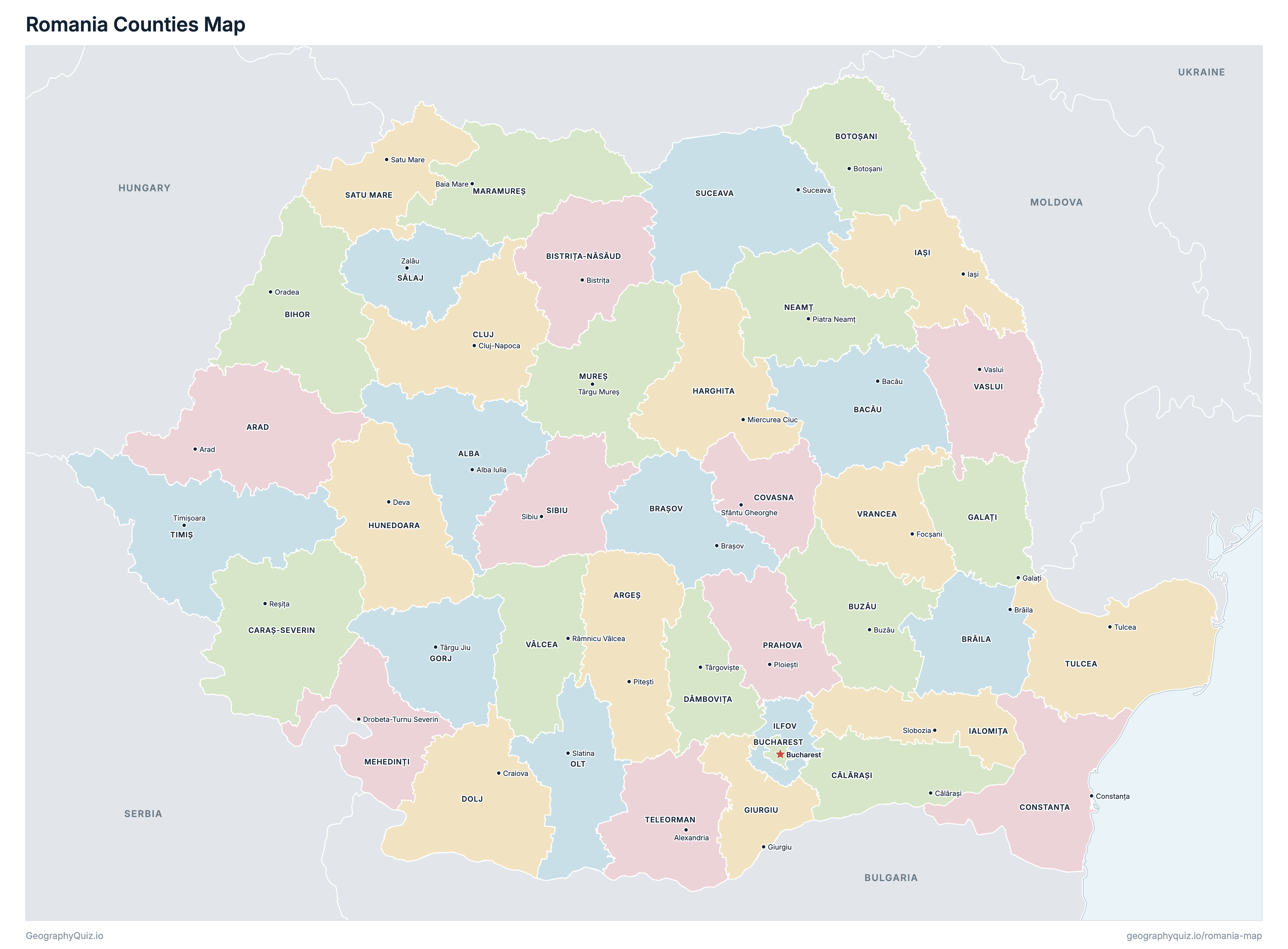
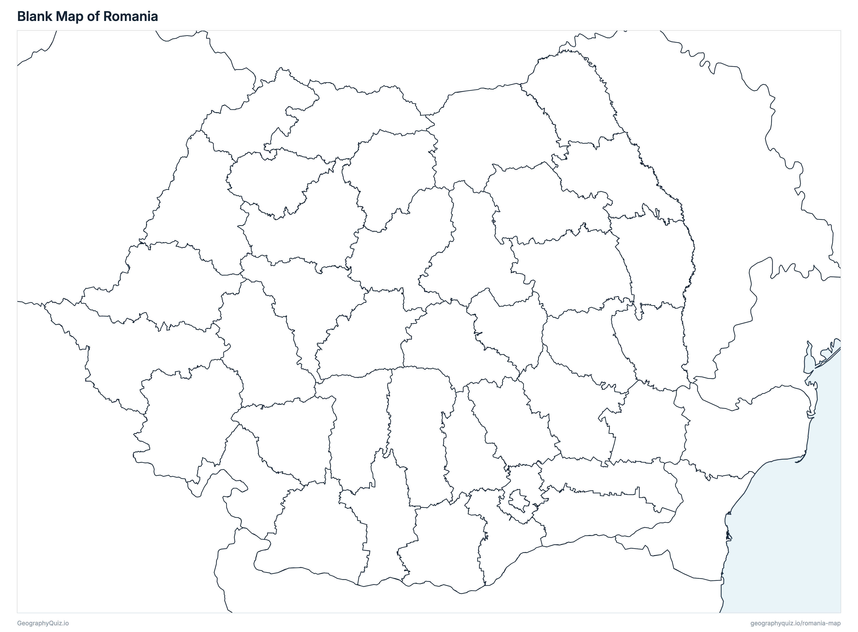
Free to print for class and home: Romania with its cities and towns, a map of its counties, and a blank outline map. PDFs fit one A4 or US Letter page.
Romania map with cities
Romania counties map
Key facts
- Capital
- Bucharest
- Largest city
- Bucharest (1,716,961)
- Population
- 19,053,815 (2021)
- Area
- 238,394 km² (92,044 sq mi)
- Counties of Romania
- 42
- Most populous county
- Bucharest (1,716,961)
- Largest county by area
- Timiș, 8,687 km² (3,354 sq mi)
About Romania
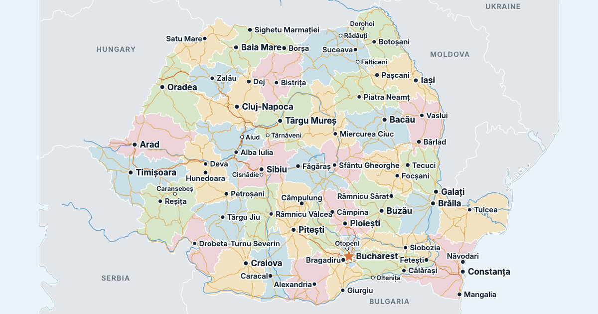
Romania has 42 counties and about 19,053,815 people (2021) on 238,394 km² (92,044 sq mi). Bucharest is both the capital and the largest city, with 1,716,961 people. It borders Hungary, Ukraine, Moldova, Bulgaria and Serbia.
Bucharest is the most populous county (1,716,961 people) and Tulcea the least (193,355); Timiș is the largest by area (8,687 km²) and Bucharest the smallest (239 km²).
Largest cities in Romania
The 25 most populous cities and towns. All 171 are on the map above: switch on Towns and zoom in to see them.
| # | City | County | Population |
|---|---|---|---|
| 1 | Bucharest | Bucharest | 1,716,961 |
| 2 | Cluj-Napoca | Cluj | 286,598 |
| 3 | Iași | Iași | 271,692 |
| 4 | Constanța | Constanța | 263,688 |
| 5 | Timișoara | Timiș | 250,849 |
| 6 | Brașov | Brașov | 237,589 |
| 7 | Craiova | Dolj | 234,140 |
| 8 | Galați | Galați | 217,851 |
| 9 | Oradea | Bihor | 183,105 |
| 10 | Ploiești | Prahova | 180,540 |
| 11 | Brăila | Brăila | 154,686 |
| 12 | Arad | Arad | 145,078 |
| 13 | Pitești | Argeș | 141,275 |
| 14 | Bacău | Bacău | 136,087 |
| 15 | Sibiu | Sibiu | 134,309 |
| 16 | Târgu Mureș | Mureș | 116,033 |
| 17 | Baia Mare | Maramureș | 108,759 |
| 18 | Buzău | Buzău | 103,481 |
| 19 | Râmnicu Vâlcea | Vâlcea | 93,151 |
| 20 | Satu Mare | Satu Mare | 91,520 |
| 21 | Botoșani | Botoșani | 90,010 |
| 22 | Suceava | Suceava | 84,322 |
| 23 | Drobeta-Turnu Severin | Mehedinți | 79,865 |
| 24 | Piatra Neamț | Neamț | 79,679 |
| 25 | Bistrița | Bistrița-Năsăud | 78,877 |
Populations are the resident population of the 2021 Census (Recensământul Populației și Locuințelor) on 1 December 2021. Cities and towns are Romania's municipalities (municipii) and towns (orașe), each with the population of its whole administrative unit, the villages that belong to it included. Bucharest is both the capital and a unit of its own, apart from any county; Ilfov county surrounds it, and Ilfov's county council sits in Bucharest.
Counties of Romania
All 42 counties. Select one to show it on the map.
| Alba Iulia | 325,941 | 6,257 | |
| Arad | 410,143 | 7,744 | |
| Pitești | 569,932 | 6,824 | |
| Bacău | 601,387 | 6,624 | |
| Oradea | 551,297 | 7,538 | |
| Bistrița | 295,988 | 5,360 | |
| Botoșani | 392,821 | 4,985 | |
| Brăila | 281,452 | 4,765 | |
| Brașov | 546,615 | 5,363 | |
| Bucharest | 1,716,961 | 239 | |
| Buzău | 404,979 | 6,102 | |
| Călărași | 283,458 | 5,088 | |
| Reșița | 246,588 | 8,530 | |
| Cluj-Napoca | 679,141 | 6,667 | |
| Constanța | 655,997 | 7,098 | |
| Sfântu Gheorghe | 200,042 | 3,709 | |
| Târgoviște | 479,404 | 4,047 | |
| Craiova | 599,442 | 7,425 | |
| Galați | 496,892 | 4,464 | |
| Giurgiu | 262,066 | 3,545 | |
| Târgu Jiu | 314,685 | 5,573 | |
| Miercurea Ciuc | 291,950 | 6,640 | |
| Deva | 361,657 | 7,074 | |
| Slobozia | 250,816 | 4,452 | |
| Iași | 760,774 | 5,477 | |
| Bucharest | 542,704 | 1,564 | |
| Baia Mare | 452,475 | 6,303 | |
| Drobeta-Turnu Severin | 234,339 | 4,941 | |
| Târgu Mureș | 518,193 | 6,708 | |
| Piatra Neamț | 454,203 | 5,898 | |
| Slatina | 383,280 | 5,502 | |
| Ploiești | 695,119 | 4,716 | |
| Zalău | 212,224 | 3,868 | |
| Satu Mare | 330,668 | 4,419 | |
| Sibiu | 388,326 | 5,435 | |
| Suceava | 642,551 | 8,554 | |
| Alexandria | 323,544 | 5,798 | |
| Timișoara | 650,533 | 8,687 | |
| Tulcea | 193,355 | 8,477 | |
| Râmnicu Vâlcea | 341,861 | 5,766 | |
| Vaslui | 374,700 | 5,316 | |
| Focșani | 335,312 | 4,855 |
Quizzes and worksheets
Sources
- Counties and the Municipality of Bucharest: Agenția Națională de Cadastru și Publicitate Imobiliară (ANCPI), administrative boundaries, as published by UN OCHA on the Humanitarian Data Exchange (Romania COD-AB, cod-ab-rou, 2022), with their areas.
- Populations: Institutul Național de Statistică (INS), Recensământul Populației și Locuințelor 2021, final results, table 1.22 (resident population on 1 December 2021 by county, municipality, town and commune; recensamantromania.ro).
- County seats: Law 2/1968 on the administrative organisation of Romania's territory, as amended.
- Town locations: US National Geospatial-Intelligence Agency, GEOnet Names Server.
- Motorways and national roads: EuroGeographics, EuroGlobalMap (Open Maps for Europe; Romania's data from ANCPI). © EuroGeographics.