Interactive map
Poland Map
Every voivodeship, city and town in Poland on one zoomable map, with its main highways, rivers and lakes. Switch on towns and voivodeships above the map and zoom in for every name; tap a voivodeship to see its population, area and largest towns.
Loading the map…
Printable maps of Poland
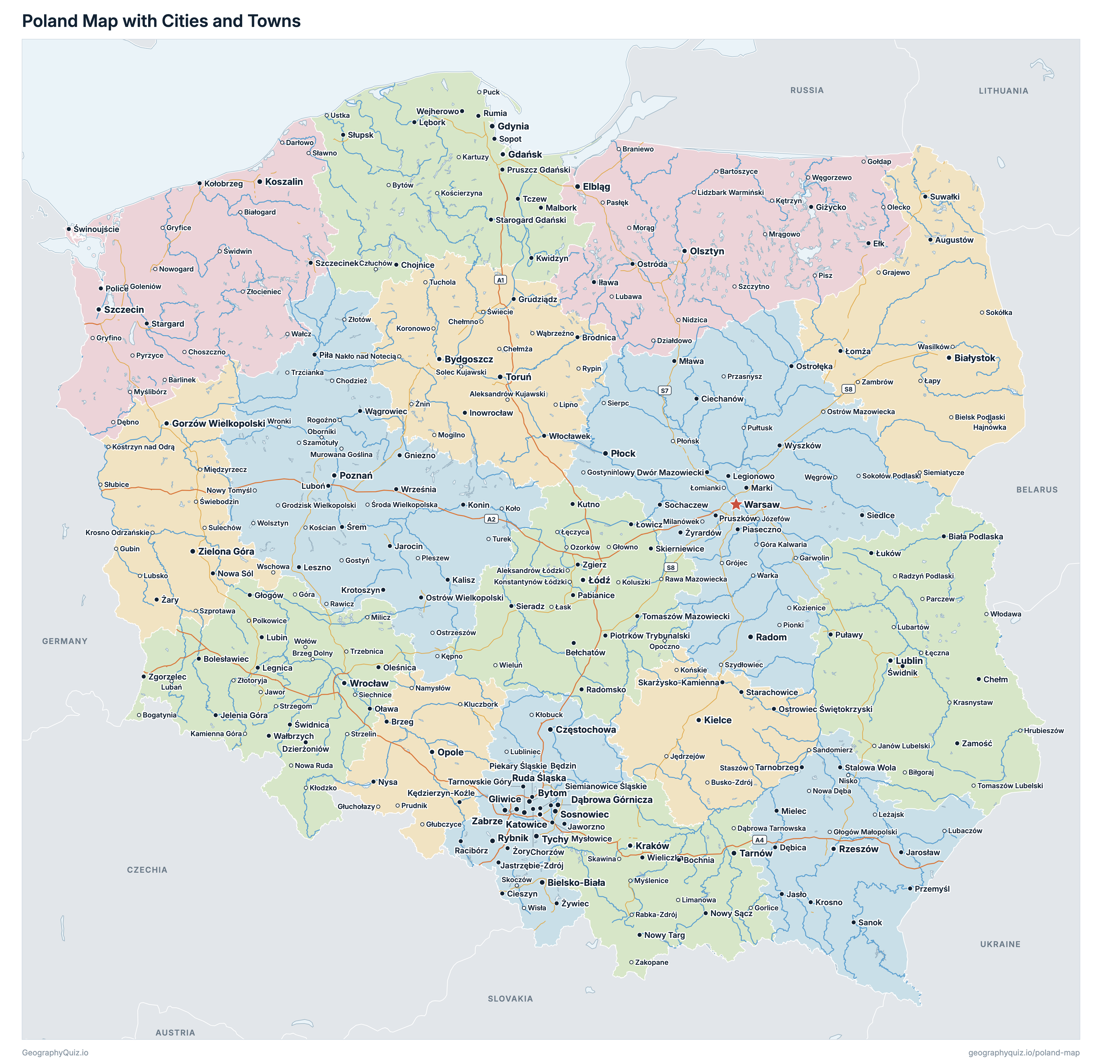
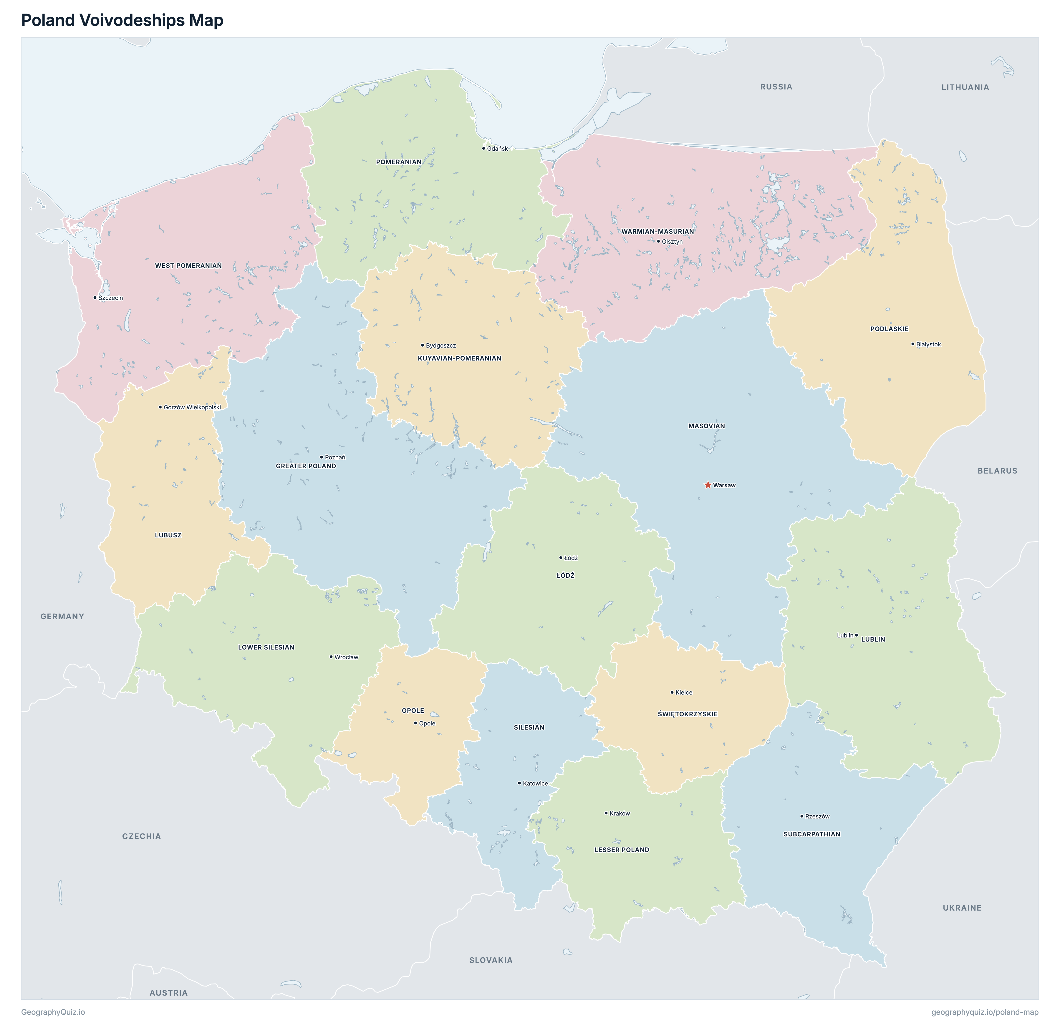
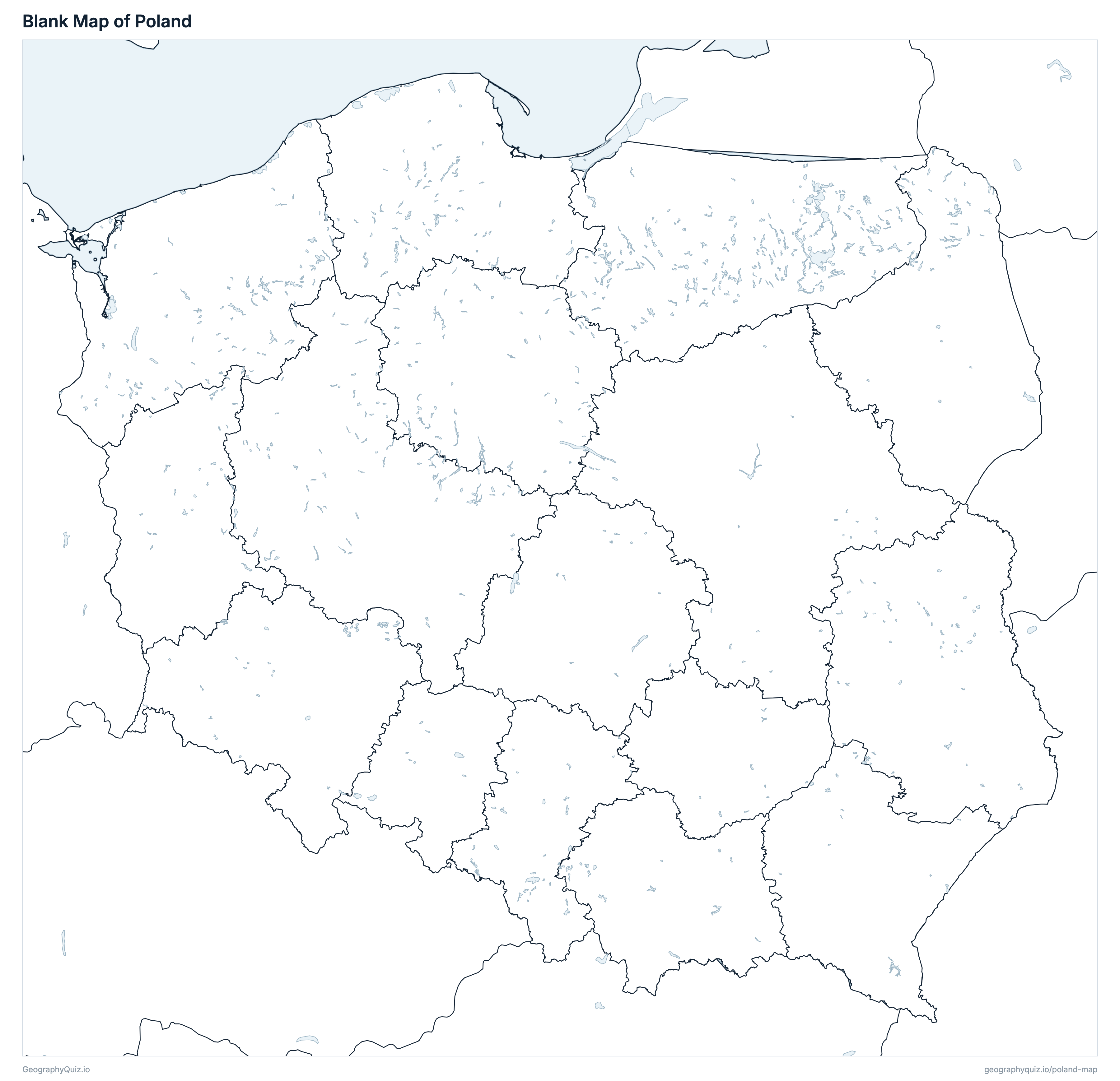
Free to print for class and home: Poland with its cities and towns, a map of its voivodeships, and a blank outline map. PDFs fit one A4 or US Letter page.
Poland map with cities
Poland voivodeships map
About Poland
Poland has 16 voivodeships and about 37,332,510 people (2025) on 313,933 km² (121,210 sq mi). Warsaw is both the capital and the largest city, with 1,866,729 people. It borders Germany, Czechia, Slovakia, Ukraine, Belarus, Lithuania and Russia.
Masovian is the most populous voivodeship (5,505,857 people) and Opole the least (923,536); Masovian is the largest by area (35,559 km²) and Opole the smallest (9,412 km²).
Largest cities in Poland
The 25 most populous cities and towns. All 382 are on the map above: switch on Towns and zoom in to see them.
| # | City | Voivodeship | Population |
|---|---|---|---|
| 1 | Warsaw | Masovian | 1,866,729 |
| 2 | Kraków | Lesser Poland | 816,614 |
| 3 | Wrocław | Lower Silesian | 672,601 |
| 4 | Łódź | Łódź | 639,890 |
| 5 | Poznań | Greater Poland | 534,239 |
| 6 | Gdańsk | Pomeranian | 489,328 |
| 7 | Szczecin | West Pomeranian | 383,786 |
| 8 | Lublin | Lublin | 326,685 |
| 9 | Bydgoszcz | Kuyavian-Pomeranian | 321,100 |
| 10 | Białystok | Podlaskie | 289,217 |
| 11 | Katowice | Silesian | 277,415 |
| 12 | Gdynia | Pomeranian | 238,712 |
| 13 | Częstochowa | Silesian | 201,439 |
| 14 | Rzeszów | Subcarpathian | 199,436 |
| 15 | Toruń | Kuyavian-Pomeranian | 192,784 |
| 16 | Radom | Masovian | 191,819 |
| 17 | Sosnowiec | Silesian | 182,971 |
| 18 | Kielce | Świętokrzyskie | 178,837 |
| 19 | Gliwice | Silesian | 166,942 |
| 20 | Olsztyn | Warmian-Masurian | 165,393 |
| 21 | Bielsko-Biała | Silesian | 163,164 |
| 22 | Zabrze | Silesian | 150,780 |
| 23 | Bytom | Silesian | 144,598 |
| 24 | Zielona Góra | Lubusz | 138,476 |
| 25 | Rybnik | Silesian | 128,788 |
Populations are Statistics Poland's population on 31 December 2025 (Local Data Bank), counted in the voivodeships, gminas and towns of that day; towns are whole towns (miasta) within their legal limits, so a city's figure stops at its boundary. Kuyavian-Pomeranian and Lubusz split their seats: the voivode sits in Bydgoszcz and Gorzów Wielkopolski, the regional assembly in Toruń and Zielona Góra.
Voivodeships of Poland
All 16 voivodeships. Select one to show it on the map.
| Poznań | 3,471,302 | 29,827 | |
| Bydgoszcz and Toruń | 1,971,891 | 17,971 | |
| Kraków | 3,429,342 | 15,184 | |
| Łódź | 2,328,825 | 18,219 | |
| Wrocław | 2,857,273 | 19,947 | |
| Lublin | 1,980,772 | 25,122 | |
| Gorzów Wielkopolski and Zielona Góra | 963,601 | 13,988 | |
| Warsaw | 5,505,857 | 35,559 | |
| Opole | 923,536 | 9,412 | |
| Białystok | 1,126,679 | 20,187 | |
| Gdańsk | 2,358,409 | 19,547 | |
| Katowice | 4,261,792 | 12,334 | |
| Rzeszów | 2,053,760 | 17,845 | |
| Kielce | 1,147,293 | 11,709 | |
| Olsztyn | 1,339,498 | 24,174 | |
| Szczecin | 1,612,680 | 22,909 |
Quizzes and worksheets
Sources
- Voivodeships and Poland's border: Head Office of Geodesy and Cartography (GUGiK), State Register of Borders (PRG), voivodeship boundaries and internal sea waters, GUGiK's open WFS (mapy.geoportal.gov.pl).
- Populations and areas: Statistics Poland (GUS), Local Data Bank (BDL), population on 31 December 2025 by voivodeship, gmina and town, and geodetic area in 2025 (bdl.stat.gov.pl).
- Town locations: GUGiK, State Register of Geographical Names (PRNG), localities (opendata.geoportal.gov.pl).
- Motorways, expressways, rivers and lakes: GUGiK, Database of General Geographic Objects (BDOO, 1:250 000), 2025 (opendata.geoportal.gov.pl).