Interactive map
Kenya Map
Every county, city and town in Kenya on one zoomable map, with its main highways, rivers and lakes. Switch on towns and counties above the map and zoom in for every name; tap a county to see its population, area and largest towns.
Loading the map…
Printable maps of Kenya
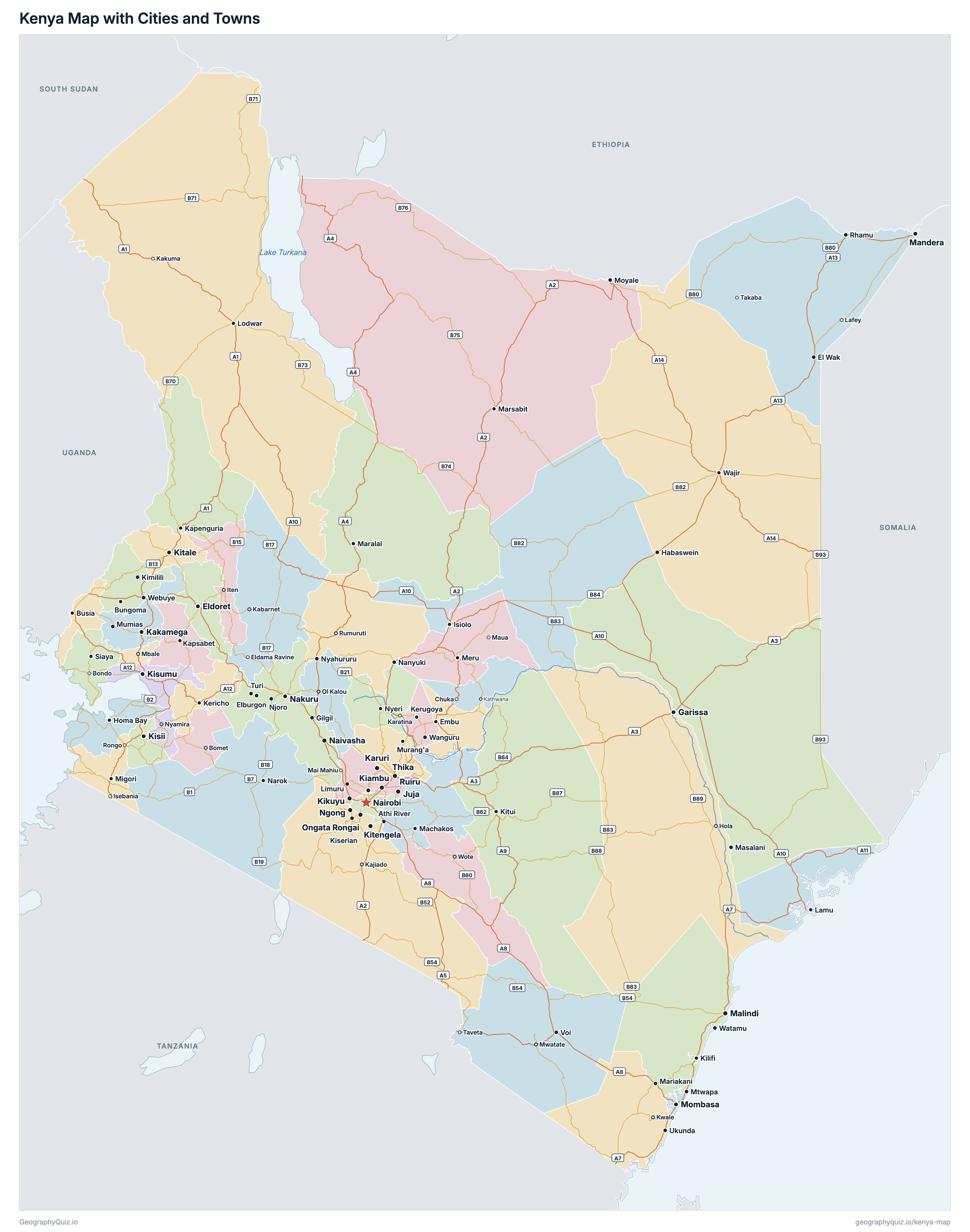
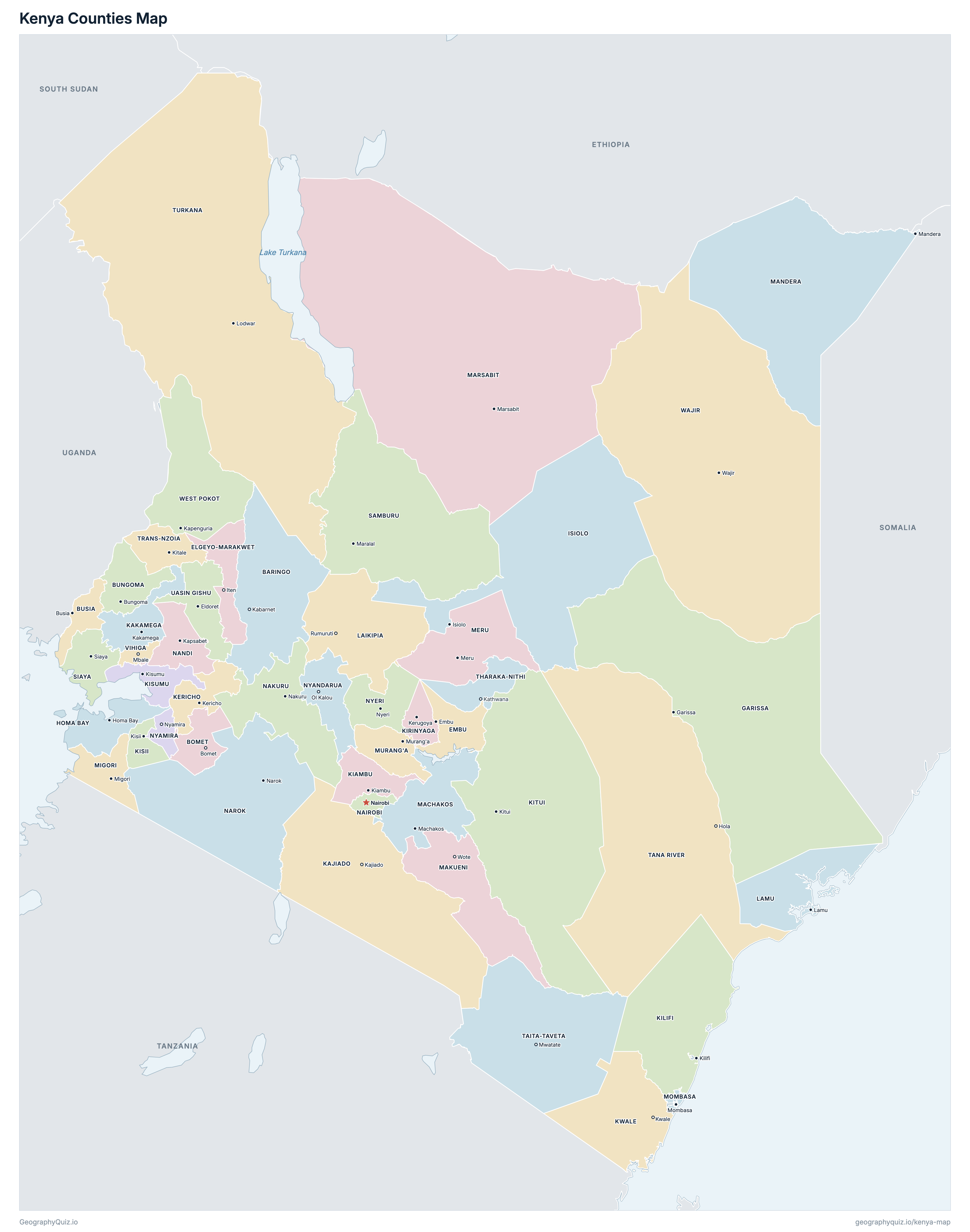
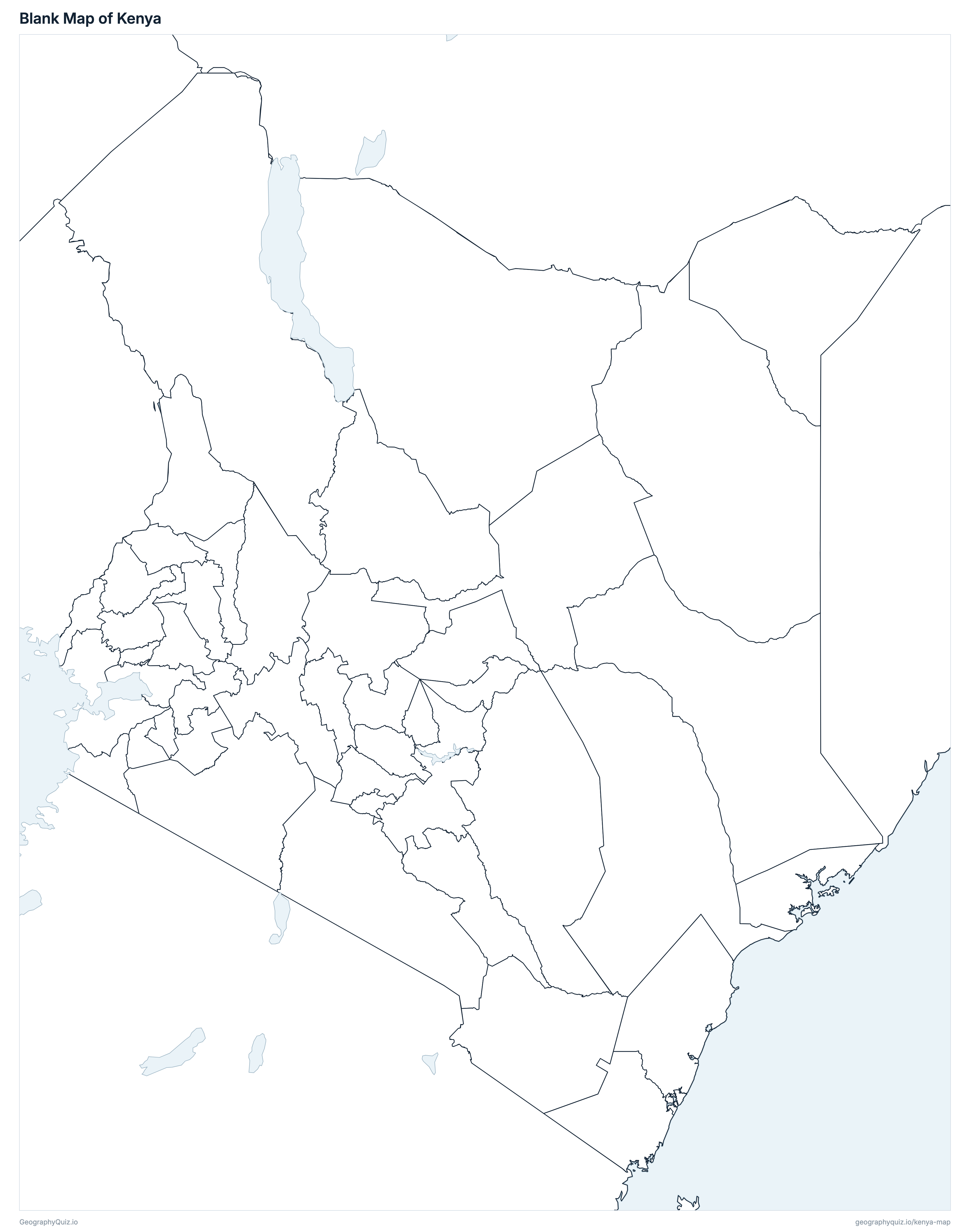
Free to print for class and home: Kenya with its cities and towns, a map of its counties, and a blank outline map. PDFs fit one A4 or US Letter page.
Kenya map with cities
Kenya counties map
Key facts
- Capital
- Nairobi
- Largest city
- Nairobi (4,397,073)
- Population
- 47,564,296 (2019)
- Area
- 580,876 km² (224,277 sq mi)
- Counties of Kenya
- 47
- Most populous county
- Nairobi (4,397,073)
- Largest county by area
- Marsabit, 70,944 km² (27,392 sq mi)
About Kenya
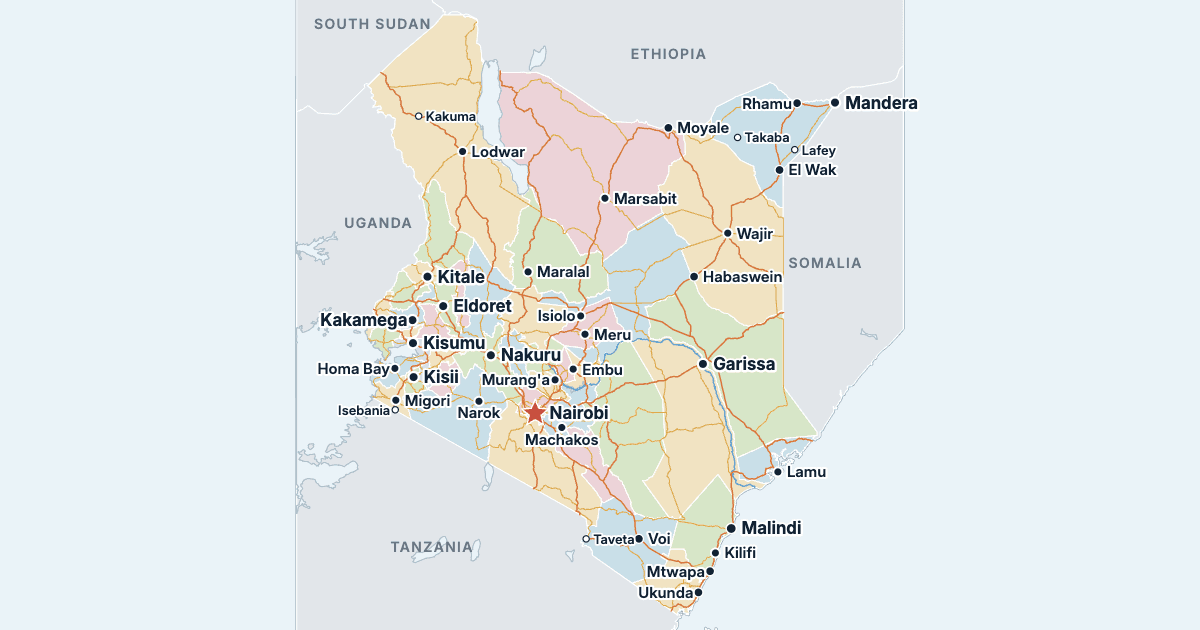
Kenya has 47 counties and about 47,564,296 people (2019) on 580,876 km² (224,277 sq mi). Nairobi is both the capital and the largest city, with 4,397,073 people. It borders Ethiopia, Somalia, South Sudan, Uganda and Tanzania.
Nairobi is the most populous county (4,397,073 people) and Lamu the least (143,920); Marsabit is the largest by area (70,944 km²) and Mombasa the smallest (220 km²).
Largest cities in Kenya
The 25 most populous cities and towns. All 92 are on the map above: switch on Towns and zoom in to see them.
| # | City | County | Population |
|---|---|---|---|
| 1 | Nairobi | Nairobi | 4,397,073 |
| 2 | Mombasa | Mombasa | 1,208,333 |
| 3 | Nakuru | Nakuru | 570,674 |
| 4 | Ruiru | Kiambu | 490,120 |
| 5 | Eldoret | Uasin Gishu | 475,716 |
| 6 | Kisumu | Kisumu | 397,957 |
| 7 | Kikuyu | Kiambu | 323,881 |
| 8 | Thika | Kiambu | 251,407 |
| 9 | Naivasha | Nakuru | 198,444 |
| 10 | Karuri | Kiambu | 194,342 |
| 11 | Ongata Rongai | Kajiado | 172,569 |
| 12 | Garissa | Garissa | 163,399 |
| 13 | Kitale | Trans-Nzoia | 162,174 |
| 14 | Juja | Kiambu | 156,041 |
| 15 | Kitengela | Kajiado | 154,436 |
| 16 | Kiambu | Kiambu | 147,870 |
| 17 | Malindi | Kilifi | 119,859 |
| 18 | Mandera | Mandera | 114,718 |
| 19 | Kisii | Kisii | 112,417 |
| 20 | Kakamega | Kakamega | 107,227 |
| 21 | Ngong | Kajiado | 102,323 |
| 22 | Mtwapa | Kilifi | 90,677 |
| 23 | Wajir | Wajir | 90,116 |
| 24 | Lodwar | Turkana | 82,970 |
| 25 | Limuru | Kiambu | 81,316 |
Populations are those of the 2019 Kenya Population and Housing Census (census night of 24/25 August 2019), by county, and county areas are KNBS's land areas. Cities and towns are the census's urban centres, each with its core-urban and peri-urban population; Kapenguria is the census's urban centre of Makutano. Nairobi is both a county and the capital. The Ilemi Triangle, administered by Kenya and claimed by South Sudan, is drawn as part of Turkana, as in Kenya's own boundaries and census.
Counties of Kenya
All 47 counties. Select one to show it on the map.
| Kabarnet | 666,763 | 10,976 | |
| Bomet | 875,689 | 2,531 | |
| Bungoma | 1,670,570 | 3,024 | |
| Busia | 893,681 | 1,696 | |
| Iten | 454,480 | 3,032 | |
| Embu | 608,599 | 2,821 | |
| Garissa | 841,353 | 44,736 | |
| Homa Bay | 1,131,950 | 3,152 | |
| Isiolo | 268,002 | 25,351 | |
| Kajiado | 1,117,840 | 21,871 | |
| Kakamega | 1,867,579 | 3,020 | |
| Kericho | 901,777 | 2,436 | |
| Kiambu | 2,417,735 | 2,539 | |
| Kilifi | 1,453,787 | 12,540 | |
| Kerugoya | 610,411 | 1,478 | |
| Kisii | 1,266,860 | 1,323 | |
| Kisumu | 1,155,574 | 2,085 | |
| Kitui | 1,136,187 | 30,430 | |
| Kwale | 866,820 | 8,267 | |
| Rumuruti | 518,560 | 9,532 | |
| Lamu | 143,920 | 6,253 | |
| Machakos | 1,421,932 | 6,043 | |
| Wote | 987,653 | 8,170 | |
| Mandera | 867,457 | 25,940 | |
| Marsabit | 459,785 | 70,944 | |
| Meru | 1,545,714 | 7,006 | |
| Migori | 1,116,436 | 2,614 | |
| Mombasa | 1,208,333 | 220 | |
| Murang'a | 1,056,640 | 2,524 | |
| Nairobi | 4,397,073 | 704 | |
| Nakuru | 2,162,202 | 7,462 | |
| Kapsabet | 885,711 | 2,856 | |
| Narok | 1,157,873 | 17,950 | |
| Nyamira | 605,576 | 897 | |
| Ol Kalou | 638,289 | 3,286 | |
| Nyeri | 759,164 | 3,325 | |
| Maralal | 310,327 | 21,065 | |
| Siaya | 993,183 | 2,530 | |
| Mwatate | 340,671 | 17,152 | |
| Hola | 315,943 | 37,950 | |
| Kathwana | 393,177 | 2,564 | |
| Kitale | 990,341 | 2,495 | |
| Lodwar | 926,976 | 68,233 | |
| Eldoret | 1,163,186 | 3,392 | |
| Mbale | 590,013 | 564 | |
| Wajir | 781,263 | 56,773 | |
| Kapenguria | 621,241 | 9,123 |
Quizzes and worksheets
Sources
- Counties: Independent Electoral and Boundaries Commission (IEBC), county boundaries, as published by UN OCHA on the Humanitarian Data Exchange (Kenya COD-AB, cod-ab-ken, 2019).
- Populations and land areas: Kenya National Bureau of Statistics (KNBS), 2019 Kenya Population and Housing Census, Volume I, table 2.4 (knbs.or.ke).
- Cities and towns: KNBS, 2019 Kenya Population and Housing Census, Volume II, table 2.5 (population by urban centre).
- County headquarters: State Department for Devolution, Devolution Knowledge Hub (knowledgehub.devolution.go.ke).
- Town locations: US National Geospatial-Intelligence Agency, GEOnet Names Server.
- Roads: Kenya Roads Board (KRB), road network 2017, via the World Bank's ENERGYDATA.INFO (CC BY 4.0).