Interactive map
Jamaica Map
Every parish, city and town in Jamaica on one zoomable map, with its main highways, rivers and lakes. Switch on towns and parishes above the map and zoom in for every name; tap a parish to see its population, area and largest towns.
Loading the map…
Printable maps of Jamaica
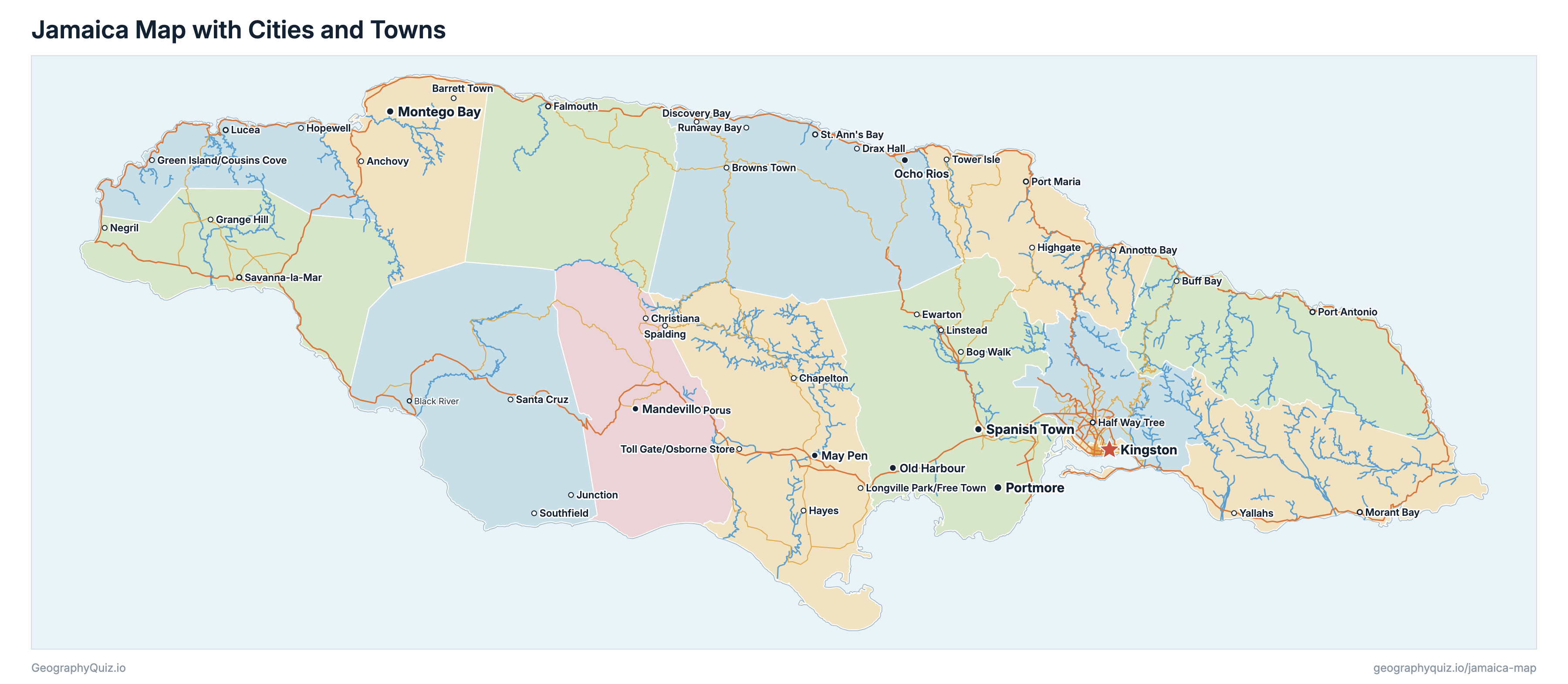
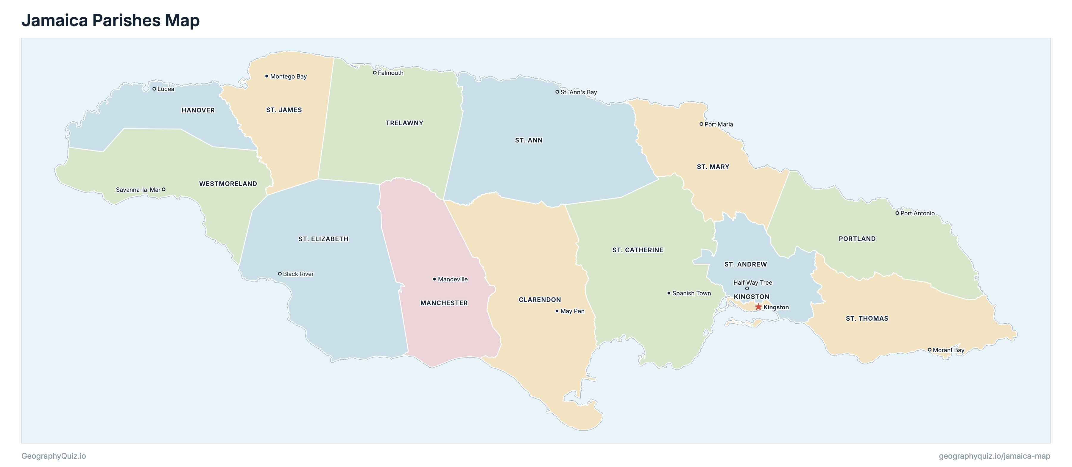
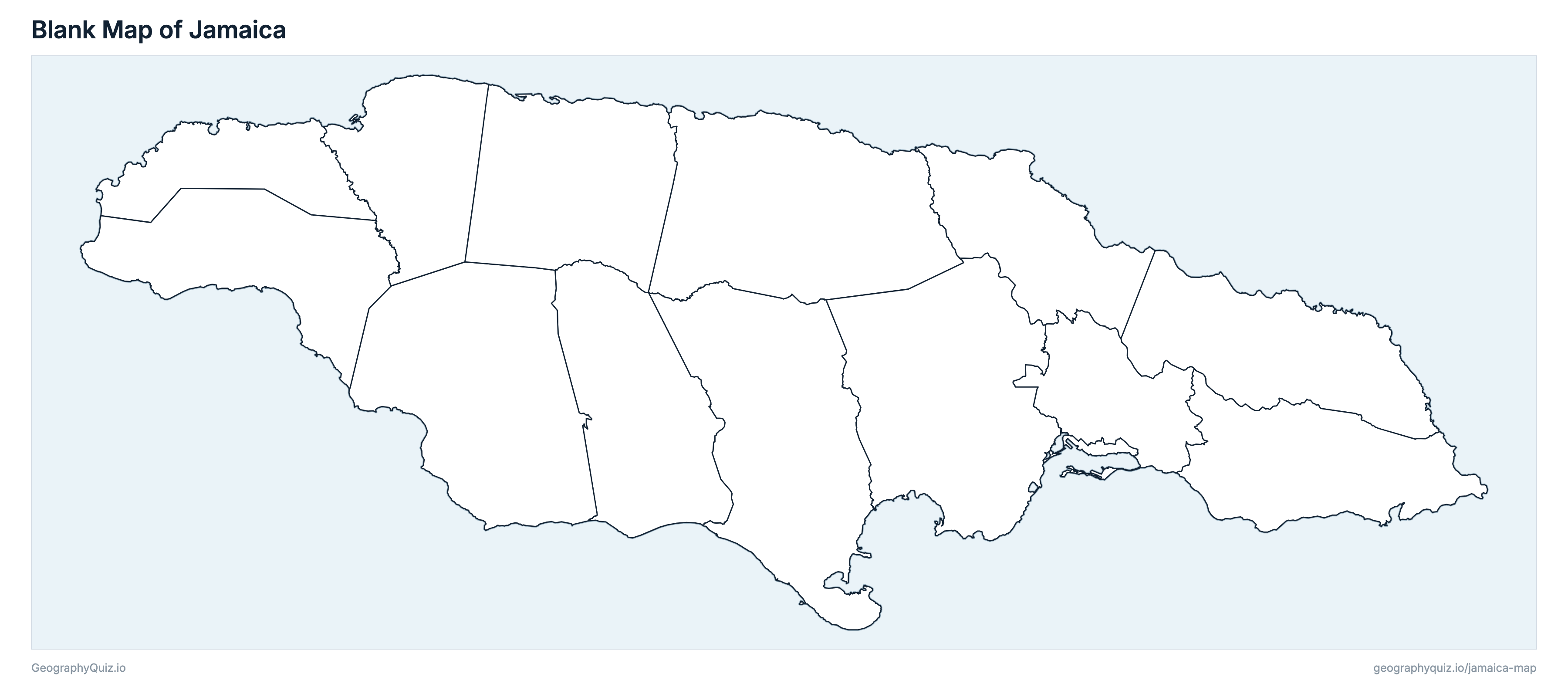
Free to print for class and home: Jamaica with its cities and towns, a map of its parishes, and a blank outline map. PDFs fit one A4 or US Letter page.
Jamaica map with cities
Jamaica parishes map
About Jamaica
Jamaica has 14 parishes and about 2,774,538 people (2022) on 10,956 km² (4,230 sq mi). Kingston is both the capital and the largest city, with 607,126 people.
St. Andrew is the most populous parish (583,717 people) and Hanover the least (69,780); St. Elizabeth is the largest by area (1,212 km²) and Kingston the smallest (27 km²).
Largest cities in Jamaica
The 25 most populous cities and towns. All 48 are on the map above: switch on Towns and zoom in to see them.
| # | City | Parish | Population |
|---|---|---|---|
| 1 | Kingston | Kingston | 607,126 |
| 2 | Spanish Town | St. Catherine | 168,900 |
| 3 | Portmore | St. Catherine | 161,442 |
| 4 | Montego Bay | St. James | 118,013 |
| 5 | May Pen | Clarendon | 75,491 |
| 6 | Mandeville | Manchester | 54,082 |
| 7 | Old Harbour | St. Catherine | 52,294 |
| 8 | Ocho Rios | St. Ann | 25,702 |
| 9 | Savanna-la-Mar | Westmoreland | 22,004 |
| 10 | Falmouth | Trelawny | 21,570 |
| 11 | Port Antonio | Portland | 20,345 |
| 12 | Morant Bay | St. Thomas | 17,792 |
| 13 | Barrett Town | St. James | 17,169 |
| 14 | Yallahs | St. Thomas | 16,635 |
| 15 | St. Ann's Bay | St. Ann | 16,226 |
| 16 | Linstead | St. Catherine | 16,215 |
| 17 | Tower Isle | St. Mary | 13,840 |
| 18 | Negril | Westmoreland | 13,779 |
| 19 | Junction | St. Elizabeth | 13,152 |
| 20 | Drax Hall | St. Ann | 12,798 |
| 21 | Runaway Bay | St. Ann | 12,358 |
| 22 | Port Maria | St. Mary | 11,913 |
| 23 | Longville Park/Free Town | Clarendon | 11,303 |
| 24 | Ewarton | St. Catherine | 11,094 |
| 25 | Santa Cruz | St. Elizabeth | 10,798 |
Populations are from the Population and Housing Census 2022 (Statistical Institute of Jamaica). STATIN publishes Kingston and St. Andrew together (672,904); each parish here is the sum of its census counts by enumeration district. Towns are STATIN's urban areas, with the preliminary census counts: Kingston is the Kingston Metropolitan Area, the city with the urban part of St. Andrew (Half Way Tree, St. Andrew's capital, lies within it).
Parishes of Jamaica
All 14 parishes. Select one to show it on the map.
| May Pen | 258,643 | 1,183 | |
| Lucea | 69,780 | 451 | |
| Kingston | 89,186 | 27 | |
| Mandeville | 193,693 | 837 | |
| Port Antonio | 84,973 | 814 | |
| Half Way Tree | 583,717 | 440 | |
| St. Ann's Bay | 175,311 | 1,211 | |
| Spanish Town | 542,764 | 1,178 | |
| Black River | 153,199 | 1,212 | |
| Montego Bay | 188,656 | 592 | |
| Port Maria | 116,499 | 610 | |
| Morant Bay | 94,485 | 742 | |
| Falmouth | 77,427 | 874 | |
| Savanna-la-Mar | 146,205 | 785 |
Sources
- Parishes: Common Operational Dataset of administrative boundaries for Jamaica (COD-AB), from the Social Development Commission, on UN OCHA's Humanitarian Data Exchange (the 14 parishes and their areas).
- Parish populations: Statistical Institute of Jamaica (STATIN), Population and Housing Census 2022 (statinja.gov.jm), summed from its counts by enumeration district, which also split Kingston and St. Andrew.
- Towns: Statistical Institute of Jamaica (STATIN), Census 2022 enumeration districts with their preliminary population counts and urban areas.
- Main roads: National Works Agency, Main Road Network 2026 (class A and class B roads).
- Rivers: Water Resources Authority, Rivers and Streams in Jamaica (digitised from the Government of Jamaica's 1:50,000 topographic maps).