Interactive map
Indonesia Map
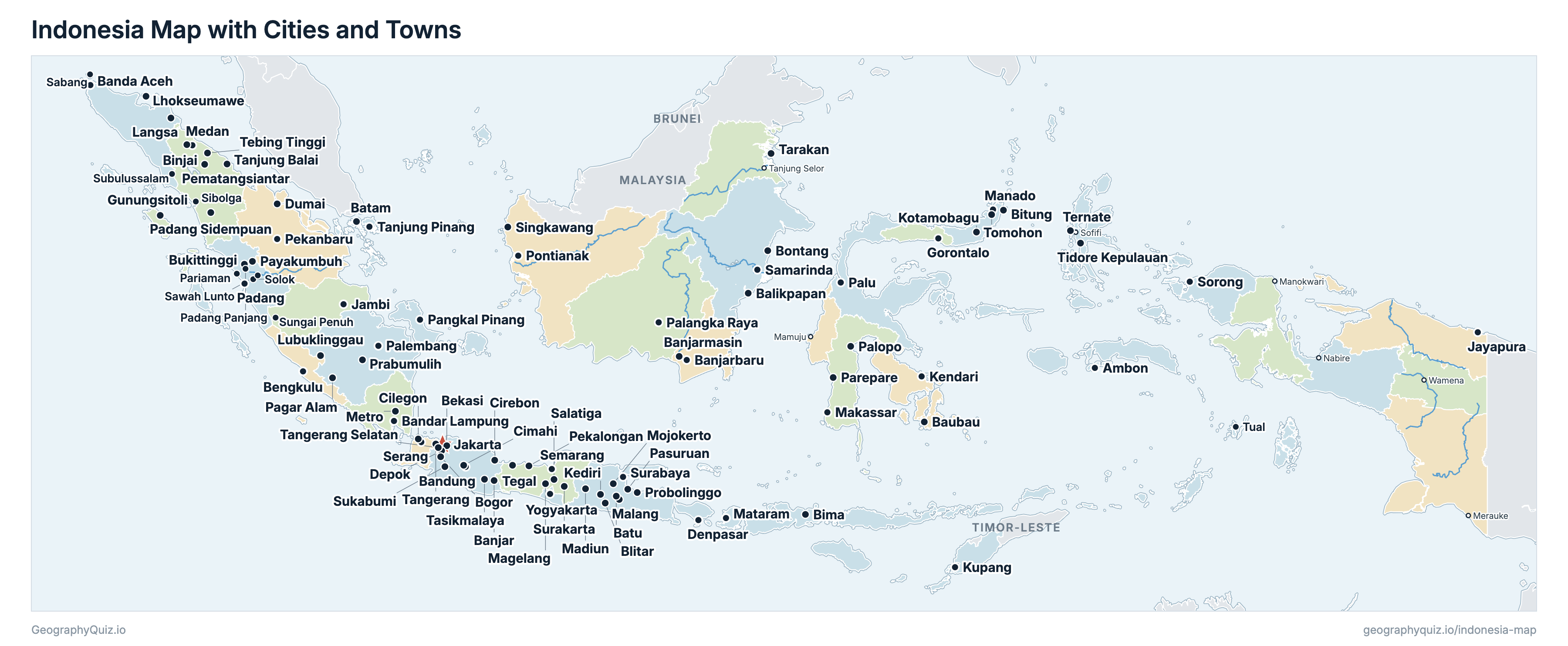
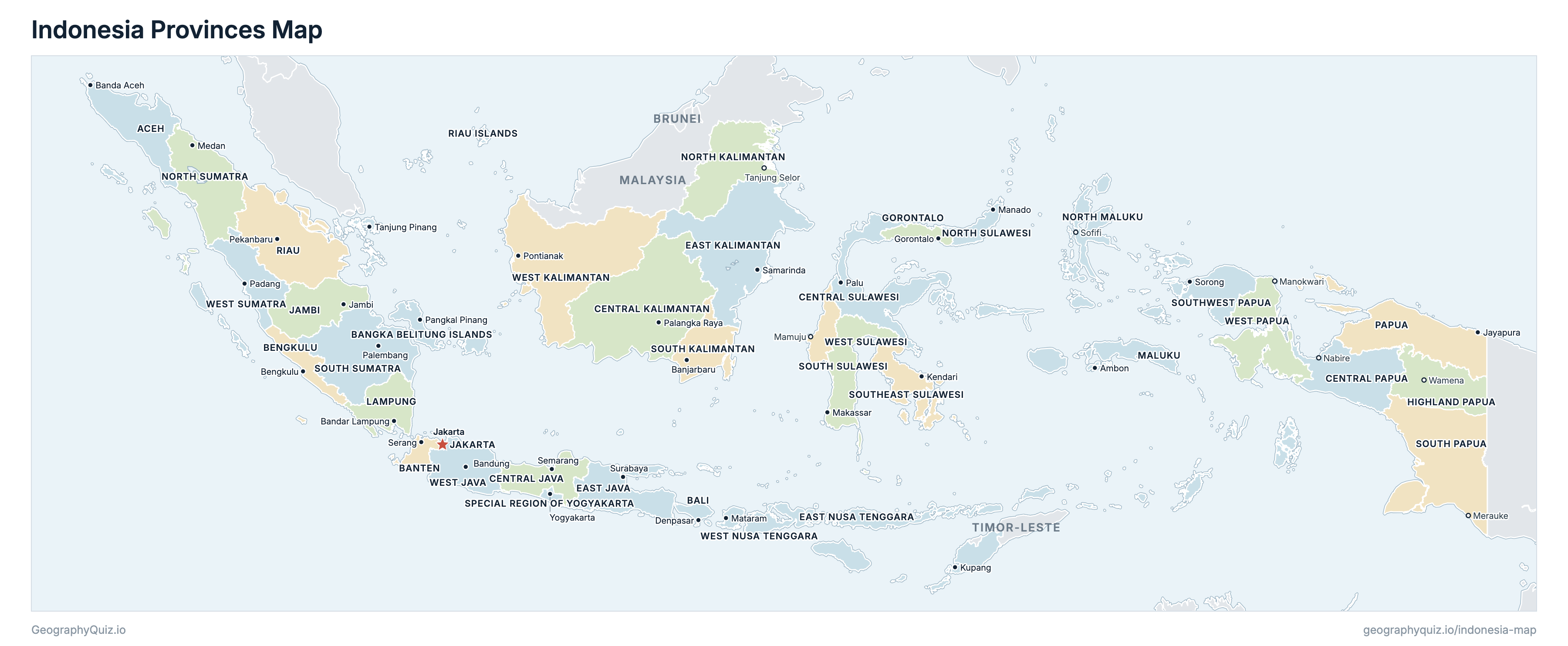
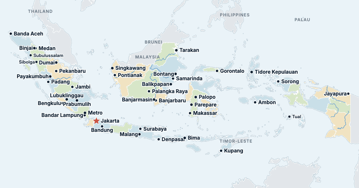
Every province, city and town in Indonesia on one zoomable map, with its main highways, rivers and lakes. Switch on towns and provinces above the map and zoom in for every name; tap a province to see its population, area and largest towns.
Loading the map…
Printable maps of Indonesia
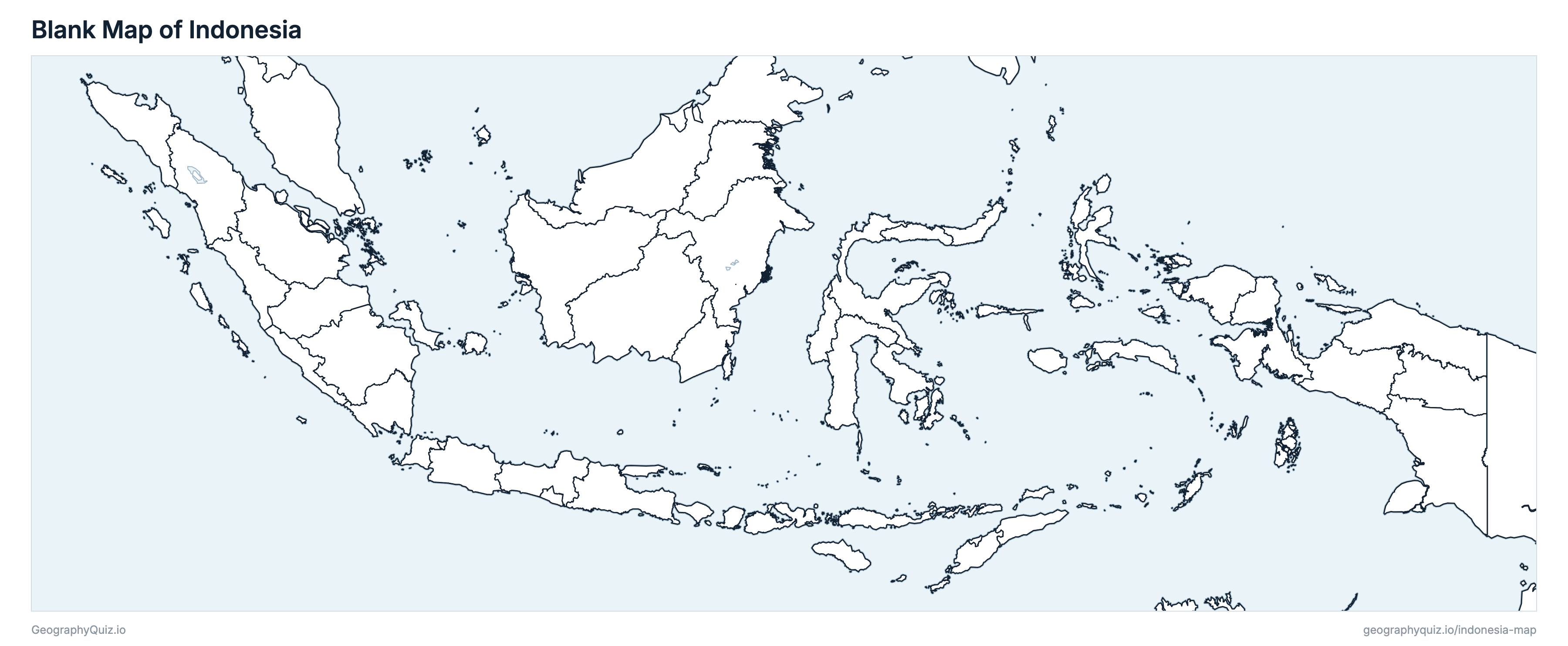
Free to print for class and home: Indonesia with its cities and towns, a map of its provinces, and a blank outline map. PDFs fit one A4 or US Letter page.
Indonesia map with cities
Indonesia provinces map
Key facts
- Capital
- Jakarta
- Largest city
- Jakarta (10,534,339)
- Population
- 284,667,253 (2025)
- Area
- 1,892,266 km² (730,608 sq mi)
- Provinces of Indonesia
- 38
- Most populous province
- West Java (50,942,801)
- Largest province by area
- Central Kalimantan, 153,430 km² (59,240 sq mi)
About Indonesia
Indonesia has 38 provinces and about 284,667,253 people (2025) on 1,892,266 km² (730,608 sq mi). Jakarta is both the capital and the largest city, with 10,534,339 people (2020). It borders Malaysia, Timor-Leste and Papua New Guinea.
West Java is the most populous province (50,942,801 people) and South Papua the least (550,308); Central Kalimantan is the largest by area (153,430 km²) and Jakarta the smallest (662 km²).
Largest cities in Indonesia
The 25 most populous cities and towns. All 101 are on the map above: switch on Towns and zoom in to see them.
| # | City | Province | Population |
|---|---|---|---|
| 1 | Jakarta | Jakarta | 10,534,339 |
| 2 | Surabaya | East Java | 2,874,314 |
| 3 | Bekasi | West Java | 2,543,676 |
| 4 | Bandung | West Java | 2,444,160 |
| 5 | Medan | North Sumatra | 2,435,252 |
| 6 | Depok | West Java | 2,056,335 |
| 7 | Tangerang | Banten | 1,895,486 |
| 8 | Palembang | South Sumatra | 1,668,848 |
| 9 | Semarang | Central Java | 1,653,524 |
| 10 | Makassar | South Sulawesi | 1,423,877 |
| 11 | Tangerang Selatan | Banten | 1,354,350 |
| 12 | Batam | Riau Islands | 1,196,396 |
| 13 | Bandar Lampung | Lampung | 1,166,066 |
| 14 | Bogor | West Java | 1,043,070 |
| 15 | Pekanbaru | Riau | 983,356 |
| 16 | Padang | West Sumatra | 909,040 |
| 17 | Malang | East Java | 843,810 |
| 18 | Samarinda | East Kalimantan | 827,994 |
| 19 | Denpasar | Bali | 725,314 |
| 20 | Tasikmalaya | West Java | 716,155 |
| 21 | Serang | Banten | 692,101 |
| 22 | Balikpapan | East Kalimantan | 688,318 |
| 23 | Pontianak | West Kalimantan | 658,685 |
| 24 | Banjarmasin | South Kalimantan | 657,663 |
| 25 | Jambi | Jambi | 606,200 |
Province populations are BPS's results of the 2025 Intercensal Population Survey (SUPAS 2025). Cities are Indonesia's kota, each with its whole area and its population at the 2020 Census (Sensus Penduduk 2020); Jakarta is its five administrative cities. The seven provincial capitals that are no city (Tanjung Selor, Mamuju, Sofifi, Manokwari, Merauke, Nabire and Wamena) have no census figure of their own. Jakarta remains the capital until a presidential decree moves it to Nusantara, in East Kalimantan.
Provinces of Indonesia
All 38 provinces. Select one to show it on the map.
| Banda Aceh | 5,631,761 | 56,835 | |
| Denpasar | 4,463,509 | 5,583 | |
| Pangkal Pinang | 1,552,391 | 16,670 | |
| Serang | 12,582,517 | 9,356 | |
| Bengkulu | 2,140,143 | 20,122 | |
| Semarang | 38,261,422 | 34,347 | |
| Palangka Raya | 2,847,855 | 153,430 | |
| Nabire | 1,493,906 | 61,080 | |
| Palu | 3,158,895 | 61,497 | |
| Surabaya | 42,111,119 | 48,058 | |
| Samarinda | 4,050,638 | 130,149 | |
| Kupang | 5,749,684 | 46,378 | |
| Gorontalo | 1,243,415 | 12,025 | |
| Wamena | 1,486,352 | 52,509 | |
| Jakarta | 10,724,334 | 662 | |
| Jambi | 3,772,062 | 49,023 | |
| Bandar Lampung | 9,531,282 | 33,571 | |
| Ambon | 1,972,606 | 46,136 | |
| Tanjung Selor | 750,145 | 69,901 | |
| Sofifi | 1,375,307 | 30,302 | |
| Manado | 2,723,019 | 14,495 | |
| Medan | 15,801,821 | 72,469 | |
| Jayapura | 1,074,761 | 81,383 | |
| Pekanbaru | 6,817,891 | 89,901 | |
| Tanjung Pinang | 2,215,913 | 8,170 | |
| Banjarbaru | 4,327,376 | 37,125 | |
| Merauke | 550,308 | 117,859 | |
| Makassar | 9,571,273 | 45,324 | |
| Palembang | 8,935,871 | 86,772 | |
| Kendari | 2,840,318 | 36,149 | |
| Sorong | 637,190 | 39,103 | |
| Yogyakarta | 3,783,309 | 3,170 | |
| Bandung | 50,942,801 | 37,053 | |
| Pontianak | 5,771,745 | 147,018 | |
| Mataram | 5,738,081 | 19,632 | |
| Manokwari | 588,374 | 60,309 | |
| Mamuju | 1,527,159 | 16,591 | |
| Padang | 5,920,700 | 42,108 |
Quizzes and worksheets
Sources
- Provinces and their areas: Badan Informasi Geospasial (BIG), administrative boundaries of the regencies and cities (Batas Wilayah Administrasi Kabupaten/Kota, 1:50,000, June 2026 edition; geoservices.big.go.id), joined into the 38 provinces.
- Populations: Badan Pusat Statistik (BPS), Survei Penduduk Antar Sensus (SUPAS) 2025: population by province, 2025.
- Cities: BPS, Sensus Penduduk 2020, population by regency and city (sensus.bps.go.id): the cities (kota).
- Provincial capitals: the laws forming each province, Law 8 of 2022 (South Kalimantan) and Laws 14, 15, 16 and 29 of 2022 (the four new Papuan provinces).
- Town locations: US National Geospatial-Intelligence Agency, GEOnet Names Server; Badan Informasi Geospasial.