Interactive map
Dominican Republic Map
Every province, city and town in the Dominican Republic on one zoomable map, with its main highways, rivers and lakes. Switch on towns and provinces above the map and zoom in for every name; tap a province to see its population, area and largest towns.
Loading the map…
Printable maps of the Dominican Republic
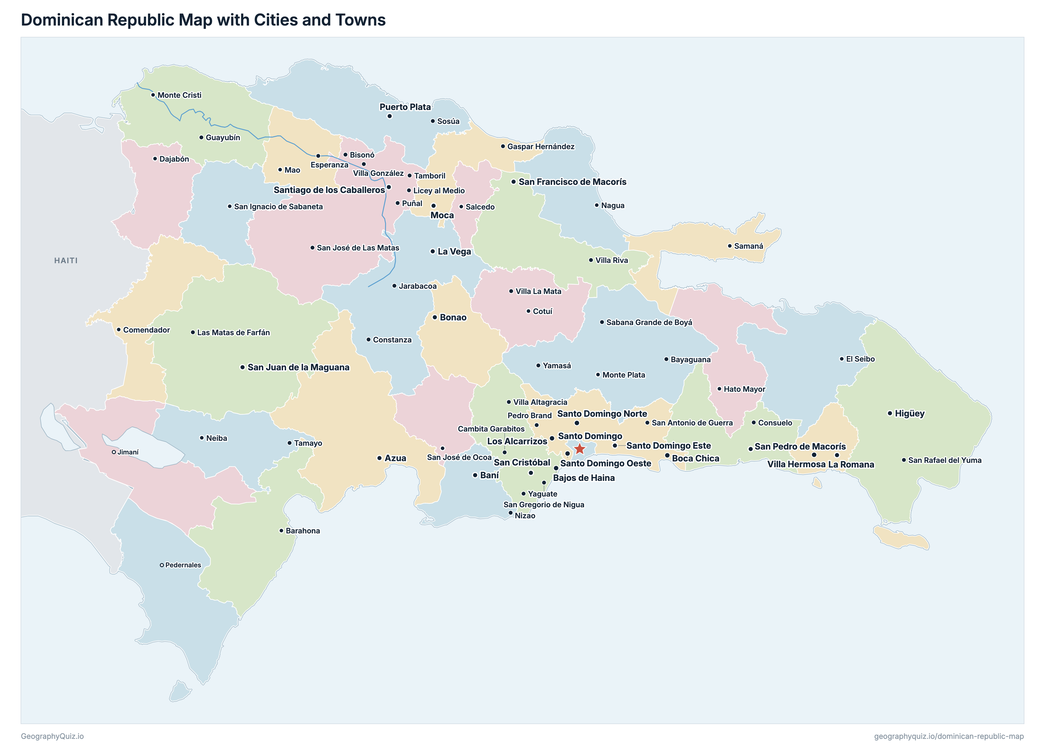
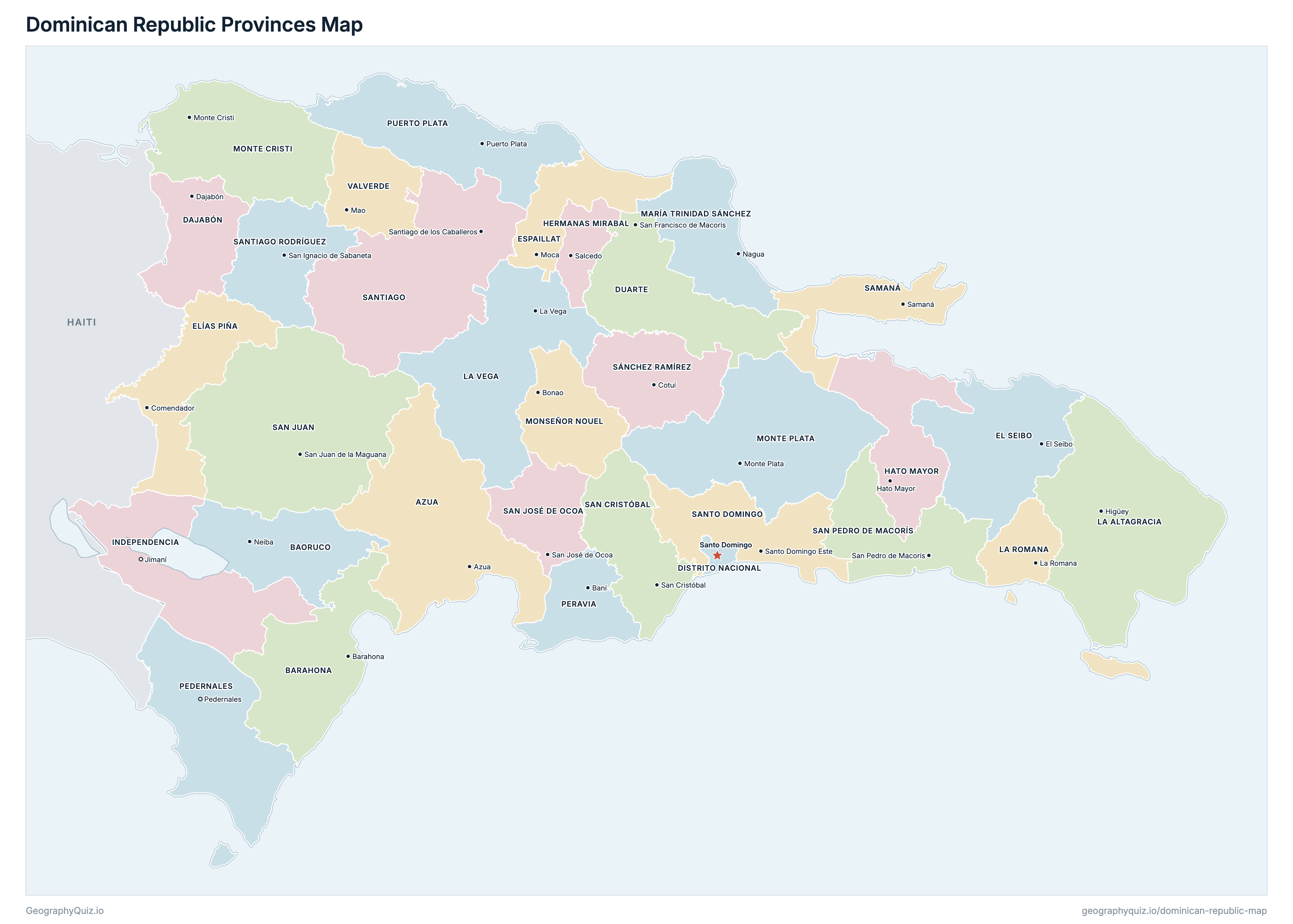
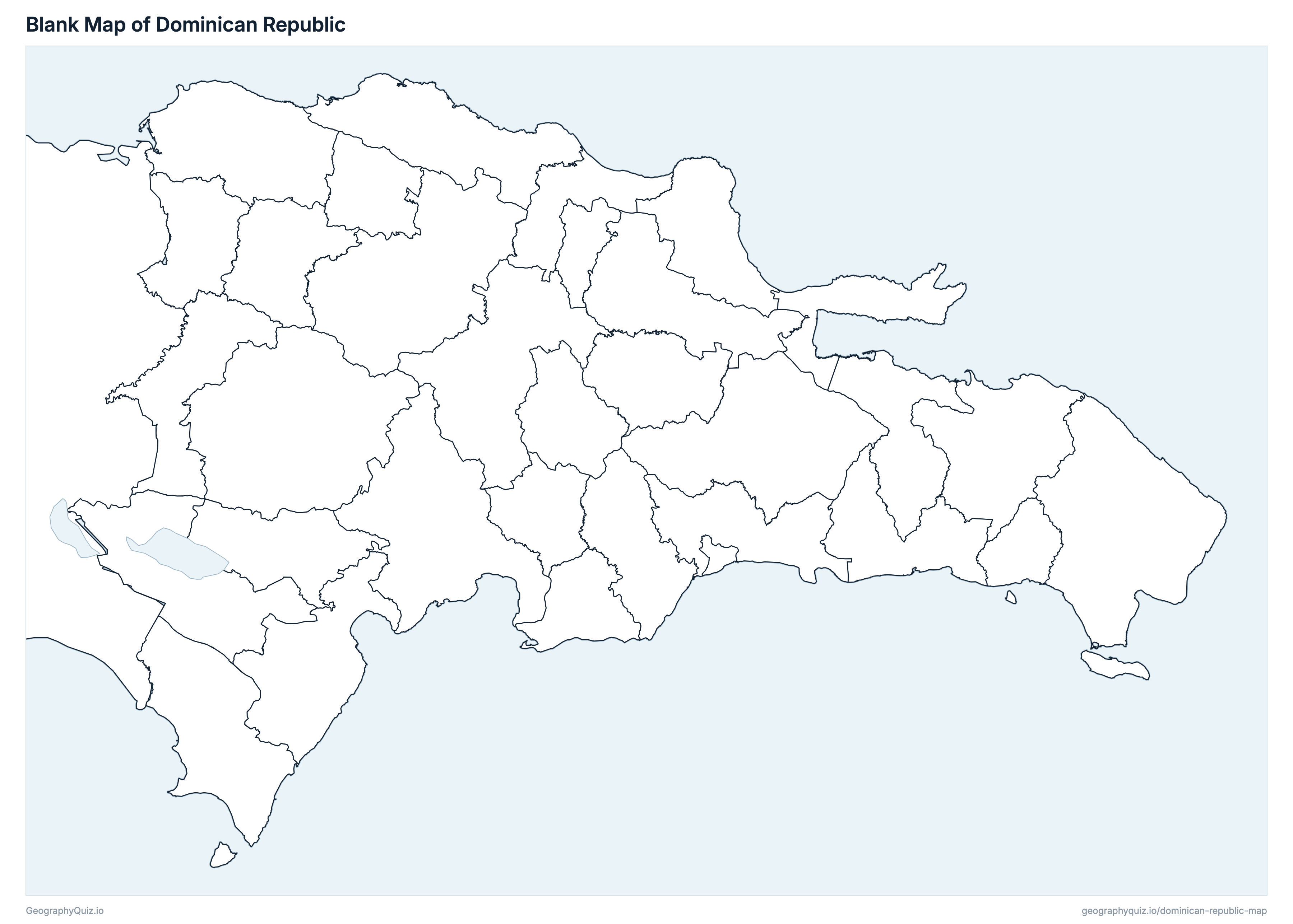
Free to print for class and home: the Dominican Republic with its cities and towns, a map of its provinces, and a blank outline map. PDFs fit one A4 or US Letter page.
Dominican Republic map with cities
Dominican Republic provinces map
About the Dominican Republic
The Dominican Republic has 32 provinces and about 10,771,504 people (2022) on 48,187 km² (18,605 sq mi). The capital is Santo Domingo; the largest city is Santo Domingo Este, with 1,029,117 people. It borders Haiti.
Santo Domingo is the most populous province (2,769,588 people) and Pedernales the least (34,375); San Juan is the largest by area (3,357 km²) and Distrito Nacional the smallest (91 km²).
Largest cities in the Dominican Republic
The 25 most populous cities and towns. All 66 are on the map above: switch on Towns and zoom in to see them.
| # | City | Province | Population |
|---|---|---|---|
| 1 | Santo Domingo Este | Santo Domingo | 1,029,117 |
| 2 | Santo Domingo | Distrito Nacional | 1,029,110 |
| 3 | Santiago de los Caballeros | Santiago | 771,748 |
| 4 | Santo Domingo Norte | Santo Domingo | 674,274 |
| 5 | Higüey | La Altagracia | 415,084 |
| 6 | Santo Domingo Oeste | Santo Domingo | 410,578 |
| 7 | Los Alcarrizos | Santo Domingo | 336,307 |
| 8 | La Vega | La Vega | 282,055 |
| 9 | San Cristóbal | San Cristóbal | 277,793 |
| 10 | San Pedro de Macorís | San Pedro de Macorís | 217,523 |
| 11 | San Francisco de Macorís | Duarte | 202,716 |
| 12 | Boca Chica | Santo Domingo | 167,040 |
| 13 | Moca | Espaillat | 164,022 |
| 14 | Puerto Plata | Puerto Plata | 162,093 |
| 15 | Bajos de Haina | San Cristóbal | 159,888 |
| 16 | Baní | Peravia | 158,019 |
| 17 | La Romana | La Romana | 153,241 |
| 18 | Bonao | Monseñor Nouel | 144,923 |
| 19 | San Juan de la Maguana | San Juan | 143,009 |
| 20 | Villa Hermosa | La Romana | 117,445 |
| 21 | Azua | Azua | 103,276 |
| 22 | Villa Altagracia | San Cristóbal | 97,620 |
| 23 | Pedro Brand | Santo Domingo | 92,973 |
| 24 | Barahona | Barahona | 90,166 |
| 25 | Mao | Valverde | 86,659 |
Populations are from the X Censo Nacional de Población y Vivienda 2022 (Oficina Nacional de Estadística, final results). Towns are shown with the population of their whole municipality, municipal districts included, at the middle of the municipality's head area; Santo Domingo is the Distrito Nacional, and Santo Domingo Este, Norte and Oeste are the neighbouring municipalities of Santo Domingo province.
Provinces of the Dominican Republic
All 32 provinces. Select one to show it on the map.
| Azua | 240,209 | 2,674 | |
| Neiba | 108,717 | 1,316 | |
| Barahona | 200,886 | 1,737 | |
| Dajabón | 74,810 | 1,019 | |
| Santo Domingo | 1,029,110 | 91 | |
| San Francisco de Macorís | 308,353 | 1,651 | |
| El Seibo | 99,169 | 1,785 | |
| Comendador | 64,614 | 1,396 | |
| Moca | 241,058 | 860 | |
| Hato Mayor | 100,133 | 1,277 | |
| Salcedo | 96,441 | 427 | |
| Jimaní | 60,689 | 1,952 | |
| Higüey | 446,060 | 2,996 | |
| La Romana | 287,914 | 650 | |
| La Vega | 442,719 | 2,292 | |
| Nagua | 156,633 | 1,204 | |
| Bonao | 195,547 | 1,001 | |
| Monte Cristi | 123,519 | 1,876 | |
| Monte Plata | 205,498 | 2,619 | |
| Pedernales | 34,375 | 1,954 | |
| Baní | 209,372 | 783 | |
| Puerto Plata | 338,355 | 1,792 | |
| Samaná | 111,987 | 892 | |
| San Cristóbal | 688,828 | 1,241 | |
| San José de Ocoa | 69,082 | 841 | |
| San Juan de la Maguana | 244,667 | 3,357 | |
| San Pedro de Macorís | 337,146 | 1,257 | |
| Cotuí | 162,642 | 1,177 | |
| Santiago de los Caballeros | 1,074,679 | 2,803 | |
| San Ignacio de Sabaneta | 64,635 | 1,151 | |
| Santo Domingo Este | 2,769,588 | 1,298 | |
| Mao | 184,069 | 818 |
Sources
- Provinces and the Distrito Nacional: Instituto Geográfico Nacional "José Joaquín Hungría Morell" (IGN-JJHM), División Político-Administrativa (provinces, municipalities and municipal districts, updated to December 2022, on ONE's census cartography), with their areas.
- Populations: Oficina Nacional de Estadística (ONE), X Censo Nacional de Población y Vivienda 2022, population by province, municipality and municipal district (one.gob.do).