Interactive map
Cuba Map
Every province, city and town in Cuba on one zoomable map, with its main highways, rivers and lakes. Switch on towns and provinces above the map and zoom in for every name; tap a province to see its population, area and largest towns.
Loading the map…
Printable maps of Cuba
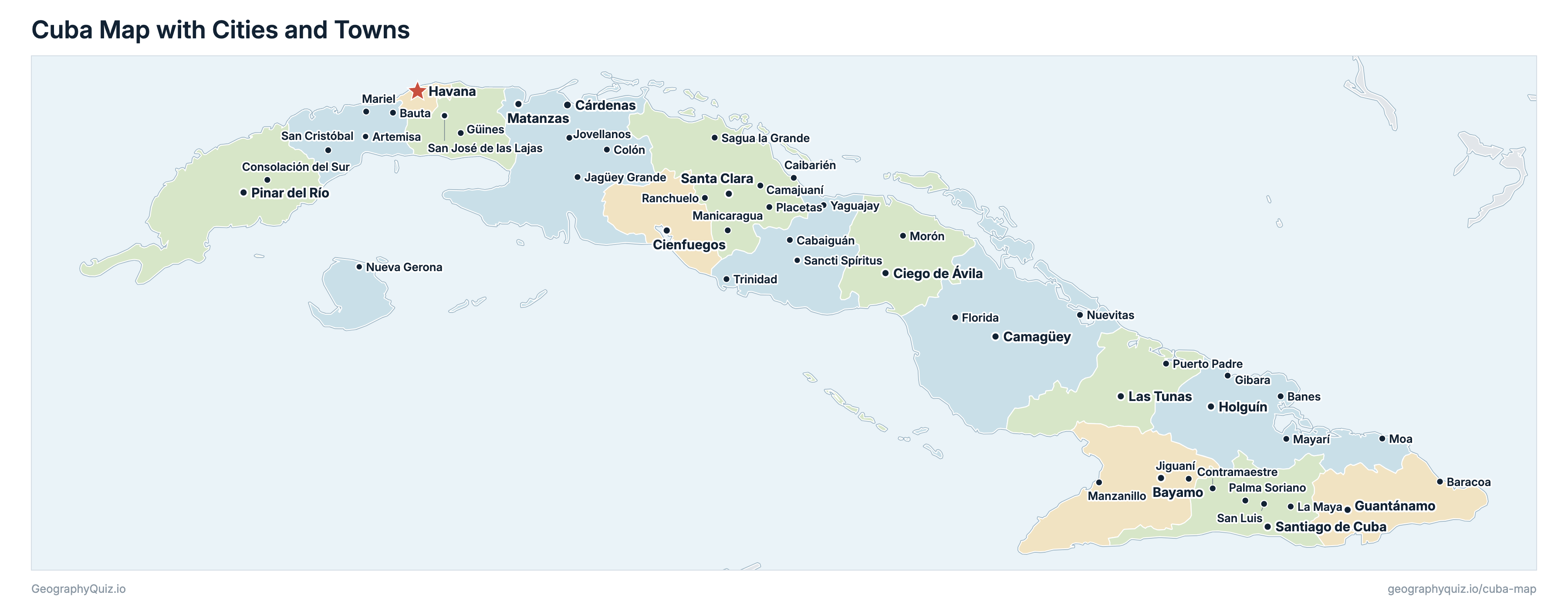
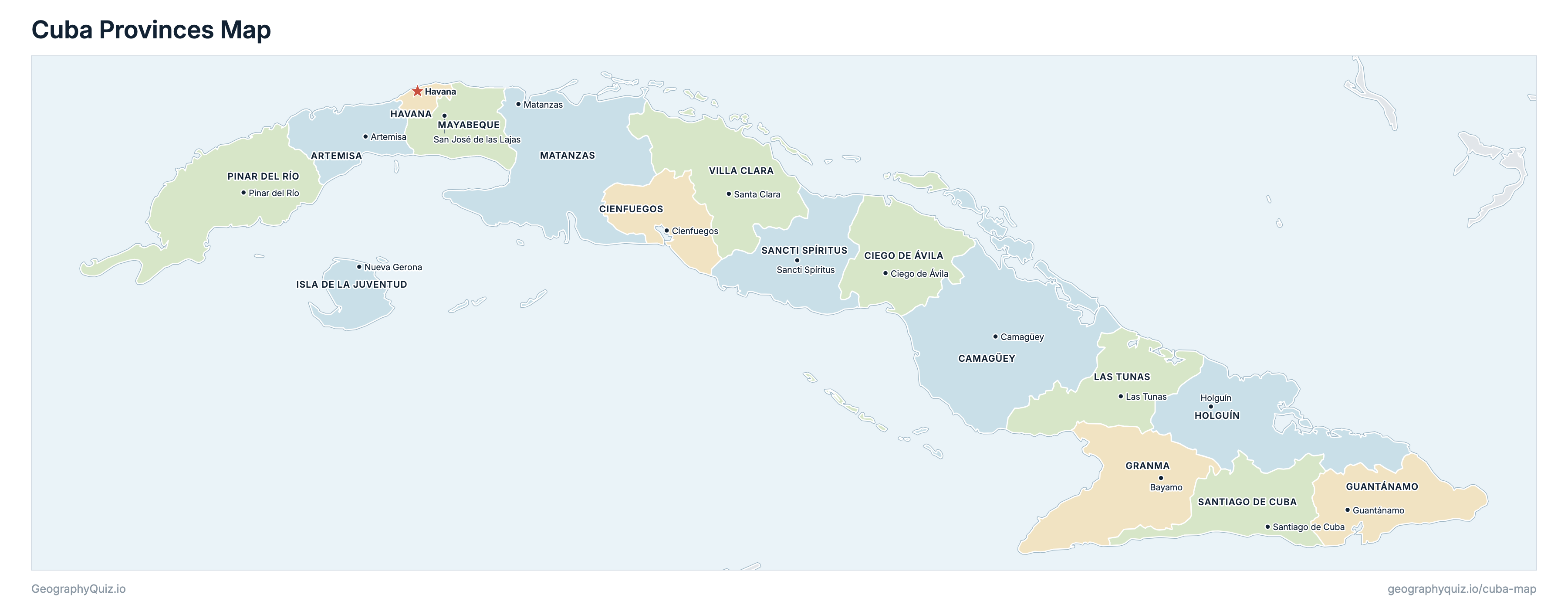
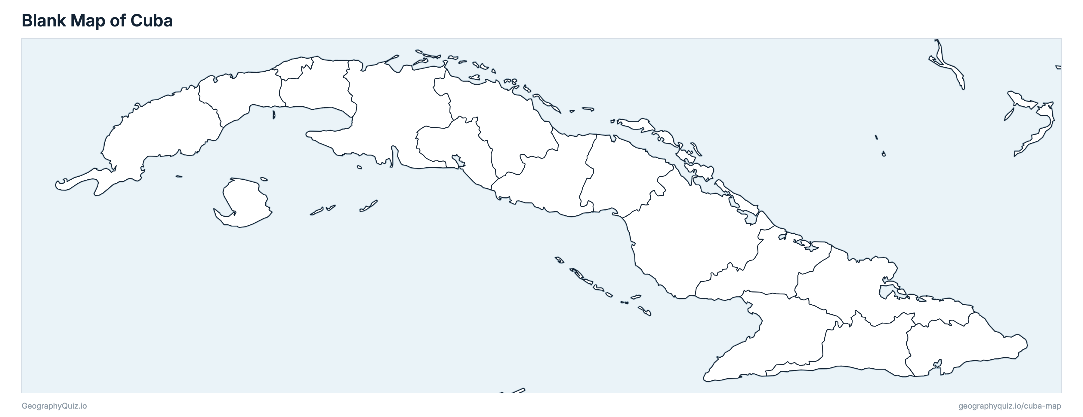
Free to print for class and home: Cuba with its cities and towns, a map of its provinces, and a blank outline map. PDFs fit one A4 or US Letter page.
Cuba map with cities
Cuba provinces map
About Cuba
Cuba has 16 provinces and about 9,748,007 people (2024) on 109,884 km² (42,426 sq mi). Havana is both the capital and the largest city, with 1,749,964 people.
Havana is the most populous province (1,749,964 people) and Isla de la Juventud the least (73,021); Camagüey is the largest by area (15,386 km²) and Havana the smallest (728 km²).
Largest cities in Cuba
The 25 most populous cities and towns. All 49 are on the map above: switch on Towns and zoom in to see them.
| # | City | Province | Population |
|---|---|---|---|
| 1 | Havana | Havana | 1,749,964 |
| 2 | Santiago de Cuba | Santiago de Cuba | 393,589 |
| 3 | Camagüey | Camagüey | 254,867 |
| 4 | Holguín | Holguín | 254,358 |
| 5 | Guantánamo | Guantánamo | 191,787 |
| 6 | Santa Clara | Villa Clara | 185,440 |
| 7 | Las Tunas | Las Tunas | 157,090 |
| 8 | Bayamo | Granma | 143,438 |
| 9 | Cienfuegos | Cienfuegos | 129,508 |
| 10 | Pinar del Río | Pinar del Río | 127,619 |
| 11 | Matanzas | Matanzas | 125,272 |
| 12 | Cárdenas | Matanzas | 123,836 |
| 13 | Ciego de Ávila | Ciego de Ávila | 106,183 |
| 14 | Sancti Spíritus | Sancti Spíritus | 94,909 |
| 15 | Manzanillo | Granma | 89,448 |
| 16 | Palma Soriano | Santiago de Cuba | 66,904 |
| 17 | Moa | Holguín | 56,902 |
| 18 | Contramaestre | Santiago de Cuba | 56,743 |
| 19 | Morón | Ciego de Ávila | 54,820 |
| 20 | Consolación del Sur | Pinar del Río | 53,673 |
| 21 | Mayarí | Holguín | 52,377 |
| 22 | Puerto Padre | Las Tunas | 49,650 |
| 23 | Trinidad | Sancti Spíritus | 49,036 |
| 24 | Colón | Matanzas | 47,546 |
| 25 | Florida | Camagüey | 46,455 |
Populations are ONEI's figures for 31 December 2024 (población efectiva, Anuario Estadístico de Cuba 2024). Havana and the other provincial capitals are shown with ONEI's city figure; other towns with the urban population of the municipality they are the seat of, which can include smaller towns nearby. Havana is both a province and the capital city. The US naval base at Guantánamo Bay, leased by the United States, lies inside Guantánamo province and is drawn as part of it, as in Cuba's own boundaries and figures.
Provinces of Cuba
All 16 provinces. Select one to show it on the map.
| Artemisa | 452,430 | 4,003 | |
| Camagüey | 653,203 | 15,386 | |
| Ciego de Ávila | 376,919 | 6,972 | |
| Cienfuegos | 342,709 | 4,189 | |
| Bayamo | 749,289 | 8,374 | |
| Guantánamo | 465,429 | 6,168 | |
| Havana | 1,749,964 | 728 | |
| Holguín | 911,674 | 9,216 | |
| Nueva Gerona | 73,021 | 2,419 | |
| Las Tunas | 475,343 | 6,593 | |
| Matanzas | 619,159 | 11,792 | |
| San José de las Lajas | 330,260 | 3,744 | |
| Pinar del Río | 515,208 | 8,884 | |
| Sancti Spíritus | 404,037 | 6,777 | |
| Santiago de Cuba | 963,915 | 6,228 | |
| Santa Clara | 665,447 | 8,412 |
Sources
- Populations: Oficina Nacional de Estadística e Información (ONEI), Anuario Estadístico de Cuba 2024 (edición 2025), cuadro 3.5, population on 31 December 2024 by province and municipality, urban and rural, onei.gob.cu.
- City populations: ONEI, Anuario Estadístico de Cuba 2024, cuadro 3.10, population of the provincial capitals; other towns: the urban population of their municipality (cuadro 3.5).
- Areas: ONEI, Anuario Estadístico de Cuba 2024, cuadro 1.4, area by province, with the adjacent cays.